Golden Beach, Queensland

Last updated

Golden Beach
Caloundra,  Queensland
Caloundra, Queensland - Golden Beach & Bribie Island.jpg
Golden Beach, looking across Pumicestone Passage towards Bribie Island
Australia Queensland location map.svg
Red pog.svg
Golden Beach
Coordinates 26°49′22″S153°07′19″E / 26.8227°S 153.1219°E / -26.8227; 153.1219 (Golden Beach (centre of suburb))
Population5,646 (2021 census) [1]
 • Density1,344/km2 (3,480/sq mi)
Postcode(s) 4551
Area4.2 km2 (1.6 sq mi)
Time zone AEST (UTC+10:00)
Location
LGA(s) Sunshine Coast Region
County Canning
Parish Bribie
State electorate(s) Caloundra
Federal division(s) Fisher
Suburbs around Golden Beach:
Caloundra West Caloundra Bribie Island North
Pelican Waters Golden Beach Bribie Island North
Pelican Waters Coochin Creek Bribie Island North

Golden Beach is a coastal suburb of Caloundra in the Sunshine Coast Region, Queensland, Australia. [2] It is located within the Caloundra urban centre directly southwest of the Caloundra CBD. In the 2021 census, Golden Beach had a population of 5,646 people. [1]

Contents

Geography

Golden Beach is a coastal suburb with the Pumicestone Passage forming its eastern boundary. It is mostly fully developed with low density residential housing. A canal from the passage passes through the suburb from east to west leading into the canal developments of the neighbouring suburb of Pelican Waters.

The long sandspit at the northern tip of Bribie Island protects Golden Beach from the Coral Sea. [3] However, this section of the Pumicestone Passage is very narrow and very shallow (less than 2 metres (6 ft 7 in)) with shifting sand and mud banks, which makes the northern sandspit highly dynamic in shape through natural processes of sand/mud buildup and erosion. During storms, waves may cross over the sandspit from the Coral Sea into the Pumicestone Passage, with the potential to break through the sandspit to create new entrances to Pumicestone Passage. The creation of new entrances would impact on Golden Beach and Pelican Waters, which would then be exposed more directly to the stronger wave action of the Coral Sea as opposed to the calmer waters of the Pumicestone Passage. [4] In December 2020, wild weather began creating channels from the ocean through the northern sandspit into Pumicestone Passage. [5]

History

Settlement of Golden Beach dates from the late 19th century, with land used mainly for farming and grazing. Development of the suburb started from the 1950s, with rapid growth from the 1960s into the 1980s. [6] The suburb was named by the Caloundra Golden Beach Ltd, the developers of the area. [2]

Golden Beach State School opened on 24 January 1983. [7]

Demographics

In the 2016 census, Golden Beach had a population of 5,575 people. [8]

In the 2021 census, Golden Beach had a population of 5,646 people. [1]

Education

Golden Beach State School is a government primary (Prep-6) school for boys and girls at Gregory Street ( 26°48′52″S153°07′00″E / 26.8144°S 153.1168°E / -26.8144; 153.1168 (Golden Beach State School) ). [9] [10] In 2017, the school had an enrolment of 657 students with 51 teachers (44 full-time equivalent) and 33 non-teaching staff (23 full-time equivalent). [11] It includes a special education program. [9] [12]

There are no secondary schools in Golden Beach; the nearest secondary school is Caloundra State High School in neighbouring Caloundra to the north. [13] Baringa State Secondary College, a new secondary education precinct was also recently opened in the nearby suburb of Baringa. [14]

Related Research Articles

<span class="mw-page-title-main">Caloundra</span> Town in Queensland, Australia

Caloundra is a coastal town in the Sunshine Coast Region, Queensland, Australia.

<span class="mw-page-title-main">Bribie Island</span> Island in Queensland, Australia

Bribie Island is the smallest and most northerly of three major sand islands forming the coastline sheltering the northern part of Moreton Bay, Queensland, Australia. The others are Moreton Island and North Stradbroke Island. Bribie Island is 34 kilometres long, and 8 kilometres at its widest. Archibald Meston believed that the name of the island came from a corruption of a mainland word for it, Boorabee meaning koala. However, the correct Joondaburri name for the island is in fact Yarun.

Ningi is a town and locality in the City of Moreton Bay, Queensland, Australia. In the 2021 census, Ningi had a population of 5,349 people. It is near Caboolture.

<span class="mw-page-title-main">Banksia Beach, Queensland</span> Town in Queensland, Australia

Banksia Beach is a town and suburb on Bribie Island in the City of Moreton Bay, Queensland, Australia. In the 2016 census the suburb of Banksia Beach had a population of 5,995 people.

<span class="mw-page-title-main">Dicky Beach, Queensland</span> Suburb of Caloundra, Queensland, Australia

Dicky Beach is both a beach and coastal suburb of Caloundra in the Sunshine Coast Region, Queensland, Australia. In the 2021 census, Dicky Beach had a population of 1,921 people.

<span class="mw-page-title-main">Shelly Beach, Queensland (Sunshine Coast)</span> Suburb of Caloundra, Queensland, Australia

Shelly Beach is a coastal suburb of Caloundra in the Sunshine Coast Region, Queensland, Australia. In the 2016 census, Shelly Beach had a population of 854 people.

<span class="mw-page-title-main">Kings Beach, Queensland</span> Suburb of Caloundra, Queensland, Australia

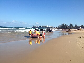
Kings Beach is a coastal suburb of Caloundra in the Sunshine Coast Region, Queensland, Australia, located directly east of Caloundra CBD. In the 2021 census, Kings Beach had a population of 3,042 people.

<span class="mw-page-title-main">Pumicestone Channel</span> Strait in Queensland, Australia

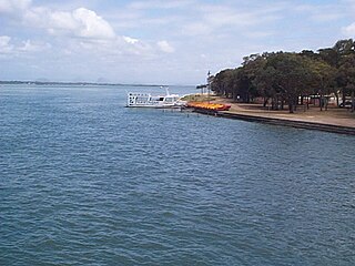
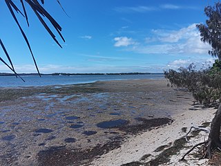
Pumicestone Channel, also known as the Pumicestone Passage, is a narrow, mesotidal waterway around 45 kilometres in length, between Bribie Island and the mainland in Queensland, Australia. The northern extent of the passage is at Caloundra, while at the south is Deception Bay. The waterway is a two way tidal estuary that has 11 creeks flowing into it. At each end of the passage the channels are the deepest and widest.

Bellara is a suburb of Bribie Island in the City of Moreton Bay, Queensland, Australia. In the 2021 census, Bellara had a population of 3,278 people.

<span class="mw-page-title-main">Sandstone Point, Queensland</span> Suburb of City of Moreton Bay, Queensland, Australia

Sandstone Point is a coastal locality in the City of Moreton Bay, Queensland, Australia. In the 2021 census, Sandstone Point had a population of 4,094 people.

<span class="mw-page-title-main">Little Mountain, Queensland</span> Suburb of Sunshine Coast, Queensland, Australia

Little Mountain is a suburb of Caloundra in the Sunshine Coast Region, Queensland, Australia. In the 2021 census, Little Mountain had a population of 11,068 people.

<span class="mw-page-title-main">Caloundra (suburb)</span> Suburb of Sunshine Coast, Queensland, Australia

Caloundra is a coastal suburb and the central business district of the town of Caloundra in the Sunshine Coast Region, Queensland, Australia. In the 2021 census, the suburb of Caloundra had a population of 3,932 people.

<span class="mw-page-title-main">Caloundra West, Queensland</span> Suburb of Caloundra, Queensland, Australia

Caloundra West is a mixed-use suburb of Caloundra in the Sunshine Coast Region, Queensland, Australia. In the 2021 census, Caloundra West had a population of 7,270 people.

<span class="mw-page-title-main">Pelican Waters, Queensland</span> Suburb of Caloundra, Queensland, Australia

Pelican Waters is a suburb of Caloundra in the Sunshine Coast Region, Queensland, Australia. In the 2021 census, Pelican Waters had a population of 7,393 people.

<span class="mw-page-title-main">Coochin Creek</span> Suburb of Sunshine Coast, Queensland, Australia

Coochin Creek is a coastal locality in the south of the Sunshine Coast Region, Queensland, Australia. The locality is named for the creek which flows through it.

<span class="mw-page-title-main">Woorim, Queensland</span> Town in Queensland, Australia

Woorim is a town and suburb of Bribie Island in the City of Moreton Bay, Queensland, Australia. In the 2016 census, Woorim had a population of 1,829 people.

<span class="mw-page-title-main">White Patch, Queensland</span> Town in Queensland, Australia

White Patch is a coastal town and locality of Bribie Island in the City of Moreton Bay, Queensland, Australia. In the 2021 census, White Patch had a population of 150 people.

<span class="mw-page-title-main">Welsby, Queensland</span> Suburb of Bribie Island, Queensland, Australia

Welsby is a coastal locality on Bribie Island in the City of Moreton Bay, Queensland, Australia. In the 2021 census, Welsby had "no people or a very low population".

<span class="mw-page-title-main">Bribie Island North</span> Suburb of Sunshine Coast Region, Queensland, Australia

Bribie Island North is a locality on Bribie Island in the Sunshine Coast Region, Queensland, Australia. It is the only part of Bribie Island in the Sunshine Coast Region with all the rest of the Bribie Island being part of the City of Moreton Bay. In the 2021 census, Bribie Island North had "no people or a very low population".

<span class="mw-page-title-main">Baringa, Queensland</span> Suburb of Sunshine Coast Region, Queensland, Australia

Baringa is a new suburb in the Sunshine Coast Region, Queensland, Australia. It was established in 2017.

References

  1. 1 2 3 Australian Bureau of Statistics (28 June 2022). "Golden Beach (SAL)". 2021 Census QuickStats. Retrieved 28 February 2023. OOjs UI icon edit-ltr-progressive.svg
  2. 1 2 "Golden Beach – suburb in Sunshine Coast Region (entry 50236)". Queensland Place Names. Queensland Government . Retrieved 27 January 2020.
  3. "Queensland Globe". State of Queensland . Retrieved 29 July 2015.
  4. "Northern Bribie Island: What are the potential risks from a tidal breakthrough?" (PDF). Sunshine Coast Regional Council. August 2009. Archived from the original (PDF) on 20 October 2012. Retrieved 29 July 2015.
  5. Stevenson, Ashleigh (14 December 2020). "Bribie Island erosion worries authorities as wild weather continues to whip the region". Australia: ABC News. Archived from the original on 16 December 2020. Retrieved 16 December 2020.
  6. "Introduction - Golden Beach". 2010. Archived from the original on 27 July 2011. Retrieved 19 July 2010.
  7. Queensland Family History Society (2010), Queensland schools past and present (Version 1.01 ed.), Queensland Family History Society, ISBN   978-1-921171-26-0
  8. Australian Bureau of Statistics (27 June 2017). "Golden Beach (SSC)". 2016 Census QuickStats. Retrieved 20 October 2018. OOjs UI icon edit-ltr-progressive.svg
  9. 1 2 "State and non-state school details". Queensland Government. 9 July 2018. Archived from the original on 21 November 2018. Retrieved 21 November 2018.
  10. "Golden Beach State School". Archived from the original on 21 April 2013. Retrieved 21 November 2018.
  11. "ACARA School Profile 2017". Archived from the original on 22 November 2018. Retrieved 22 November 2018.
  12. "Golden Beach SS - Special Education Program". Archived from the original on 21 April 2013. Retrieved 21 November 2018.
  13. "Queensland Globe". State of Queensland . Retrieved 9 August 2023.
  14. "Baringa State Secondary College". Baringa State Secondary College. 13 September 2022. Archived from the original on 25 July 2023. Retrieved 25 July 2023.