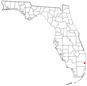
Broadview-Pompano Park is a neighborhood and former census-designated place (CDP) in North Lauderdale, Broward County, Florida, United States. The population was 5,314 at the 2000 census.
Broward Estates was a census-designated place (CDP) in Broward County, Florida, United States. The population was 3,416 at the 2000 census. It now serves as Lauderhill's neighborhood. Residents of this neighborhood often refer to their neighborhood as "Parkway" as well, as it also contains Parkway Middle School.
Chula Vista Isles is a neighborhood of Fort Lauderdale, Florida, United States. It was previously a census-designated place (CDP) in Broward County, Florida, United States. The population was 573 at the 2000 census.
Country Estates was a census-designated place (CDP) in Broward County, Florida, United States. The population was 1,910 at the 2000 census. It is now a neighborhood incorporated into the town of Southwest Ranches, Florida in 2000.
Golden Heights was a census-designated place (CDP) in Broward County, Florida, United States. It is now a neighborhood in the City of Fort Lauderdale. The population was 501 at the 2000 census.
Green Meadow was a census-designated place (CDP) in Broward County, Florida, United States. The population was 1,875 at the 2000 census. It was incorporated into the town of Southwest Ranches, Florida in 2000.
Hillsboro Pines is a census-designated place (CDP) in Broward County, Florida, United States. The population was 496 at the 2020 census.

Ivanhoe Estates was a census-designated place (CDP) in Broward County, Florida, United States. It is located in the Miami metropolitan area. The population was 279 at the 2000 census. It's now a community incorporated into Southwest Ranches, Florida in 2000. Ivanhoe Estates is part of the larger Ivanhoe neighborhood that is split between Southwest Ranches and southwestern Davie, and includes the other Ivanhoe communities, in neighboring Davie, of Hawkes Bluff, Falcon's Lea, Waterford, Cross Bow, and Waverly Hundred, as well as the Les Chateux, Sheridan Glen, The Enclave, and Chelsea at Ivanhoe communities.

Kendall Green was a census-designated place (CDP) in Broward County, Florida, United States, and is now a neighborhood of Pompano Beach, Florida. The population was 3,084 at the 2000 census.
Lake Forest was a census-designated place (CDP) in Broward County, Florida, United States. The population was 4,994 at the 2000 census. It is now a neighborhood of West Park, Florida.
Loch Lomond is a former census-designated place (CDP) in Broward County, Florida, United States. The population was 3,537 at the 2000 census. It now serves as a Pompano Beach neighborhood.
Oak Point was a census-designated place (CDP) in Broward County, Florida, United States. The population was 145 at the 2000 census. It now serves as a Hollywood, Florida neighborhood known for its wealthy residents and beautiful large homes. It is more commonly referred to as Arapahoe.
Rock Island was a census-designated place (CDP) in Broward County, Florida, United States. The population was 3,076 at the 2000 census. It is now a neighborhood of Fort Lauderdale.
Rolling Oaks was a census-designated place (CDP) in Broward County, Florida, United States. The population was 1,291 at the 2000 census. It was incorporated into the town of Southwest Ranches, Florida in 2000, and is now a neighborhood.
Roosevelt Gardens is a census-designated place (CDP) in Broward County, Florida, United States. The population was 2,749 at the 2020 census.
St. George was a census-designated place (CDP) in Broward County, Florida, United States. The population was 2,450 at the 2000 census. It now serves as a neighborhood of Lauderhill, Florida.
Sunshine Ranches is a former census-designated place (CDP) in Broward County, Florida, United States. The population was 1,704 at the 2000 census. It was incorporated into the town of Southwest Ranches, Florida in 2000, and now serves as a neighborhood.

Utopia was a census-designated place (CDP) in Broward County, Florida, in the United States. As of the 2000 census, the CDP population was 714. The area is now part of a West Park neighborhood.
Village Park was a census-designated place (CDP) in Broward County, Florida, United States. The population was 895 at the 2000 census. It is now a part of North Lauderdale, Florida.
Cassville is a census-designated place (CDP) in Monongalia County, West Virginia, United States. The population was 1,268 at the 2020 census. It is included in the Morgantown, West Virginia Metropolitan Statistical Area. Cassville was named after Lewis Cass, a prominent American statesman who served as Secretary of War, Secretary of State, and Governor of Michigan.

