
Busselton is a city in the South West region of the state of Western Australia approximately 220 km (140 mi) south-west of Perth. Busselton has a long history as a popular holiday destination for Western Australians; however, the closure of the Busselton Port in 1972 and the contemporaneous establishment of the nearby Margaret River wine region have seen tourism become the dominant source of investment and development, supplemented by services and retail. The city is best known for the Busselton Jetty, the longest wooden jetty in the Southern Hemisphere.

The Shire of Augusta Margaret River is a local government area in the south-west corner of the South West region of Western Australia, approximately 270 kilometres (168 mi) south of Perth. The shire covers an area of 2,243 square kilometres (866 sq mi) and had a population of over 14,000 at the 2016 Census, about half of whom live in the towns of Margaret River and Augusta.

The City of Busselton is a local government area in the South West region of Western Australia, approximately 230 km (140 mi) south of Perth, the state capital. The city covers an area of 1,455 km2 (562 sq mi) and had a population of 40,640 as at the 2021 Census. It contains two large towns, Busselton and Dunsborough, and a number of smaller towns. The city office is located on Southern Drive, Busselton.
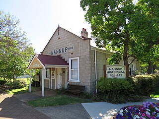
The Shire of Nannup is a local government area in the South West region of Western Australia, approximately 280 kilometres (174 mi) south of the state capital, Perth and 60 kilometres (37 mi) southeast of the coastal resort town of Busselton. Its seat of government is the town of Nannup, where about half of the Shire's population reside.

Vasse is a suburb of the city of Busselton in the South West region of Western Australia, 10 kilometres (6 mi) west of Busselton and 240 kilometres (149 mi) southwest of Perth. Its local government area is the City of Busselton. At the 2021 census, Vasse had a population of 2,853.

The Shire of Capel is a local government area in the South West region of Western Australia, taking in the land between the cities of Bunbury and Busselton about 200 kilometres (124 mi) south of the state capital, Perth. The Shire covers an area of 557.6 square kilometres (215.3 sq mi), and its seat of government is the town of Capel.
Jarrahwood is a small town located in the South West region of Western Australia, near the Vasse Highway between Busselton and Nannup. At the 2021 census, the area had a population of nine.
Ambergate is a semi-rural suburb of the city of Busselton in the South West region of Western Australia. At the 2021 census, it had a population of 564.

Boranup is a locality in the Shire of Augusta-Margaret River in the South West region of Western Australia. It is the site of a large coastal dune blow out known as the "Boranup sand patch" as part of the Boranup beach, and the site of a former M. C. Davies timber company mill. The sand patch area and sand blows affected the alignment of the Busselton to Flinders Bay railway.

Wilyabrup, also spelt Willyabrup, is a locality in Western Australia's Margaret River wine region, in the local government area of the City of Busselton. The Quinninup Falls are within the locality.
Yoongarillup is a locality in Western Australia's South West region in the local government area of the City of Busselton. At the 2021 census, the area had a population of 79.
Yalyalup is a suburb of the Western Australian city of Busselton. At the 2021 census, it had a population of 2,950.

Broadwater is a suburb of the Western Australian city of Busselton. At the 2021 census, it had a population of 4,269.
Bovell is a semi-rural suburb of the Western Australian city of Busselton. At the 2021 census, it had a population of 475. The area has been earmarked for future urban development. Bovell contains Geographe Primary School, named after the nearby suburb, which was established in 2002.
Geographe is a suburb of the Western Australian city of Busselton. At the 2021 census, it had a population of 3,622.
Chapman Hill is a locality in the South West region of Western Australia in the local government area of the City of Busselton. At the 2021 census, the area had a population of 109.
Hithergreen is a rural locality of the City of Busselton in the South West region of Western Australia, located on the Vasse Highway.
Kalgup is a rural locality of the City of Busselton in the South West region of Western Australia.
Reinscourt is a semi-rural locality of the City of Busselton in the South West region of Western Australia, located on the Vasse River in the south-east of Busselton. The southern border of the locality is formed by the Bussell Highway.
Yoganup is a rural locality of the City of Busselton in the South West region of Western Australia. It is the largest locality in the City of Busselton but has the second-lowest population, being almost completely forested. Whicher National Park is almost completely located within Yoganup and the small town of Jarrahwood is completely surrounded by the locality, but not part of it. The Vasse Highway passes through the south-west of Yoganup.

