
Eastern Market is an island platformed Washington Metro station in the Capitol Hill neighborhood of Washington, D.C., United States. The station was opened on July 1, 1977, and is operated by the Washington Metropolitan Area Transit Authority (WMATA). The station currently provides service for the Blue, Orange, and Silver Lines. The station is located in Southeast Washington at Pennsylvania Avenue and 7th Street. It is named after the nearby Eastern Market, a historic Washington, D.C. public marketplace.

Potomac Avenue is an island-platformed Washington Metro station in the Capitol Hill neighborhood of Southeast Washington, D.C., United States. The station was opened on July 1, 1977, and is operated by the Washington Metropolitan Area Transit Authority (WMATA). The station currently provides service for the Blue, Orange, and Silver Lines. The station serves a dense residential area of Southeast Washington around Potomac Avenue and is located at 14th and G Streets.

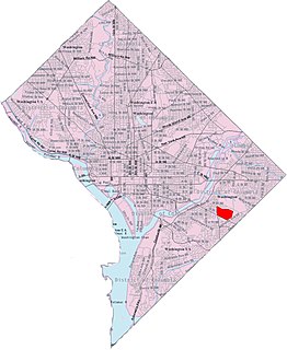
Southeast is the southeastern quadrant of Washington, D.C., the capital of the United States, and is located south of East Capitol Street and east of South Capitol Street. It includes the Capitol Hill and Anacostia neighborhoods, the Navy Yard, the Joint Base Anacostia-Bolling (JBAB), the U.S. Marine Barracks, the Anacostia River waterfront, Eastern Market, the remains of several Civil War-era forts, historic St. Elizabeths Hospital, RFK Stadium, Nationals Park, and the Congressional Cemetery. It also contains a landmark known as "The Big Chair," located on Martin Luther King Jr. Avenue. The quadrant is split by the Anacostia River, with the portion that is west of the river sometimes referred to as "Near Southeast". Geographically, it is the second-smallest quadrant of the city.
Northeast is the northeastern quadrant of Washington, D.C., the capital of the United States. It encompasses the area located north of East Capitol Street and east of North Capitol Street.

Neighborhoods in Washington, D.C., are distinguished by their history, culture, architecture, demographics, and geography. The names of 131 neighborhoods are unofficially defined by the D.C. Office of Planning. Neighborhoods can be defined by the boundaries of wards, historic districts, Advisory Neighborhood Commissions, civic associations, and business improvement districts (BIDs); these boundaries will overlap. The eight wards each elect a member to the Council of the District of Columbia and are redistricted every ten years.

Queens Chapel is a mostly residential neighborhood with commercial elements located in Ward 5 of Northeast Washington, D.C.. Queens Chapel is contained between Eastern Avenue N.E. to the north, Galloway Street N.E. to the south, Riggs Rd N.E. to the north, and the Washington Metropolitan Area Red Line train tracks to the west. Queens Chapel borders the adjacent neighborhoods of Riggs Park, Fort Totten, North Michigan Park, and Michigan Park, which also are located in Ward 5 of Northeast Washington D.C. In addition to these Ward 5 neighborhoods of Northeast Washington D.C., Queens Chapel also borders the neighborhood of Chillum, which is located in Prince George's County, Maryland. The Queens Chapel neighborhood is often confused with the Queens Chapel Neighborhood Association which is located in the Michigan Park neighborhood. It was named for early landowner Richard Queen.

University Heights is a neighborhood adjacent to The Catholic University of America in Ward 5 of Northeast Washington, D.C. in the Upper Northeast area element. It is located east of the University and west of the Franciscan Monastery, bounded by the tracks for the Red Line of the Washington Metro to the west; 14th Street NE to the east; Taylor Street to the north; and Otis Street to the south. University Heights is in DC Neighborhood Cluster 20 along with the Michigan Park and North Michigan Park neighborhoods.

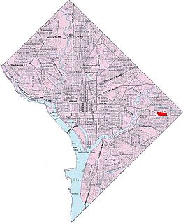
Benning is a residential neighborhood located in Ward 7 of Northeast Washington, D.C. It is bounded by East Capitol Street to the south, Minnesota Avenue to the west, and Benning Road on the north and east. It is served by the Benning Road station on the Blue Line of the Washington Metro.
Benning Heights is a residential neighborhood located in northeast Washington, D.C. It is bounded by East Capitol Street to the south, Brooks Street NE to the north, 44th Street NE and Benning Road NE to the west, and Division Avenue NE to the east. It is served by the Benning Road Metro Rail station on the Blue Line and Silver Line of the Washington Metro.
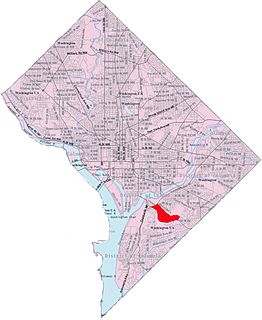
Buena Vista is a residential neighborhood in Southeast Washington, D.C., in the United States. Buena Vista is located in Ward 8. The neighborhood is dominated by detached single-family housing and multi-family apartment complexes.
Central Northeast, also sometimes called Mahaning Heights, is a small neighborhood located in Northeast Washington, D.C. with Fort Mahan Park at its center. It is bounded by Nannie Helen Burroughs Avenue to the north, Benning Road to the south, the tracks of the Washington Metro and Minnesota Ave station to the west, and 44th Street NE to the east.

Lincoln Heights is a residential neighborhood in Northeast Washington, D.C. It is bounded by Nannie Helen Burroughs Avenue NE to the north, Blaine Street NE to the south, Division Avenue NE to the east, and 49th Street NE to the west.

Mayfair or Parkside-Mayfair is a residential neighborhood in Northeast Washington, D.C., United States., on the eastern bank of the Anacostia River. It is bounded by Jay Street NE on the north, Foote Street on the south, Kenilworth Terrace and Anacostia Avenue on the west, and Kenilworth Avenue on the east. Mayfair is encircled by Jay Street and Hayes St., which met at the back of the neighborhood.

Skyland is a neighborhood in Southeast Washington, D.C. It is bounded by Good Hope Road to the northeast, Alabama Avenue to the southeast, and Fort Stanton Park to the south and west. Also see article on Anacostia.
Woodland is a small residential and industrial neighborhood in Southeast Washington, D.C. Woodland lies in Washington's Ward 8, among the poorest and least developed of the city's wards. Like the neighborhoods around it, Woodland is almost exclusively African American. Woodland is bounded by Ainger Place SE to the north; Alabama Avenue SE and Knox Place SE to the east; Hartford Street SE to the south; and Langston Place SE, Raynolds Place SE, and Erie Street SE to the southwest. Fort Stanton Park forms the northwest and northern border of the neighborhood.

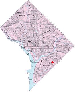
Randle Highlands is a neighborhood in Southeast Washington, D.C., east of the Anacostia River.
Penn Branch is a neighborhood in Southeast Washington, D.C., east of the Anacostia River. It is bounded by Pennsylvania Avenue SE to the south; Pope Branch Park and Pope Creek to the north; Branch Avenue to the west; and Fort Davis Park to the east. ‘Penn Branch’, takes its name from its location at the intersection of two major thoroughfares, Pennsylvania and Branch Avenue.

Douglass is a residential neighborhood in Southeast Washington, D.C., on the eastern side of St. Elizabeths Hospital, on the border of the Congress Heights Metro Station. It is bounded by Suitland Parkway to the north and east, Alabama Avenue to the south, and the St. Elizabeths campus to the west.

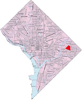
East River Heights is a residential and mixed use neighborhood located in Ward 7 of Washington, DC. It is considered the "downtown" area of the ward and has high walkability ratings. Its borders are East Capital Street, Minnesota Ave, Benning Road up to 41st Street. It is a neighborhood of retired and working people and many children. There is quite a bit of development occurring. The houses are small but have large yards. It is centrally located. It is located between the Minnesota Avenue and Benning Road stations on the Washington Metro.
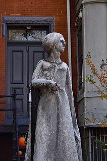
Seward Square is a square and park maintained by the National Park Service located at the intersection of Pennsylvania Avenue and North Carolina Avenue in the Capitol Hill neighborhood of Southeast Washington, D.C. The square is bounded by 4th Street to the west and 6th Street to the east. North and south of the park are the respective westbound and eastbound lanes of Seward Square, SE. Because Pennsylvania and North Carolina Avenues intersect in the middle of the square, it divides the square into four unique smaller parks. The park is named after William Henry Seward, the United States Secretary of State under Presidents Abraham Lincoln and Andrew Johnson. Seward is noted for his part in the American purchase of Alaska from the Russian Empire in 1867. The purchase was ridiculed at the time and was colloquially known as "Seward's Folly". There is no statue of William Seward on the site of the park, however there is a statue of his adopted daughter, Olive Risley Seward located at a private residence at the corner of 6th Street and North Carolina Avenue, SE. The statue was sculpted in 1971 by John Cavanaugh.


