Kreis (Habsburg monarchy)

Last updated

Ethnographic map of the Austrian Empire c. 1855 which also shows the boundaries of the crown lands and Kreise
. Ethnographic map of austrian monarchy czoernig 1855.jpg
Ethnographic map of the Austrian Empire c.1855 which also shows the boundaries of the crown lands and Kreise.

A Kreis (pl.Kreise) or 'Circle' was an administrative division of the Habsburg monarchy and Austrian Empire between 1748 and 1867.

Contents

History

Creation

After the Prussian annexation of the bulk of Silesia following the First and Second Silesian Wars, it became apparent that Frederick II's administrative structures allowed him to take much higher tax revenues from the area. Therefore, in the years following end of the War of the Austrian Succession in 1748, Maria Theresa and Joseph II enacted several administrative reforms with Prussia as a model, and the old territorial divisions were converted into new Kreise. These reforms were carried out by Maria Theresa's advisor Count Friedrich Wilhelm von Haugwitz and continued under chancellor Prince Wenzel Anton von Kaunitz-Rietberg from 1760. The bureaucratisation in the form of Kreisämtern ('circle offices', sg.Kreisamt ) lessened the influence of the estates by essentially separating them from the administration of the realms.

The origin of the Kreis as a unit of administration lay in Bohemia, where Kraje (Kreise in German) had existed as territorial units since the 14th century (see Bohemia § Historical administrative divisions). Through the reform the system was further developed and applied to the Habsburgs' other realms (other than Hungary). In the Archduchy of Austria and Duchy of Styria the old quarters (German: Viertel) served as a basis for the new Kreise (Waldviertel, Mostviertel, Industrieviertel and Weinviertel in Lower Austria; Innviertel, Hausruckviertel, Mühlviertel, and Traunviertel in Upper Austria; Quarter division of Styria 1462  [ de ]).

The Hungarian counterparts were the Comitatus (German: Gespanschaften or Komitate, formerly spelled Comitate; Hungarian : Vármegyék), which had existed for much longer and were dominated by the nobility.

In LombardyVenetia (18151859/66) there were "delegations", [1] which gave rise to the later Provinces.

After 1848

The Amtsbezirke  [ de ] ('office districts'), or more precisely the Bezirksämter ('district offices'), created in the reforms which followed the Revolutions of 1848 (specifically those of 1849 [2] and 1853 [3] ), largely took over the responsibilities of the Kreisämter. These were proposed as early as 1849 by Interior Minister Alexander von Bach as part of a necessary reform to the administrative apparatus to deal with the increase in the number citizens interacting with the offices following the final abolition of serfdom in 1848. The Kreis administrations were thereby subdivided into subordinate Amtsbezirke. Some smaller Kreise were abolished or merged. The Kreis system was also expanded to the Voivodeship of Serbia and Banat of Temeschwar [3] [4] (formerly part of southern Hungary) and the Grand Principality of Transylvania [5] in the course of these reforms.

The statutory cities were also excluded from Kreis administration, much like they are excluded from the modern districts (Bezirke).

Abolition

With the creation of the political districts (Bezirke) in 1868, which go back to the December Constitution of 1867, [6] the Kreis divisions were abolished and replaced with much more finely divided Bezirk divisions; however, the newly created district commissions (Bezirkshauptmannschaften) were strongly influenced by the former Kreis administrations.

Organisation

With the Kreisämtern there was for the first time a level of administration between the manors and free cities and the Imperial Court  [ de ] (in the crown lands the gubernatorial administration). At the head of every Kreis was a Kreishauptmann  [ de ] (roughly 'circle/district captain/head'; see Hauptmann ), whose officials were entrusted with clearly defined tasks, which significantly disempowered the estates in financial matters. The Kreisämter were the lowest level of political administration. This brought together direct oversight of taxation, as well as the conscription and recruitment system, the supervision of schools and poorhouses, the supervision of the individual municipalities and the protection of the peasants before the manor lords. The captains were obliged to travel to the Kreise at least once per year or allow the inspectors to visit. For this the captains received a state salary, but were not allowed to hold any other lordly or stately offices and were bound to their instructions.

The Kreisämtern were subordinate to the Gubernia  [ de ] (the administrative bodies of the crown lands, roughly governorates).

Legacy

Despite numerous reforms, the borders of the Kreise are still roughly visible in the 39 Austrian electoral districts. Also the divisions (Sprengel) of the district courts (Kreisgerichte; now regional courtsLandesgerichte) are essentially equivalent to those of the former Kreisämter. The 35 NUTS 3 regions are loosely aligned with the former Kreis divisions.

List of Kreise

The following is a list of the Kreise and statutory cities in the non-Hungarian lands of the Austrian Empire (Cisleithania in later terminology) c.1854; [7] pre-1848 Kreise [1] are also listed where applicable.

Lands of the Bohemian Crown

Kingdom of Bohemia

Josephinische Landaufnahme Boemia.jpg
Overview map of Bohemia from the Josephinian Land Survey (c.1764–83) showing the Kreise
Mapa kralovstvi ceskeho 1847.jpg
Kreise of Bohemia c.1847
Karte des Konigreiches Bohmen nach der Eintheilung vom Jahre 1854 01.jpg
Kreise of Bohemia from 1854
NameSeat/administrative centreNotes
GermanCzech
PragPrahaitself (Prague)Statutory city
Kreis Prag, Prager KreisPražský krajPragueformed in 1849 from Rakonitzer Kreis and parts of Berauner, Bunzlauer and Kaurimer Kreise
Kreis Beraun  [ de ] or Berauner Kreis Berounský kraj  [ cs ] Beroun ; Kreisamt in Prague [1] abolished in 1849; divided between the Prager and Taborer Kreise
Kreis Kaurim/Kaurzim or Kaur(z)imer Kreis Kouřimský kraj  [ cs ] Kouřim ; Kreisamt in Prague [1] abolished in 1849; mostly divided between the Prager and Taborer Kreise, with some areas passing to the Caslauer Kreis
Kreis Rakonitz or Rakonitzer Kreis Rakovnický kraj  [ cs ]Rakonitz/ Rakovník abolished in 1849
Kreis Budweis or Budweiser KreisBudějovický krajBudweis/ České Budějovice
Kreis Bunzlau  [ de ] or Bunzlauer Kreis Boleslavský kraj  [ cs ]Jung-Bunzlau/ Mladá Boleslav
  • Kreisgerichte ('circle/district courts') 1854: Jung-Bunzlau, Reichenberg [8]
  • City of Reichenberg (Liberec; Stadtbezirk subordinate to Bunzlauer Kreis) [8]
Kreis Chrudim  [ de ] or Chrudimer Kreis Chrudimský kraj  [ cs ] Chrudim
Kreis Časlau, Kreis Czaslau or Časlauer/Czaslauer Kreis Čáslavský kraj  [ cs ]Czaslau/ Čáslav
Kreis Eger or Egerer KreisChebský krajEger/ Cheb established in 1849 from Elbogener Kreis and part of Pilsner Kreis
Kreis Elbogen  [ de ] or Elbogner Kreis Loketský kraj  [ cs ]Elbogen/ Loket became Egerer Kreis in 1849
Kreis Gitschin, Gitschiner Kreis or Jičiner KreisJičínský krajGitschin/Jičínestablished in 1849 from Bidschower Kreis
Kreis Bidschow or Bidschower KreisBydžovský krajBidschow/ Nový Bydžov became Gitschiner Kreis in 1849
Kreis Königgrätz  [ de ] or Königgrätzer Kreis Hradecký kraj  [ cs ]Königgrätz/ Hradec Králové
Kreis Leitmeritz  [ de ] or Leitmeritzer Kreis Litoměřický kraj  [ cs ] Litoměřice Kreisgerichte ('circle/district courts') 1854: Leitmeritz, Böhmisch-Leipa [8]
Kreis Pilsen or Pilsner Kreis Plzeňský kraj  [ cs ] Plzeň in 1849 absorbed Klattauer Kreis
Kreis Pisek or Piseker Kreis Písek established in 1849 from Prachiner Kreis
Kreis Prachin or Prachiner KreisPrácheňský kraj or Prácheňsko Prácheň Castle  [ de; cs ]became Piseker Kreis in 1849
Kreis Saaz  [ de ] or Saazer Kreis Žatecký kraj  [ cs ]Saaz/ Žatec
Kreis Tábor or Tabórer Kreis Táborský kraj  [ cs ] Tábor
Kreis Klattau or Klattauer Kreis Klatovský kraj  [ cs ]Klattau/ Klatovy abolished in 1849 (absorbed into Pilsner Kreis)

The Kreise in Bohemia were abolished in 1862 (enacted 23 October, effective 31 October). [9]

1849–54

In the 1849 administrative reforms which followed the Revolutions of 1848 and introduced the first political districts (Bezirkshaupmannschaften), the Kreise of Bohemia were reduced to seven: [10]

  • City of Prague
  • Prager Kreis – 8 political districts:
    • Smichow
    • Eule
    • Carolinenthal
    • Rakonitz
    • Schlan
    • Melnik
    • Przibram
    • Horzowic
  • Budweiser Kreis – 9 political districts:
    • Budweis
    • Krumau
    • Kaplitz
    • Neuhaus
    • Tabor
    • Mühlhausen
    • Pilgram
    • Beneschau
    • Wotitz
  • Pardubitzer Kreis – 11 political districts:
    • Pardubitz
    • Kolin
    • Schwarz-Kosteletz
    • Kuttenberg
    • Ledetsch
    • Deutsch-Brod
    • Chotieborg
    • Chrudim
    • Hohenmauth
    • Leitomischl
    • Landskron
  • Gitschiner Kreis – 16 political districts:
    • Gitschin
    • Königgrätz
    • Königinhof
    • Trautenau
    • Braunau
    • Reichenau
    • Senftenberg
    • Neustadt
    • Horzic
    • Hohenelbe
    • Podiebrad
    • Neubidschow
    • Turnau
    • Semil
    • Jungbunzlau
    • Nimburg
  • Böhmisch-Leippaer Kreis – 10 political districts:
    • Böhmisch-Leippa
    • Reichenberg
    • Friedland
    • Gabel
    • Tetschen
    • Außig
    • Schlukenau
    • Rumburg
    • Dauba
    • Leitmeritz
  • Egerer Kreis – 12 political districts:
    • Eger
    • Falkenau
    • Plan
    • Tachau
    • Carlsbad
    • Luditz
    • Graßlitz
    • Joachimsthal
    • Saaz
    • Kaaden
    • Brüx
    • Teplitz
  • Pilsner Kreis – 13 political districts:
    • Pilsen
    • Rokitzan
    • Kralowitz
    • Klattau
    • Przestiz
    • Bischofteinitz
    • Tauß
    • Schüttenhofen
    • Winterberg
    • Prachatitz
    • Pisek
    • Strakinitz
    • Brzeznitz

These Kreise lasted until the reforms of 1853/54. [8]

Margraviate of Moravia

Josephinische Landaufnahme Mahren.jpg
Overview map of Moravia from the Josephinian Land Survey (c.1764–81) showing the Kreise
Mahren u. Oesterreichisch Schlesien.jpg
Kreise of Moravia and Austrian Silesia c.1845

Until 1848 part of the joint Gubernium of Moravia and Silesia (Gouvernment Mähren und Schlesien or Mährischschlesisches Landesgubernium; Moravskoslezské gubernium  [ cs; pl ]). [1]

  • City of Brünn (Brno) [11]
  • Kreis Brünn or Brünner Kreis (Czech: Brněnský kraj); in the late 18th century included the area around Saar/Žďár, Neustadtl/Nové Město and Bystrzitz/Bystřice, which later became part of the Iglauer Kreis.
  • Kreis Iglau or Iglauer Kreis (Czech: Jihlavský kraj; Jihlava)
  • Kreis Neutitschein (Czech: Novojičínský kraj; Nový Jičín); until 1848: Kreis Prerau or Prerauer Kreis (Czech: Přerovský kraj; Přerov); Prerau/Přerov itself became part of Kreis Olmütz in 1854. [11]
  • Kreis Olmütz or Olmützer Kreis (Czech: Olomoucký kraj; Olomouc)
    • City of Olmütz (Stadtbezirk subordinate to Kreis Olmütz) [11]
  • Kreis Hradisch or Hradischer Kreis (Czech: Hradišťský kraj; Uherské Hradiště)
  • Kreis Znaim or Znaimer Kreis (Czech: Znojemský kraj; Znojmo)

The traditional Moravian Kreise were abolished in 1849 (see below) but were reconstituted (with some border changes and with Nový Jičín/Neutitschein replacing Přerov/Prerau) in 1854 and divided into Bezirke (76 in total, excluding the cities of Brünn and Olmütz). [11] Changes included:

  • the assignment of the upper (southern) Bečva valley (Bezirk Wsetin/Vsetín) to Kreis Neutitschein [11] (formerly part of the Hradischer Kreis)
  • the assignment of Bezirk Prerau (Přerov) to Kreis Olmütz [11] (formerly the nominal seat of the Prerauer Kreis).
  • the assignment of Bezirk Göding (Hodonín) and Bezirk Kremsier (Kroměříž) to Kreis Hradisch [11] (formerly of the Brünner Kreis and the Prerauer Kreis respectively; Kwassitz/Kvasice, which was part of the new Bezirk Kremsier had already been part of the Hradischer Kreis pre-1848)
  • the assignment of the Bezirke Gewitsch, (Mährisch) Triebau and Zwittau (Jevíčko, Moravská Třebová and Svitavy), as well as part of the new Bezirk Boskowitz around Knichnitz (Knínice) to Kreis Brünn [11] (formerly of the Olmützer Kreis).
  • the assignment of Bezirk Nikolsburg (Mikulov) to Kreis Znaim [11] (formerly of the Brünner Kreis).
  • several settlements along the borders of Kreis Iglau, Kreis Brünn and Kreis Znaim, as well as several exclaves, changed hands, including Groß Bitesch (Velká Bíteš; from Znaim to Iglau) and Eibenschütz (Ivančice; from Znaim to Brünn). [11]

The Moravian Kreise were dissolved in 1860 and their Bezirke (and Bezirksämter) subordinated directly to the Statthalterei in Brünn/Brno. [12]

1849–54

In the 1849 administrative reforms which followed the Revolutions of 1848 and introduced the first political districts (Bezirkshaupmannschaften), the Kreise of Moravia were reduced to two: [13]

The six pre-revolution Kreise were reconstituted, with various changes, in the reforms of 1853/54. [11]

Austrian Silesia

Map of the Teschner Kreis
c. 1844. Teschner Kreis 1844.svg
Map of the Teschner Kreisc.1844.

Formally the Duchy of Upper and Lower Silesia (Herzogtum Ober- und Niederschlesien). Until 1848 part of the joint Gubernium of Moravia and Silesia (Gouvernment Mähren und Schlesien or Mährischschlesisches Landesgubernium). [1] Although administratively separate Silesia was judicially subordinate to Brünn (Moravia) thereafter. [14] Austrian Silesia had no Kreise after the 1849 [13] or 1853 reforms, [3] but the separate Kreisgerichte remained for judicial matters. [14]

  • City of Troppau (Opava)
  • Kreis Troppau or Troppauer Kreis (Czech: Opavský kraj)
  • Kreis Teschen  [ de; cs; pl ] or Teschner Kreis (Czech: Těšínský kraj; Polish : Cyrkuł cieszyński; seat at Těšín, German: Teschen, Polish: Cieszyn; similar to Cieszyn Silesia but with an exclave on the far side of the Oder)

From 1860 Silesia was administered once again from the Moravian Statthalterei in Brünn/Brno but remained a formally separate crown land. [12]

Archduchy of Austria

The Viertel
(Kreise
) of Austria (above and below the Enns) c. 1800. The Muhlkreis
is shown divided into Upper and Lower sections. The map also shows the County of Neuburg [de] in the north-west, which was not part of Austria. Neueste Karte des Erzherzogthums Oesterreich Ob und Unter der Enns.jpg
The Viertel (Kreise) of Austria (above and below the Enns) c.1800. The Mühlkreis is shown divided into Upper and Lower sections. The map also shows the County of Neuburg  [ de ] in the north-west, which was not part of Austria.

Austria below the Enns

Corresponds with modern Lower Austria.

Austria above the Enns

Corresponds with modern Upper Austria. The Kreise in Austria above the Enns were from 1749 subdivided into district commissions and regional courts. [18]

Duchy of Salzburg (from 1849)

Formerly the Salzburgkreis or Salzachkreis of Austria above the Enns, the Duchy of Salzburg became a crown land in its own right (with a single Kreis) on 26 June 1849 [22] (formally constituted 30 December [23] ). The Duchy of Salzburg had no Kreise after 1853. [3]

Duchy of Styria

Kreise
of Styria c. 1855. The solid coloured areas show the pre-1848 Kreise
; the post-1848 Kreise
are shown as numbered areas. Steiermark Perthes 1855.jpg
Kreise of Styria c.1855. The solid coloured areas show the pre-1848 Kreise; the post-1848 Kreise are shown as numbered areas.

The Duchy of Styria (German: Herzogtum Steiermark, contemporary spelling Herzogthum Steyermark), although administered as a single gubernium/Gouvernement, was divided into upper and lower parts – Obersteiermark (Obere-Steyermark) and Untersteiermark (Untere-Steyermark). [1] :318 The upper part, which comprised the Judenburger and Brucker Kreise, [1] :318 corresponds with the modern Austrian use of the term Upper Styria, i.e. the modern districts of Bruck-Mürzzuschlag, Leoben, Liezen, Murau and Murtal in the north-west of the modern Austrian state of Styria; from 1848 it was synonymous with the now-expanded Brucker Kreis. The lower part, which comprised the Grazer, Marburger and Cillier Kreise, [1] :318 included all of Slovene Styria and the modern Austrian Central Styria  [ de ].

Kingdom of Illyria (until 1849)

The Kingdom of Illyria was a crown land formed as a successor to the Napoleonic Illyrian Provinces [note 2] after the 1815 Congress of Vienna returned its territory to Austria. It was divided into two Gubernia: Gubernium Laibach [note 3] and Gubernium Triest. [note 4] It was disbanded in 1849 and replaced with the separate Duchy of Carinthia, Duchy of Carniola and Austrian Littoral crown lands. The Kreise listed below are grouped by these post-1849 crown lands; internally within the Kingdom they were grouped as such, [1] and the duchies and subdivisions of the Littoral correspond with Habsburg states which existed before the 1809 Treaty of Schönbrunn by which they were annexed by Napoleon.

Overview map of Inner Austria from the Josephinian Land Survey (c. 1784-85) showing the Kreise
. Josephinische Landaufnahme Belso Ausztria.jpg
Overview map of Inner Austria from the Josephinian Land Survey (c.1784–85) showing the Kreise.

Until 1809 the area (excluding those parts of Croatia and the Military Frontier which were Illyrian until the 1820s) was organised as part of Inner Austria, an informal region which comprised the Duchies of Styria, Carinthia and Carniola, the County of Gorizia and Gradisca, the March/Margraviate of Istria and the Free City of Trieste. During this period the Habsburg March of Istria only included a small interior part of the peninsula centred on Mitterburg (Pazin, Pisino) and was administered from Carniola; the north-eastern mostly inland part of the later Istrian Kreis, as well as part of the eastern coast of the peninsula and a northern coastal exclave around Duino-Aurisina were part of the Carniolan Adelsberger Kreis. The Republic of Venice held most of the peninsula itself, including all of the western coast and around half of the eastern coast, as well as the islands in the Kvarner Gulf including Krk and Cres; the Venetian territories were annexed by Austria (as the Venetian Province) in the 1797 Treaty of Campo Formio, but lost again to the Napoleonic Kingdom of Italy in the 1805 Peace of Pressburg. The mercury-mining area around Idrija had a special status apart from the Carniolan Kreise. The Princely County of Gorizia and Gradisca included several exclaves in Venetian territory and within the Carniolan Adelsberger Kreis; by the 1805 Peace of Pressburg and 1807 Treaty of Fontainebleau, the parts of the county west of the Soča/Isonzo were ceded to the Napoleonic Kingdom of Italy.

Duchy of Carinthia

The Duchy of Carinthia (Herzogt(h)um Kärnten) was 1815–49 part of Gubernium Laibach of the Kingdom of Illyria; separate crown land thereafter. Carinthia had no Kreise after 1853. [3]

Duchy of Carniola

Map of the Kreise
of Carniola c. 1836 Konigreich Illyrien, Gouvernement Laibach Charte der Kreise 1836.jpg
Map of the Kreise of Carniola c.1836

The Duchy of Carniola (Herzogt(h)um Krain) was 1815–49 part of Gubernium Laibach of the Kingdom of Illyria. Carniola had no Kreise after 1853. [3]

Littoral

Map of the Austrian Littoral, showing the situation some time after 1868; however the Littoral's internal borders are unchanged from the 1850s. Austrian Litoral.jpg
Map of the Austrian Littoral, showing the situation some time after 1868; however the Littoral's internal borders are unchanged from the 1850s.

Formally the Princely County of Gorizia and Gradisca, the Margraviate of Istria and the City of Triest with its Territory (die gefürstete Grafschaft Görz und Gradiska, die Markgrafschaft Istrien und die Stadt Triest mit ihr Gebiet). 1815–49 Gubernium Triest of the Kingdom of Illyria; separate crown land thereafter.

Judicially the Gorizian districts of Comen (Komen) and Sessana (Sežana) and the Istrian districts of Capo d'Istria (Koper, Kopar), Pirano (Piran), Castel-Nuovo (Podgrad) and Volosca (Volosko) were subordinate to the Landesgericht in Trieste (c.1853). [26]

Other

In addition to the Kreise of Carinthia, Carniola and the Littoral listed above, until the 1820s the Kingdom of Illyria also included the former Croatie civile province of the Napoleonic Illyrian Provinces. This territory was transferred to the re-established Kingdom of Croatia, except for Fiume (Rijeka), which returned to its previous status as a Corpus separatum under Hungary. This was organised into:

  • Kreis Karlstadt/Karlstädter Kreis (Karlovac)
  • Kreis Fiume/Fiumaner Kreis (Fiume/Rijeka, which also included the eastern parts of the Istrian peninsula which would later become part of Kreis Istrien

Like the Littoral, these belonged to Gubernium Triest. During this time the remainder of Istria and the southern part of what was later Görz, including all of its coastline (much of which had been part of the Carniolan Adelsberger Kreis until 1809), was organised as the Triester Kreis, which was distinct from the city of Triest.

Tyrol and Vorarlberg

Map showing the Kreise
of the County of Tyrol with Vorarlberg c. 1845 Karte der gefursteten Grafschaft Tyrol nebst Vorarlberg u. dem Furstenthum Lichtenstein.jpg
Map showing the Kreise of the County of Tyrol with Vorarlberg c.1845

Formally the Princely County of Tyrol with Vorarlberg (die gefürstete Grafschaft Tirol mit Vorarlberg) [27] until 1861.

Galicia and Lodomeria; Bukovina

Formally the Kingdom of Galicia and Lodomeria with the Grand Duchy of Kraków (after 1846) and the Duchies of Auschwitz and Zator (Königreich Galizien und Lodomerien mit dem Großherzogt(h)um Krakau und den Herzogt(h)ümern Auschwitz und Zator). The Grand Duchy of Kraków, which was annexed in 1846 (previously the Free City of Cracow) corresponded with the Krakauer Kreis; Auschwitz and Zator had no administrative status, with both forming part of the Wadowicer Kreis, although nominally they were part of the German Confederation while the rest was not.

The Kreise in Galicia and Lodomeria were abolished in 1865 (enacted 23 September, effective 31 October). [30]

Regierungsbezirke (1850–53)

In 1850 Galicia and Lodomeria was divided into three Regierungsbezirke ('government districts'), named after their capitals: Lemberg, Krakau and Stanislau. The Kreise were abolished and replaced with political districts ( Bezirkshauptmannschaften ). [33]

Verwaltungsbebiete (1854–60)

The 1850 changes to the administrative structure of the empire were reversed in Bach's January 1853 reforms, although the precise divisions remained to be determined. [3] In April 1854 Galicia and Lodomeria was divided into two Verwaltungsgebiete (lit.'administrative regions/territories') and its Kreise formally restored: [34]

  • Verwaltungsgebiet Lemberg, containing the 12 eastern Kreise:
    • Lemberg
    • Zołkiew
    • Przemyśl
    • Sanok
    • Złoczow
    • Brzezan
    • Stryi
    • Sambor
    • Tarnopol
    • Czortkow
    • Kolomea
    • Stanislau
  • Verwaltungsgebiet Krakau, containing the 7 western Kreise:
    • Krakau
    • Wadowice
    • Sandec
    • Jasło
    • Rzeszow
    • Tarnow
    • Bochnia

The cities of Lemberg and Krakau remained directly subordinate to the crown land. [34] Bukovina was not part of Galicia and Lodomeria at this time. [3]

A list detailing the Bezirke of each Kreis from 1853 can be found at Subdivisions of the Kingdom of Galicia and Lodomeria § List of Kreise and Bezirke from 1854

In 1860 Verwaltungsgebiet Krakau and Bukovina were dissolved and re-subordinated to Lemberg. [31]

West or New Galicia (1795–1803/09)

Nowa Galicja Mapa - Krakow - Slomniki - Stopnica oraz Bochnia - Myslenice - Nowy Sacz 1803.jpg
Nowa Galicja Mapa - Konskie - Radom - Jozefow - Opatow 1803.jpg
Nowa Galicja Mapa - Wiazowna-Siedlce-Biala-Chelm-Lublin 1803.jpg
Maps of the Kreise of West Galicia c.1803

West or New Galicia (Westgalizien/Neugalizien) comprised the Habsburgs' gains in the Third Partition of Poland in 1795. The first-partition Myslenicer, Sandecer and Bochnier Kreise were also attached to it. It was incorporated into Galicia and Lodomeria 1803–09 as a separate gubernium. Other than the first-partition Kreise it was ceded to the Duchy of Warsaw in 1809 by the Treaty of Schönbrunn (Congress Poland and Free City of Cracow after 1815).

Kingdom of Dalmatia

The Kreise in Dalmatia were abolished in 1865 (enacted 5 December, effective 31 December). [35]

Other crown lands

In the years following the revolutions of 1848 the Kreis system was extended to some additional crown lands:

Voivodeship of Serbia and Banat of Temeschwar

The Kreise
of the Voivodeship of Serbia and Banat of Temeschwar. Vojvodstvo srbija okruzi 1850 01.png
The Kreise of the Voivodeship of Serbia and Banat of Temeschwar.

The Voivodeship of Serbia and Banat of Temeschwar, a short-lived crown land which existed 1849–60, was formally divided into Kreise in 1854. [4] Before the revolutions of 1848 it had been the Bács-Bodrog, Torontál, Temes, and Krassó Counties of Hungary and part of the Syrmia County of Slavonia

Grand Principality of Transylvania

1857 map showing the Transylvanian Kreise
after 1854. Grossfuerstentum Siebenbuergen 1857.JPG
1857 map showing the Transylvanian Kreise after 1854.
  • 1851–54 (5 Kreise or Verwaltungsgebiete): [5]
    • Kreis Herrmannstadt or Herrmannstädter Kreis (the " Sachsenland "; Romanian: Sibiu, Hungarian: Nagyszeben)
    • Kreis Karlsburg or Karlsburger Kreis (Romanian: Alba Iulia, Hungarian: Gyulafehérvár)
    • Kreis Klausenburg or Klausenburger Kreis (Romanian: Cluj-Napoca, Hungarian: Kolozsvár)
    • Kreis Dées or Déeser Kreis (Romanian: Dej; modern Hungarian: Dés; German: Desch, Burglos)
    • Kreis Maros-Vásárhely (modern Hungarian: Marosvásárhely, Romanian: Târgu Mureș, German: Neumarkt am Mieresch)
  • 1854 (10 Kreise): [36]
    • Kreis Herrmannstadt
    • Kreis Kronstadt (Romanian: Brașov, Hungarian: Brassó)
    • Kreis Udvarhely (German: Odorhellen, Romanian: Odorheiu Secuiesc, Hungarian: (Székely)udvarhely)
    • KreisMaros-Vásárhely
    • Kreis Bistritz (Romanian: Bistrița, Hungarian: Beszterce)
    • KreisDéés
    • Kreis Szilágy-Somlyó (German: Schomlenmarkt, Romanian: Șimleu Silvaniei, modern Hungarian: Szilágysomlyó)
    • Kreis Klausenburg
    • Kreis Karlsburg
    • Kreis Broos (Romanian: Orăștie, Hungarian: Szászváros)

The traditional subdivisions of Transylvania (and the Partium ) were restored in the 1860s.

Notes

  1. 1 2 3 By the 1809 Treaty of Schönbrunn the Kingdom of Bavaria annexed various territories from Austria in 1810. These were returned in the 1816 Treaty of Munich.
  2. The Illyrian provinces contained some territory – eastern Tyrol around Lienz – which was not part of the Kingdom of Illyria. Likewise, eastern/"Lower" Carinthia was part of the Kingdom of Illyria but never part of the Illyrian Provinces, having remained Austrian in 1809.
  3. Gubernium Laibach was also known as Upper Illyria (Ober-Illyrien) [1]
  4. Gubernium Triest was also known as Lower Illyria (Unter-Illyrien) or as the Littoral (Küstenland), [1] a name also used for the post-1849 crown land.
  5. 1 2 3 4 In contemporary German the word Tal, meaning valley, was spelled Thal, as were the names of Kreise which included it, i.e.: Oberinnthal or Ober-Innthal; Unterinnthal, Unter-Innthal or Unter-Inn und Wippthal; Pusterthal.
  6. 1 2 In addition to the territory of modern Trentino, post-1849 Kreis Trient also included what is now: The northernmost part of the Chiese valley was part of the Austrian Kingdom of Lombardy–Venetia (specifically the Lombard province of Bergamo) at this time. Kreis Trient gained Truden/Trodena (previously part of the Bozener Kreis, today part of South Tyrol) in the 1854 reforms. [27]
  7. In addition to the territory of modern South and East Tyrol, Kreis Brixen also included Livinallongo del Col di Lana, Colle Santa Lucia and Cortina d'Ampezzo, which are now part of Belluno. It also excluded Graun im Vinschgau (which was part of Kreis Innsbruck), and a few municipalities which were part of Kreis Trient. [note 6]

Related Research Articles

<span class="mw-page-title-main">Esztergom County</span> County of the Kingdom of Hungary

Esztergom County was an administrative county of the Kingdom of Hungary, situated on both sides of the Danube river. Its territory is now divided between Hungary and Slovakia. The territory to the north of the Danube is part of Slovakia, while the territory to the south of the Danube is part of Hungary.

<span class="mw-page-title-main">Komárom County</span> County of the Kingdom of Hungary

Komárom county was an administrative county (comitatus) of the Kingdom of Hungary, situated on both sides of the Danube river. Today, the territory to the north of the Danube is part of Slovakia, while the territory to the south of the Danube is part of Hungary.

<span class="mw-page-title-main">Syrmia County</span> Historic county of the Kingdom of Croatia-Slavonia

Syrmia County was a historic administrative subdivision (županija) of the Kingdom of Croatia-Slavonia. Croatia-Slavonia was an autonomous kingdom within the Lands of the Crown of Saint Stephen (Transleithania), the Hungarian part of Austria-Hungary. The region of Syrmia is today split between Croatia and Serbia. The capital of the county was Vukovar.

<span class="mw-page-title-main">Varaždin County (former)</span> Historic county of the Kingdom of Croatia-Slavonia

Varaždin County was an administrative subdivision (županija) of the Kingdom of Croatia-Slavonia. Croatia-Slavonia was an autonomous kingdom within the Lands of the Crown of Saint Stephen (Transleithania), the Hungarian part of the dual Austro-Hungarian Empire. Its territory is now in northern Croatia. The capital of the county was Varaždin.

<span class="mw-page-title-main">Kingdom of Bohemia</span> Monarchy in Central Europe (1198–1918), predecessor of modern Czechia

The Kingdom of Bohemia, sometimes referenced in English literature as the Czech Kingdom, was a medieval and early modern monarchy in Central Europe. It was the predecessor state of the modern Czech Republic.

<span class="mw-page-title-main">Duchy of Bukovina</span> Austrian crown land (1849–1918)

The Duchy of Bukovina was a constituent land of the Austrian Empire from 1849 and a Cisleithanian crown land of Austria-Hungary from 1867 until 1918.

<span class="mw-page-title-main">Austrian Silesia</span> Autonomous region of Bohemia and Austria (1742–1918)

Austrian Silesia, officially the Duchy of Upper and Lower Silesia, was an autonomous region of the Kingdom of Bohemia and the Habsburg monarchy. It is largely coterminous with the present-day region of Czech Silesia and was, historically, part of the larger Silesia region.

<span class="mw-page-title-main">Voivodeship of Serbia and Banat of Temeschwar</span> Crownland of the Austrian Empire between 1849 and 1860

The Voivodeship of Serbia and Banat of Temeschwar or Serbian Voivodeship and the Banate of Temes, known simply as the Serbian Voivodeship, was a crownland of the Austrian Empire that existed between 1849 and 1861.

<span class="mw-page-title-main">Districts of Austria</span> Administrative subdivision of Austria

A district is a second-level division of the executive arm of the Austrian government. District offices are the primary point of contact between residents and the state for most acts of government that exceed municipal purview: marriage licenses, driver licenses, passports, assembly permits, hunting permits, or dealings with public health officers for example all involve interaction with the district administrative authority.

<span class="mw-page-title-main">Subdivisions of the Kingdom of Galicia and Lodomeria</span>

The Kingdom of Galicia and Lodomeria, a crown land of Austria-Hungary, was subdivided into political districts for administrative purposes, which were referred to in Polish as powiaty. When they were introduced in 1867 there were 74 of these administrative counties; in 1900 there were 78 counties. The administrative counties were responsible for storing vital records. These counties were introduced following the 1867 December Constitution.

<span class="mw-page-title-main">Zala County (former)</span> County of the Kingdom of Hungary

Zala was an administrative county (comitatus) of the Kingdom of Hungary, bordered by the river Drave to the south. The territory of the former county is now divided between Hungary, Croatia and Slovenia. The capital of the county was Zalaegerszeg.
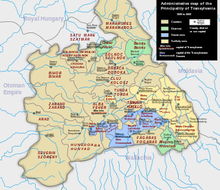
<span class="mw-page-title-main">Kraszna County</span> County of the Kingdom of Hungary

Kraszna county is a former administrative county of the Kingdom of Hungary along the river Kraszna; its territory is now in north-western Romania. Its capital cities were Krasznavár, Valkóvár and Szilágysomlyó.
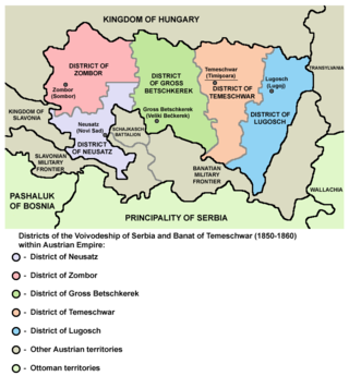
<span class="mw-page-title-main">Neusatz District</span> Defunct district of the Voivodeship of Serbia and Banat of Temeschwar

Neusatz District was one of five administrative districts of the Voivodeship of Serbia and Banat of Temeschwar from 1850 to 1860. Its administrative center was Neusatz.

<span class="mw-page-title-main">Zombor District</span> Administrative district of Voivodeship of Serbia and Banat of Temeschwar

Zombor District was one of five administrative districts of the Voivodeship of Serbia and Temes Banat from 1850 to 1860. Its administrative center was Zombor.

<span class="mw-page-title-main">Großbetschkerek District</span> Administrative district of Voivodeship of Serbia and Banat of Temeschwar

Großbetschkerek District was one of five administrative districts of the Voivodeship of Serbia and Banat of Temeschwar from 1850 to 1860. Its administrative center was Großbetschkerek.

Szolnok County was a county in the Kingdom of Hungary between the 11th century and 1426. It was made up of two disconnected parts, one in what later became Transylvania and the Partium, the other around the Tisza centred on the settlement of Szolnok. The county was eventually split and became:

<span class="mw-page-title-main">Margraviate of Moravia</span> Part of the Bohemian Crown from 1182 to 1918

The Margraviate of Moravia was one of the Lands of the Bohemian Crown within the Holy Roman Empire and then Austria-Hungary, existing from 1182 to 1918. It was officially administered by a margrave in cooperation with a provincial diet. It was variously a de facto independent state, and also subject to the Duchy, later the Kingdom of Bohemia. It comprised the historical region called Moravia, which lies within the present-day Czech Republic.

<span class="mw-page-title-main">Bukovina District</span> Administrative-territorial unit of the Kingdom of Galicia and Lodomeria

The Bukovina District, also known as the Chernivtsi District, was an administrative division – a Kreis – of the Kingdom of Galicia and Lodomeria within the Habsburg monarchy in Bukovina, annexed from Moldavia. It was first a military district from 1775 to 1786 until it was officially incorporated into Galicia and Lodomeria as its own district.

<span class="mw-page-title-main">Temesvár District</span> Administrative district of Voivodeship of Serbia and Banat of Temeschwar

Temesvár District was one of five administrative districts of the Voivodeship of Serbia and Banat of Temeschwar from 1851 to 1860. Its administrative centre was Temesvár, which was also the capital of the crown land. Following the 1854 reform Temesvár itself was directly subject to the crown land, and so separate from the district, while still acting as its capital.

<span class="mw-page-title-main">Lugos District</span> Administrative district of Voivodeship of Serbia and Banat of Temeschwar

Lugos District was one of five administrative districts of the Voivodeship of Serbia and Banat of Temeschwar from 1851 to 1860. Its administrative centre was Lugos.

References

  1. 1 2 3 4 5 6 7 8 9 10 11 12 13 14 15 16 17 18 19 20 21 22 23 24 25 26 A. Balbis (1842), Allgemeine Erdbeschreibung oder Hausbuch des geographischen Wissens., Pest
  2. Gesetz vom 26. Juni 1849, RGBl. 295/1849: "Kaiserliche Entschließung vom 26. Juni 1849, wodurch die Grunzüge für die Organisation der Politischen Verwaltungs-Behörden genehmiget werden". ÖNB-ALEX - Historische Rechts- und Gesetztexte Online (in German). 1849-06-26. Retrieved 2023-07-04.
  3. 1 2 3 4 5 6 7 8 9 10 Gesetz vom 19. Jänner 1853, RGBl. 10/1853: "Verordnung der Minister des Inneren, der Justiz und der Finanzen vom 19. Jänner 1853, womit die Allerhöchsten Entschließungen über die Einrichtung und Amtswirksamkeit der Bezirksämter, Kreisbehörden und Statthaltereien, über die Einrichtung der Gerichtsstellen und das Schema der systemisirten Gehalte und Diätenclassen, sowie über die Ausführung der Organisirung für die Kronländer Oesterreich ob und unter der Enns, Böhmen, Mähren, Schlesien, Galizien und Lodomerien mit Krakau, Bukowina, Salzburg, Tirol mit Vorarlberg, Steiermark, Kärnthen, Krain, Görz, Gradiska und Istrien mit Triest, Dalmatien, Kroatien und Slawonien, Siebenbürgen, die serbische Wojwodschaft mit dem Banate, kundgemacht werden". ÖNB-ALEX - Historische Rechts- und Gesetztexte Online (in German). 1853-01-19. Retrieved 2023-07-04.
  4. 1 2 "Verordnung der Minister des Inneren, der Justiz und der Finanzen vom 1. Februar 1854, betreffend die politische und gerichtliche Organisirung der serbischen Woiwodschaft und des Temeser Banates". Reichs-Gesetz-Blatt für das Kaiserthum Österreich (in German). 1854-02-01. Retrieved 2023-07-04 via ÖNB-ALEX - Historische Rechts- und Gesetztexte Online.
  5. 1 2 "Verordnung des Ministeriums des Inneren vom 12. Mai 1851, wodurch in Folge Allerhöchster Entschließung vom 12. Mai 1851 die Organisirung politischen Verwaltung im Großfürstenthume Siebenbürgen kundgemacht wird". Reichs-Gesetz-Blatt für das Kaiserthum Österreich (in German). 1851-05-12. Retrieved 2023-07-04 via ÖNB-ALEX - Historische Rechts- und Gesetztexte Online.
  6. "RGBl. 1868/44. Gesetz vom 19. Mai 1868 über die Einrichtung der politischen Verwaltungsbehörden in (...)" [Act of 19 May 1868, about the establishment of the political administrative authorities in [list of crown lands]], Reichs-Gesetz-Blatt für das Kaiserthum Österreich (in German), pp. 76–81, 1868-05-19 via ÖNB-ALEX - Historische Rechts- und Gesetztexte Online (Österreichische Nationalbibliothek)
  7. Rumpler, Helmut (1997), Österreichische Geschichte 1804–1914. Eine Chance für Mitteleuropa. Bürgerliche Emanzipation und Staatsverfall in der Habsburgermonarchie.[Austrian History 1804–1914. A chance for Central Europe. Citizen Emancipation and State Decline in the Habsburg Monarchy] (in German), Vienna: Ueberreuther, pp. 476–477, ISBN   978-3-8000-3979-1
  8. 1 2 3 4 Gesetz vom 9. October 1854, RGBl. 274/1854: "Verordnung der Ministerien des Innern, der Justiz und der Finanzen vom 9. October 1854, betreffend die politische und gerichtliche Organisirung des Königreiches Böhmen". Reichs-Gesetz-Blatt für das Kaiserthum Österreich (in German). 1854-10-09. Retrieved 2023-07-05 via ÖNB-ALEX - Historische Rechts- und Gesetztexte Online.
  9. Gesetz vom 23. October 1862, RGBl. 73/1862: "Verordnung des Staatsministeriums vom 23. October 1862, die Aufhebung der Kreisbehörden in Böhmen betreffend". Reichs-Gesetz-Blatt für das Kaiserthum Österreich (in German). 1862-10-23. Retrieved 2024-10-16 via ÖNB-ALEX - Historische Rechts- und Gesetztexte Online.
  10. Gesetz vom 9. August 1849, RGBl. 352/1849: "Erlaß der Ministeriums des Innern vom 9. August 1849, womit die in Folge Allerhöchster Entschliesung vom 4. August 1849 genehmigte Organisirung der politischen Verwaltungsbehörden für das Kronland Böhmen kundgemacht wird, und sie Maßregeln zu deren Durchführung festgesetzt werden". Reichs-Gesetz-Blatt für das Kaiserthum Österreich (in German). 1849-08-09. Retrieved 2023-07-05 via ÖNB-ALEX - Historische Rechts- und Gesetztexte Online.
  11. 1 2 3 4 5 6 7 8 9 10 11 Gesetz vom 21. April 1854, RGBl. 103/1854: "Verordnung der Minister des Innern, der Justiz und der Finanzen vom 21. April 1854, betreffend die politische und gerichtliche Organisirung der Markgrafschaft Mähren". Reichs-Gesetz-Blatt für das Kaiserthum Österreich (in German). 1854-04-21. Retrieved 2023-07-05 via ÖNB-ALEX - Historische Rechts- und Gesetztexte Online.
  12. 1 2 Gesetz vom 5. Juni 1860, RGBl. 142/1860: "Verordnung des Ministers des Innern vom 5. Juni 1860, giltig für den ganzen Umfang des Reiches, betreffend die Auflösung der Kreisbehörden in Mähren, der Landesregierung und Landes-Baudirection in Schlesien und die administrative Unterordnung dieses Herzogthumes unter die Statthalterei zu Brünn". Reichs-Gesetz-Blatt für das Kaiserthum Österreich (in German). 1860-06-05. Retrieved 2024-04-20 via ÖNB-ALEX - Historische Rechts- und Gesetztexte Online.
  13. 1 2 Gesetz vom 9. August 1849, RGBl. 355/1849: "Erlaß der Ministeriums des Innern vom 9. August 1849, womit die in Folge Allerhöchster Entschliesung vom 4. August 1849 genehmigte Organisirung der politischen Verwaltungsbehörden für die Kronländer Mähren und Schlesien kundgemacht wird, und sie Maßregeln zu deren Durchführung festgesetzt werden". Reichs-Gesetz-Blatt für das Kaiserthum Österreich (in German). 1849-08-09. Retrieved 2023-07-05 via ÖNB-ALEX - Historische Rechts- und Gesetztexte Online.
  14. 1 2 Gesetz vom 21. April 1854, RGBl. 104/1854: "Verordnung der Minister des Innern, der Justiz und der Finanzen vom 21. April 1854, betreffend die politische und gerichtliche Organisirung des Herzogthumes Ober- und Nieder-Schlesien". Reichs-Gesetz-Blatt für das Kaiserthum Österreich (in German). 1854-04-21. Retrieved 2023-07-05 via ÖNB-ALEX - Historische Rechts- und Gesetztexte Online.
  15. Gesetz vom 20. März 1850, LGBl. 21/1850: "Kundmachung der k.k. Statthalterei und Kreisregierung von Niederösterreich vom 20. März 1850, womit die Verordnung des Ministers des Innern vom 9. März 1850, wegen Erlassung der provisorischen Gemeindeordnung für die Stadt Wien zur allgemein Kenntniß gebracht wird". Landes-Gesetz- und Verordnungsblatt für das Erzherzogthum Oesterreich unter der Enns (in German). 1850-03-20. Retrieved 2023-11-09 via ÖNB-ALEX - Historische Rechts- und Gesetztexte Online.
  16. 1 2 3 4 Gesetz vom 25. November 1853, RGBl. 249/1853: "Verordnung der Minister des Innern, der Justiz und der Finanzen vom 25. November 1853, betreffend die politische und gerichtliche Organisirung des Erzherzogthumes Oesterreich unter der Enns". Reichs-Gesetz-Blatt für das Kaiserthum Österreich (in German). 1853-11-25. Retrieved 2023-11-09 via ÖNB-ALEX - Historische Rechts- und Gesetztexte Online.
  17. Gesetz vom 19. September 1866, LGBl. 17/1866: "Gesetz, womit ein Gemeinde-Statut und eine Gemeinde-Ordnung für die Stadt Wiener-Neustadt erlassen wird". Landes-Gesetz- und Verordnungsblatt für das Erzherzogthum Oesterreich unter der Enns (in German). 1866-09-19. Retrieved 2023-11-09 via ÖNB-ALEX - Historische Rechts- und Gesetztexte Online.
  18. Benedikt Pillwein, ed. (1830), "3: Der Hausruckkreis.", Geschichte, Geographie und Statistik des Erzherzogthums Oesterreich ob der Enns und des Herzogthums Salzburg (1 ed.), Linz, p. 167 With a register, which provides both the topographic and genealogical lexicon, and the Kreis map. Geographical-historical-statistical detail after Districts-Commissioner. (Google eBook); (2nd edition 1843 Google Book)
  19. Erlaß vom 15. Juni 1850, LGBl. 261/1850: "Erlaß des Statthalters vom 15. Juni 1850, womit die Gemeindeordnung für die Landeshauptstadt Linz und die Vorschrift zur Durchführung der Wahlen für den nach derselben zu knstitutuirenden Gemeinderath kundgemacht werden". Landes-Gesetz- und Regierungsblatt für das Erzherzogthum Oesterreich ob der Enns (in German). 1850-06-15. Retrieved 2023-11-09 via ÖNB-ALEX - Historische Rechts- und Gesetztexte Online.
  20. 1 2 3 4 5 Gesetz vom 25. November 1853, RGBl. 250/1853: "Verordnung der Minister des Innern, der Justiz und der Finanzen vom 25. November 1853, betreffend die politische und gerichtliche Organisirung des Erzherzogthumes Oesterreich ob der Enns". Reichs-Gesetz-Blatt für das Kaiserthum Österreich (in German). 1853-11-25. Retrieved 2023-11-09 via ÖNB-ALEX - Historische Rechts- und Gesetztexte Online.
  21. Gesetz vom 18. Jänner 1867, LGBl. 8/1850: "Landesgesetz betreffend das Gemeinde-Statut für die Stadtgemeinde Steyr". Landes-Gesetz- und Regierungsblatt für das Erzherzogthum Oesterreich ob der Enns (in German). 1867-01-18. Retrieved 2023-11-09 via ÖNB-ALEX - Historische Rechts- und Gesetztexte Online.
  22. 1 2 Gesetz vom 26. Juni 1849, RGBl. 289/1849: "Kaiserliche Verordnung vom 26. Juni 1849, womit die Organisirung der Gerichte in den Kronländern Oesterreich ob der Enns und Salzburg genehmigt wird". Reichs-Gesetz-Blatt für das Kaiserthum Österreich (in German). 1849-06-26. Retrieved 2023-07-20 via ÖNB-ALEX - Historische Rechts- und Gesetztexte Online.
  23. Patent vom 30. December 1849, RGBl. 3/1849: "Kaiserliches Patent vom 30. December 1849, wodurch die Landesverfassung für das Herzogthum Salzburg sammt der dazu gehörigen Landtags-Wahlordnung erlassen und verkündet wird". Reichs-Gesetz-Blatt für das Kaiserthum Österreich (in German). 1849-12-30. Retrieved 2023-07-20 via ÖNB-ALEX - Historische Rechts- und Gesetztexte Online.
  24. "Die provisorische, von Sr. Majestät genehmigte Gemeinde-Ordnung für die Stadt Graz nebst der Vorschrift über den Wirkungskreis des gegenwärtigen Gemeinderathes in Betreff der ersten nach dieser Gemeinde-Ordnung vorzunehmenden Wahlen". Landesgesetzblatt Steiermark (in German). 1850-04-27. Retrieved 2023-07-05 via ÖNB-ALEX - Historische Rechts- und Gesetztexte Online.
  25. 1 2 Gesetz vom 31. Jänner 1854, RGBl. 27/1854: "Verordnung der Minister des Innern, der Justiz und der Finanzen vom 31. Jänner 1854, betreffend die politische und gerichtliche Organisirung des Herzogthumes Steiermark". Reichs-Gesetz-Blatt für das Kaiserthum Österreich (in German). 1854-01-31. Retrieved 2023-07-05 via ÖNB-ALEX - Historische Rechts- und Gesetztexte Online.
  26. 1 2 Gesetz vom 6. December 1853, RGBl.261/1853: "Verordnung der Minister des Innern, der Justiz und der Finanzen vom 6. December 1853, betreffend die politische und gerichtliche Organisirung der gefürsteten Grafschaft Görz und Gradiska, der Markgrafschaft Istrien und der Stadt Triest mit ihrem Gebiete". Reichs-Gesetz-Blatt für das Kaiserthum Österreich (in German). 1853-12-06. Retrieved 2023-12-13 via ÖNB-ALEX - Historische Rechts- und Gesetztexte Online.
  27. 1 2 3 4 Gesetz vom 6. Mai 1854, RGBl.117/1854: "Verordnung der Minister des Innern, der Justiz und der Finanzen vom 6. Mai 1854, betreffend die politische und gerichtliche Organisirung der gefürsteten Grafschaft Tirol mit Vorarlberg". Reichs-Gesetz-Blatt für das Kaiserthum Österreich (in German). 1854-05-06. Retrieved 2023-07-20 via ÖNB-ALEX - Historische Rechts- und Gesetztexte Online.
  28. 1 2 3
  29. 1 2 Patent vom 28. Februar 1861, RGBl. 20/1861: "February Patent". Reichs-Gesetz-Blatt für das Kaiserthum Österreich. 1861-02-28. Retrieved 2023-07-07 via ÖNB-ALEX - Historische Rechts- und Gesetztexte Online.
  30. Gesetz vom 23. September 1865, RGBl. 92/1865: "Verordnung des Staatsministeriums vom 23. September 1865, über die Aufhebung der Kreisbehörden in Galizien". Reichs-Gesetz-Blatt für das Kaiserthum Österreich (in German). 1865-09-23. Retrieved 2024-10-16 via ÖNB-ALEX - Historische Rechts- und Gesetztexte Online.
  31. 1 2 3 4 5 Gesetz vom 6. August 1860, RGBl. 198/1860: "Verordnung der Ministerien des Innern und der Justiz vom 6. August 1860, giltig für das Königreich Galizien mit dem Großherzogthume Krakau und für das Herzogthum Bukowina, womit der Zeitpunct der Einstellung der Amtswirksamkeit der Landesregierungen in Krakau und Czernowitz, sowie der Landes-Bauhehörden daselbst, dann der Kreisbehörden in Wadowice, Bochnia und Jasło, ferner der Beginn der Wirksamkeit der Kreisbehörde in Czernowitz bekannt gegeben, und die aus diesem Anlasse in politischer und gerichtlicher Beziehung erforderlichen Uebergangsbestimmungen erlassen werden". Reichs-Gesetz-Blatt für das Kaiserthum Österreich (in German). 1860-08-06. Retrieved 2023-07-04 via ÖNB-ALEX - Historische Rechts- und Gesetztexte Online.
  32. Gesetz vom 13. März 1849, RGBl. 163/1849: "Erlaß des Ministeriums des Innern vom 13. März 1849, womit die Stellung und der Wirkungskreis des k. k. Kreishauptmannes zu Czernowitz, als provisorischer Landeschef des Kronlandes Bukowina, festgesetzt wird". Reichs-Gesetz-Blatt für das Kaiserthum Österreich (in German). 1849-03-13. Retrieved 2023-07-09 via ÖNB-ALEX - Historische Rechts- und Gesetztexte Online.
  33. "Verordnung des Ministeriums des Innern vom 8. October 1850, wodurch die von Seiner Majestät sanctionirte Organisation der politischen Verwaltung der Königreiche Galizien und Lodomerien mit den Herzogthümern Auschwitz und Zator und dem Großherzogthume Krakau kundgemacht wird". Reichs-Gesetz-Blatt für das Kaiserthum Österreich. 1850-10-08. Retrieved 2023-07-06 via ÖNB-ALEX - Historische Rechts- und Gesetztexte Online.
  34. 1 2 "Verordnung der Minister des Innern, der Justiz und der Finanzen vom 24. April 1854, betreffend die politische und gerichtliche Organisirung der Königreiche Galizien und Lodomerien mit dem Großherzogthume Krakau und den Herzogthümern Auschwitz und Zator" [Regulation of the Ministers of the Interior, Justice and Finance of 24 April 1854, concerning the political and judicial organisation of the Kingdoms of Galicia and Lodomeria with the Grand Duchy of Krakau and the Duchies of Auschwitz and Zator.]. Reichs-Gesetz-Blatt für das Kaiserthum Österreich. 1854-04-24. Retrieved 2023-07-04 via ÖNB-ALEX - Historische Rechts- und Gesetztexte Online.
  35. Gesetz vom 5. December 1865, RGBl. 129/1865: "Verordnung des Staatsministeriums vom 5. December 1865, über die Aufhebung der Kreisbehörden in Dalmatien". Reichs-Gesetz-Blatt für das Kaiserthum Österreich (in German). 1865-12-05. Retrieved 2024-10-16 via ÖNB-ALEX - Historische Rechts- und Gesetztexte Online.
  36. "Verordnung der Minister des Inneren, der Justiz und der Finanzen vom 4. Juni 1854, betreffend die politische und gerichtliche Organisirung des Großfürstenthumes Siebenbürgen". Reichs-Gesetz-Blatt für das Kaiserthum Österreich (in German). 1854-06-04. Retrieved 2023-07-04 via ÖNB-ALEX - Historische Rechts- und Gesetztexte Online.