List of Roman amphitheatres

Last updated
Map of Roman amphitheatres Amphi-Rome.PNG
Map of Roman amphitheatres

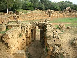
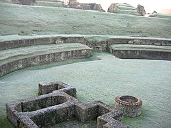
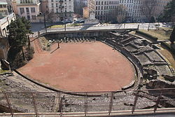
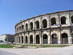
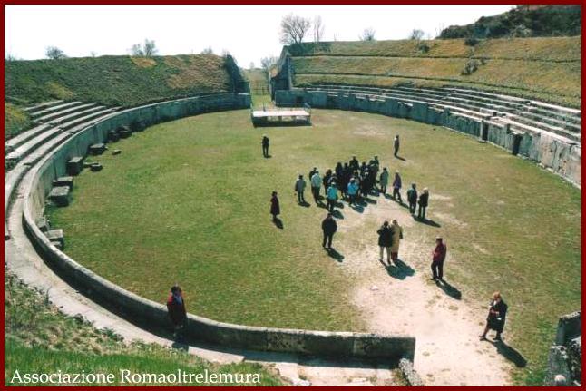
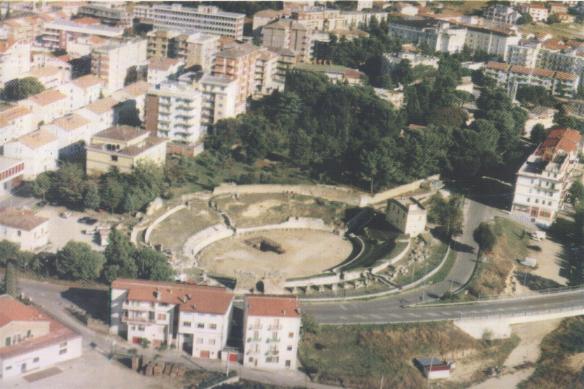
The remains of at least 230 Roman amphitheatres have been found widely scattered around the area of the Roman Empire. These are large, circular or oval open-air venues with raised 360 degree seating and not to be confused with the more common theatres, which are semicircular structures. There are, however, a number of buildings that have had a combined use as both theatre and amphitheatre, particularly in western Europe. Following is an incomplete list of Roman amphitheatre locations by country.

Contents

City
(Roman name)
City
(modern name)
Country
Year of
construction
Coordinates
External Axes (m)Notes
References
Photograph
Dyrrhachium Durrës Albania 2nd century AD 41°18′44″N19°26′43″E / 41.312186°N 19.445323°E / 41.312186; 19.445323 (Dyrrhachium (Durres)) 132 x 113 Durrës Amphitheatre
Amphitheatre of durres albania 2016.jpg
Lambaesis Lambèse Algeria 35°29′21″N6°15′36″E / 35.489247°N 6.259935°E / 35.489247; 6.259935 (Lambaesis (Lambèse))
Colonia Claudia Caesarea Cherchell Algeria 36°36′31″N2°11′56″E / 36.608740°N 2.198826°E / 36.608740; 2.198826 (Colonia Claudia Caesarea (Cherchell))
Gemellae M'lili Algeria 34°38′07″N5°31′22″E / 34.635409°N 5.522764°E / 34.635409; 5.522764 (Gemellae (M'lili))
Theveste Tébessa Algeria 4th century AD 35°24′04″N8°07′26″E / 35.401246°N 8.123764°E / 35.401246; 8.123764 (Theveste (Tébessa)) Aerial Photograph [1]
Tipasa Tipaza Algeria 36°35′35″N2°26′44″E / 36.593152°N 2.445456°E / 36.593152; 2.445456 (Tipasa (Tipaza)) Map of Tipasa
Tipasa.jpg
Brigantium Bregenz Austria 47°30′02″N9°44′52″E / 47.500461°N 9.747879°E / 47.500461; 9.747879 (Brigantium (Bregenz) - civil) Roman Theatre (Bregenz)
Bregenz-Roman theater-01ASD.jpg
Carnuntum Petronell Austria 48°06′36″N16°51′03″E / 48.1101°N 16.8509°E / 48.1101; 16.8509 (Carnuntum (Petronell) - civil)

48°07′37″N16°53′34″E / 48.1269°N 16.8927°E / 48.1269; 16.8927 (Carnuntum (Petronell) - military)

2 amphitheatres [2]
Ancient Roman amphitheatre in Petronell-Carnuntum.JPG
Flavia Solva Leibnitz Austria 46°46′00″N15°34′03″E / 46.766744°N 15.567417°E / 46.766744; 15.567417 (Flavia Solva (Leibnitz)) [2]
Virunum Magdalensberg Austria 46°41′53″N14°22′01″E / 46.697951°N 14.366943°E / 46.697951; 14.366943 (Virunum (Magdalensberg)) [2]
AT Virunum Panorama.jpg
Augusta Traiana Stara Zagora Bulgaria
Stara Zagora - Bulgarien Romisches Theater.JPG
Diocletianopolis (Thrace) Hisarya Bulgaria 42°30′10″N24°42′35″E / 42.502825°N 24.709776°E / 42.502825; 24.709776 (Diocletianopolis (Hisarya)) [2]
Amphitheatre Diocletianopolis.jpg
Marcianopolis Devnya Bulgaria 43°13′20″N27°34′10″E / 43.222222°N 27.569444°E / 43.222222; 27.569444 (Marcianopolis (Devnya))
Amphitheatre Marcianopolis.jpg
Serdica Sofia Bulgaria 3rd century AD 42°41′52″N23°19′48″E / 42.697803°N 23.330031°E / 42.697803; 23.330031 (Serdica (Sofia)) 60 x 43 Amphitheatre of Serdica [3]
Sofia-amphitheatre-remnants-1.jpg
Pietas Iulia Pola Pula Croatia 1st century AD 44°52′23″N13°51′00″E / 44.873176°N 13.850112°E / 44.873176; 13.850112 (Pietas Iulia Pola (Pula)) 132 x 105 Pula Arena [4]
2017 Amphitheatre (Pula), exterior 03.jpg
Salona Solin Croatia 43°32′18″N16°28′26″E / 43.538469°N 16.473956°E / 43.538469; 16.473956 (Salonae (Solin)) 125 x 100
The Amphitheatre, erected in the latter half of the 2nd century AD, the fights in the arena could be watched by some 17,000 spectators, Salona (12248983623).jpg
Burnum Croatia 44°01′09″N16°01′06″E / 44.0192°N 16.0182°E / 44.0192; 16.0182 (Burnum) 101 x 77Roman military camp near Šibenik, had a small amphitheatre, recently discovered [2]
Augusta Paphus Paphos Cyprus 34°45′18″N32°24′19″E / 34.754942°N 32.405344°E / 34.754942; 32.405344 (Augusta Paphus (Paphos)) [2]
Salamis Cyprus 35°11′08″N33°54′09″E / 35.185522°N 33.90238°E / 35.185522; 33.90238 ((Salamis)) Amphitheatre almost vanished. [2]
Calleva Atrebatum Silchester England 51°21′32″N1°04′31″W / 51.35885°N 1.07528°W / 51.35885; -1.07528 (Calleva Atrebatum (Silchester)) [2]
Silchester Amphitheatre.jpg
Camulodunum Colchester England 51°53′00″N0°54′00″E / 51.883333°N 0.9°E / 51.883333; 0.9 (Camulodunum (Colchester)) Located in 2005 (near Circular Road North)
Corinium Dobunnorum Cirencester England 2nd century AD 51°42′41″N1°58′20″W / 51.711500°N 1.972190°W / 51.711500; -1.972190 (Corinium Dobunnorum (Cirencester)) Cirencester Amphitheatre [2]
Cirencester Amphitheatre.jpg
Deva Victrix Chester England 1st century AD 53°11′21″N2°53′13″W / 53.189191°N 2.887027°W / 53.189191; -2.887027 (Deva Victrix (Chester)) 97.5 x 87.2 Chester Roman Amphitheatre [2]
Chester amphitheatre.jpg
Durnovaria Dorchester England 50°42′28″N2°26′25″W / 50.70790°N 2.44039°W / 50.70790; -2.44039 (Durnovaria (Dorchester)) Maumbury Rings [2]
Maumbury-rings-inside.jpg
Frilford England 51°40′15″N1°21′44″W / 51.670833°N 1.362222°W / 51.670833; -1.362222 (Frilford) Debated [2]
Iscalis (?) Charterhouse England 51°18′19″N2°43′13″W / 51.3054°N 2.72032°W / 51.3054; -2.72032 (Iscalis (Charterhouse)) [2]
Isurium Brigantum Aldborough England 54°05′17″N1°22′53″W / 54.088179°N 1.381325°W / 54.088179; -1.381325 (Isurium Brigantum (Aldborough))
Londinium London England 1st century AD 51°30′56″N0°05′32″W / 51.515546°N 0.092215°W / 51.515546; -0.092215 (Londinium (London)) Amphitheatre (London)
Noviomagus Reginorum Chichester England 50°50′08″N0°46′21″W / 50.835448°N 0.772496°W / 50.835448; -0.772496 (Noviomagus Reginorum (Chichester)) [2]
Rutupiae Richborough England 51°17′25″N1°19′36″E / 51.290171°N 1.326534°E / 51.290171; 1.326534 (Rutupiae (Richborough)) [2]
Viroconium Cornoviorum Wroxeter England 52°40′00″N2°39′00″W / 52.666667°N 2.65°W / 52.666667; -2.65 (Virocorium Cornoviorum (Wroxeter)) No confirmed amphitheatre found at Wroxeter. Speculation as to purpose of cropmark enclosure includes such.
Venta Icenorum Caistor St Edmund England 52°34′48″N1°17′18″E / 52.579979°N 1.288262°E / 52.579979; 1.288262 (Venta Icenorum (Caistor St Edmund)) [2]
Verulamium St Albans England 51°45′14.56″N0°21′29.88″W / 51.7540444°N 0.3583000°W / 51.7540444; -0.3583000 (Verulamium (St Albans)) Theatre that had been used as an amphitheatre; note the almost oval shape.
Verulamium Roman Theatre 2.jpg
Agedincum Sens France 48°12′00″N3°17′35″E / 48.200036°N 3.292997°E / 48.200036; 3.292997 (Agedincum (Sens)) [2]
Aginnum Agen France 44°12′18″N0°36′48″E / 44.204938°N 0.613258°E / 44.204938; 0.613258 (Aginnum (Agen))
Alalia Aléria France Corsica [2]
Apta Julia Apt France 43°52′36″N5°23′51″E / 43.876569°N 5.397437°E / 43.876569; 5.397437 (Apta Julia (Apt)) No remains of Amphitheatre located. This is the theatre. [2]
Arelate Arles France 1st century AD 43°40′39.92″N4°37′51.37″E / 43.6777556°N 4.6309361°E / 43.6777556; 4.6309361 (Arelate (Arles)) 136 x 109 Arles Amphitheatre. [2] Still in use today for bull games (where the bulls are not harmed), plays, concerts & events.
MK54160 Arenes d'Arles.jpg
Argentomagus Argenton-sur-Creuse France 46°35′57″N1°30′35″E / 46.599061°N 1.509718°E / 46.599061; 1.509718 (Argentomagus (Argenton-sur-Creuse)) Theatre used also as amphitheatre. [2]
Augustodunum Autun France 46°57′06″N4°17′58″E / 46.951667°N 4.299444°E / 46.951667; 4.299444 (Augustodunum (Autun)) 154 x 130 [2]
Augustomagus Senlis France 49°12′19″N2°34′33″E / 49.205191°N 2.575768°E / 49.205191; 2.575768 (Augustomagus (Senlis)) Theatre used as amphitheatre. Photograph [2]
Senlis (60), arenes, gradins nord, vomitoire secondaire nord.jpg
Augustoritum Limoges France 45°49′50″N1°15′06″E / 45.830446°N 1.251743°E / 45.830446; 1.251743 (Augustoritum (Limoges)) [2]
Avaricum Bourges France 47°05′04″N2°23′27″E / 47.0845°N 2.39087°E / 47.0845; 2.39087 (Avaricum (Bourges)) [2]
Beaumont-sur-Oise France 49°08′46″N2°17′48″E / 49.146210°N 2.296752°E / 49.146210; 2.296752 ((Beaumont-sur-Oise))
Beaumont amphi1.JPG
Burdigala Bordeaux France 44°50′51.81″N0°34′57.57″W / 44.8477250°N 0.5826583°W / 44.8477250; -0.5826583 (Burdigala (Bordeaux)) [2]
Bordeaux Palais Gallien 31.JPG
Caesarodunum Tours France 1st century AD 47°23′43″N0°41′47″E / 47.3953°N 0.696394°E / 47.3953; 0.696394 (Caesarodunum (Tours)) 156 x 134 Tours Amphitheatre
Amphi Tours vomit.jpg
Cassinomagus Chassenon France 45°51′02″N0°46′08″E / 45.850565°N 0.768990°E / 45.850565; 0.768990 (Cassinomagus (Chassenon)) [2]
Divona Cadurcorum Cahors France 44°26′44″N1°26′27″E / 44.4455°N 1.4408°E / 44.4455; 1.4408 (Cassinomagus (Chassenon)) Discovered in 2007 when digging a parking garage
Cahors - Amphitheatre - parking amphitheatre allees Fenelon -319.jpg
Cemenelum Nice France 43°43′11.84″N7°16′31.42″E / 43.7199556°N 7.2753944°E / 43.7199556; 7.2753944 (Cemenelum (Nice)) [2]
Arenes de Cimiez, Nice, France.jpg
Derventum Drevant France 46°41′35″N2°31′21″E / 46.693051°N 2.522388°E / 46.693051; 2.522388 (Derventum (Drevant)) Theatre that had been adapted for gladiatorial events [2]
Drevant Amphitheatre Gallo-Romain.JPG
Divodurum Metz France 49°07′11″N6°10′20″E / 49.119631°N 6.172198°E / 49.119631; 6.172198 (Divodurum (Metz)) 148 x 124
Forum Iulium Fréjus France 43°26′4.01″N6°43′42.60″E / 43.4344472°N 6.7285000°E / 43.4344472; 6.7285000 (Forum Iulium (Fréjus)) 113 x 83 Arènes de Fréjus [2]
Frejus-amphitheatre-03.jpg
Geinum Gennes France 47°20′6.75″N0°14′19.44″W / 47.3352083°N 0.2387333°W / 47.3352083; -0.2387333 (Geinum (Gennes)) [2]
Grannus Grand France 48°23′07″N5°29′28″E / 48.385268°N 5.491047°E / 48.385268; 5.491047 ((Grand))

A "half amphitheatre", distinguished from a normal theatre by its oval layout. [2]

Amphitheatre grand.jpg
Julia Baeterrae Septimanorum Béziers France 43°20′23″N3°12′51″E / 43.3396°N 3.2141°E / 43.3396; 3.2141 (Julia Baeterrae Septimanorum (Béziers)) [2]
Beziers Arenes.jpg
Juliobona Lillebonne France 49°31′04″N0°32′12″E / 49.517815°N 0.536603°E / 49.517815; 0.536603 (Juliobona (Lillebonne)) A half-amphitheatre. [2]
TheatreLillebonne.jpg
Limonum Poitiers France 46°34′41″N0°20′23″E / 46.5781°N 0.33965°E / 46.5781; 0.33965 (Limonum (Poitiers)) [2]
Lugdunum Lyon France 1st century AD 45°46′13.79″N4°49′50.15″E / 45.7704972°N 4.8305972°E / 45.7704972; 4.8305972 (Lugdunum (Lyon)) 81 x 60 Amphitheatre of the Three Gauls [2]
03. Amphitheatre des Trois Gaules.JPG
Lutetia Paris France 1st century AD 48°50′41.99″N2°21′10.46″E / 48.8449972°N 2.3529056°E / 48.8449972; 2.3529056 (Lutetia (Paris)) Arènes de Lutèce [2]
P1090451 Paris V arenes de Lutece rwk.JPG
Mediolanum Santonum Saintes France 45°44′45″N0°38′39″W / 45.745892°N 0.644060°W / 45.745892; -0.644060 (Mediolanum Santonum (Saintes)) [2]
Saintes amphitheatre.jpg
Montbouy France 47°52′22″N2°49′09″E / 47.872894°N 2.819046°E / 47.872894; 2.819046 (Montbuoy)
Amphi montbouy-4.jpg
Narbo Martius Narbonne France 43°11′01″N3°00′15″E / 43.1836°N 3.0042°E / 43.1836; 3.0042 (Narbo Martius (Narbonne)) No amphitheatre has ever been located at Narbonne [2]
Nemausus Nîmes France 1st century AD 43°50′5.69″N4°21′34.75″E / 43.8349139°N 4.3596528°E / 43.8349139; 4.3596528 (Nemausus (Nimes)) 133 x 101 Arena of Nîmes. [2] Still in use today (for Bullfighting, plays, concerts & events).
Nimes amphi.jpg
Samarobriva Amiens France 49°32′02″N2°10′28″E / 49.534020°N 2.174333°E / 49.534020; 2.174333 (Samarobriva (Amiens)) Now underground and buried [2]
Segodunum Rodez France 44°21′06″N2°34′10″E / 44.3518°N 2.56939°E / 44.3518; 2.56939 (Segodunum (Rodez)) [2]
Tolosa Toulouse France 43°36′53″N1°23′52″E / 43.614780°N 1.397841°E / 43.614780; 1.397841 (Tolosa (Toulouse)) [2]
Vesontio Besançon France 47°14′21″N6°00′58″E / 47.239279°N 6.015977°E / 47.239279; 6.015977 (Vesontio (Besançon)) [2]
Vestiges Arenes Besancon.jpg
Vesuna Petrucorriorum Périgueux France 45°10′58″N0°42′48″E / 45.1827°N 0.7134°E / 45.1827; 0.7134 (Vesuna Petrucorriorum (Perigueux)) [2]
Augusta Treverorum Trier Germany 2nd century AD 49°44′53″N6°38′57″E / 49.748019°N 6.649105°E / 49.748019; 6.649105 (Augusta Treverorum (Trier)) 70.54 x 47.50 Trier Amphitheater
TrierAmphitheaterMay1999.jpg
Castra Vetera Germany 51°38′15″N6°28′22″E / 51.637517°N 6.472900°E / 51.637517; 6.472900 (Castra Vetera) Near Xanten
Colonia Ulpia Traiana Xanten Germany 51°40′02″N6°27′05″E / 51.667200°N 6.451251°E / 51.667200; 6.451251 (Ulpia Traiana (Xanten))
Stadium (3) (archaeological park Xanten, Germany, 2005-04-23).jpg
Corinth Corinth Greece 37°54′35″N22°53′31″E / 37.909824°N 22.892078°E / 37.909824; 22.892078 (Corinth (Corinth)) [2]
Gortyn Gortyn Greece 35°03′29″N24°57′30″E / 35.058004°N 24.958405°E / 35.058004; 24.958405 (Gortyn (Gortyn)) Map of Gortyn, showing amphitheatre This is incorrect. It is a great theatre, long mistaken for an amphitheatre, but clearly D-shaped from aerial photos. The actual amphitheatre lies under the church in the village of Agioi Deka, built over the arena where the 10 saints were martyred. The shape of the arena can be made out in surrounding buildings. [2]
Aquincum Budapest Hungary 47°34′03″N19°02′53″E / 47.567577°N 19.047985°E / 47.567577; 19.047985 (Aquincum (Budapest) - civil) Aquincum Civil Amphitheatre [2]
Budapest III., Aquincum, Ancient Roman civil amphitheatre.jpg
Aquincum Budapest Hungary 47°31′59″N19°02′21″E / 47.532947°N 19.039066°E / 47.532947; 19.039066 (Aquincum (Budapest) - military) Aquincum Military Amphitheatre [2]
Budapest, Obuda. Military Amphitheatre.jpg
Gorsium Tác Hungary [2]
Caesarea Maritima Caesarea Israel 32°30′24″N34°53′51″E / 32.506568°N 34.897378°E / 32.506568; 34.897378 (Caesarea Maritima) [2]
Eleutheropolis Beit Guvrin Israel 31°36′30″N34°53′38″E / 31.6082°N 34.8939°E / 31.6082; 34.8939 (Eleutheropolis) [2]
Beit Guvrin.JPG
Scythopolis Bet She'an Israel 32°29′55″N35°30′05″E / 32.498508°N 35.501446°E / 32.498508; 35.501446 (Scythopolis (Bet She'an)) [2]
IMG 1214.jpg
Abella Avella Italy 40°57′41″N14°36′30″E / 40.961454°N 14.608316°E / 40.961454; 14.608316 (Avella) Photograph
Abellinum Avellino Italy 40°55′00″N14°47′00″E / 40.91667°N 14.78333°E / 40.91667; 14.78333 (Abellinum (Avellino)) [2]
Acelum Asolo Italy 45°48′00″N11°55′00″E / 45.8°N 11.91667°E / 45.8; 11.91667 (Acelum (Asolo)) [2]
Alba Fucens Albe Italy 42°04′38″N13°24′44″E / 42.0772°N 13.4123°E / 42.0772; 13.4123 (Alba Fucens (Albe)) Photograph [2]
Anfiteatro di Alba Fucens e monte Velino.jpg
Castra Albana Albano Laziale Italy 41°43′58″N12°39′54″E / 41.732720°N 12.664948°E / 41.732720; 12.664948 (Alba Longa (Albano Laziale)) Roman Amphitheater of Albano Laziale
Amphitheatre Castra Albana.jpg
Albingaunum Albenga Italy 44°02′38″N8°12′41″E / 44.043859°N 8.211315°E / 44.043859; 8.211315 (Albingaunum (Albenga)) [2]
Allifae Alife Italy 41°19′32″N14°20′06″E / 41.325586°N 14.334989°E / 41.325586; 14.334989 (Allifae (Alife))
Anfiteatro Alife.jpg
Altinum Altino Italy 45°32′57″N12°24′00″E / 45.5492°N 12.4001°E / 45.5492; 12.4001 (Altinum (Altino))
Amiternum L'Aquila Italy 42°24′02″N13°18′22″E / 42.400513°N 13.306014°E / 42.400513; 13.306014 (Amiternum (L'Aquila)) [2]
Amiternum.jpg
Ancona Italy 43°37′29″N13°30′43″E / 43.6246°N 13.5119°E / 43.6246; 13.5119 ((Ancona)) [2]
Antium Anzio Italy 41°27′00″N12°37′00″E / 41.45°N 12.61667°E / 41.45; 12.61667 (Antium (Anzio)) [2]
Aquileia Italy 45°46′07″N13°21′56″E / 45.76861°N 13.36556°E / 45.76861; 13.36556 (Aquileia) [2]
Aquinum Aquino Italy 41°30′N13°42′E / 41.5°N 13.7°E / 41.5; 13.7 (Aquinum (Aquino)) Now completely disappeared, buried beneath the Autostrada. [2]
Ariminum Rimini Italy 44°03′36″N12°34′29″E / 44.059939°N 12.574804°E / 44.059939; 12.574804 (Ariminum (Rimini)) [2]
Rimini015.jpg
Arretium Arezzo Italy 43°27′38″N11°52′49″E / 43.460570°N 11.880326°E / 43.460570; 11.880326 (Arretium (Arezzo)) [2]
Arezzo-anfiteatro01.jpg
Asculum Ascoli Piceno Italy 42°51′20″N13°34′15″E / 42.855678°N 13.570776°E / 42.855678; 13.570776 (Asculum (Ascoli Piceno))
Assisium Assisi Italy 43°04′16″N12°37′13″E / 43.071079°N 12.620270°E / 43.071079; 12.620270 (Assisium (Assisi)) [2]
Augusta Bagiennorum Bene Vagienna Italy 44°33′23″N7°50′59″E / 44.556327°N 7.849728°E / 44.556327; 7.849728 (Augusta Bene Vagienna (Augusta Bagiennorum)) [2]
Augusta Praetoria Salassorum Aosta Italy 45°44′27″N7°19′24″E / 45.740766°N 7.323419°E / 45.740766; 7.323419 (Augusta Praetoria Salassorum (Aosta)) [2]
Semicolonne anfiteatro di aosta.jpg
Beneventum Benevento Italy 41°07′56″N14°46′04″E / 41.132266°N 14.767640°E / 41.132266; 14.767640 (Beneventum (Benevento))
Benevento-Anfiteatro romano.jpg
Cales Calvi Italy 41°12′05″N14°08′16″E / 41.201408°N 14.137759°E / 41.201408; 14.137759 (Cales (Calvi)) [2]
Canusium Canosa di Puglia Italy 41°13′19″N16°03′22″E / 41.222051°N 16.055983°E / 41.222051; 16.055983 (Canusium (Canosa di Puglia)) [2]
Capua Santa Maria Capua Vetere Italy 1st Century BC 41°05′09″N14°15′00″E / 41.085931°N 14.250105°E / 41.085931; 14.250105 (Capua) 167 x 137Just to the south, currently being excavated beneath the Piazza Adriano are the remains of another amphitheatre, believed to predate the standing one. Amphitheatre of Capua
The Amphitheatre of Santa Maria Capua Vetere 003.jpg
Caralis Cagliari Italy 2nd century AD 39°13′26″N9°06′48″E / 39.223914°N 9.113216°E / 39.223914; 9.113216 (Caralis (Cagliari)) 93 x 79 Roman Amphitheatre of Cagliari
Cagliari Anfiteatro Romano Cagliari Anfiteatro Romano.jpg
Cagliari Anfiteatro Romano
Carsulae Italy 42°38′22″N12°33′33″E / 42.6395°N 12.5591°E / 42.6395; 12.5591 (Carsulae) [2]
Casinum Cassino Italy 41°28′58″N13°49′25″E / 41.482732°N 13.823544°E / 41.482732; 13.823544 (Casinum (Cassino)) Photograph [2]
Catăna  • Catĭna Catania Italy 37°30′26″N15°05′07″E / 37.507335°N 15.085354°E / 37.507335; 15.085354 (Catăna (Catania)) 125 x 105 Amphitheatre of Catania [5] [2]
Catania anfiteatro romano2423.jpg
Civitas Camunnorum Cividate Camuno Italy 45°56′37″N10°16′52″E / 45.9435°N 10.281°E / 45.9435; 10.281 (Civitas Camunnorum (Cividate Camuno)) Estimated capacity: 5500 people. [6] Civitas Camunnorum
Anfiteatro romano - Cividate Camuno (Foto Luca Giarelli).jpg
Cumae Italy 40°50′31″N14°03′21″E / 40.841929°N 14.055903°E / 40.841929; 14.055903 (Cumae) Photograph [2]
Egnatia Anazzo Italy 40°53′16″N17°23′28″E / 40.887799°N 17.391103°E / 40.887799; 17.391103 (Egnatia (Anazzo)) Photograph [2]
Eporedia Ivrea Italy 45°28′04″N7°53′16″E / 45.4678°N 7.88769°E / 45.4678; 7.88769 (Eporedia (Ivrea)) [2]
Fabrateria Nova San Giovanni Incarico Italy 41°31′08″N13°33′11″E / 41.518807°N 13.552995°E / 41.518807; 13.552995 (Fabrateria Nova (San Giovanni Incarico)) Photograph
Falerio Picenus Falerone Italy 43°06′04″N13°29′47″E / 43.1011°N 13.4964°E / 43.1011; 13.4964 (Falerio Picenus (Falerone)) 120 × 105
Anfiteatro Falerio picenus 3.jpg
Falerii Novi Italy 42°18′10″N12°21′39″E / 42.302694°N 12.360894°E / 42.302694; 12.360894 (Falerii Novi) [2]
Fidenae Italy A wooden amphitheatre collapsed here in AD 27, killing at least 20,000. [7]
Firmum Picenum Fermo Italy
Florentia Florence Italy 43°46′09″N11°15′34″E / 43.769228°N 11.259521°E / 43.769228; 11.259521 (Florentia (Florence)) Roman Amphitheatre of Florence [2]
Palazzo peruzzi, lato anfiteatro 2.JPG
Formiae Formia Italy 41°16′00″N13°37′00″E / 41.26667°N 13.61667°E / 41.26667; 13.61667 (Formiae (Formia)) [2]
Forum Novum Vescovio Italy
Forum Traiani - Sardinia Fordongianus Italy 39°59′36″N8°48′17″E / 39.993215°N 8.804670°E / 39.993215; 8.804670 (Forum Traiani (Fordongianus)) partially excavated, mostly built of wood
Fordongianus - Anfiteatro romano di Forum Traiani (04).JPG
Frusinum Frosinone Italy 39°35′37″N8°28′54″E / 39.593526°N 8.481682°E / 39.593526; 8.481682 (Frusinum (Frosinone)) [2]
Grumentum Italy 40°17′14″N15°54′42″E / 40.287320°N 15.911550°E / 40.287320; 15.911550 (Grumentum) [2]
Herdoniae Ordona Italy 41°18′38″N15°37′23″E / 41.3105°N 15.6231°E / 41.3105; 15.6231 (Herdoniae (Ordona)) ? [2]
Himera Termini Imerese Italy 37°59′16″N13°41′37″E / 37.987800°N 13.693664°E / 37.987800; 13.693664 (Himera (Termini Imerese)) Photograph [2]
Hispellum Spello Italy 42°59′45″N12°39′55″E / 42.995938°N 12.665265°E / 42.995938; 12.665265 (Hispellum (Spello)) [2]
Histonium Vasto Italy 42°06′41″N14°42′28″E / 42.111279°N 14.707821°E / 42.111279; 14.707821 (Histonium (Vasto)) [2]
Interamna Nahars Terni Italy 42°33′35″N12°38′36″E / 42.5598°N 12.6433°E / 42.5598; 12.6433 (Interamna Nahars (Terni)) [2]
Terni, anfiteatro, 04.jpg
Interamnia Praetutiana Teramo Italy 42°39′29″N13°42′11″E / 42.658115°N 13.703109°E / 42.658115; 13.703109 (Interamna Praetutiana(Teramo)) Photograph [2]
Lanuvium Lanuvio Italy 41°41′00″N12°42′00″E / 41.68333°N 12.7°E / 41.68333; 12.7 (Lanuvium (Lanuvio)) Photograph [2]
Larinum Larino Italy 41°48′20″N14°54′59″E / 41.805529°N 14.916364°E / 41.805529; 14.916364 (Larinum (Larino)) Photograph [2]
Larino Amphitheatre. First Century AD.jpg
Legio Megiddo Israel 32°34'52.1"N 35°11'01.1"ELegio Amphitheater [8] [9]
Libarna Italy 44°42′21″N8°52′04″E / 44.705942°N 8.867859°E / 44.705942; 8.867859 (Libarna) Amphitheatre of Libarna; [2]
Libarna (Serravalle Scrivia)-area archeologica e rinvenimenti citta romana3.jpg
Liternum Lago di Patria Italy 40°55′01″N14°01′46″E / 40.917073298049765°N 14.029566265509363°E / 40.917073298049765; 14.029566265509363 (Liternum) [2]
Lucca Italy 43°50′43″N10°30′22″E / 43.845320°N 10.506166°E / 43.845320; 10.506166 (Lucca) [2]
Anfiteatro Lucca.png
Lucera Italy 41°30′30″N15°20′42″E / 41.5083°N 15.3449°E / 41.5083; 15.3449 ((Lucera)) Lucera's amphitheatre [2]
Amphitheatre of Lucera4.jpg
Lucus Feroniae Italy 42°07′48″N12°35′41″E / 42.129874°N 12.594746°E / 42.129874; 12.594746 (Lucus Feroniae) [2]
Luna Luni Italy 44°03′45″N10°01′20″E / 44.062573°N 10.022085°E / 44.062573; 10.022085 (Luna (Luni)) [2]
Luna Amphitheater1.jpg
Lupiae Lecce Italy 40°21′09″N18°10′23″E / 40.352473°N 18.172944°E / 40.352473; 18.172944 (Lupiae (Lecce)) [2]
Lecce Anfiteatro 2003.jpg
Marruvium San Benedetto dei Marsi Italy 42°00′23″N13°37′39″E / 42.0065°N 13.6276°E / 42.0065; 13.6276 (Marruvium (San Benedetto dei Marsi))
Mediolanum Milan Italy 2nd century AD 45°27′25″N9°10′43″E / 45.457026°N 9.178663°E / 45.457026; 9.178663 (Mediolanum (Milan)) Milan amphitheatre
4193 - Milano - Ruderi dell'Arena romana - Foto Giovanni Dall'Orto 14-July.2007.jpg
Mevania Bevagna Italy 42°56′13″N12°36′55″E / 42.936912°N 12.615350°E / 42.936912; 12.615350 (Mevania (Bevagna))
Minturnae Minturno Italy 41°14′30″N13°45′50″E / 41.241630°N 13.763832°E / 41.241630; 13.763832 (Minturnae (Minturno))
Neapolis Naples Italy 40°51′07″N14°15′20″E / 40.851843°N 14.255639°E / 40.851843; 14.255639 (Neapolis (Naples))
Nora Pula, Sardinia Italy Unexcavated (English) [2]
Nuvlana Nola Italy 40°55′40″N14°31′13″E / 40.927722°N 14.520287°E / 40.927722; 14.520287 (Nuvlana (Nola))
Ocriculum Otricoli Italy 42°24′43″N12°28′01″E / 42.411882°N 12.466898°E / 42.411882; 12.466898 (Ocriculum (Otricoli))
Ostia Ostia Antica Italy 41°45′14″N12°17′24″E / 41.753898°N 12.289925°E / 41.753898; 12.289925 (Ostia Antica (Ostia)) New discovery
Paestum Italy 40°25′21″N15°00′23″E / 40.422409°N 15.006500°E / 40.422409; 15.006500 (Paestum) [2]
Paestum BW 2013-05-17 13-16-32.jpg
Patavium Padua Italy 45°24′42″N11°52′45″E / 45.411630°N 11.879132°E / 45.411630; 11.879132 (Patavium (Padua)) The arena has been built upon, its site commemorated in the Arena Chapel [2]
PadovaAnfiteatro1.jpg
Peltuinum Italy 42°17′13″N13°37′24″E / 42.286878°N 13.623418°E / 42.286878; 13.623418 (Peltuinum) (?) [2]
Pollentia Pollenzo Italy 44°41′05″N7°53′45″E / 44.684739°N 7.895866°E / 44.684739; 7.895866 (Pollentia (Pollenzo)) [2]
Pompeii Pompei Italy 1st century BC 40°45′05″N14°29′42″E / 40.751264°N 14.494970°E / 40.751264; 14.494970 (Pompeii) 135 x 104 Amphitheatre of Pompeii
Pompeji - Arena.jpg
Puteoli Pozzuoli Italy 1st century AD 40°49′33″N14°07′31″E / 40.825919°N 14.125313°E / 40.825919; 14.125313 (Puteoli (Pozzuoli)) 147 x 117 Flavian Amphitheater; a 2nd minor amphitheater buried beneath the nearby subway line. [2]
Flavian Amphitheater (Pozzuoli) -3.jpg
Roma Rome Italy 1st century AD 41°53′25″N12°29′33″E / 41.890177°N 12.492395°E / 41.890177; 12.492395 (Colosseum) 189 x 156 Colosseum
Colosseum in Rome-April 2007-1- 2D.jpg
Roma Rome Italy 3rd century AD 41°53′15″N12°30′54″E / 41.887569°N 12.515047°E / 41.887569; 12.515047 (Amphitheatrum Castrense) 88 x 75.8 Amphitheatrum Castrense
Anfiteatro castrense.jpg
Roma Rome Italy 1st century AD 41°53′24″N12°29′42″E / 41.889882°N 12.494881°E / 41.889882; 12.494881 (Ludus Magnus) Ludus Magnus, a "training amphitheatre". No longer extant are the Amphitheater of Statilius Taurus or the Amphitheater of Nero.
Monti - Ludus Magnus 1010039.JPG
Rudiae Italy 40°20′03″N18°08′50″E / 40.3342°N 18.1473°E / 40.3342; 18.1473 (Rudiae) ? [2]
Rusellae Roselle Italy 1st century AD 42°49′42″N11°09′33″E / 42.828364°N 11.159210°E / 42.828364; 11.159210 (Rusellae (Roselle)) [2]
Amphitheatre Rosellae.jpg
Scolacium Borgia Italy 38°49′12″N16°35′00″E / 38.82°N 16.5833°E / 38.82; 16.5833 (Scolacium (Borgia)) Photograph [2]
Segusium Susa Italy 45°08′00″N7°02′42″E / 45.133356°N 7.045136°E / 45.133356; 7.045136 (Segusium (Susa)) [2]
Susa anfiteatro.jpg
Spoletium Spoleto Italy 42°44′19″N12°44′21″E / 42.738489°N 12.739059°E / 42.738489; 12.739059 (Spoletium (Spoleto)) [2]
Suasa Castelleone di Suasa Italy 43°37′29″N12°59′12″E / 43.6247°N 12.9867°E / 43.6247; 12.9867 (Suasa (Castelleone di Suasa)) [2]
Anfiteatro di Suasa - Vomitorium laterale 3.JPG
Sulci Sant'Antioco Italy 39°04′26″N8°27′05″E / 39.073911°N 8.451355°E / 39.073911; 8.451355 (Sulci (Sant'Antioco)) partially excavated, mostly built of wood (English)
Sutrium Sutri Italy 42°14′21″N12°13′44″E / 42.239028°N 12.228974°E / 42.239028; 12.228974 (Sutrium (Sutri)) [2]
Sutri Amphitheater Aussicht.JPG
Syracusae Syracuse Italy 37°04′27″N15°16′44″E / 37.074178°N 15.278904°E / 37.074178; 15.278904 (Syracusae (Syracuse)) Roman amphitheatre of Syracuse [2]
Roman Amphitheatre - panoramio (2) (cropped).jpg
Teate Marrucinorum Chieti Italy 42°20′43″N14°09′45″E / 42.345175°N 14.162512°E / 42.345175; 14.162512 (Teate Marrucinorum (Chieti)) [2]
ChietiAnfiteatro.jpg
Telesia Telese Terme Italy 41°13′26″N14°30′04″E / 41.223857°N 14.501014°E / 41.223857; 14.501014 (Telesia (Telese Terme)) [2]
Anfiteatro Telesia.jpg
Tharros Cabras Italy 39°52′36″N8°26′27″E / 39.876583°N 8.440699°E / 39.876583; 8.440699 (Tharros (Cabras)) 46.47 x 46.47circular, unexcavated, mostly built of wood (English)

Tibur Tivoli Italy 41°57′39″N12°47′53″E / 41.960705°N 12.798095°E / 41.960705; 12.798095 (Tibur (Tivoli)) [2]
Anfiteatro di Bleso 2.JPG
Trebula Mutuesca Monteleone Sabino Italy 42°13′43″N12°52′03″E / 42.228480°N 12.867593°E / 42.228480; 12.867593 (Trebula Mutuesca (Monteleone Sabino))
Tusculum Italy [2]
Tutere Todi Italy 42°46′43″N12°24′48″E / 42.778637°N 12.413282°E / 42.778637; 12.413282 (Tutere (Todi)) [2]
Urbs Salvia Urbisaglia Italy 43°12′03″N13°23′14″E / 43.2009°N 13.3872°E / 43.2009; 13.3872 (Urbs Salvia (Urbisaglia)) Picture (?) [2]
Anfiteatro Urbs Salvia.jpg
Veleia Italy 44°47′06″N9°43′24″E / 44.785057°N 9.723301°E / 44.785057; 9.723301 (Veleia) [2]
Venafrum Venafro Italy 41°28′58″N14°02′47″E / 41.482710°N 14.046255°E / 41.482710; 14.046255 (Venafrum (Venafro)) [2]
Venusia Venosa Italy 40°58′11″N15°49′35″E / 40.969681°N 15.826380°E / 40.969681; 15.826380 (Venusia (Venosa)) [2]
Verona Verona Italy 1st century AD 45°26′20″N10°59′40″E / 45.439006°N 10.994400°E / 45.439006; 10.994400 (Verona) 152 x 123 Verona Arena is still functional.
Arena-XE3F2406a.jpg
Villa of the Antonines Genzano di Roma Italy 41°41′34″N12°41′46″E / 41.692832°N 12.696152°E / 41.692832; 12.696152 (Villa of the Antonines) [10]
Volsinii Bolsena Italy 42°39′01″N11°59′24″E / 42.650256°N 11.990112°E / 42.650256; 11.990112 (Volsinii (Bolsena)) [2]
Zagarolo Italy 41°51′31″N12°49′09″E / 41.858487°N 12.819272°E / 41.858487; 12.819272 (Zagarolo)
Botrus Batroun Lebanon 34°15′12″N35°39′38″E / 34.253315°N 35.660419°E / 34.253315; 35.660419 (Botrus (Batroun)) [2]
Cyrene Libya 32°49′29″N21°51′03″E / 32.824585°N 21.850739°E / 32.824585; 21.850739 (Cyrene) [2]
Cyrene3.jpg
Leptis Magna Libya 32°37′56″N14°18′33″E / 32.632251°N 14.309281°E / 32.632251; 14.309281 (Leptis Magna) [2]
Leptis Magna amphitheatre - panoramio.jpg
Ptolemais Libya 32°42′29″N20°56′44″E / 32.707946°N 20.945587°E / 32.707946; 20.945587 (Ptolemais) [2]
Sabratha Libya 32°48′14″N12°29′38″E / 32.803934°N 12.494008°E / 32.803934; 12.494008 (Sabratha) [2]
Lixus Morocco 35°11′59″N6°06′31″W / 35.199735°N 6.108586°W / 35.199735; -6.108586 (Lixus) Amphitheater of Lixus [2]
Lixus, Morocco (39259190311).jpg
Ulpia Noviomagus Batavorum Nijmegen The Netherlands 51°51′41″N6°02′45″E / 51.861286°N 6.045742°E / 51.861286; 6.045742 (Ulpia Noviomagus Batavorum (Nijmegen)) No longer extant, but traced out in the street paving of the present-day Rembrandstraat with a few bits of its foundations still visible Amfitheater van Nijmegen 2.jpg
Bobadela Portugal 40°21′40″N7°53′36″W / 40.361098°N 7.893427°W / 40.361098; -7.893427 ((Bobadela)) [2]
Conímbriga Portugal 1st century BC 40°06′01″N8°29′43″W / 40.100360°N 8.495403°W / 40.100360; -8.495403 ((Conímbriga)) Conímbriga's amphitheatre [2]
Tavira Portugal [2]
Micia Veţel Romania 45°54′54″N22°49′02″E / 45.914951°N 22.817234°E / 45.914951; 22.817234 (Veţel (Micia)) [2]
Porolissum Moigrad-Porolissum Romania 47°10′39″N23°09′15″E / 47.177632°N 23.154054°E / 47.177632; 23.154054 (Porolissum (Moigrad)) [2]
Ulpia Traiana Sarmizegetusa Sarmizegetusa Romania 45°31′00″N22°47′09″E / 45.516751°N 22.785838°E / 45.516751; 22.785838 (Ulpia Traiana Sarmizegetusa) [2]
Ulpia Traiana Sarmizegetusa 12.JPG
Inveresk Scotland
Trimontium Newstead Scotland 55°36′09″N2°40′39″W / 55.6026°N 2.6775°W / 55.6026; -2.6775 (Trimontium (Newstead))
Viminacium Stari Kostolac Serbia 44°43′N21°10′E / 44.717°N 21.167°E / 44.717; 21.167 (Viminacium (Stari Kostolac))
Rekonstruisani amfiteatar Rekonstruisani amfiteatar.JPG
Rekonstruisani amfiteatar
Carmo Carmona Spain 37°28′11″N5°39′03″W / 37.469600°N 5.650728°W / 37.469600; -5.650728 ((Carmona)) [2] Anfiteatro romano de Carmona..jpg
Carthago Nova Cartagena Spain 37°36′03″N0°58′48″W / 37.600771°N 0.980048°W / 37.600771; -0.980048 (Carthago Nova (Cartagena)) [2]
Anfiteatro cartagena.jpg
Corduba Córdoba Spain 37°53′03″N4°47′20″W / 37.884140°N 4.788804°W / 37.884140; -4.788804 (Corduba (Córdoba))
Emerita Augusta Mérida Spain 1st century BC 38°54′57″N6°20′16″W / 38.915956°N 6.337893°W / 38.915956; -6.337893 (Emerita Augusta (Mérida)) Mérida amphitheatre [2]
VR Merida 02.JPG
Emporiae Empúries Spain 2nd century AD 42°07′48″N3°07′03″E / 42.1301°N 3.11741°E / 42.1301; 3.11741 (Emporion (Ampurias)) ? [2] Anfiteatro ampurias.JPG
Forum Municipii Flavii Caparensis Cáparra Spain 40°09′51″N6°06′00″W / 40.1643°N 6.09997°W / 40.1643; -6.09997 (Forum Municipii Flavii Caparensis (Caparra)) [2]
Italica Itálica Spain 2nd century AD [11] 37°26′38″N6°02′48″W / 37.443816°N 6.046670°W / 37.443816; -6.046670 (Italica) 157 x 134 Roman amphitheatre of Italica [2]
Italica amphitheatre Santiponce Andalucia Spain.JPG
Segobriga Saelices Spain 39°53′10″N2°48′50″W / 39.8860°N 2.8140°W / 39.8860; -2.8140 (Segobriga (Saelices)) [2]
Segobriga, anfiteatro, vista general, 02.jpg
Sisapo Almodovar del Campo Spain 38°38′47″N4°31′06″W / 38.6463°N 4.51827°W / 38.6463; -4.51827 (Sisapo (Almodovar del Campo)) Excavation began in 2009
AnfiteatroSisapo2.JPG
Tarraco Tarragona Spain 2nd century AD 41°06′52″N1°15′32″E / 41.114547°N 1.258817°E / 41.114547; 1.258817 (Tarraco (Tarragona)) 130 x 102 Tarragona Amphitheatre [2]
Tarragona, Spain (29668447030).jpg
Augusta Raurica Augst Switzerland 47°31′46″N7°43′14″E / 47.529313°N 7.720602°E / 47.529313; 7.720602 (Augusta Raurica (Augst)) [2] Augusta Raurica - anfiteatro.jpg
Aventicum Avenches Switzerland 46°52′52″N7°02′34″E / 46.881003°N 7.042657°E / 46.881003; 7.042657 (Aventicum (Avenches)) [2]
Avenches amphitheatre 20180409.jpg
Brenodurum (?) Bern Switzerland 46°58′33″N7°27′04″E / 46.975758°N 7.451130°E / 46.975758; 7.451130 (Brenodurum (Bern)) Engehalbinsel [2] [12]
Engehalbinsel Romertheater von oben.jpg
Julia Equestris Nyon Switzerland 46°23′00″N6°14′29″E / 46.383451°N 6.241263°E / 46.383451; 6.241263 (Julia Equestris (Nyon))
Roman Amphitheatre of Nyon.jpg
Octodurum Martigny Switzerland 46°05′40″N7°04′24″E / 46.094365°N 7.073460°E / 46.094365; 7.073460 (Octodurum (Martigny)) [2]
Martigny, ville romaine et moderne, amphitheatre.jpg
Vindonissa Windisch Switzerland 47°28′34″N8°12′49″E / 47.476249°N 8.213603°E / 47.476249; 8.213603 (Vindonissa (Windisch)) [2]
Amphitheatre-Vindonissa.jpg
Bosra Syria 32°31′05″N36°28′48″E / 32.517922°N 36.479872°E / 32.517922; 36.479872 (Bosra)
Dura Europos Syria 3rd century AD 34°44′59″N40°43′44″E / 34.749855°N 40.728926°E / 34.749855; 40.728926 (Dura Europos) [2] Small amphitheatre primarily built for the soldiers there. Remains destroyed by ISIS.
Agbia Tunisia [1]
Acholla Tunisia 35°04′34″N11°01′08″E / 35.0762°N 11.0188°E / 35.0762; 11.0188 (Acholla) [1]
Bararus Tunisia 35°12′43″N10°47′28″E / 35.211842°N 10.791201°E / 35.211842; 10.791201 (Bararus) [1]
Belalis Maior Hr. el Faouar Tunisia [1]
Bulla Regia Tunisia 36°33′37″N8°45′28″E / 36.560414°N 8.757769°E / 36.560414; 8.757769 (Bulla Regia) [1]
Carpis Tunisia [1]
Carthago Carthage Tunisia 36°51′23″N10°18′54″E / 36.856336°N 10.314921°E / 36.856336; 10.314921 (Carthago (Carthage)) 156 x 128 Carthage amphitheatre
Amphitheatre carthage 2006.jpg
Girba Djerba Tunisia 33°41′09″N10°54′50″E / 33.685822°N 10.913907°E / 33.685822; 10.913907 (Djerba (Djerba))
Colonia Julia Aurelia Commoda Thuburbo Majus Tunisia 36°23′54″N9°54′21″E / 36.398212°N 9.905750°E / 36.398212; 9.905750 (Colonia Julia Aurelia Commoda (Thuburbo Majus)) [1]
Thuburbo Maius Amphitheatre.jpg
Hadrumentum Sousse Tunisia 35°49′34″N10°38′24″E / 35.826°N 10.64°E / 35.826; 10.64 (Hadrumentum (Sousse)) [1]
Jebel Moraba Tunisia 36°35′51″N9°51′39″E / 36.597628°N 9.860814°E / 36.597628; 9.860814 ((Jebel Moraba)) [1]
Ksar Hellal Tunisia [1]
Ksar Lemsa Tunisia 36°02′05″N9°41′36″E / 36.034857°N 9.693440°E / 36.034857; 9.693440 ((Ksar Lemsa))
Leptis Minor Tunisia 35°40′42″N10°51′59″E / 35.678313°N 10.866518°E / 35.678313; 10.866518 (Leptis Minor) [1]
Amphitheatre de Leptis Minor Amphitheatre.JPG
Mactaris Maktar Tunisia 35°51′20″N9°12′23″E / 35.855562°N 9.206366°E / 35.855562; 9.206366 (Mactaris) [1]
Amphitheatre romain 3.jpg
Municipium Aurelium Commodum Henchir Bou Cha Tunisia 36°31′40″N9°53′21″E / 36.5277°N 9.88918°E / 36.5277; 9.88918 (Municipium Aurelium Commodum (Henchir Bou Cha))
Pheradi Maius Bouficha Tunisia 36°15′00″N10°23′49″E / 36.250003°N 10.397047°E / 36.250003; 10.397047 (Pheradi Maius (Sidi Khalifa)) [1]
Pupput Hammamet, Tunisia Tunisia 36°24′00″N10°37′00″E / 36.4°N 10.616667°E / 36.4; 10.616667 (Pupput (Hammamet)) [1]
Seressi Oum El Abouab Tunisia 36°09′49″N9°46′32″E / 36.163516°N 9.775575°E / 36.163516; 9.775575 (Seressi) [1]
Sicca Veneria El Kef Tunisia 36°11′10″N8°42′00″E / 36.186°N 8.7°E / 36.186; 8.7 (Sicca Veneria (El Kef)) [1]
Simitthus Chemtou Tunisia 36°29′25″N8°34′49″E / 36.490397°N 8.580217°E / 36.490397; 8.580217 (Simitthus (Chemtou)) Map of Simitthus Photograph [1]
Sufetula Sbeitla Tunisia 35°14′37″N9°06′52″E / 35.243627°N 9.114540°E / 35.243627; 9.114540 (Sufetula (Sbeitla)) Map of Sufetula [1]
Thaenae Tunisia 34°39′20″N10°40′23″E / 34.655531°N 10.673080°E / 34.655531; 10.673080 (Thaenae)
Thapsus Tunisia 35°37′09″N11°02′32″E / 35.619145°N 11.042257°E / 35.619145; 11.042257 (Thapsus) [1]
Thibaris Tunisia 36°30′17″N9°04′54″E / 36.504680°N 9.081555°E / 36.504680; 9.081555 (Thignica (Ain Tounga)) [1]
Thignica Ain Tounga Tunisia 36°31′40″N9°21′42″E / 36.527815°N 9.361791°E / 36.527815; 9.361791 (Thignica (Ain Tounga)) [2]
Thimisua Argoub Tunisia 36°18′39″N9°19′09″E / 36.310720°N 9.319186°E / 36.310720; 9.319186 (Thimisua (Gaafour)) [1]
Thuburbo Minus Tebourba Tunisia 36°49′46″N9°50′28″E / 36.829485°N 9.841089°E / 36.829485; 9.841089 (Thurburbo Minus (Thebourba)) The amphitheatre here was destroyed at the end of the 17th century during the construction of a bridge. [1] Herbermann, Charles, ed. (1913). "Thuburbo Minus"  . Catholic Encyclopedia . New York: Robert Appleton Company.
Thugga Tunisia 36°25′27″N9°13′02″E / 36.4242°N 9.21733°E / 36.4242; 9.21733 ((Thugga)) [2]
Thysdrus El Djem Tunisia 3rd century 35°17′47″N10°42′25″E / 35.2964°N 10.7069°E / 35.2964; 10.7069 (Thysdrus (El Djem) - Large) 148 x 122 Amphitheatre of El Jem
Anfiteatro, El Jem, Tunez, 2016-09-04, DD 09.jpg
Uchi Maius Tunisia 36°24′44″N9°05′07″E / 36.4123°N 9.08526°E / 36.4123; 9.08526 (Uchi Maius) [2]
Ulissipira Tunisia 35°57′31″N10°26′28″E / 35.958633°N 10.441163°E / 35.958633; 10.441163 (Ulissipira) [1]
Upenna Enfida Tunisia 36°08′02″N10°22′39″E / 36.133958°N 10.377445°E / 36.133958; 10.377445 (Upenna (Enfida)) Nothing now remains of Upenna amphitheatre. [2]
Uthina Oudna Tunisia 36°36′31″N10°10′10″E / 36.608681°N 10.169365°E / 36.608681; 10.169365 (Uthina (Oudna))
Oudhna Amphiteatre.JPG
Utica Tunisia 37°03′09″N10°03′26″E / 37.052482°N 10.057350°E / 37.052482; 10.057350 (Utica) 2 amphitheatres [1]
Anazarbus Turkey 37°14′39″N35°53′42″E / 37.244079°N 35.894983°E / 37.244079; 35.894983 (Anazarbus)
Mastaura (Caria) Turkey 37°57′23″N28°20′30″E / 37.956332°N 28.341756°E / 37.956332; 28.341756 (Mastaura)
Pergamon Bergama Turkey 39°07′33″N27°10′28″E / 39.125747°N 27.174432°E / 39.125747; 27.174432 (Pergamon (Bergama)) Map
The remains of Roman amphitheatre (view from the Acropolis), Pergamon (7107158993).jpg
Isca Augusta Caerleon Wales 51°36′29″N2°57′25″W / 51.608056°N 2.956889°W / 51.608056; -2.956889 (Isca Augusta (Caerleon)) Caerleon amphitheatre [2]
Aerial view of Caerleon Roman amphitheatre.jpg
Moridunum Carmarthen Wales 51°51′43″N4°17′48″W / 51.862004°N 4.296705°W / 51.862004; -4.296705 (Moridunum (Carmarthen)) [2]
Carmarthen Ampitheatre.jpg
Tomen y Mur Wales 52°55′55″N3°55′24″W / 52.931914°N 3.923463°W / 52.931914; -3.923463 ((Tomen-y-Mur)) near Llan Ffestiniog [2]
Venta Silurum Caerwent Wales 51°36′45″N2°45′59″W / 51.612381°N 2.766406°W / 51.612381; -2.766406 (Venta Silurum (Caerwent)) [2]

See also

Related modern building structures

Related Research Articles

<span class="mw-page-title-main">Amphitheatre</span> Open air entertainment venue

An amphitheatre or amphitheater is an open-air venue used for entertainment, performances, and sports. The term derives from the ancient Greek ἀμφιθέατρον, from ἀμφί, meaning "on both sides" or "around" and θέατρον, meaning "place for viewing".

<span class="mw-page-title-main">Roman circus</span> Large open-air venue used for public events in the ancient Roman Empire

A Roman circus was a large open-air venue used mainly for chariot races, although sometimes serving other purposes. It was similar to the ancient Greek hippodrome. Along with theatres and amphitheatres, circuses were one of the main entertainment venues at the time.

<span class="mw-page-title-main">National Register of Historic Places listings in Cheboygan County, Michigan</span>

This is a list of the National Register of Historic Places listings in Cheboygan County, Michigan.

<span class="mw-page-title-main">National Register of Historic Places listings in Ulster County, New York</span>

List of the National Register of Historic Places listings in Ulster County, New York

<span class="mw-page-title-main">Grade I listed buildings in the East Riding of Yorkshire</span>

There are over 9,300 Grade I listed buildings in England. This page is a list of the 111 of these buildings in the ceremonial county of the East Riding of Yorkshire. In the United Kingdom, the term listed building refers to a building or other structure officially designated as being of special architectural, historical or cultural significance; Grade I structures are those considered to be "buildings of exceptional interest". In England, the authority for listing under the Planning Act 1990 rests with Historic England, a non-departmental public body sponsored by the Department for Culture, Media and Sport.

The Monmouth Heritage Trail is a walking route which connects various sights in the town of Monmouth, Wales.

<span class="mw-page-title-main">Grade II* listed buildings in the East Riding of Yorkshire</span>

There are over 20,000 Grade II* listed buildings in England. This page is a list of the 183 of these buildings in the ceremonial county of the East Riding of Yorkshire.

References

  1. 1 2 3 4 5 6 7 8 9 10 11 12 13 14 15 16 17 18 19 20 21 22 23 24 25 Jean-Claude Lachaux: Théâtres et amphithéâtres d'Afrique Proconsulaire. Édisud, La Calade, Aix-en-Provence 1970
  2. 1 2 3 4 5 6 7 8 9 10 11 12 13 14 15 16 17 18 19 20 21 22 23 24 25 26 27 28 29 30 31 32 33 34 35 36 37 38 39 40 41 42 43 44 45 46 47 48 49 50 51 52 53 54 55 56 57 58 59 60 61 62 63 64 65 66 67 68 69 70 71 72 73 74 75 76 77 78 79 80 81 82 83 84 85 86 87 88 89 90 91 92 93 94 95 96 97 98 99 100 101 102 103 104 105 106 107 108 109 110 111 112 113 114 115 116 117 118 119 120 121 122 123 124 125 126 127 128 129 130 131 132 133 134 135 136 137 138 139 140 141 142 143 144 145 146 147 148 149 150 151 152 153 Raymond G. Chase: Ancient Hellenistic and Roman amphitheatres, stadiums, and theatres: the way they look now. P. E. Randall, Portsmouth 2002, ISBN   1-931807-08-6
  3. "BNR Radio Bulgaria History and Religion". www.bnr.bg. Archived from the original on 8 August 2007. Retrieved 13 January 2022.
  4. Pula amphitheatre
  5. R. J. Wilson, La topografia della Catania romana. Problemi e prospettive, in <<CATANIA ANTICA, Atti del Convegno della SISAC>>, Pisa-Roma 1996, pp. 165-167.
  6. Mariotti 2004
  7. s:The Annals (Tacitus)/Book 4#62
  8. "First Roman military amphitheater in Southern Levant". The Jerusalem Post | JPost.com. Retrieved 2023-09-16.
  9. Liu, Michael (2022-08-04). "First Roman military amphitheater discovered in Israel's Armageddon". News and Events. Retrieved 2023-09-16.
  10. FASTI On-line. "c.d. Villa degli Antonin" . Retrieved 8 April 2016.
  11. "Conjunto Arqueológico de Itálica. Portal de Museos y Conjuntos Arqueológicos y Monumentales de Andalucía". www.juntadeandalucia.es. Retrieved 2016-02-13.
  12. Bern, Engehalbinsel, Römerbad Archived 2007-09-30 at the Wayback Machine (in German)