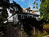
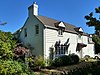
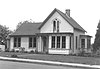
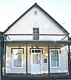
[5] Name on the Register Image Date listed [6] Location City or town Description 1 Louis J. Adams House Louis J. Adams House March 12, 2011 (# 11000076 423 W. Main St. 45°00′11″N 122°47′13″W / 45.003056°N 122.786944°W / 45.003056; -122.786944 (Louis J. Adams House ) Silverton 2 Louise Adams House Louise Adams House March 3, 2015 (# 15000052 401 W. Main Street 45°00′12″N 122°47′09″W / 45.003376°N 122.785841°W / 45.003376; -122.785841 (Louise Adams House ) Silverton 3 Adolph Block Adolph Block February 1, 1980 (# 80003348 360–372 State Street 44°56′24″N 123°02′22″W / 44.939903°N 123.039552°W / 44.939903; -123.039552 (Adolph Block ) Salem 4 Samuel Adolph House Samuel Adolph House October 2, 1978 (# 78002297 2493 State Street 44°55′57″N 123°00′37″W / 44.9326°N 123.0103°W / 44.9326; -123.0103 (Samuel Adolph House ) Salem 5 James Mechlin Anderson House James Mechlin Anderson House October 16, 1979 (# 79002118 728 Ankeny Hill Road, SE 44°46′36″N 123°02′46″W / 44.7767°N 123.0462°W / 44.7767; -123.0462 (James Mechlin Anderson House ) Jefferson vicinity 6 Aurora Colony Historic District Aurora Colony Historic District April 16, 1974 (# 74001696 District roughly bounded by Cemetery Road, Bobs Avenue, and Liberty Street 45°13′57″N 122°45′30″W / 45.23258°N 122.7584°W / 45.23258; -122.7584 (Aurora Colony Historic District ) Aurora 7 Bank of Woodburn Bank of Woodburn September 27, 1996 (# 96001049 199 N Front Street 45°08′31″N 122°51′27″W / 45.14181°N 122.8574°W / 45.14181; -122.8574 (Bank of Woodburn ) Woodburn 8 Beauchamp Building Beauchamp Building November 1, 2019 (# 100004557 395 N 3rd Avenue 44°47′52″N 122°47′33″W / 44.797809°N 122.792567°W / 44.797809; -122.792567 (Beauchamp Building ) Stayton 9 Oliver Beers House Oliver Beers House August 1, 1984 (# 84003036 10602 Wheatland Road, N 45°04′23″N 123°01′24″W / 45.07305°N 123.0232°W / 45.07305; -123.0232 (Oliver Beers House ) Gervais vicinity 10 Frederick Bents House Frederick Bents House December 9, 1981 (# 81000502 22776 Bents Road, NE 45°14′54″N 122°48′40″W / 45.24829°N 122.8111°W / 45.24829; -122.8111 (Frederick Bents House ) Aurora vicinity Originally built in 1887, this French Prairie farmhouse expanded several times over subsequent years, resulting in an unusual admixture of multiple 19th-century architectural styles. It reflects the changing requirements of farm life and economics over a long period in this portion of the Willamette Valley . [7] 11 R. P. Boise Building R. P. Boise Building December 2, 1981 (# 81000504 217 State Street 44°56′27″N 123°02′30″W / 44.940946°N 123.041671°W / 44.940946; -123.041671 (R. P. Boise Building ) Salem 12 Boon Brick Store Boon Brick Store November 20, 1975 (# 75001590 888 Liberty Street, NE 44°56′55″N 123°01′59″W / 44.94859°N 123.033°W / 44.94859; -123.033 (Boon Brick Store ) Salem 13 John D. Boon House John D. Boon House January 17, 1975 (# 75001591 1313 Mill Street, SE 44°56′02″N 123°01′39″W / 44.93382°N 123.0275°W / 44.93382; -123.0275 (John D. Boon House ) Salem Included in the Mission Mill Museum . [8] 14 Charles and Martha Brown House Charles and Martha Brown House September 6, 2002 (# 02000949 425 N First Avenue 44°47′53″N 122°47′40″W / 44.798°N 122.7944°W / 44.798; -122.7944 (Charles and Martha Brown House ) Stayton 15 Sam Brown House Sam Brown House November 5, 1974 (# 74001697 12878 Portland Road, NE 45°06′21″N 122°53′14″W / 45.105840°N 122.887086°W / 45.105840; -122.887086 (Sam Brown House ) Gervais 16 Burggraf–Burt–Webster House Burggraf–Burt–Webster House April 1, 1980 (# 80003349 901 13th Street, SE 44°55′43″N 123°01′46″W / 44.928594°N 123.029573°W / 44.928594; -123.029573 (Burggraf–Burt–Webster House ) Salem 17 Bush and Brey Block and Annex Bush and Brey Block and Annex December 21, 1981 (# 81000505 179–197 Commercial Street, NE 44°56′29″N 123°02′26″W / 44.941396°N 123.040467°W / 44.941396; -123.040467 (Bush and Brey Block and Annex ) Salem 18 Asahel Bush House Asahel Bush House January 21, 1974 (# 74001700 600 Mission Street, SE 44°55′53″N 123°02′21″W / 44.931428°N 123.039305°W / 44.931428; -123.039305 (Asahel Bush House ) Salem 19 Bush–Breyman Block Bush–Breyman Block February 17, 1978 (# 78002298 141–147 Commercial Street, NE 44°56′28″N 123°02′26″W / 44.940974°N 123.040586°W / 44.940974; -123.040586 (Bush–Breyman Block ) Salem 20 Calvary Lutheran Church and Parsonage Calvary Lutheran Church and Parsonage June 6, 1985 (# 85001182 310–314 Jersey Street 45°00′16″N 122°46′52″W / 45.0045°N 122.781°W / 45.0045; -122.781 (Calvary Lutheran Church and Parsonage ) Silverton 21 Hamilton Campbell House Hamilton Campbell House March 13, 1979 (# 79002119 13600 Jefferson Highway 99E, SE 44°45′37″N 123°01′41″W / 44.76031°N 123.0281°W / 44.76031; -123.0281 (Hamilton Campbell House ) Jefferson vicinity 22 William Case Farm William Case Farm March 21, 1973 (# 73001578 20755 Case Road, NE 45°13′06″N 122°52′49″W / 45.218319°N 122.880393°W / 45.218319; -122.880393 (William Case Farm ) Aurora 23 Champoeg Cemetery Champoeg Cemetery January 21, 2004 (# 03001475 Champoeg Cemetery Road 45°14′20″N 122°52′34″W / 45.23898°N 122.8762°W / 45.23898; -122.8762 (Champoeg Cemetery ) Aurora 24 Champoeg State Park Historic Archeological District Champoeg State Park Historic Archeological District August 1, 1984 (# 84003038 8239 Champoeg Road, NE 45°14′54″N 122°53′37″W / 45.2482°N 122.8936°W / 45.2482; -122.8936 (Champoeg State Park Historic Archeological District ) St. Paul 25 Chemawa Indian School Site Chemawa Indian School Site December 16, 1992 (# 92001333 3700 Chemawa Road, NE 45°00′04″N 122°59′42″W / 45.00118°N 122.9951°W / 45.00118; -122.9951 (Chemawa Indian School Site ) Chemawa 26 Chemeketa Lodge No. 1 Odd Fellows Buildings Chemeketa Lodge No. 1 Odd Fellows Buildings April 8, 1988 (# 88000275 185–195 High Street, NE 44°56′26″N 123°02′14″W / 44.940452°N 123.037253°W / 44.940452; -123.037253 (Chemeketa Lodge No. 1 Odd Fellows Buildings ) Salem 27 George Collins House George Collins House December 1, 1989 (# 89002063 1340 Chemeketa Street, NE 44°56′19″N 123°01′27″W / 44.938509°N 123.024165°W / 44.938509; -123.024165 (George Collins House ) Salem 28 Jacob Conser House Jacob Conser House January 21, 1974 (# 74001699 114 Main Street 44°43′04″N 123°00′43″W / 44.717659°N 123.012038°W / 44.717659; -123.012038 (Jacob Conser House ) Jefferson 29 Court Street – Chemeketa Street Historic District Court Street – Chemeketa Street Historic District August 26, 1987 (# 87001373 District roughly along Chemeketa and Court Streets, between Mill Creek and 14th Street 44°56′15″N 123°01′15″W / 44.93742°N 123.0208°W / 44.93742; -123.0208 (Court Street – Chemeketa Street Historic District ) Salem 30 Curtis Cross House Curtis Cross House December 18, 1981 (# 81000506 1635 Fairmount Avenue, S 44°55′30″N 123°02′56″W / 44.92496°N 123.0489°W / 44.92496; -123.0489 (Curtis Cross House ) Salem 31 Dr. William A. Cusick House Dr. William A. Cusick House February 23, 1990 (# 90000281 415 Lincoln Street, S 44°55′32″N 123°02′57″W / 44.925609°N 123.049116°W / 44.925609; -123.049116 (Dr. William A. Cusick House ) Salem 32 Alexander Daue House Alexander Daue House June 6, 1985 (# 85001181 1095 Saginaw Street, S 44°55′50″N 123°02′45″W / 44.930454°N 123.045848°W / 44.930454; -123.045848 (Alexander Daue House ) Salem 33 Murton E. and Lillian DeGuire House Murton E. and Lillian DeGuire House March 12, 2011 (# 11000077 631 B St. 45°00′35″N 122°46′46″W / 45.009722°N 122.779444°W / 45.009722; -122.779444 (Murton E. and Lillian DeGuire House ) Silverton Silverton, Oregon, and Its Environs MPS 34 DeGuire–Ludowitzki House DeGuire–Ludowitzki House March 3, 2015 (# 15000053 840 S. Water Street 44°59′53″N 122°46′37″W / 44.998153°N 122.777062°W / 44.998153; -122.777062 (DeGuire–Ludowitzki House ) Silverton 35 Deidrich Building Deidrich Building July 7, 2006 (# 06000570 195 N 3rd Avenue 44°47′47″N 122°47′33″W / 44.79632°N 122.7924°W / 44.79632; -122.7924 (Deidrich Building ) Stayton 36 Delaney–Edwards House Delaney–Edwards House July 23, 2004 (# 04000729 4292 Delaney Road, SE 44°50′35″N 122°58′20″W / 44.843053°N 122.972297°W / 44.843053; -122.972297 (Delaney–Edwards House ) Salem vicinity 37 Joseph Despard Cabin Site Upload image October 31, 1991 (# 91001573 Address restricted [9] St. Paul Site only. Foundations removed from short ridge in 1875. 38 June D. Drake House June D. Drake House March 12, 2011 (# 11000078 409 S. Water St. 45°00′12″N 122°46′52″W / 45.003333°N 122.781111°W / 45.003333; -122.781111 (June D. Drake House ) Silverton Silverton, Oregon, and Its Environs MPS 39 Magnus and Emma Ek House Magnus and Emma Ek House February 20, 2013 (# 13000032 729 S. Water Street 45°00′00″N 122°46′40″W / 45°N 122.7778194°W / 45; -122.7778194 (Magnus and Emma Ek House ) Silverton Silverton, Oregon, and Its Environs MPS 40 Elsinore Theater Elsinore Theater June 17, 1994 (# 91001575 170 High Street, SE 44°56′20″N 123°02′14″W / 44.938856°N 123.037153°W / 44.938856; -123.037153 (Elsinore Theater ) Salem 41 Farrar Building Farrar Building August 26, 1982 (# 82003737 351–373 State Street 44°56′25″N 123°02′22″W / 44.940376°N 123.039391°W / 44.940376; -123.039391 (Farrar Building ) Salem 42 Henry Fawk House Henry Fawk House February 20, 1991 (# 91000060 310 Lincoln Street, S 44°55′31″N 123°02′51″W / 44.92527°N 123.0476°W / 44.92527; -123.0476 (Henry Fawk House ) Salem 43 First Methodist Episcopal Church of Salem First Methodist Episcopal Church of Salem May 9, 1983 (# 83002162 600 State Street 44°56′20″N 123°02′08″W / 44.938763°N 123.035424°W / 44.938763; -123.035424 (First Methodist Episcopal Church of Salem ) Salem 44 Gaiety Hill – Bush's Pasture Park Historic District Gaiety Hill – Bush's Pasture Park Historic District October 10, 1986 (# 86002849 Roughly bounded by Pringle Creek, Mission Street, Bush's Pasture Park, and Cross, High, and Liberty Streets 44°55′50″N 123°02′11″W / 44.93068°N 123.0365°W / 44.93068; -123.0365 (Gaiety Hill – Bush's Pasture Park Historic District ) Salem 45 Gaiety Hollow Gaiety Hollow December 16, 2014 (# 14000895 545 Mission Street, SE 44°55′58″N 123°02′24″W / 44.932741°N 123.039920°W / 44.932741; -123.039920 (Gaiety Hollow ) Salem Includes both the home and the six gardens of Edith Schryver and Elizabeth Lord , who were landscape architects. The pair started the first landscape architecture firm owned by women in the Pacific Northwest, Lord & Schryver , and used the gardens to test new concepts. [10] 46 Gallon House Bridge Gallon House Bridge November 29, 1979 (# 79002124 Abiqua Creek 45°01′56″N 122°47′53″W / 45.03218°N 122.7981°W / 45.03218; -122.7981 (Gallon House Bridge ) Silverton vicinity 47 R.C. Geer Farmhouse R.C. Geer Farmhouse February 12, 1980 (# 80003353 12390 Sunnyview Road, NE 44°56′28″N 122°48′26″W / 44.94106°N 122.8072°W / 44.94106; -122.8072 (R.C. Geer Farmhouse ) Salem vicinity 48 Andrew T. Gilbert House Andrew T. Gilbert House November 6, 1980 (# 80003350 116 Marion Street, NE 44°56′43″N 123°02′28″W / 44.9453°N 123.041°W / 44.9453; -123.041 (Andrew T. Gilbert House ) Salem 49 J. K. Gill Building J. K. Gill Building February 1, 1980 (# 80003351 356 State Street 44°56′24″N 123°02′23″W / 44.939940°N 123.039727°W / 44.939940; -123.039727 (J. K. Gill Building ) Salem 50 Gordon House Gordon House September 22, 2004 (# 04001066 879 W Main Street 44°59′55″N 122°47′36″W / 44.99857°N 122.7932°W / 44.99857; -122.7932 (Gordon House ) Silverton 51 Benjamin F. Harding House Benjamin F. Harding House December 21, 1981 (# 81000507 1043 High Street, SE 44°55′51″N 123°02′29″W / 44.930744°N 123.041350°W / 44.930744; -123.041350 (Benjamin F. Harding House ) Salem 52 Hinkle–Reid House Hinkle–Reid House January 21, 1994 (# 93001503 525 NE Alder Street 44°45′18″N 122°28′14″W / 44.75493°N 122.4706°W / 44.75493; -122.4706 (Hinkle–Reid House ) Mill City 53 Hobson–Gehlen General Merchandise Store Hobson–Gehlen General Merchandise Store May 22, 2013 (# 13000311 189 N. 2nd Avenue 44°47′47″N 122°47′37″W / 44.796481°N 122.793547°W / 44.796481; -122.793547 (Hobson–Gehlen General Merchandise Store ) Stayton 54 Hudson's Bay Company Granary and Clerk's House Site Hudson's Bay Company Granary and Clerk's House Site October 31, 1991 (# 91001574 Address restricted [9] St. Paul Built as an attempt by HBC to keep locals trading with HBC and not to take business to the Vancouver area. 55 Daniel B. Jarman House and Garden Daniel B. Jarman House and Garden December 6, 1979 (# 79002120 567 High Street, SE 44°56′06″N 123°02′24″W / 44.935013°N 123.040000°W / 44.935013; -123.040000 (Daniel B. Jarman House and Garden ) Salem 56 Jefferson Methodist Church Jefferson Methodist Church November 6, 1980 (# 80003346 310–342 N. 2nd Street 44°43′12″N 123°00′38″W / 44.719936°N 123.010532°W / 44.719936; -123.010532 (Jefferson Methodist Church ) Jefferson 57 Jones–Sherman House Jones–Sherman House December 21, 1981 (# 81000508 835 D Street, NE 44°56′49″N 123°01′38″W / 44.94701°N 123.0273°W / 44.94701; -123.0273 (Jones–Sherman House ) Salem 58 Thomas Kay Woolen Mill Thomas Kay Woolen Mill May 8, 1973 (# 73001579 1313 Mill Street, SE 44°56′06″N 123°01′38″W / 44.934987°N 123.027198°W / 44.934987; -123.027198 (Thomas Kay Woolen Mill ) Salem Included in the Mission Mill Museum . [8] 59 John W. and Thomas F. Kirk House John W. and Thomas F. Kirk House June 17, 1987 (# 87000867 4686 St. Paul Highway , NE 45°12′30″N 122°57′59″W / 45.208207°N 122.966430°W / 45.208207; -122.966430 (John W. and Thomas F. Kirk House ) St. Paul 60 Frederick S. Lamport House Frederick S. Lamport House June 19, 1991 (# 91000806 590 Lower Ben Lomond Drive, SE 44°55′01″N 123°02′26″W / 44.916950°N 123.040593°W / 44.916950; -123.040593 (Frederick S. Lamport House ) Salem 61 Lee Mission Cemetery Lee Mission Cemetery December 29, 1978 (# 78002299 D Street 44°56′34″N 123°00′35″W / 44.94278°N 123.0097°W / 44.94278; -123.0097 (Lee Mission Cemetery ) Salem 62 Jason Lee House Jason Lee House April 23, 1973 (# 73001580 260 12th Street, SE 44°56′02″N 123°01′39″W / 44.93382°N 123.0275°W / 44.93382; -123.0275 (Jason Lee House ) Salem Included in the Mission Mill Museum . [8] 63 T. A. Livesley House T. A. Livesley House April 26, 1990 (# 90000684 533 Lincoln Street, S 44°55′33″N 123°03′02″W / 44.925725°N 123.050677°W / 44.925725; -123.050677 (T. A. Livesley House ) Salem 64 S. A. Manning Building S. A. Manning Building February 10, 1987 (# 87000035 200–210 State Street 44°56′26″N 123°02′31″W / 44.940480°N 123.041965°W / 44.940480; -123.041965 (S. A. Manning Building ) Salem 65 Marion County Housing Committee Demonstration House Marion County Housing Committee Demonstration House August 11, 1988 (# 88001243 140 Wilson Street, S 44°55′41″N 123°02′41″W / 44.928077°N 123.044805°W / 44.928077; -123.044805 (Marion County Housing Committee Demonstration House ) Salem 66 McCallister–Gash Farmhouse McCallister–Gash Farmhouse November 6, 1980 (# 80003354 9626 Kaufman Road 44°58′06″N 122°51′50″W / 44.96846°N 122.864°W / 44.96846; -122.864 (McCallister–Gash Farmhouse ) Silverton vicinity 67 David McCully House David McCully House February 14, 1978 (# 78002300 1365 John Street, S 44°55′40″N 123°03′01″W / 44.927782°N 123.050340°W / 44.927782; -123.050340 (David McCully House ) Salem 68 Methodist Mission Parsonage Methodist Mission Parsonage December 31, 1974 (# 74001701 1313 Mill Street, SE 44°56′02″N 123°01′39″W / 44.93382°N 123.0275°W / 44.93382; -123.0275 (Methodist Mission Parsonage ) Salem Included in the Mission Mill Museum . [8] 69 Mill City Southern Pacific Rail Road (SPRR) Bridge Mill City Southern Pacific Rail Road (SPRR) Bridge June 22, 2021 (# 100006686 Spanning the North Santiam River 44°45′19″N 122°28′40″W / 44.755268°N 122.477772°W / 44.755268; -122.477772 (Mill City Southern Pacific Rail Road (SPRR) Bridge ) Mill City 70 Miller Cemetery Church Miller Cemetery Church August 10, 1978 (# 78002304 Cascade Highway, NE 45°02′21″N 122°43′46″W / 45.03915°N 122.7295°W / 45.03915; -122.7295 (Miller Cemetery Church ) Silverton vicinity 71 John and Douglas Minto Houses John and Douglas Minto Houses December 18, 1981 (# 81000509 821–841 Saginaw Street, S 44°55′58″N 123°02′44″W / 44.932896°N 123.045659°W / 44.932896; -123.045659 (John and Douglas Minto Houses ) Salem 72 Joseph Henry Moser Barn Joseph Henry Moser Barn June 14, 2013 (# 13000396 507 S. 3rd Street 45°00′13″N 122°46′37″W / 45.003548°N 122.776924°W / 45.003548; -122.776924 (Joseph Henry Moser Barn ) Silverton 73 Carl E. Nelson House Carl E. Nelson House June 13, 1997 (# 97000587 960 E Street, NE 44°56′50″N 123°01′30″W / 44.947225°N 123.025084°W / 44.947225; -123.025084 (Carl E. Nelson House ) Salem 74 Odd Fellows Rural Cemetery Odd Fellows Rural Cemetery September 11, 2013 (# 13000707 2201 Commercial Street, SE 44°55′12″N 123°02′52″W / 44.919908°N 123.047796°W / 44.919908; -123.047796 (Odd Fellows Rural Cemetery ) Salem 75 Olallie Meadows Guard Station Olallie Meadows Guard Station May 26, 2015 (# 15000272 Mount Hood National Forest 44°51′33″N 121°46′23″W / 44.859068°N 121.773104°W / 44.859068; -121.773104 (Olallie Meadows Guard Station ) Estacada vicinity 76 Old First National Bank Building Old First National Bank Building October 9, 1986 (# 86002851 388 State Street 44°56′23″N 123°02′21″W / 44.939794°N 123.039251°W / 44.939794; -123.039251 (Old First National Bank Building ) Salem 77 Old Garfield School Old Garfield School December 2, 1981 (# 81000510 528 Cottage Street, NE 44°56′37″N 123°01′53″W / 44.94357°N 123.0315°W / 44.94357; -123.0315 (Old Garfield School ) Salem 78 Old Woodburn City Hall Old Woodburn City Hall March 30, 1979 (# 79002125 550 N 1st Street 45°08′39″N 122°51′21″W / 45.14413°N 122.8559°W / 45.14413; -122.8559 (Old Woodburn City Hall ) Woodburn 79 Oregon Pacific Railroad Linear Historic District Oregon Pacific Railroad Linear Historic District October 29, 1999 (# 99001285 Roughly a 20-mile linear section of the old railroad grade between Idanha and the Cascade Range summit (See also Linn and Jefferson counties.) 44°27′10″N 121°53′57″W / 44.452778°N 121.899167°W / 44.452778; -121.899167 (Oregon Pacific Railroad Linear Historic District ) Idanha to the Cascade Range summit via Santiam Junction Beginning in 1872, the colorful Thomas Egenton Hogg set out to build a transcontinental railroad terminating in the Oregon Coast . By the time of his venture's final bankruptcy in 1894, completed track reached only from Yaquina Bay to Idanha in the Cascade foothills , with grade work under way east of Idanha to the summit . The historic district protects the remaining signs of the grade work east of Idanha, as well as the sites of two construction camps. Abandoned part way through construction, these remnants provide a unique window onto construction methods and living conditions in 19th century railroad camps. [11] 80 Oregon State Capitol Oregon State Capitol June 29, 1988 (# 88001055 Capitol Mall 44°56′18″N 123°01′49″W / 44.938466°N 123.030374°W / 44.938466; -123.030374 (Oregon State Capitol ) Salem 81 Oregon State Fair Stadium and Poultry Building Ensemble Oregon State Fair Stadium and Poultry Building Ensemble June 20, 2002 (# 02000671 2330 17th Street, NE 44°57′29″N 123°00′41″W / 44.95796°N 123.0114°W / 44.95796; -123.0114 (Oregon State Fair Stadium and Poultry Building Ensemble ) Salem 82 Oregon State Forester's Office Building Oregon State Forester's Office Building April 15, 1982 (# 82003738 2600 State Street 44°55′53″N 123°00′27″W / 44.93148°N 123.0076°W / 44.93148; -123.0076 (Oregon State Forester's Office Building ) Salem 83 Oregon State Hospital Historic District Oregon State Hospital Historic District February 28, 2008 (# 08000118 2600 Center Street, NE 44°56′24″N 123°00′13″W / 44.939922°N 123.003550°W / 44.939922; -123.003550 (Oregon State Hospital Historic District ) Salem Boundary decrease approved August 23, 2019. 84 Christopher Paulus Building Christopher Paulus Building March 5, 1992 (# 92000133 355–363 Court Street, NE 44°56′29″N 123°02′20″W / 44.941496°N 123.038886°W / 44.941496; -123.038886 (Christopher Paulus Building ) Salem 85 Edgar T. Pierce House Edgar T. Pierce House February 21, 1997 (# 97000136 1610 Fir Street, S 44°55′30″N 123°02′49″W / 44.925034°N 123.046997°W / 44.925034; -123.046997 (Edgar T. Pierce House ) Salem 86 Pleasant Grove Presbyterian Church Pleasant Grove Presbyterian Church August 7, 1974 February 10, 1987 (relisted)(# 74001703 1313 Mill Street, SE 44°56′02″N 123°01′39″W / 44.93382°N 123.0275°W / 44.93382; -123.0275 (Pleasant Grove Presbyterian Church ) Salem Included in the Mission Mill Museum . [8] Delisted due to relocation September 1984. Relisted in 1987. 87 Dr. Luke A. Port House Dr. Luke A. Port House October 2, 1973 (# 73001581 1116 Mission Street, SE 44°55′48″N 123°01′54″W / 44.929894°N 123.031736°W / 44.929894; -123.031736 (Dr. Luke A. Port House ) Salem 88 Port–Manning House Port–Manning House October 2, 1978 (# 78002301 4922 Halls Ferry Road, S 44°52′51″N 123°07′53″W / 44.880887°N 123.131448°W / 44.880887; -123.131448 (Port–Manning House ) Salem 89 Queen of Angels Priory Queen of Angels Priory July 8, 1982 (# 82003736 840 S Main Street 45°03′43″N 122°48′10″W / 45.06207°N 122.8029°W / 45.06207; -122.8029 (Queen of Angels Priory ) Mount Angel 90 Reed Opera House and McCornack Block Addition Reed Opera House and McCornack Block Addition March 8, 1978 (# 78002302 177–189 Liberty Street, NE 44°56′28″N 123°02′20″W / 44.940995°N 123.038771°W / 44.940995; -123.038771 (Reed Opera House and McCornack Block Addition ) Salem 91 Dr. and Mrs. Charles G. Robertson House and Garden Dr. and Mrs. Charles G. Robertson House and Garden May 19, 1983 (# 83002163 460 Leffelle Street, S 44°55′34″N 123°02′59″W / 44.926059°N 123.049655°W / 44.926059; -123.049655 (Dr. and Mrs. Charles G. Robertson House and Garden ) Salem 92 St. Mary's Roman Catholic Church St. Mary's Roman Catholic Church October 22, 1976 (# 76001583 575 E College Street 45°04′03″N 122°47′38″W / 45.06747°N 122.7939°W / 45.06747; -122.7939 (St. Mary's Roman Catholic Church ) Mount Angel 93 St. Paul Historic District St. Paul Historic District March 15, 1982 (# 82003739 45°12′35″N 122°58′34″W / 45.20969°N 122.9761°W / 45.20969; -122.9761 (St. Paul Historic District ) St. Paul 94 St. Paul Roman Catholic Church St. Paul Roman Catholic Church October 16, 1979 (# 79002098 Junction of Christie Street and Mission Avenue, NE 45°12′43″N 122°58′42″W / 45.21181°N 122.9783°W / 45.21181; -122.9783 (St. Paul Roman Catholic Church ) St. Paul 95 Salem Civic Center Historic District Salem Civic Center Historic District November 2, 2022 (# 100008330 555 Liberty St. SE 44°56′10″N 123°02′28″W / 44.9360°N 123.0412°W / 44.9360; -123.0412 (Salem Civic Center Historic District ) Salem 96 Salem Downtown State Street – Commercial Street Historic District Salem Downtown State Street – Commercial Street Historic District September 28, 2001 (# 01001067 Roughly bounded by Ferry, High, Chemeketa, and Front Streets 44°56′24″N 123°02′22″W / 44.94009°N 123.0394°W / 44.94009; -123.0394 (Salem Downtown State Street – Commercial Street Historic District ) Salem Located on the Willamette River transportation corridor and near Jason Lee 's Mission Mill , Salem's central business district was first platted in 1846. Subsequent development patterns closely reflected the drivers of Salem's growth as an important agricultural and commercial center. Surviving buildings represent a wide range of architectural styles from the 1860s through the 1950s. [12] 97 Salem Southern Pacific Railroad Station Salem Southern Pacific Railroad Station February 12, 2010 (# 10000015 500 13th Avenue, SE 44°55′56″N 123°01′42″W / 44.932348°N 123.028196°W / 44.932348; -123.028196 (Salem Southern Pacific Railroad Station ) Salem This grand Beaux-Arts style train station , completed in 1918, is the third station to occupy the same site. The adjacent REA freight terminal is a remnant of the 1889 Queen Anne station that burned in 1917. In 1999, the buildings were restored to their appearance during the first half of the 20th century. The site has been in continuous use for passenger rail service from 1871 through at least 2009. [13] 98 William Riley Scheurer House William Riley Scheurer House December 23, 1981 (# 81000503 23707 1st Street, NE 45°15′44″N 122°50′37″W / 45.262090°N 122.843515°W / 45.262090; -122.843515 (William Riley Scheurer House ) Butteville Located in Butteville along the Willamette River . 99 Jesse H. Settlemier House Jesse H. Settlemier House December 19, 1974 (# 74001704 355 N. Settlemier Avenue 45°08′41″N 122°51′43″W / 45.144653°N 122.861827°W / 45.144653; -122.861827 (Jesse H. Settlemier House ) Woodburn 100 U. G. Shipley House and Garden U. G. Shipley House and Garden October 14, 1994 (# 94001219 260 Washington Street, S 44°55′27″N 123°02′48″W / 44.92426°N 123.0468°W / 44.92426; -123.0468 (U. G. Shipley House and Garden ) Salem 101 Silver Creek Youth Camp – Silver Falls State Park Upload image June 20, 2002 (# 02000673 20024 Silver Falls Highway 44°51′23″N 122°36′36″W / 44.8564°N 122.6099°W / 44.8564; -122.6099 (Silver Creek Youth Camp – Silver Falls State Park ) Sublimity vicinity 102 Silver Falls State Park Concession Building Area Silver Falls State Park Concession Building Area June 30, 1983 (# 83002164 20024 Silver Falls Highway 44°52′45″N 122°39′23″W / 44.87925°N 122.6565°W / 44.87925; -122.6565 (Silver Falls State Park Concession Building Area ) Sublimity vicinity 103 Silverton Commercial Historic District Silverton Commercial Historic District July 29, 1987 (# 87000878 Roughly bounded by High and Oak Streets, Silver Creek , and Lewis, Water, and 1st Streets 45°00′19″N 122°46′59″W / 45.005223°N 122.782927°W / 45.005223; -122.782927 (Silverton Commercial Historic District ) Silverton These 27 buildings in Silverton's downtown core, dating from between 1870 and 1936, recall the twin stories of water power and commercial development in this small Willamette Valley town. [14] 104 Smith–Ohmart House Smith–Ohmart House November 16, 1979 (# 79002121 2655 East Nob Hill Street, SE 44°54′57″N 123°02′37″W / 44.915933°N 123.043559°W / 44.915933; -123.043559 (Smith–Ohmart House ) Salem 105 Peter and Bertha Soderberg House Peter and Bertha Soderberg House June 14, 2013 (# 13000397 1106 Pine Street 45°00′40″N 122°47′32″W / 45.011148°N 122.792262°W / 45.011148; -122.792262 (Peter and Bertha Soderberg House ) Silverton 106 South First National Bank Block South First National Bank Block March 31, 1983 (# 83002165 241–247 Commercial Street, NE 44°56′32″N 123°02′24″W / 44.942087°N 123.039999°W / 44.942087; -123.039999 (South First National Bank Block ) Salem 107 Starkey–McCully Block Starkey–McCully Block March 12, 1979 (# 79002122 223–233 Commercial Street, NE 44°56′31″N 123°02′24″W / 44.941899°N 123.040101°W / 44.941899; -123.040101 (Starkey–McCully Block ) Salem 108 State Library of Oregon State Library of Oregon April 21, 2022 (# 100007638 250 Winter St. NE 44°56′24″N 123°01′51″W / 44.9399°N 123.0309°W / 44.9399; -123.0309 (State Library of Oregon ) Salem 109 John Stauffer House and Barn John Stauffer House and Barn May 1, 1974 (# 74001698 13551 Stauffer Road, NE 45°11′42″N 122°47′02″W / 45.194938°N 122.783820°W / 45.194938; -122.783820 (John Stauffer House and Barn ) Hubbard 110 C. C. Stratton House C. C. Stratton House November 15, 1984 (# 84000475 1599 State Street 44°56′09″N 123°01′17″W / 44.935866°N 123.021425°W / 44.935866; -123.021425 (C. C. Stratton House ) Salem 111 Supreme Court and Library Building Supreme Court and Library Building March 4, 2020 (# 100005014 1163 State Street 44°56′15″N 123°01′40″W / 44.937532°N 123.027689°W / 44.937532; -123.027689 (Supreme Court and Library Building ) Salem 112 Union Street Railroad Bridge and Trestle Union Street Railroad Bridge and Trestle January 11, 2006 (# 05001520 Junction of Union and Water Streets, NE (See also Polk County .) 44°56′50″N 123°02′31″W / 44.94712°N 123.042°W / 44.94712; -123.042 (Union Street Railroad Bridge and Trestle ) Salem 113 Victor Point School Victor Point School September 27, 1996 (# 96001050 1156 Victor Point Road, SE 44°54′59″N 122°45′19″W / 44.916341°N 122.755229°W / 44.916341; -122.755229 (Victor Point School ) Silverton vicinity 114 William Lincoln Wade House William Lincoln Wade House February 17, 1978 (# 78002303 1305 John Street, S 44°55′41″N 123°03′01″W / 44.928186°N 123.050353°W / 44.928186; -123.050353 (William Lincoln Wade House ) Salem 115 Waller Hall, Willamette University Waller Hall, Willamette University November 20, 1975 (# 75001593 900 State Street 44°56′14″N 123°01′52″W / 44.937177°N 123.031050°W / 44.937177; -123.031050 (Waller Hall, Willamette University ) Salem 116 Willamette Station Site, Methodist Mission in Oregon Willamette Station Site, Methodist Mission in Oregon August 1, 1984 (# 84003040 10991 Wheatland Ferry Road 45°05′03″N 123°02′33″W / 45.084216°N 123.042498°W / 45.084216; -123.042498 (Willamette Station Site, Methodist Mission in Oregon ) Gervais vicinity 117 Windischar's General Blacksmith Shop Windischar's General Blacksmith Shop November 7, 1980 (# 80003347 110 Sheridan Street 45°04′04″N 122°47′48″W / 45.067744°N 122.796752°W / 45.067744; -122.796752 (Windischar's General Blacksmith Shop ) Mount Angel 118 T. M. and Emma Witten Drug Store – House T. M. and Emma Witten Drug Store – House August 12, 1999 (# 99001002 104 N Main Street 44°43′04″N 123°00′42″W / 44.71786°N 123.0117°W / 44.71786; -123.0117 (T. M. and Emma Witten Drug Store – House ) Jefferson 119 Robert Witzel House Robert Witzel House November 15, 1979 (# 79002123 6576 Joseph Street, SE 44°53′07″N 122°55′40″W / 44.88515°N 122.9277°W / 44.88515; -122.9277 (Robert Witzel House ) Salem 120 Casper Zorn Farmhouse Casper Zorn Farmhouse February 12, 1980 (# 80003355 8448 Champoeg Road, NE 45°14′44″N 122°53′11″W / 45.245480°N 122.886317°W / 45.245480; -122.886317 (Casper Zorn Farmhouse ) St. Paul vicinity