San Nicolas, Manila

Last updated

San Nicolas
District of Manila
Buildings in Binondo and San Nicolas, Manila, 2018 (01).jpg
View of the skyline of San Nicolas (left) and Binondo (right), taken from Fort Santiago, Manila
Ph fil manila san nicolas.png
San Nicolas, Manila
Country Philippines
Region National Capital Region
City Manila
Congressional districtPart of the 3rd district of Manila
Barangays 15
Founded1598
Founded by Dominican Order
Named for Saint Nicholas
Area
  Total1.6385 km2 (0.6326 sq mi)
Population
 (2020) [1]
  Total42,957
  Density26,000/km2 (68,000/sq mi)
Zip codes
1010
Area codes 2

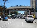
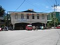
San Nicolas is one of the sixteen districts in the city of Manila in the Philippines. It is located at the west central part of the city, on the northern bank of the Pasig River [2] bounded by the districts of Binondo to the east by Estero de Binondo, and Tondo to the north and west, and by the Pasig River to the south. Considered as a heritage district of Manila, [3] this community has kept its 19th-century ancestral houses, which symbolizes the wealthy lives of the people who used to live there, similar to the ancestral houses of Silay and Vigan.

Contents

As of the May 1, 2020, national census, the population of San Nicolas, which is composed of 15 barangays named as numbers from 268 to 276 and from 281 to 286, is 42,957. This is slightly lower than the 2010 census that counted San Nicolas residents at 44,241. [1]

History

The town of San Nicolas was originally named Baybay, meaning "shore" in Tagalog. [3] [4]

According to Piet Van der Loon (1966), a Sangley Chinese community had already settled in Baybay near Tondo on the banks of the Pasig river, before the Spanish conquest of Manila in the Battle of Manila (1570), and way before the market at Parián (modern-day Arroceros Urban Forest Park) attracted large numbers of traders and craftsmen, especially immigrants and merchants from Southern Fujian, [5] so before Parián and Binondo became the local Chinatown of the area, Sangley Chinese settlers and merchants were already living in Baybay in between Tondo and old Manila (modern-day Intramuros) on the south bank of the Pasig river.

During Spanish rule, Baybay was renamed to San Nicolas, after the patron saint of sailors, boatmen, and mariners. [6] San Nicolas is now the western part of Manila Chinatown, the first Chinatown in the Philippines, and perhaps the world; [7] the eastern part is Binondo, which was founded in 1594 by Governor-General Luis Pérez Dasmariñas. [7] The Dominican order came to western part of Chinatown in 1596 [7] and then founded San Nicolas in 1598. [3] This was the first mission by the Dominicans outside Intramuros. [3]

In 1901, during the American Occupation of the Philippines, San Nicolas became a district of the newly chartered city of Manila as its borders were extended outside the walled city presently known as Intramuros. [8] Daniel Burnham, an American architect and urban planner, was commissioned to build a Plan of Manila. [9] The result of the plan was the making of places and parishes that included San Nicolas. [10] In modern times, San Nicolas is one of the administrative districts of Manila and part of the third legislative district of Manila. [11] It became an extension of the Filipino-Chinese community in Binondo. [12]

Barangays

Zone/BarangayLand area (km²)Population (2020 census)
Zone 25
Barangay 2680.04373 km²489
Barangay 2690.04217 km²904
Barangay 2700.03705 km²918
Barangay 2710.06139 km²633
Barangay 2720.01970 km²1,064
Barangay 2730.02041 km²825
Barangay 2740.01210 km²1,944
Barangay 2750.02696 km²19,809
Barangay 2760.02080 km²2,543
Zone 26
Barangay 2810.09284 km²2,288
Barangay 2820.1113 km²2,458
Barangay 2830.05035 km²1,345
Barangay 2840.05324 km²961
Barangay 2850.05489 km²2,066
Barangay 2860.04595 km²4,710

Barangays 268, 269, 270, 271, 272, 273, 274, 275, and 276 are part of Zone 25; and Barangays 281, 282, 283, 284, 285, and 286 are part of Zone 26.

List of cultural properties of San Nicolas

In art

Notable

See also

Notes

  1. wmph is an internal identifier used by Wikimedia Philippines to identify the monument. This is not an official identifier, and only shown temporarily in the templates until the government creates an updated complete list.

Related Research Articles

<span class="mw-page-title-main">Metro Manila</span> Metropolitan area and region of the Philippines

Metropolitan Manila, commonly shortened to Metro Manila and formally the National Capital Region, is the capital region and largest metropolitan area of the Philippines. Located on the eastern shore of Manila Bay, the region lies between the Central Luzon and Calabarzon regions. Encompassing an area of 619.57 km2 (239.22 sq mi) and with a population of 13,484,462 as of 2020, it is composed of sixteen highly urbanized cities: the capital city, Manila, Caloocan, Las Piñas, Makati, Malabon, Mandaluyong, Marikina, Muntinlupa, Navotas, Parañaque, Pasay, Pasig, Quezon City, San Juan, Taguig, and Valenzuela, along with one independent municipality, Pateros. As the second most populous and the most densely populated region in the Philippines, it ranks as the 9th most populous metropolitan area in Asia and the 6th most populous urban area in the world.

<span class="mw-page-title-main">Manila</span> Capital of the Philippines

Manila, officially the City of Manila, is the capital and second-most-populous city of the Philippines after Quezon City. Located on the eastern shore of Manila Bay on the island of Luzon, it is classified as a highly urbanized city. As of 2019, it is the world's most densely populated city proper. It was the first chartered city in the country, and was designated as such by the Philippine Commission Act No. 183 on July 31, 1901. It became autonomous with the passage of Republic Act No. 409, "The Revised Charter of the City of Manila", on June 18, 1949. Manila is considered to be part of the world's original set of global cities because its commercial networks were the first to extend across the Pacific Ocean and connect Asia with the Spanish Americas through the galleon trade; when this was accomplished, it was the first time an uninterrupted chain of trade routes circling the planet had been established.

<span class="mw-page-title-main">Pasig</span> Highly urbanized city in Metro Manila, Philippines

Pasig, officially the City of Pasig, is a highly urbanized city in the National Capital Region of the Philippines. According to the 2020 census, it has a population of 803,159 people.

<span class="mw-page-title-main">Binondo</span> District of Manila, Metro Manila, Philippines

Binondo is a district in Manila and is referred to as the city's Chinatown. Its influence extends beyond to the places of Quiapo, Santa Cruz, San Nicolas and Tondo. It is the oldest Chinatown in the world, established in 1594 by the Spaniards as a settlement near Intramuros but across the Pasig River for Catholic Chinese; it was positioned so that the colonial administration could keep a close eye on their migrant subjects. It was already a hub of Chinese commerce even before the Spanish colonial period. Binondo is the center of commerce and trade of Manila, where all types of business run by Filipino-Chinese thrive.

<span class="mw-page-title-main">Sangley</span> Archaic terms used in the Philippines

Sangley and Mestizo de Sangley are archaic terms used in the Philippines during the Spanish colonial era to describe respectively a person of pure overseas Chinese ancestry and a person of mixed Chinese and native Filipino ancestry. The Sangley Chinese were ancestors to both modern Chinese Filipinos and modern Filipino mestizo descendants of the Mestizos de Sangley, also known as Chinese mestizos, which are mixed descendants of Sangley Chinese and native Filipinos. Chinese mestizos were mestizos in the Spanish Empire, classified together with other Filipino mestizos.

<span class="mw-page-title-main">Santa Cruz, Manila</span> District of Manila, Metro Manila, Philippines

Santa Cruz is a district in the northern part of the City of Manila, Philippines, located on the right bank of the Pasig River near its mouth, bordered by the districts of Tondo, Binondo, Quiapo, and Sampaloc, as well as the areas of Grace Park and Barrio San Jose in Caloocan and the district of La Loma in Quezon City. The district belongs to the 3rd congressional district of Manila.

<span class="mw-page-title-main">Tondo (historical polity)</span> City-state in what is now Manila, Philippines, from c. 900 to 1589

In early Philippine history, the Tagalog settlement at Tondo, sometimes referred to as the Kingdom of Tondo, was a major trade hub located on the northern part of the Pasig River delta on Luzon island. Together with Maynila, the polity (bayan) that was also situated on the southern part of the Pasig River delta, Tondo had established a shared monopoly on the trade of Chinese goods throughout the rest of the Philippine archipelago, making it an established force in trade throughout Southeast Asia and East Asia.

<span class="mw-page-title-main">Sangley Rebellion</span> Armed confrontations between the Sangley, the Spanish and allied forces in 1603

The Sangley Rebellion was a series of armed confrontations between overseas Chinese, known as the Sangley, and the Spanish and their allied forces in Manila under the Captaincy General of the Philippines, in October 1603. The local ethnic Chinese residents dominated trade and outnumbered Spanish residents in Manila by a five-to-one ratio, although both were minorities to the indigenous Tagalog population. The ruling Spaniards feared and resented the rival Chinese minority. Policies of persecution were enacted against the local Chinese residents and they were expelled from the city to an undesirable swamp area in 1586, which the local Chinese turned into a thriving town. The local Chinese planned a strike due to worsening relations, but it resulted in the execution of their mayor, and became a rebellion. It ended in the massacre of more than 20,000 ethnic Chinese in Manila at the hands of the Spaniards, local Japanese, and indigenous Tagalog forces.

The geography of the City of Manila is characterized by its coastal position at the estuary of the Pasig River that flows to Manila Bay. The city is located on a naturally protected harbor, regarded as one of the finest harbors in Asia. The scarce availability of land is a contributing factor that makes Manila the densest populated city in the world.

<span class="mw-page-title-main">Manila (province)</span> Philippine province (1571–1901)

Manila, also known as Tondo until 1859, was a province of the Philippines that encompassed the former pre-Hispanic polities of Tondo, Maynila, and Namayan. In 1898, it comprised the city of Manila and 23 other municipalities. In 1901, the province was dissolved, with the city of Manila absorbing six of its smaller neighboring municipalities. The remaining part was merged with the adjacent district of Morong to form the province of Rizal.

<span class="mw-page-title-main">Parián (Manila)</span>

Parián or Pantin, also Parián de Arroceros was an area adjacent to Intramuros at its east built to house Sangley (Chinese) merchants in Manila in the 16th and 17th centuries during the Spanish rule in the Philippines. The place gave its name to the gate connecting it to Intramuros, the Puerta del Parián.

<span class="mw-page-title-main">Mel Lopez Boulevard</span> Major street in Metro Manila, Philippines

Mel Lopez Boulevard, formerly known as President Ferdinand E. Marcos Highway or simply as Marcos Road, is a 6.2-kilometer (3.9 mi), six-to-ten lane divided highway in northern Manila, Philippines, connecting Bonifacio Drive in Port Area and Intramuros in the south with Radial Road 10 (R-10) in Navotas in the north. The highway is the main component of the R-10 network, which runs north of the Pasig River until Anda Circle, and is an extension of Bonifacio Drive, running north–south through the Manila North Port area serving the coastal districts of Tondo and Port Area, as well as San Nicolas and Intramuros.

Pariáns were districts of cities in the Spanish East Indies, particularly in the Philippines or Chinese trading settlements in Spanish Formosa, during the Spanish colonial era of the Philippines where Chinese (Sangley) were required to live by Spanish colonial authorities. In Luzon there are several towns and cities with districts for chinese settlers, the most famous being the Parian of Manila which moved locations within the city from time to time, before finally settling on Binondo Chinatown, another is in the neighborhood of El Pariancillo in Vigan and Pariancillo in Malolos which was established in 1755 as a Chinese enclave of Malolos that were from migrants from Manila. There are also many other Pariáns throughout Luzon, such as Parian, Mexico, Pampanga, Parian in Calamba, Laguna, etc. In the Visayas, Cebu City had a Parián, which is now a modern-day barangay in the city named Pari-an, and Iloilo City also had a Parián, which was located in the modern-day city district of Molo. Cebu's Parián was founded in 1590 after the arrival of Chinese traders and was supervised by the Jesuits. There were many other Pariáns throughout the Philippines during the Spanish colonial era. In the short-lived Spanish Formosa before, Keelung used to also have a nearby small Chinese trading settlement also known as a Parián, where the first Han Taiwanese of Keelung lived in, many of whom were also Sangley Chinese from Manila and traders from Fujian.

<span class="mw-page-title-main">Circumferential Road 1</span> Road in the Philippines

Circumferential Road 1 (C-1), informally known as the C-1 Road, is a network of roads and bridges that all together form the first and innermost beltway of Metro Manila in the Philippines. Spanning some 5.98 kilometers (3.72 mi), it connects the districts of Ermita, Intramuros, San Miguel, Quiapo, Sampaloc, Santa Cruz, Binondo, San Nicolas, and Tondo in Manila.

<span class="mw-page-title-main">Outline of Metro Manila</span> Overview of and topical guide to Metro Manila

The following outline is provided as an overview of and topical guide to Metro Manila:

<span class="mw-page-title-main">Index of Metro Manila–related articles</span>

The following is an alphabetical list of articles related to the Philippine capital region of Metro Manila.

<span class="mw-page-title-main">Binondo–Intramuros Bridge</span> Bridge in Manila, Philippines

The Binondo–Intramuros Bridge is a tied-arch bridge in Manila, Philippines that spans the Pasig River. It connects Muelle de Binondo in Binondo and in San Nicolas to Solana Street and Riverside Drive in Intramuros. The bridge has four lanes and exhibits a steel bowstring arch design with inclined arches. It has a length of 680 meters (2,230 ft).

<span class="mw-page-title-main">Manila's 1st congressional district</span> Legislative district of the Philippines

Manila's 1st congressional district is one of the six congressional districts of the Philippines in the city of Manila. It has been represented in the House of Representatives of the Philippines since 1916 and earlier in the Philippine Assembly from 1907 to 1916. The district consists of barangays 1 to 146 in the western part of the Manila district of Tondo, west of Dagupan Street, Estero de Vitas and Estero de Sunog Apog bordering Navotas. It is currently represented in the 19th Congress by Ernesto M. Dionisio Jr. of Asenso Manileño and Lakas–CMD.

The Real Alcaicería de San Fernando was a marketplace and custom house constructed after a royal decree by King Ferdinand VI in 1752. The mandate intended the space to be a residential and commercial zone for the transient Chinese merchants to conduct their business. It was located on Calle San Fernando, San Nicolas, Manila, Philippines.

References

  1. 1 2 "Highlights of the National Capital Region (NCR) Population 2020 Census of Population and Housing (2020 CPH)". Philippine Statistics Authority. Retrieved November 13, 2021.
  2. "Manila Reborn - Filipinas Heritage Library". Google Arts & Culture. Retrieved April 15, 2021.
  3. 1 2 3 4 "Why San Nicolas is Manila's heritage district". Inquirer Lifestyle. November 2, 2020. Retrieved April 15, 2021.
  4. See, Teresita Ang (November 5, 2018). "Behind Binondo's whimsical street names are some amusing stories". ABS-CBN News. Retrieved April 15, 2021.
  5. Van der Loon (1966)
  6. Sorilla, Franz IV (June 6, 2022). "San Nicolas District: The Forgotten Treasure of Manila". Tatler Asia. Retrieved July 22, 2022.
  7. 1 2 3 Lustre Jr., Philip M. (February 18, 2018). "Where heroes and kin used to tread". INQUIRER.net. Retrieved April 15, 2021.
  8. Act No. 183 (July 31, 1901), An act to incorporate the City of Manila , retrieved July 22, 2022
  9. "Historical Background | EMB - National Capital Region" . Retrieved April 15, 2021.
  10. "NCR - Regional Profile". Department of Trade and Industry Philippines. Retrieved April 15, 2021.
  11. Torres, Amaryllis T.; Samson, Laura L.; Diaz, Manuel P. (2015). FILIPINO GENERATIONS IN A CHANGING LANDSCAPE (PDF). Philippine Social Science Council. p. 120. ISBN   978-971-8514-36-8.
  12. "Memory and modernity in San Nicolas District". The Urban Roamer. March 30, 2013. Retrieved April 15, 2021.

Sources