St. Clement's Island State Park | |
---|---|
Location | Saint Mary's County, Maryland, United States |
Coordinates | 38°12′40″N76°44′44″W / 38.21111°N 76.74556°W [1] |
Area | 62 acres (25 ha) [2] |
Elevation | 10 ft (3.0 m) [1] |
Established | 1962 |
Administered by | Maryland Department of Natural Resources |
Designation | Maryland state park |
Website | Official website |
St. Clement's Island Historic District | |
Nearest city | Leonardtown, Maryland |
Area | 1,499 acres (607 ha) [3] |
NRHP reference No. | 72001484 |
Added to NRHP | April 10, 1972 |
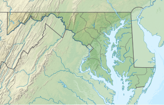
St. Clement's Island State Park is a publicly owned historic preservation and recreational area that encompasses St. Clement's Island, an uninhabited Potomac River island lying one-half mile southeast of Colton's Point, St. Mary's County, Maryland. The state park features a 40-foot stone cross dedicated to the beginnings of freedom of religion in the United States as well as a reconstruction of the historic Blakistone Island Light. [4] It is the central feature of the St. Clement's Island Historic District that was listed on the National Register of Historic Places in 1972. [5]
The park preserves the site of the March 23, 1634, landing of Maryland's first colonists, who had sailed from Cowes on the Isle of Wight in England four months earlier. [6] [7] On March 25, the colonists celebrated a mass of thanksgiving for their safe arrival and this date is commemorated annually as Maryland Day. [8] [9] The island was a convenient, temporary base of operations for the 150 settlers as they negotiated with the Yaocomico Native Americans for land for a permanent settlement. They named the island in honor of Pope Clement I, patron saint of mariners. It was the site of the first Roman Catholic Mass celebrated in the British-American colonies, said by Jesuit Father Andrew White.
The island measured "not above 400 acres" at the time of the settlers' landing, according to White's account of the journey. [10] Five years later, in 1639, the Surveyor General measured the island and found that it was about 80 acres. [11] It formed part of St. Clement's Manor, which was granted by the Second Lord Baltimore to Thomas Gerard in 1639. [12] Gerard subsequently became a major landholder and political figure in Maryland and Virginia. After the island became the property of Gerard's daughter Elizabeth, the wife of Nehemiah Blackistone, it became known as Blackistone Island. [3]
After the Blackistone family took ownership in 1669, the island remained in the family for 162 years. It was taken over by the US Navy in 1919, at which time a landing strip and piers were built and the island's buildings and trees were removed. [13] In 1962, the property was designated as a state park when it was leased from the Federal government and its name reverted to St. Clement's Island. [14] The name change was made official by the Board of Geographic Names in 1965. [1]
The island's 40-foot stone cross was erected in 1934 in celebration of Maryland's 300th anniversary, recognizing the location as one of the foundation sites of religious toleration in the United States. [14]
A replica of the Blakistone Island Light was completed in 2008 through the efforts of the St. Clement's Hundred community organization. [14] The original lighthouse occupied the island from 1851 until 1956 when it was destroyed by fire. [13]
The island is only accessible by private boat or via a water taxi that operates seasonally from the St. Clement's Island Museum in Colton's Point. [14] Activities on the island include hiking, picnicking, fishing, and hunting. [4]
St. Mary's County, established in 1637, is a county located in the U.S. state of Maryland. As of the 2020 census, the population was 113,777. Its county seat is Leonardtown. The name is in honor of Mary, the mother of Jesus. St. Mary's County comprises the California-Lexington Park, Maryland Metropolitan Statistical Area, which also is included in the Washington-Baltimore-Arlington, DC-MD-VA-WV-PA Combined Statistical Area. It is part of the Southern Maryland region. The county was the home to the first Maryland Colony, and the first capital of the Colony of Maryland. Settled by English Catholics, it is considered to be the birthplace of religious freedom in North America, at a time when the British colonies were settled primarily by Protestants. The county is home to the Patuxent River Naval Air Station and St. Mary's College of Maryland. Traditionally, St. Mary's County has been known for its unique and historic culture of Chesapeake Bay tidewater farming, fishing, and crabbing communities. But with the advent of the military bases, growth of an extensive defense contractor presence, and the growth of St. Mary's College of Maryland, as well as increasing numbers of long-distance Washington, D.C. commuters, it has been undergoing a decades-long transformation which has seen the county's population double since 1970. The county is part of the Southern Maryland region of the state.
St. Mary's City is a former colonial town that was founded in March 1634, as Maryland's first European settlement and capital. It is now a state-run historic area, which includes a reconstruction of the original colonial settlement and a designated living history venue and museum complex. Half the area is occupied by the campus of St. Mary's College of Maryland. The entire area contains a community of about 933 permanent residents and some 1,400 students living in campus dorms and apartments.
The Province of Maryland was an English and later British colony in North America from 1634 until 1776, when the province was one of the Thirteen Colonies that joined in supporting the American Revolution against Great Britain. In 1781, Maryland was the 13th signatory to the Articles of Confederation. The province's first settlement and capital was in St. Mary's City, located at the southern end of St. Mary's County, a peninsula in the Chesapeake Bay bordered by four tidal rivers.
U.S. Route 113 (US 113) is a U.S. Highway that is a spur of US 13 in the U.S. states of Maryland and Delaware. The route runs 74.75 miles (120.30 km) from US 13 in Pocomoke City, Maryland, north to Delaware Route 1 (DE 1) in Milford, Delaware. In conjunction with DE 1, US 113 is one of two major north–south highways on the Delmarva Peninsula that connect Dover with Pocomoke City and the Eastern Shore of Virginia. The U.S. Highway is the primary north–south highway in Worcester County, Maryland, where it connects Pocomoke City with Snow Hill and Berlin. US 113 is one of three major north–south highways in Sussex County, Delaware, where it connects Selbyville, Millsboro, and Georgetown with Milford. While US 113 does not pass through Ocean City or the Delaware Beaches, the U.S. Highway intersects several highways that serve the Atlantic seaboard resorts, including US 50, Maryland Route 90 (MD 90), US 9, DE 404, DE 16, and DE 1. US 113 is a four-lane divided highway for its whole length.
Leonard Calvert was the first proprietary governor of the Province of Maryland. He was the second son of The 1st Baron Baltimore (1579–1632), the first proprietor of Maryland. His younger brother Cecil (1605–1675), who inherited the colony and the title upon the death of their father George, April 15, 1632, appointed Leonard as governor of the Colony in his absence.
Southern Maryland, also referred to as SoMD, is a geographical, cultural and historic region, as well as a National Heritage Area, in Maryland composed of the state's southernmost counties on the Western Shore of the Chesapeake Bay. According to the state of Maryland, the region includes all of Calvert, Charles, and St. Mary's counties and the southern portions of Anne Arundel and Prince George's counties. It is largely coterminous with the region of Maryland that is part of the Washington metropolitan area. Portions of the region are also part of the Baltimore Metropolitan Area and the California-Lexington Park Metropolitan Statistical Area. As of the 2020 Census, the region had a population of 373,177. The largest community in Southern Maryland is Waldorf, with a population of 81,410 as of the 2020 Census.
Maryland Day is a legal holiday in the U.S. state of Maryland. It is observed on the anniversary of the March 25, 1634, landing of the first European settlers in the Province of Maryland, the third English colony to be settled in British North America. On this day settlers from The Ark and The Dove first set foot onto Maryland soil, at St. Clement's Island in the Potomac River. The settlers were about 150 in number, departed from Gravesend on the Thames River downstream from London. Three Jesuit priests were collected from Cowes on the Isle of Wight in England where they avoided having to give the oath of allegiance and supremacy to the King. The colony's grant was renewed to Cecil Calvert, 2nd Baron Baltimore, (1605-1675), two years prior by Charles I of England, after first being given to his father Sir George Calvert, 1st Baron Baltimore, (1574-1632), along with the title of "Lord Baltimore", and a first grant of the Province of Avalon, in the Newfoundland Colony,, who had served the King in many official and personal capacities as Secretary of State, 1619-1625. In thanksgiving for the safe landing, Jesuit Father Andrew White celebrated the Mass for the colonists led by the younger brother of Lord Baltimore, Leonard Calvert, (1606-1647), who served as the first governor, and perhaps for the first time ever in this part of the world on the first landing at Blackistone Island, later known as St. Clement's Island off the northern shore of the Potomac River, which was the new border between the new colony and the earlier English settlements in Virginia) and erected a large cross. The landing coincided with the Feast of the Annunciation, a holy day honoring Mary, and the start of the new year in England's legal calendar. Maryland Day on 25 March celebrates the 1634 landing at St Clements. Later the colonists and their two ships sailed further back down river to the southeast to settle a capital at St. Mary's City near the point where the Potomac flows into the Chesapeake Bay.
First Landing State Park offers recreational opportunities at Cape Henry in the independent city of Virginia Beach, Virginia. As the first planned state park of Virginia, First Landing is listed on the National Register of Historic Places as Seashore State Park Historic District. A portion of the park is listed as a National Natural Landmark as part of the Seashore Natural Area.
The Blackistone Island Light was a lighthouse located on what is now St. Clement's Island on the Potomac River in Maryland. It is best known as the target of a Confederate raid in the Civil War. Completed in 1851, the structure was destroyed by fire in 1956 and its shell was razed; a replica was completed in 2008.
Sandy Point State Park is a public recreation area on Chesapeake Bay, located at the western end of the Chesapeake Bay Bridge in Anne Arundel County, Maryland. The state park is known for the popularity of its swimming beach, with annual attendance exceeding one million visitors. The park grounds include the Sandy Point Farmhouse, which is listed on the National Register of Historic Places. The historic Sandy Point Shoal Lighthouse stands in about five feet of water some 1,000 yards (910 m) east of the park's beach.
Chapel Point State Park is an undeveloped public recreation area located on the Port Tobacco River, a tributary of the Potomac, in Charles County, Maryland. The state park offers fishing and hunting. Adjacent to the park, St. Ignatius Church and cemetery, the oldest continuous Roman Catholic parish in the United States, offers a scenic river view.
Rosaryville State Park is a public recreation area with historical features located three miles southeast of Joint Base Andrews in Rosaryville, Prince George's County, Maryland. The state park includes the restored Mount Airy Mansion, which was formerly operated as an event facility, as well as hiking, biking and equestrian trails for day-use.
St. Mary's River State Park is a public recreation area located in St. Mary's County, Maryland. The state park consists of two sites: one encompasses 250-acre (100 ha) St. Mary's Lake ; the second covers 2,200 acres (890 ha) and is largely undeveloped. The park is managed by the Maryland Department of Natural Resources.
St. Ignatius Roman Catholic Church, also known as St. Inigoes Church or The Cove Church, is a historic Catholic parish located in St. Inigoes, St. Mary's County, Maryland. It is a direct descendant of Maryland's first Catholic chapel, in St. Mary's City, whose communicants formed the first nucleus of American Catholicism. The parish fell under the umbrella of the first establishment of religious freedom in America by George Calvert and his sons, who established the Maryland colony as a refuge for persecuted Catholics.
Coltons Point is an unincorporated community in what is popularly called the "Seventh District" of St. Mary's County, Maryland, United States. A small historical museum and a lighthouse are located there. Seasonal boat service carry visitors the short distance to the shrinking, uninhabited St. Clement's Island, where in 1634 the first European settlers arriving in Maryland landed and celebrated the first Catholic Mass in English-speaking North America. It was listed on the National Register of Historic Places in 1972. The ZIP Code for Coltons Point is 20626.
St. Inigoes, sometimes called St. Inigoes Shores, is a small, rural, unincorporated farming, fishing and crabbing community at the southern end of St. Mary's County in the U.S. state of Maryland that is undergoing a transition to small residential subdevelopment plots. Its western side is bordered by a number of coves and creeks that are connected to the St. Marys River, a brackish tidal tributary, near where it feeds into the mouth of the Potomac River and close to its entry point into the Chesapeake Bay.
Maryland Route 242 is a state highway in the U.S. state of Maryland. Known as Colton Point Road, the state highway runs 12.80 miles (20.60 km) from Coltons Point north to MD 5 in Morganza. MD 242 connects the communities of Morganza, Clements, Bushwood, Avenue, and Coltons Point in western St. Mary's County. The state highway also leads to St. Clement's Island State Park, the site of Maryland's First Landing. MD 242 was constructed in the early 1920s.
The Ark was a 400-ton English merchant ship hired in 1633 by Cecil Calvert, 2nd Baron Baltimore to bring roughly 140 English colonists and their equipment and supplies to the new colony and Province of Maryland, one of the original Thirteen Colonies of British North America on the Atlantic Ocean eastern seaboard. On the historic trans-oceanic voyage from England in late 1633 and early 1634, The Ark was accompanied by the smaller 40-ton pinnace Dove.
Heron Island is a sandbar located in the Potomac River east-north-east of Saint Clement's Island in St. Mary's County, Maryland, United States. The closest town is Colton's Point, Maryland, 1⁄2 mile to the north. The island is named for the large numbers of herons seen by the European colonists when they arrived in 1634.
Elkridge Landing was a Patapsco River seaport in Maryland, and is now part of Elkridge, Maryland. The historic Elkridge Furnace Inn site resides within the Patapsco Valley State Park.