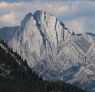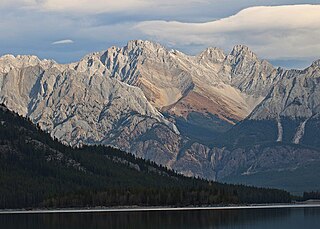
Mount Saskatchewan is a mountain located in the North Saskatchewan River valley of Banff National Park, in the Canadian Rockies of Alberta, Canada.

Mount Glasgow is a prominent 2,935-metre (9,629 ft) pyramid-shaped summit located between the Elbow River valley and Little Elbow River valley of Kananaskis Country in the Canadian Rockies of Alberta, Canada. The peak is visible from Calgary, weather permitting. Mount Glasgow's nearest higher peak is Mount Cornwall, 2.0 km (1.2 mi) to the southwest.

Aquila Mountain is a 2,840-metre (9,320-foot) mountain summit located in the Athabasca River valley of Jasper National Park, in the Canadian Rockies of Alberta, Canada. Aquila Mountain was so named on account of eagles in the area, aquila meaning "eagle" in Latin. The mountain's name was officially adopted on March 5, 1935 when approved by the Geographical Names Board of Canada. Precipitation runoff from Aquila Mountain drains into Portal Creek and Astoria River which are both tributaries of the Athabasca River. Aquila Mountain can be seen from the Icefields Parkway, weather permitting. Lectern Peak is situated one kilometer to the north, and Franchère Peak two km south.

Banded Peak is a 2,934-metre (9,626-foot) summit located in the Elbow River valley of Kananaskis Country in the Canadian Rockies of Alberta, Canada. Banded Peak has a distinctive limestone cliff band which gave it its descriptive name. Its name has been used since around 1896. The peak is visible from Highway 66, weather permitting. The mountain's name became official in 1951 by the Geographical Names Board of Canada.

Mount Black Prince is a 2,939-metre (9,642-foot) mountain summit located in Peter Lougheed Provincial Park in the Canadian Rockies of Alberta, Canada. Its nearest higher peak is Mount Smith Dorrien, 5.8 km (3.6 mi) to the northwest. The mountain can be seen from Highway 742, also known as Smith-Dorrien/Spray Trail.

Mount Blane is a 2,993-metre (9,820-foot) mountain summit located in the Opal Range of the Canadian Rockies of Alberta, Canada. Its nearest higher peak is Mount Jerram, 3.3 km (2.1 mi) to the southeast.

Mount Brock is a 2,902-metre (9,521-foot) mountain summit located in the Opal Range of the Canadian Rockies of Alberta, Canada. Its nearest higher peak is Mount Evan-Thomas, 3.3 km (2.1 mi) to the north.

Mount Cornwall is a prominent 2,970-metre (9,740-foot) summit located between the Elbow River valley and Little Elbow River valley of Kananaskis Country in the Canadian Rockies of Alberta, Canada. The peak is visible from Highway 66, weather permitting. Mount Cornwall's nearest higher peak is Tombstone Mountain, 6.6 km (4.1 mi) to the southwest.

Cougar Mountain is a summit in the Elbow River Valley, Kananaskis Country, Alberta, Canada.

Elpoca Mountain is a 3,036-metre (9,961-foot) mountain summit located at the southern end of the Opal Range in the Canadian Rockies of Alberta, Canada. The nearest higher peak is Mount Evan-Thomas, 12.0 km (7.5 mi) to the north. Elpoca Mountain is situated 4.0 kilometres south of Mount Jerram, and 2.0 km east of Gap Mountain, and all are within Peter Lougheed Provincial Park. Precipitation runoff from the west side of the mountain drains into tributaries of the Kananaskis River, whereas the east side drains into Elbow River.

Mount Wilson is a 3,260-metre (10,696 ft) mountain summit located in the North Saskatchewan River valley of Banff National Park, in the Canadian Rockies of Alberta, Canada. Its nearest higher peak is Mount Cline, 9.81 km (6.10 mi) to the northeast. Mount Wilson is situated immediately north of the confluence of the North Saskatchewan River, Mistaya River, and Howse River near Saskatchewan Crossing, where the Icefields Parkway intersects with the David Thompson Highway.

Mount Lyautey is a 3,045-metre (9,990-foot) mountain summit located in Kananaskis Country in the Canadian Rockies of Alberta, Canada. Mount Lyautey is situated 2.0 kilometres east of the Continental Divide, within Peter Lougheed Provincial Park. Its nearest higher peak is Mount Joffre, 8.0 km (5.0 mi) to the south. Mount Lyautey can be seen from Upper Kananaskis Lake and Alberta Highway 40.

Mount Jerram is a 2,996-metre (9,829-foot) mountain summit located in the Opal Range of the Canadian Rockies of Alberta, Canada. Its nearest higher peak is Elpoca Mountain, 4.0 km (2.5 mi) to the south-southeast. Mount Jerram is situated east of Mount Wintour, within Peter Lougheed Provincial Park.

Mount Indefatigable is a 2,667-metre (8,750-foot) mountain summit located in Peter Lougheed Provincial Park in the Canadian Rockies of Alberta, Canada. The peak is visible from Alberta Highway 40, and the Kananaskis Lakes area. Mount Indefatigable's nearest higher neighbour is Mount Invincible, 1.8 km (1.1 mi) to the northwest.

Mount Sarrail is a 3,159-metre (10,364-foot) mountain summit located in Kananaskis Country in the Canadian Rockies of Alberta, Canada. Mount Sarrail is situated 1.0 kilometre north of the Continental Divide, within Peter Lougheed Provincial Park. Its nearest higher peak is Mount Foch, 1.0 km (0.62 mi) to the southeast. Mount Sarrail can be seen from Upper Kananaskis Lake and Alberta Highway 40.

Wind Mountain is a 3,153-metre (10,344-foot) mountain summit located in Kananaskis Country in the Canadian Rockies of Alberta, Canada. Wind Mountain's nearest higher peak is Mount Galatea, 13.0 km (8.1 mi) to the south, and both are part of the Kananaskis Range. Wind Mountain can be seen from the Trans-Canada Highway in the Bow River valley, and from Highway 40.

Mount Turner is a 2,806-metre (9,206-foot) mountain summit located in the upper Spray River Valley of southern Banff National Park, in the Canadian Rockies of Alberta, Canada. Mount Turner in not visible from any road in Banff Park, however, it can be seen from Alberta Highway 742, also known as the Smith-Dorrien/Spray Trail in Kananaskis Country. Mount Turner's nearest higher peak is Cone Mountain, 2.91 km (1.81 mi) to the north.

Mount Romulus is a 2,832-metre (9,291-foot) mountain summit located in the Little Elbow River Valley of Kananaskis Country in the Canadian Rockies of Alberta, Canada. Weather permitting, the peak is visible from highways southwest of Calgary as it is recognizable by its signature band of snow that forms above the broad southeast cliffs. The mountain is named for Romulus, who along with his twin brother Remus were the mythological founders of Ancient Rome. Mount Remus is situated 2.0 km (1.2 mi) to the east-northeast. The name was officially adopted by the Geographical Names Board of Canada in 1940. Mount Romulus' nearest higher peak is Fisher Peak, 4.0 km (2.5 mi) to the northwest.

Mount Remus is a 2,688-metre (8,819-foot) mountain summit located in the Little Elbow River Valley of Kananaskis Country in the Canadian Rockies of Alberta, Canada. The mountain is named for Remus, who along with his twin brother Romulus were the mythological founders of Ancient Rome. The name was officially adopted by the Geographical Names Board of Canada in 1940. Mount Remus' nearest higher peak is Mount Romulus, 2.0 km (1.2 mi) to the west-southwest.

Tombstone Mountain is a 3,002-metre (9,849-foot) double summit mountain located near the southern end of the Opal Range in Kananaskis Country of the Canadian Rockies in Alberta, Canada. Tombstone South is the lower of the two summits, and is labelled as Tombstone Mountain on some maps. It can be reached via scrambling, whereas the true north summit requires technical climbing. Tombstone Mountain is situated within Elbow-Sheep Wildland Provincial Park, and its nearest higher peak is Elpoca Mountain, 4.0 km (2.5 mi) to the south.


