
The Srinagar District is an administrative district of Indian-administered Jammu and Kashmir in the disputed Kashmir region. It is one of the 20 districts of Jammu and Kashmir. Situated in the centre of the Kashmir Valley, it is the second-most populous district of the union territory after Jammu District as per the 2011 national census, and is home to the summer capital city of Srinagar. Likewise, the city of Srinagar also serves as the Srinagar District's headquarters.
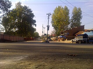
Nowhatta, known as Navyut in Kashmiri, is a town of historical importance situated at a distance of 5 km from Lal Chowk, Srinagar in Jammu and Kashmir, India. Nowhatta is famous because of Historical Mosque known as Jamia Masjid. Nowhatta area has eighteen sub-communities Mohalla. The place is also notable for high rate of stone pelting incidents in Kashmir. Each week after Friday prayers, people stage their protest against Indian rule which most of the times results in stone pelting incidents in the area.

Ganderbal is a city and the headquarters of Ganderbal district in the Indian-administered union territory of Jammu and Kashmir, in disputed Kashmir region. It is in Central Kashmir; and has an average elevation of 1,619 metres. Ganderbal is bordered by district Srinagar District in the south, Bandipora District to the north, Kargil District in the northeast, Anantnag District to the southeast, and Baramulla District in the southwest. The current District Magistrate of Ganderbal is Shri. Shyambir Singh (IAS) and the current Superintendent of police is Shri. Ragav S. (IPS). Ganderbal is renowned for its beauty, boasting numerous picturesque places and captivating landscapes. Sonamarg is the most famous place in Ganderbal; Shri Amarnath Ji Yatra is also traversed through Ganderbal district. Manasbal Lake famous for natural and purity of water as compared to other water lakes of the Kashmir Valley.

Pampore, known as Pampar or Panpar in Kashmiri, is a historical town situated on the eastern side of the Jhelum River on the Jammu–Srinagar National Highway. It was known as Padmapura in antiquity. Pampore is about 11 kilometres (6.8 mi) away from Srinagar city centre Lal Chowk. It is primarily known for its cultivation of saffron.
Bemina is a region in the city of Srinagar, the summer capital of Jammu and Kashmir, India. It is in the heart of the summer capital of Jammu and Kashmir just about 4 km (2.5 mi) from Lal Chowk. It lies in the Batamaloo Assembly Constituency, Batamaloo assembly segment of the Srinagar parliamentary constituency.

Lal Chowk is a city square in Srinagar, in the Indian administered Jammu and Kashmir.

Soura, known as Sovur in Kashmiri, is a neighborhood in Indian-administered Srinagar in the disputed region of Jammu and Kashmir. It is located about 9 km north of Lal Chowk, Srinagar on Srinagar-Ladakh Highway in Jammu and Kashmir, India. Soura is noted for Sher-i-Kashmir Institute of Medical Sciences, a multi-specialty hospital. Besides serving as a hospital, it is the medical deemed university of Kashmir valley. Soura is located near Anchar Lake. The whole western side of the area is covered by Anchar Lake. It also hosts a famous Muslim Shrine known as Asar-e-Sharif Jinab Sahib Soura which holds more than 13 holy relics.

Hazratbal is the notified area situated in the Srinagar district of Jammu and Kashmir. It is about 10 km (6.2 mi) from the Srinagar city center. The area became famous after the construction of Hazratbal Shrine, where hundreds of thousands of people visit every year because many relics related to the Islamic prophet Muhammad are believed to be there.
Rajbagh is the notified area in the municipal committee of Srinagar, in the Indian union territory of Jammu and Kashmir. It comes under the Lal chowk Constituency. Rajbagh is a posh locality in the civil line area of Srinagar. The postal code of Rajbagh is 190008. Rajbagh is considered one of the many best residential places in Srinagar. There are many hotels, restaurants and schools in this locality. Rajbagh area was heavily damaged by the 2014 Kashmir floods, it was one of the worst affected areas due to flood.

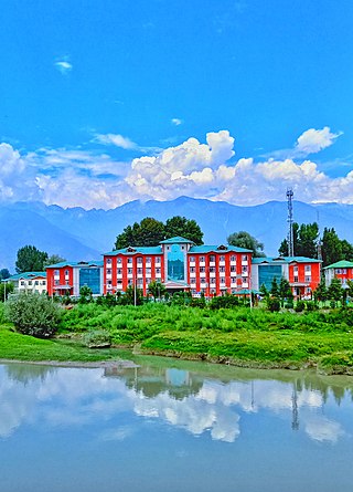
Lal Bazar is a locality in the municipal committee of Srinagar in the Indian administered union territory of Jammu and Kashmir. It comes under the Zadibal constituency of the Srinagar Legislative Assembly. Lal Bazar is a well known slum area in the upper downtown area of Srinagar. The Pincode of Lal Bazar is 190023. Considered amongst the best residential areas in Srinagar the area has many amenities such as major banks and schools along with University of Kashmir,NIT Srinagar, Institute of Technology, University of Kashmir, Zakura Campus, Sher - i - Kashmir Institute of Medical Sciences close by, roughly 2 km from Lal Bazar.
Downtown, popularly known as Shahar-e-Khaas, is the largest and the most densely populated area of the city of Srinagar in the union territory of Jammu and Kashmir, India. The area is mostly located on the banks of Jhelum river about five km (3.1 mi) from city center. The area is considered as the core point in the city as the first inhabitants of the Srinagar lived there. In general, the whole area to the north of city centre Lal Chowk is considered a part of downtown although some areas hold high significance. The Jamia Masjid, Srinagar and many other shrines are located here, which makes it the central spiritual, religious, political and moral center of whole Kashmir.
Nowshera is the notified area in the municipal committee of Srinagar, in the Indian union territory of Jammu and Kashmir. It is also alternatively spelled as Nowshehra or Noushera. It is one of the oldest residential places in Srinagar founded by Sultan Zain-ul-Abidin. It is located about 9.9 km towards North from the commercial center of Kashmir.
Zakura, also known as Zukura and Zukur, is a notified area and town in the Srinagar district of the Kashmir Valley, in the union territory of Jammu and Kashmir, India. The town is the integral part of Hazratbal constituency. The area is located about 12 km from commercial center of the Kashmir Valley. The area provides at least two major road links which connects municipal committee of Ganderbal with Srinagar.
Karan Nagar is the notified area and the town in the city of Srinagar in the Indian administered union territory of Jammu and Kashmir. A portion of Karan Nagar in the name of Deewan Bagh was the first declared civil colony in 1942 by the former princely state government of Jammu and Kashmir. It is a posh locality of Srinagar city. The famous SMHS hospital and Government Medical College is located here. It is located about 2 km (1.2 mi) from the commercial center of Kashmir, Lal Chowk.
Jawahar Nagar is the notified area in the municipal committee of Srinagar, in the Indian administered union territory of Jammu and Kashmir. It comes under the Amira Kadal Constituency. Jawahar Nagar is a posh locality in the civil line area of Srinagar. The postal code of Jawahar Nagar is 190008. Jawahar Nagar is considered one of the many best residential places in Srinagar. The airport is located at a distance of 9.3 km (5.8 mi). Jawahar Nagar area was heavily damaged by the 2014 Kashmir floods, it was one of the worst affected areas due to flood. There are two Branches of Jammu and Kashmir Bank, one of which is exclusively for women. There are multiple gymnasiums, mosques and shops in the area.
Ganderbal Assembly constituency is one of the 90 constituencies in the Jammu and Kashmir Legislative Assembly of Jammu and Kashmir a north state of India. Ganderbal is also part of Srinagar Lok Sabha constituency.
Hazratbal Assembly constituency is one of the 90 constituencies in the Jammu and Kashmir Legislative Assembly of Jammu and Kashmir a north state of India. Hazratbal is also part of Srinagar Lok Sabha constituency.
Imambara Zadibal was the first Imambara(Husayniyya) or Marak constructed in Kashmir Valley by Kaji Chak, minister in the regime of Sultan Mohammad in the year 1518. It is situated in the Zadibal area of Srinagar to the west side of Hari Parbat fort. This Imambara was burned down and destroyed number of times.
Rainawari is a location in Srinagar, Kashmir. Rainawari lies on NH "Srinagar-Leh" road about 4 km from Lalchowk.Rainawari was known as Rajanavatika in Ancient times an was considered the largest suburbs of Srinagar falling on North side traversed by numerous canals coming from Dal Lake.
Barbar Shah, also known as Barbarshun in the Kashmiri language, is a neighbourhood of Srinagar in Jammu and Kashmir, India. It is situated about 0.5 km from Lal Chowk.

