List of regional routes in South Africa

Last updated

This is a list of regional routes in South Africa. [1]

Contents

R101–R120

Route numbers with three digits starting with "R1" are given to sections of road that were formerly part of a national route with a corresponding number, when the national route has since been moved to a new alignment, usually a freeway. So, for example, the R102 number is given to road segments that were formerly part of the N2, and the R114 number is given to road segments that were formerly part of the N14.

No.Route
SA road R101.svg R101
SA road R102.svg R102
SA road R103.svg R103
SA road R104.svg R104
SA road R114.svg R114 MuldersdriftCenturion

R300–R499

Roads with a three-digit route number starting with 3 or 4 are located in the former Cape Province.

No.Route
SA road R300.svg R300 Mitchells PlainKuilsrivierBrackenfell
SA road R301.svg R301 R45 at WemmershoekPaarlWellingtonR43 near Romansrivier
SA road R302.svg R302 BellvilleDurbanvilleKlipheuwelMalmesbury
SA road R303.svg R303 CeresCitrusdal
SA road R304.svg R304 AtlantisKlipheuwelStellenbosch
SA road R305.svg R305 StilbaaiN2 near Riversdale
SA road R306.svg R306 R61 near Beaufort WestN9 near Willowmore
SA road R307.svg R307 R27 near Atlantis – Atlantis – Darling – R45 near Moorreesburg
SA road R308.svg R308 R356 near FraserburgR63 near Carnarvon
SA road R309.svg R309 N8 between Groblershoop and GriekwastadPostmasburg
SA road R310.svg R310 MuizenbergMitchell's PlainStellenboschR45 between Paarl and Franschhoek
SA road R311.svg R311 R45 near HopefieldMoorreesburgRiebeek-Kasteel
SA road R312.svg R312 R302 near DurbanvilleR44 near Paarl
SA road R313.svg R313 PrieskaN8 near Griekwastad
SA road R315.svg R315 YzerfonteinDarlingMalmesbury
SA road R316.svg R316 CaledonNapierBredasdorpArniston
SA road R317.svg R317 RobertsonBonnievaleBredasdorp
SA road R318.svg R318 N1 near De DoornsMontagu
SA road R319.svg R319 L'AgulhasStruisbaaiBredasdorpN2 near Swellendam
SA road R320.svg R320 R43 near HermanusCaledon
SA road R321.svg R321 GrabouwR45 near Villiersdorp
SA road R322.svg R322 R324 near SuurbraakHeidelbergPort Beaufort
SA road R323.svg R323 R62 near LadismithRiversdale - Laingsburg
SA road R324.svg R324 BarrydaleN2 near SwellendamWitsand
SA road R325.svg R325 KathuPostmasburgGriekwastad
SA road R326.svg R326 StanfordN2 near Riviersonderend
SA road R327.svg R327 R62 near LadismithN2 near Mossel Bay
SA road R328.svg R328 Mossel BayOudtshoornPrince Albert
SA road R329.svg R329 WillowmoreSteytlervilleR75 at Wolwefontein
SA road R330.svg R330 HankeyHumansdorpCape St. Francis
SA road R331.svg R331 R332 near Patensie – Patensie – HankeyN2 near Thornhill
SA road R332.svg R332 R331 near PatensieR330 near Humansdorp
SA road R334.svg R334 N2 west of Port ElizabethUitenhageCoega
SA road R335.svg R335 N2 near Motherwell – Motherwell – AddoSomerset East
SA road R336.svg R336 R75 west of Kirkwood – Kirkwood – Addo
SA road R337.svg R337 R329 between Willowmore and SteytlervilleKlipplaatJansenvillePearstonCradock
SA road R338.svg R338 AberdeenKlipplaatR329 at Baroe
SA road R339.svg R339 N2 near KnysnaAvontuurUniondaleR341 north of Uniondale
SA road R340.svg R340 N2 near KeurboomsrivierR339 on Prince Alfred Pass
SA road R341.svg R341 De RustN9 between Uniondale and Willowmore
SA road R342.svg R342 R335 near AddoPatersonN2
SA road R343.svg R343 N2 near GrahamstownKenton-on-Sea
SA road R344.svg R344 DordrechtSterkstroomTarkastadAdelaideGrahamstown
SA road R345.svg R345 CathcartHogsbackAlicePeddieR72
SA road R346.svg R346 StutterheimKing William's TownEast London
SA road R347.svg R347 R346 near King William's TownR72 near Kidd's Beach
SA road R349.svg R349 N2 near KomgaKei MouthKentaniWillowvaleCoffee BayPort St Johns
SA road R350.svg R350 BedfordGrahamstown
SA road R351.svg R351 R67 near KatbergWhittleseaCathcartR61 between Queenstown and Qamata
SA road R352.svg R352 DimbazaKeiskammahoekStutterheimTsomo
SA road R353.svg R353 BrandvleiWillistonFraserburgLeeu-Gamka
SA road R354.svg R354 R27 near CalviniaSutherlandMatjiesfontein
SA road R355.svg R355 KleinzeeSpringbokLoeriesfonteinCalviniaR46 near Ceres
SA road R356.svg R356 R46 near CeresSutherlandFraserburgLoxton
SA road R357.svg R357 NieuwoudtvilleLoeriesfonteinBrandvleiVan WyksvleiPrieskaDouglasKimberley
SA road R358.svg R358 N7 near BitterfonteinPofadderOnseepkans (– Karasburg, Namibia)
SA road R359.svg R359 Augrabies FallsKakamasUpington
SA road R360.svg R360 (Mariental, Namibia –) Mata MataKgalagadi Transfrontier ParkUpington
SA road R361.svg R361 KenhardtVan WyksvleiR386 near Carnarvon
SA road R362.svg R362 DoringbaaiLutzvilleVredendalKlawer (along the north bank)
SA road R363.svg R363 NuwerusLutzvilleVredendalKlawer (along the south bank)
SA road R364.svg R364 Lambert's BayGraafwaterClanwilliamR27 between Nieuwoudtville and Calvinia
SA road R365.svg R365 Lambert's BayLeipoldtvillePiketberg
SA road R366.svg R366 Elands BayRedelinghuysR365
SA road R369.svg R369 R357 near PrieskaHopetownPetrusvilleColesberg
SA road R370.svg R370 DouglasSchmidtsdriftJan Kempdorp
SA road R371.svg R371 N14 between Kuruman and VryburgReiviloR370
SA road R372.svg R372 N14 near KurumanReiviloTaung
SA road R374.svg R374 Barkly WestWindsortonN12 at Windsorton Road
SA road R375.svg R375 MakopongBrayVergeleëMareetsaneSannieshof
SA road R376.svg R376 R378 between Tosca and GanyesaVorstershoopMakopong
SA road R377.svg R377 VergeleëPiet PlessisStellaN14 near Delareyville
SA road R378.svg R378 R375 between Makopong and BrayToscaGanyesaVryburg
SA road R380.svg R380 (Tsabong, Botswana –) McCarthy's RestHotazelKathu
SA road R381.svg R381 LoxtonBeaufort West
SA road R382.svg R382 Port NollothSteinkopf
SA road R383.svg R383 KenhardtMarydaleR313 near Griekwastad
SA road R384.svg R384 CarnarvonVosburgBritstown
SA road R385.svg R385 N14 near OlifantshoekPostmasburgR31 near DaniëlskuilCampbellDouglas
SA road R386.svg R386 PrieskaCarnarvon
SA road R387.svg R387 N12 near StrydenburgR369 near Orania
SA road R388.svg R388 HopetownDe AarRichmond
SA road R389.svg R389 PhilipstownN1 near HanoverNoupoort
SA road R390.svg R390 BethulieVenterstadSteynsburgHofmeyrCradock
SA road R391.svg R391 HofmeyrBurgersdorp
SA road R392.svg R392 QueenstownDordrechtLady GreyHerschelSterkspruit
SA road R393.svg R393 SterkspruitTele BridgeLundin's NekMoshesh's FordR58 near Elliot
SA road R394.svg R394 N2 near KokstadR61 between Flagstaff and Bizana
SA road R396.svg R396 R410 near Lady FrereIndweBarkly EastMoshesh's FordRhodesMaclearTsoloN2 north of Mthatha
SA road R397.svg R397 BurgersdorpStormbergMoltenoSterkstroomN6
SA road R398.svg R398 N12 near BritstownMerrimanRichmondMiddelburg
SA road R399.svg R399 VredenburgVelddrifN7 near Piketberg
SA road R400.svg R400 R75 between Jansenville and WolwefonteinRiebeeck EastR350 near Grahamstown
SA road R401.svg R401 R61 near Bethesda Road – HofmeyrR61 near Tarkastad
SA road R402.svg R402 KareedouwN2
SA road R403.svg R403 R386 near PrieskaVosburgN12 near Victoria West
SA road R404.svg R404 N9 near GeorgeHerolds Bay
SA road R405.svg R405 Mount FrereR56 near Matatiele
SA road R406.svg R406 N2 near CaledonGenadendalGreytonN2 near Riviersonderend
SA road R407.svg R407 Prince Albert RoadPrince AlbertKlaarstroomWillowmore
SA road R408.svg R408 NgcoboDutywaWillowvale
SA road R409.svg R409 R61 near Tsomo – Tsomo – Bholani – N2 near ButterworthKentani
SA road R410.svg R410 R392 near QueenstownLady FrereCalaR58 near Elliot
SA road R411.svg R411 N2 near MthathaCoffee Bay
SA road R412.svg R412 R61 near MthathaUgie

R500–R599

Roads with a three-digit route number starting with 5 are located in the former Transvaal Province.

No.Route
SA road R500.svg R500 R509 near MagaliesburgCarletonvilleFochvilleR53 near Parys
SA road R501.svg R501 R59 near ViljoenskroonPotchefstroomCarletonvilleN12 near Westonaria
SA road R502.svg R502 N12 between Bloemhof and WolmaransstadMakwassieLeeudoringstadOrkneyN12 between Klerksdorp and Potchefstroom
SA road R503.svg R503 MafikengLichtenburgColignyKlerksdorp
SA road R504.svg R504 PudimoeSchweizer-RenekeWolmaransstadLeeudoringstadBothaville
SA road R505.svg R505 WesselsbronMakwassieWolmaransstadOttosdalLichtenburgOttoshoop
SA road R506.svg R506 DelareyvilleSchweizer-RenekeChristiana
SA road R507.svg R507 SetlagoleDelareyvilleOttosdalHartbeesfonteinR30 between Klerksdorp and Ventersdorp
SA road R508.svg R508 MusinaTshipise
SA road R509.svg R509 SwartruggensKosterDerbyMagaliesburg
SA road R510.svg R510 Botswana border at StockpoortLephalaleThabazimbiRustenburg
SA road R511.svg R511 R510 near ThabazimbiBritsHartebeespoortN14 exit 309 – N1 exit 95
SA road R512.svg R512 BritsBroederstroomLanseriaN14 exit 295 – N1 exit 90 – Randburg
SA road R513.svg R513 R511 near HartebeespoortPretoria NorthCullinanBronkhorstspruit
SA road R514.svg R514 PretoriaR511 near Hartebeespoort
SA road R515.svg R515 CullinanRaytonN4R25 between Bapsfontein and Bronkhorstspruit
SA road R516.svg R516 R511 near ThabazimbiBela-BelaR519 between Mookgophong and Roedtan
SA road R517.svg R517 N1 near ModimolleModimolleVaalwaterR510 between Lephalale and Thabazimbi
SA road R518.svg R518 LephalaleMokopaneLebowakgomo
SA road R519.svg R519 MookgophongRoedtanN1 near Polokwane
SA road R520.svg R520 Mookgophong – Vanalphensvlei
SA road R521.svg R521 Pontdrift border post – AlldaysPolokwane
SA road R522.svg R522 R521 between Polokwane and AlldaysLouis Trichardt
SA road R523.svg R523 R521 between Polokwane and Alldays – N1 between Louis Trichardt and MusinaThohoyandou
SA road R524.svg R524 Louis TrichardtThohoyandouPunda Maria Gate
SA road R525.svg R525 N1 between Louis Trichardt and MusinaTshipisePafuri Gate
SA road R526.svg R526 GravelotteR40 between Phalaborwa and HoedspruitR36 between Tzaneen and Ohrigstad
SA road R527.svg R527 R36 between Tzaneen and OhrigstadHoedspruit
SA road R528.svg R528 HaenertsburgTzaneen
SA road R529.svg R529 R36 between Tzaneen and OhrigstadLetsiteleGiyani
SA road R531.svg R531 R527 near HoedspruitKlaserieOrpen Gate
SA road R532.svg R532 R36 between Tzaneen and OhrigstadBlyde River CanyonGraskopSabieR536 near Sabie
SA road R533.svg R533 R36 between Ohrigstad and MashishingPilgrim's RestGraskopBushbuckridge
SA road R534.svg R534 R532 near GraskopGod's WindowR532 further from Graskop
SA road R535.svg R535 R533 near GraskopHazyview
SA road R536.svg R536 SabieHazyviewPaul Kruger Gate
SA road R537.svg R537 SabieWhite River
SA road R538.svg R538 R40 near HazyviewWhite RiverN4 near Nelspruit
SA road R539.svg R539 R36 between Waterval Boven and MashishingN4 near Montrose pass – R37 between Sabie and Nelspruit
SA road R540.svg R540 BelfastDullstroomMashishing
SA road R541.svg R541 MachadodorpBadplaasN17 between Chrissiesmeer and Ngwenya
SA road R542.svg R542 VandyksdrifHendrinaBreytenChrissiesmeer
SA road R543.svg R543 VredeVolksrustWakkerstroomPiet RetiefMahamba border post
SA road R544.svg R544 R573 between Pretoria and Marble HallWitbankR35 near Bethal
SA road R545.svg R545 N4 between Bronkhorstspruit and WitbankOgiesBethal
SA road R546.svg R546 KinrossStandertonVrede
SA road R547.svg R547 R555 near WitbankKrielKinrossR23 between Greylingstad and Standerton
SA road R548.svg R548 R50 near DelmasDevonR51 near Balfour
SA road R549.svg R549 HeidelbergDeneysville
SA road R550.svg R550 EnnerdaleNigelDevon
SA road R551.svg R551 EvatonMeyertonR42 near Suikerbosrand Nature Reserve
SA road R552.svg R552 Lanseria International AirportFourways
SA road R553.svg R553 R42 near VanderbijlparkSebokengEvaton – M1 near Johannesburg
SA road R554.svg R554 LenasiaAlbertonSprings
SA road R555.svg R555 SpringsDelmasWitbankMiddelburg (MP)BurgersfortOhrigstad
SA road R556.svg R556 Sun CityN4 at Modderspruit
SA road R557.svg R557 R550 near EnnerdaleDalesideR42 between Vereeniging and Heidelberg
SA road R558.svg R558 KrugersdorpLenasiaEnnerdale
SA road R559.svg R559 RandfonteinR558 near Lenasia
SA road R560.svg R560 R24 near MagaliesburgR512 near Hartbeespoort Dam
SA road R561.svg R561 R518 at MarkenMaasstroomZanzibar border post
SA road R562.svg R562 N14 exit 309 – N1 exit 115 – R21 exit 25
SA road R563.svg R563 R560 between Magaliesburg and HartbeespoortKrugersdorp
SA road R564.svg R564 RoodepoortFourwaysR101 near Buccleuch
SA road R565.svg R565 R24 near RustenburgR556 at Sun City
SA road R566.svg R566 R512 near BritsRosslynR101 at Pretoria North
SA road R567.svg R567 N11 between Mokopane and BotswanaPolokwane
SA road R568.svg R568 R25 near BronkhorstspruitEkangalaKwaMhlangaSiyabuswa
SA road R569.svg R569 R538 between White River and HazyviewNumbi Gate
SA road R570.svg R570 Malelane GateJeppe's Reef border post
SA road R571.svg R571 Crocodile Bridge GateKomatipoortMananga border post
SA road R572.svg R572 R510 near Lephalale – Swartwater – AlldaysMusina
SA road R573.svg R573 PretoriaKwaMhlangaSiyabuswaMarble Hall
SA road R575.svg R575 R555 near MiddelburgR544 between Witbank and Bethal
SA road R576.svg R576 R101N1 exit 224 – R516 near Settlers
SA road R577.svg R577 RoossenekalMashishing
SA road R578.svg R578 N1 near Louis TrichardtElimR81 near Giyani
SA road R579.svg R579 R37 near ChuenespoortLebowakgomoJane FurseR33 near Stoffberg
SA road R580.svg R580 R50 between Delmas and LeandraR546 near Secunda

R600–R699

Roads with a three-digit route number starting with 6 are located in KwaZulu-Natal.

No.Route
SA road R600.svg R600 N11 near LadysmithWintertonChampagne Castle
SA road R602.svg R602 N11 between Ladysmith and NewcastleGlencoeDundee
SA road R603.svg R603 KingsburghN3 near Camperdown
SA road R612.svg R612 R617 near BulwerDonnybrookIxopoUmzintoPark Rynie
SA road R614.svg R614 R33 between Pietermaritzburg and MpolweniTongaat
SA road R616.svg R616 N3 near LadysmithBergville
SA road R617.svg R617 KokstadFranklinUnderbergHowick
SA road R618.svg R618 AlphaNongomaMtubatubaGreater St. Lucia Wetland Park
SA road R619.svg R619 N2 near EmpangeniRichards Bay
SA road R620.svg R620 R61 in SouthbroomRamsgateMargateUvongoShelly BeachPort Shepstone
SA road R621.svg R621 DundeeHattingspruitDannhauserN11 between Ladysmith and Newcastle
SA road R622.svg R622 Mooi RiverGreytown
SA road R624.svg R624 R56 near RichmondR603 near Mpumalanga

R700–R799

Roads with a three-digit route number starting with 7 are located in the Free State.

No.Route
SA road R700.svg R700 BloemfonteinBultfonteinHoopstad
SA road R701.svg R701 R26 near WepenerSmithfieldBethulieN1 near Gariep Dam
SA road R702.svg R702 BloemfonteinDewetsdorpWepenerVan Rooyen's Gate
SA road R703.svg R703 R26 near ClocolanExcelsiorVerkeerdevleiBrandfortSoutpanR64 near Dealesville
SA road R704.svg R704 TrompsburgJagersfonteinFauresmithKoffiefontein
SA road R705.svg R705 N12 near RitchieJacobsdalR48 near Koffiefontein
SA road R706.svg R706 BloemfonteinR704 near Jagersfontein
SA road R707.svg R707 MarquardSenekalArlingtonLindleyPetrus SteynR34 near Frankfort
SA road R708.svg R708 Jan KempdorpChristianaHertzogvilleBultfonteinTheunissenWinburgMarquardClocolan
SA road R709.svg R709 HobhouseTweespruitExcelsiorWinburg
SA road R710.svg R710 BultfonteinWelkom
SA road R711.svg R711 BethlehemClarensFouriesburg
SA road R712.svg R712 HarrismithClarens
SA road R713.svg R713 R34 near KroonstadR30 between Odendaalsrus and Bothaville
SA road R714.svg R714 BethlehemWarden
SA road R715.svg R715 SpringfonteinBethulie
SA road R716.svg R716 ViljoensdrifOranjevilleR26 between Frankfort and Villiers
SA road R717.svg R717 ColesbergPhilippolisTrompsburgEdenburgReddersburgDewetsdorp
SA road R719.svg R719 BultfonteinWesselsbronR30 between Bothaville and Odendaalsrus
SA road R720.svg R720 R70 near SenekalSteynsrusEdenvilleKoppiesR721 near Vredefort
SA road R721.svg R721 KroonstadVredefort
SA road R722.svg R722 HarrismithMemel
SA road R723.svg R723 ParysHeilbron
SA road R724.svg R724 Petrus SteynR76 near Bethlehem
SA road R725.svg R725 LindleyHeilbron
SA road R726.svg R726 Zastron – Intersection of R392 and R393
SA road R727.svg R727 BothavilleR76 between Viljoenskroon and Kroonstad
SA road R730.svg R730 R30 near Virginia – Virginia – WelkomR34 near Odendaalsrus

See also

Related Research Articles

<span class="mw-page-title-main">Interstate Highway System</span> Network of freeways in the United States

The Dwight D. Eisenhower National System of Interstate and Defense Highways, commonly known as the Interstate Highway System, or the Eisenhower Interstate System, is a network of controlled-access highways that forms part of the National Highway System in the United States. The system extends throughout the contiguous United States and has routes in Hawaii, Alaska, and Puerto Rico.

<span class="mw-page-title-main">United States Numbered Highway System</span> Highway system of the United States of America

The United States Numbered Highway System is an integrated network of roads and highways numbered within a nationwide grid in the contiguous United States. As the designation and numbering of these highways were coordinated among the states, they are sometimes called Federal Highways, but the roadways were built and have always been maintained by state or local governments since their initial designation in 1926.

<span class="mw-page-title-main">Great Britain road numbering scheme</span>

The Great Britain road numbering scheme is a numbering scheme used to classify and identify all roads in Great Britain. Each road is given a single letter and a subsequent number. Though this scheme was introduced merely to simplify funding allocations, it soon became used on maps and as a method of navigation. There are two sub-schemes in use: one for motorways, and another for non-motorway roads.

<span class="mw-page-title-main">Interstate 238 and State Route 238 (California)</span> Highway in California

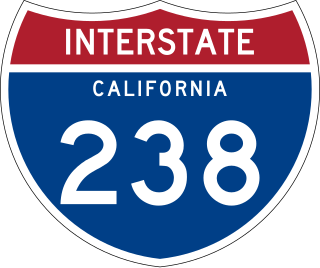
Route 238, consisting of State Route 238 (SR 238) and Interstate 238 (I-238), is a mostly north–south state and auxiliary Interstate highway in the San Francisco Bay Area of California. The southern segment is signed as SR 238 and is a divided multilane surface highway that runs parallel to the Hayward hills between I-680 in Fremont and I-580 in Castro Valley. The northern segment is signed as I-238 and is a six-lane freeway that runs more east–west between I-580 and I-880 in San Leandro.

A routenumber, designation or abbreviation is an identifying numeric designation assigned by a highway authority to a particular stretch of roadway to distinguish it from other routes and, in many cases, also to indicate its classification, general geographical location and/or orientation. The numbers chosen may be used solely for internal administrative purposes; however, in most cases they are also displayed on roadside signage and indicated on maps.

<span class="mw-page-title-main">Florida State Highway System</span> Highway system in Florida, United States

The State Highway System of the U.S. state of Florida comprises the roads maintained by the Florida Department of Transportation (FDOT) or a toll authority. The components are referred to officially as state roads, abbreviated as SR.

Regional routes are the third category of road in the South African route numbering scheme. They are designated with the letter "R" followed by a three-digit number. They serve as feeders connecting smaller towns to the national and provincial routes. Designation as a regional road does not necessarily imply any particular size of road; they range from gravel roads to multi-lane freeways.

<span class="mw-page-title-main">State highways in Oregon</span> Highway system of Oregon in the United States

The state highway system of the U.S. state of Oregon is a network of highways that are owned and maintained by the Highway Division of the Oregon Department of Transportation (ODOT).

The Massachusetts State Highway System in the U.S. Commonwealth of Massachusetts is a system of state-numbered routes assigned and marked by the highway division of the Massachusetts Department of Transportation (MassDOT). U.S. Highways and Interstate Highways are included in the system; the only overlaps are with the end-to-end U.S. Route 3 and Route 3 and the far-apart Interstate 295, shared with Rhode Island, and Route 295, shared with New York State. A state highway in Massachusetts is a road maintained by the state, which may or may not have a number. Not all numbered routes are maintained or owned by the state.

<span class="mw-page-title-main">Maine State Route 4</span> State highway in Maine, US

State Route 4 is a 168.85-mile (271.74 km) long state highway located in southern and western Maine. It is a major interregional route and the first such route to be designated in the state. The southern terminus is at the New Hampshire border in South Berwick, where it connects to New Hampshire Route 4, and the northern terminus is at Haines Landing on Mooselookmeguntic Lake in Rangeley. Major cities and towns along the length of SR 4 include Sanford, Gorham, Windham, Auburn and Farmington.

In 1955, Louisiana passed a law that undertook a comprehensive revision to the state highway classification and numbering system. The new system designated roads by importance to travel patterns and rectified the previous numbering system under new unified designations.

<span class="mw-page-title-main">Pennsylvania State Route System</span> Highway system of Pennsylvania in the United States

In the U.S. state of Pennsylvania, state highways are generally maintained by the Pennsylvania Department of Transportation (PennDOT). Each is assigned a four-digit State Route (SR) number in the present Location Referencing System. Traffic Routes are signed as Interstate Highways, U.S. Routes and Pennsylvania Routes, and are prefixed with one to three zeroes to give a four-digit number. PA Routes are also called Pennsylvania Traffic Routes, and formerly State Highway Routes.

In New York, a reference marker is a small green sign mounted approximately every one-tenth mile on highways maintained by the New York State Department of Transportation. This was initiated in response to the Highway Safety Act of 1966 enacted by Congress, in an effort to monitor traffic and identify high-accident locations. New York's system inventories and indexes all touring and reference routes, in addition to service and rest areas, ramps, and reservation roads.

<span class="mw-page-title-main">Highway location marker</span> Numbered marker along a road or boundary

A highway location marker is the modern-day equivalent of a milestone. Unlike traditional milestones, however, which were originally carved from stone and sited at one-mile intervals, modern highway location markers are made from a variety of materials and are almost invariably spaced at intervals of a kilometre or a fraction thereof. In some countries they may be known as driver location signs, milestones or kilometre stones.

<span class="mw-page-title-main">Governor's Drive</span> Major highway in Calabarzon, Philippines

The Juanito R. Remulla Sr. Road, formerly and still commonly referred to as Governor's Drive, is a two-to-nine lane, 58.3-kilometer (36.2 mi) network of primary, secondary and tertiary highways and bridges traversing through the central cities and municipalities of the province of Cavite, Philippines. It is the widest among the three major highways located in the province, the others being the Aguinaldo and Antero Soriano Highways.

<span class="mw-page-title-main">Numbered routes in South Africa</span> Numbered Routes in South Africa

In South Africa some roads are designated as numbered routes to help with navigation. There is a nationwide numbering scheme consisting of national, provincial and regional routes, and within various urban areas there are schemes of metropolitan route numbering.

References

  1. Falkner, John (May 2012). South African Numbered Route Description and Destination Analysis (Report). National Department of Transport. pp. 27–30. Archived from the original on 6 June 2014. Retrieved 12 August 2014.