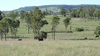
Beeron, Queensland

Last updated

Beeron
Queensland
Australia Queensland location map.svg
Red pog.svg
Beeron
Coordinates 25°54′04″S151°16′39″E / 25.9011°S 151.2774°E / -25.9011; 151.2774 (Beeron (centre of locality))
Population34 (2021 census) [1]
 • Density0.0845/km2 (0.219/sq mi)
Postcode(s) 4626
Area402.2 km2 (155.3 sq mi)
Time zone AEST (UTC+10:00)
LGA(s) North Burnett Region
State electorate(s) Callide
Federal division(s) Flynn
Suburbs around Beeron:
Brovinia Derri Derra Old Cooranga
Brovinia Beeron Toondahra
Brovinia Boondooma Boondooma

Beeron is a rural locality in the North Burnett Region, Queensland, Australia. [2] In the 2021 census, Beeron had a population of 34 people. [1]

Contents

Geography

The Mundubbera–Durong Road (State Route 75) runs from north to south through the north-west of the locality. The Boyne River forms the north-eastern boundary, and the Beeron National Park occupies the south-eastern corner. [3]

History

The locality's name derives from a pastoral run name held in 1856 by William Strathdee. In 1872, it was written as Beerone but by 1878 it had become Beeron. [2]

Beeron Road Provisional School opened on 5 September 1927. In 1952 it became Beeron Road State School. It closed on 11 December 1987. [4] It was at 1070 Beeron Road ( 25°43′49″S151°18′01″E / 25.7303°S 151.30033°E / -25.7303; 151.30033 (Beeron Road State School (former)) ) now in Derri Derra. [5] The school grounds are used as a sports and recreation area under the control of the North Burnett Regional Council. [6]

Demographics

In the 2016 census Beeron had a population of 14 people. [7]

In the 2021 census, Beeron had a population of 34 people. [1]

Related Research Articles

<span class="mw-page-title-main">Mundubbera</span> Town in Queensland, Australia

Mundubbera is a rural town and a locality in the North Burnett Region, Queensland, Australia. In the 2021 census, the locality of Mundubbera had a population of 1,120 people.

<span class="mw-page-title-main">Eidsvold, Queensland</span> Town in Queensland, Australia

Eidsvold is a rural town and locality in the North Burnett Region, Queensland, Australia. The town is the self-proclaimed Beef Capital of the Burnett and is a hub for the regional cattle industry. In the 2021 census, the locality of Eidsvold had a population of 538 people.

<span class="mw-page-title-main">Ceratodus, Queensland</span> Town in Queensland, Australia

Ceratodus is a rural town and locality in the North Burnett Region, Queensland, Australia. In the 2021 census, the locality of Ceratodus had a population of 34 people.

<span class="mw-page-title-main">Degilbo</span> Town in Queensland, Australia

Degilbo is a rural town and locality in the North Burnett Region, Queensland, Australia. In the 2021 census, the locality of Degilbo had a population of 182 people.

<span class="mw-page-title-main">Durong, Queensland</span> Suburb of South Burnett Region, Queensland, Australia

Durong is a rural locality in the South Burnett Region, Queensland, Australia. In the 2021 census, Durong had a population of 219 people.

<span class="mw-page-title-main">Didcot, Queensland</span> Suburb of North Burnett Region, Queensland, Australia

Didcot is a rural locality in the North Burnett Region, Queensland, Australia. In the 2021 census, Didcot had a population of 85 people.

Boondooma is a rural locality in the South Burnett Region, Queensland, Australia. In the 2021 census, Boondooma had a population of 70 people.

Monogorilby is a locality in the North Burnett Region, Queensland, Australia. The neighbourhood of Allies Creek is located in the south-east of Monogorilby.

Brovinia is a rural locality in the North Burnett Region, Queensland, Australia. In the 2021 census, Brovinia had "no people or a very low population".

Derri Derra is a rural locality in the North Burnett Region, Queensland, Australia. In the 2021 census, Derri Derra had a population of 115 people.

Glenrae is a rural locality in the North Burnett Region, Queensland, Australia. In the 2021 census, Glenrae had a population of 63 people.

<span class="mw-page-title-main">Mundowran</span> Suburb of North Burnett Region, Queensland, Australia

Mundowran is a rural locality in the North Burnett Region, Queensland, Australia. In the 2021 census, Mundowran had a population of 119 people.

Riverleigh is a rural locality in the North Burnett Region, Queensland, Australia. In the 2021 census, Riverleigh had a population of 95 people.

Tellebang is a rural locality in the North Burnett Region, Queensland, Australia. In the 2021 census, Tellebang had a population of 60 people.

Good Night is a rural locality split between the Bundaberg Region and the North Burnett Region, Queensland, Australia. It is also written as Goodnight. In the 2021 census, Good Night had a population of 151 people.

Boynewood is a rural locality in the North Burnett Region, Queensland, Australia. In the 2021 census, Boynewood had a population of 138 people.

Coonambula is a locality in the North Burnett Region, Queensland, Australia. In the 2021 census, Coonambula had a population of 80 people.

Branch Creek is a locality in the North Burnett Region, Queensland, Australia. In the 2021 census, Branch Creek had a population of 33 people.

Grosvenor is a locality in the North Burnett Region, Queensland, Australia. In the 2021 census, Grosvenor had a population of 29 people.

Eidsvold East is a rural locality in the North Burnett Region, Queensland, Australia. In the 2021 census, Eidsvold East had a population of 27 people.

References

  1. 1 2 3 Australian Bureau of Statistics (28 June 2022). "Beeron (SAL)". 2021 Census QuickStats. Retrieved 28 February 2023. OOjs UI icon edit-ltr-progressive.svg
  2. 1 2 "Beeron – locality in North Burnett Region (entry 45316)". Queensland Place Names. Queensland Government . Retrieved 15 December 2020.
  3. Google (15 August 2019). "Beeron, Queensland" (Map). Google Maps . Google. Retrieved 15 August 2019.
  4. Queensland Family History Society (2010), Queensland schools past and present (Version 1.01 ed.), Queensland Family History Society, ISBN   978-1-921171-26-0
  5. "Mundubbera" (Map). Queensland Government. 1971. Archived from the original on 28 December 2020. Retrieved 28 December 2020.
  6. "Queensland Globe". State of Queensland . Retrieved 28 December 2020.
  7. Australian Bureau of Statistics (27 June 2017). "Beeron (SSC)". 2016 Census QuickStats. Retrieved 20 October 2018. OOjs UI icon edit-ltr-progressive.svg