"Orange Line (Philadelphia)" redirects here. For other color coded transit lines named “Orange Line”, see Orange Line. For the London railroad line sometimes called the "Broad Street branch", see North London Line City Branch.
The line, which is entirely underground except for the northern terminus at Fern Rock, has four tracks in a local/express configuration from Fern Rock to Walnut-Locust and two tracks from Lombard-South to the southern terminus at NRG station. It is one of only two rapid transit lines in the SEPTA Metro system overall alongside the Market–Frankford Line, though Center City Philadelphia is also served by four stations of the PATCO Speedline rapid transit line which runs from Center City Philadelphia through Camden, New Jersey to Lindenwold, New Jersey. With about 115,000 boardings[5] on an average weekday in 2019, it is the second busiest route in the SEPTA system.
The line and its trains were leased to SEPTA in 1968[6] after it assumed operation of the city transit systems from the former Philadelphia Transportation Company (PTC).[7] Broad Street Line subway cars bear both the SEPTA logo and the seal of the City of Philadelphia to reflect the split ownership-operation arrangement.
History
The proposed Center City distribution loop of the Broad Street Line from the 1913 rapid transit development plan utilizing Arch Street, 8th Street, and Walnut Street.
Service on the northern half of the Broad Street Line, between City Hall and Olney Avenue, opened on September1, 1928. While the original subway tunnel had been finished to just north of the present-day Lombard-South station, service to the Walnut-Locust station did not begin until 1930, and the Lombard-South station entered service in 1932. Service from that point south to Snyder Avenue began on September18, 1938. Service to a new park-and-ride station built next to the Fern Rock shops began in 1956, and the line was extended further south to Pattison Avenue in 1973 to serve the recently completed Sports Complex.[8]
The total cost of the original segment, "Olney Avenue to South Street," was stated[by whom?] at $102 million.[citation needed]
Although the Broad Street Line was originally planned in the 1920s to be a 4-track facility for its entire length (Fern Rock portal to Snyder), the tunnel was built with provision for 4 tracks only from the portal to just north of Lombard-South. At the time of opening, the outer 2 tracks were built along this length, whereas the inner 2 express tracks were built only in two sections, from the Fern Rock portal/shops to just south of Olney, and from Girard to their terminus just north of Lombard South. To close the gaps, the two inner express tracks were laid from Erie to Girard in 1959, and again from Olney to Erie in 1991.
From Lombard-South station south to Snyder, the tunnel was constructed differently – only the eastern half of the line was built. The track currently used for southbound trains is actually the northbound express track. The extension in 1973 to Pattison station (now called NRG station) continued this arrangement. Space exists under the western half of Broad Street for the construction of the western half of the tunnel, which would include the remaining 2 tracks and additional island platforms for southbound local and express trains. The resulting infrastructure would match the configuration built in the northern half of the line.
Provisions for flying junctions exist in the tunnels at three locations: north of Olney station, north of Erie station, and between Tasker-Morris and Snyder stations. These were to connect to planned but never built extensions to the north, northeast, northwest and southwest. Tracks were laid in the upper levels of the flying junctions north of Olney and Erie; these have been used over the years to store out-of-service trains and as layover points for express and Ridge Spur trains.
The NRG Station contains a lower level platform (very narrow compared to the very wide upper level platform), built to accommodate additional trains for large crowds at sporting events. Seldom used for passenger service in recent years, these tracks are most often used to store rolling stock and work trains.
Two of the Broad Street subway system's stations have been closed. The Spring Garden station on the Ridge Avenue spur line was closed in 1989. The Franklin Square station on the PATCO route was closed in 1953, reopened in 1976 for the US Bicentennial, then closed again in 1979. It is scheduled to reopen (after a major renovation) in 2024.[9]
The Broad Street Line is one of only two rapid transit lines in the United States outside of New York City to use separate local and express tracks for a significant length, the other being Chicago's North Side Main Line from Armitage north, used by Purple Line express trains.
Proposed new icon for the Broad Street Line under the SEPTA Metro wayfinding project[11]
Proposed new icon for the Broad Street Local Line under the SEPTA Metro wayfinding project[11]
Proposed new icon for the Broad Street Express Line under the SEPTA Metro wayfinding project[11]
Proposed new icon for the Broad Street Spur Express Line under the SEPTA Metro wayfinding project[11]
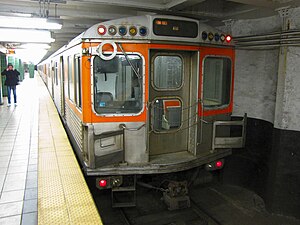
A Broad Street Line local train bound for NRG station arrives at City Hall station
In September 2021, SEPTA proposed updating wayfinding across the SEPTA Rail Transit network. Part of the proposal, SEPTA proposed rebranding their rail transit service as "SEPTA Metro", in order to make the system easier to navigate. Under this proposal, services along the Broad Street Line will be rebranded as the "B" lines with an orange color. Each service utilizing the trunk would receive a numeric suffix. Local service would be known as the B1 Broad Street Local, the express and special service as the B2 Broad Street Express and B2 Express Sport Special, and the Broad–Ridge Spur as the B3 Broad–Ridge Express.[12][11]
Following public feedback, SEPTA revised the Wayfinding Master Plan. Rather than being referred to as the B Lines, the current Broad Street Line would become the B Line. Express and special services would be consolidated into the B2 Broad Street Express, with signage letting riders know whether a train terminates at Walnut–Locust or NRG station. Additionally, SEPTA stated they would pilot neighborhood maps in stations and prioritize the deployment of real-time information signage and on mobile apps.[13]
Both the City of Philadelphia and SEPTA have studied extending the Broad Street Line along Roosevelt Boulevard, in order to serve a growing population in the northeast section of the city. The city government's archives contain a survey report, prepared in 1948, discussing a need for an extension of the Broad Street line from Erie Avenue to the vicinity of Pennypack Circle (see Roosevelt Boulevard).[14] Subway car destination signage even included station and terminus names for major streets along Roosevelt Boulevard such as Rhawn Street, in the newer "South Broad" cars. An expansion into another part of the City could better use the capacity of the four-track trunk line.[15]
In 1964, the city proposed a nine-mile (14km), $94million extension of the Broad Street line along Roosevelt Blvd. in conjunction with a new Northeast Expressway to be built by the Pennsylvania Department of Transportation. Development was limited to the building of one subway station by Sears, Roebuck and Company in 1967, at its complex on Roosevelt Boulevard at Adams Avenue, at the cost of $1million, in anticipation of future service. This station was destroyed when the facility was demolished in October 1994.[16] Ultimately the Northeast Expressway was never built, due to lack of funds, and the subway extension remained a paper concept.
On September10, 1999, SEPTA filed a Notice of Intent to prepare an Environmental Impact Statement for the Northeast Extension with the EPA.[17] In December 2001, the Philadelphia City Planning Commission supported extending the Broad Street Line along Roosevelt Blvd. to Bustleton Avenue, where it would be joined by the Market–Frankford Line, extended from its Frankford terminal (now the rebuilt Frankford Transportation Center). The estimated cost had ballooned to $3.4billion.
Philadelphia Naval Yard
Currently, the Broad Street Line terminates southbound at NRG station at Pattison Avenue and three major stadiums. With the redevelopment of the Philadelphia Naval Yard directly to the south, a Health Impact Assessment report was issued in March of 2012 to determine if extending the line to the Naval Yard would be a viable option for commuters. It determined that extending the line to the Naval Yard would more than halve the number of private cars commuting back and forth, with the remainder taking the proposed subway line and/or using a bicycle sidepath. The HIA recommends making an extension of the Broad Street Line a priority, and recently, the extension has garnered much support.[18][19]
West and Southwest Philadelphia
Subway & Elevated Lines for Suggested Unified System "Twinning Plan", 1916, map
In 1916, The director of the Philadelphia department of city transit, William S. Twinning Proposed scrapping the initial plan of Building an elevated line along Woodland Avenue in Southwest Philadelphia that would’ve connect onto the existing Market Street Subway-Elevated at 32nd Street and planned to replace it with a branch of the Broad Street Subway that would have split off at Broad and Federal Streets, continued along Federal Street before merging onto Greys Ferry Avenue until the Schuylkill river. Then crossing the Schuylkill to merge with Woodland Avenue then continuing down Woodland and Island Avenues where the line would have ended. [20][21] Twinning had an alternate plan which would’ve split off from the Broad Street subway at Broad and Ridge and continued down Ridge avenue before merging southwards onto 8th Street then, turning west on Walnut Street where it would have continued under the Schuylkill River into West Philadelphia before turning southward on 42nd Street then finally turning onto Woodland Avenue where it would have continued to Island Avenue.[22] This alternate plan would officially be adopted by the city and authorized the construction of the subway-elevated line to southwest Philadelphia in 1922.[23]
Ground broke along Ridge, 8th and Locust in 1930 and in 1932 Fairmount, Spring Garden, Vine(now Chinatown) and 8th and Market opened. Due to the worsening effects of The Great Depression, construction on Locust Street was paused indefinitely leaving an unfinished tunnel from 8th and Market to 18th and Locust. The city was able to gather limited funds from president Roosevelt's new deal program for other subway projects but none for the Woodland line. In a report from the mid 40’s by the Department of city transit started to seriously consider finishing the subway to at least 49th and Woodland knowing that traffic from Camden and North Philadelphia alone couldn't justify service under Locust Street. But in the end nothing came from these reports.[24] By the ‘50s 9th/10th and Locust, 12th/13th and Locust and 15th/16th and Locust were furnished for passenger service and opened in 1953 servicing trains running on the Bridge line from Camden, New Jersey. Majority of passengers on the bridge line did not continue south of 8th-Market,[25] Transferring the Market-Frankford or Ridge Avenue lines instead. In 1969 the Bridge line was extended to Lindenwold, New Jersey and ownership and operation were handed over to Delaware River Port Authority as the service was renamed to PATCO.
Northwest
The same report also proposed a northwest extension. This would have branched off at the North Philadelphia station and would have taken over the Pennsylvania Railroad's Chestnut Hill Branch which is still operated today as part of the SEPTA Regional Rail system as the Chestnut Hill West Line.
Operation
Rolling stock
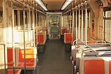
Interior of a Broad Street Line train
The first set of rail cars for the Broad Street subway was the B-1 cars built in 1926–27 by the J.G. Brill Company. The Pressed Steel Car Company supplied an additional set in 1938 collectively known as the B-2's. The JG Brill Company also built and delivered 26 deluxe art-deco streamlined subway cars to the Delaware River Joint Commission in early 1936 for use on its Bridge Line from 8th and Market into Camden, NJ via the Benjamin Franklin Bridge. These cars were designed to be compatible with the other Broad Street cars, and could run in multiple with them. After the Bridge Line became part of the PATCO Lindenwold Hi-Speedline in late 1968, 23 of these former "Bridge Line" cars were sold to the City of Philadelphia in 1969 to be used on the Broad Street subway, and were designated as the B-3's, until they were retired by early 1984.
The first set has had the second longest lifespan of any subway car in Philadelphia, after that of the Market Street cars built for what ultimately became the Market–Frankford Line. Although the line was a host for the UMTA's State of the Art Car program, real replacements for the Broad Street cars did not come until late 1982, when SEPTA introduced new "B-IV" cars built by Kawasaki, which are currently the only cars operating the line. The cars are 67ft 6in long, 10ft 1.5in wide, and 12ft 3in tall.
Preservation
A small number of B-1, B-2, and B-3 historic cars remain stored in derelict condition within Fern Rock yard.[26]
Broad Street subway train at Fern Rock Transportation Center station.
A local trip along the entire line takes about 35 minutes. Trains run from approximately 5:00am to 1:00am, with a timed transfer at 12:30am at City Hall station to connect with the Market Frankford Line based on final trains. The Broad Street Owl bus service replaces the subway throughout the night Monday through Friday mornings, stopping at the same locations as the subway trains. The line itself ran 24 hours a day until it was eliminated in 1991; it was reinstated on June20, 2014, for Friday and Saturday overnights only on a trial basis. It was made permanent on October8, 2014, due to the line successfully carrying an extra 10,000 riders on the Broad Street Line during the weekend overnight periods. This was eliminated again in 2020 due to the COVID-19 Pandemic.
The local portion of the Broad Street Line carries a headway of 8 minutes or less during the daytime all day weekdays, 10–12 minutes all day on weekends and major holidays, and 12 minutes in the evenings. Weekend night service consists of a 20-minute frequency, while owl bus service early weekday mornings utilize a 15-minute frequency. The express portion of the line ranges from seven minutes during peak hours to 12 minutes off-peak, while the Broad Ridge Spur ranges from 7 minutes during peak hours to 20 minutes off-peak.
Service
Start Time
End Time
Northbound train
4:52am
12:55am
Southbound train
4:45am
12:43am
Northbound night owl bus
12:22am
5:35am
Southbound night owl bus
12:14am
5:34am
Northbound Broad–Ridge Spur (Monday–Friday)
5:45am
9:15pm
Southbound Broad–Ridge Spur (Monday–Friday)
5:24am
8:48pm
Northbound Broad–Ridge Spur (Saturday)
6:40am
9:26pm
Southbound Broad–Ridge Spur (Saturday)
6:17am
9:03pm
Broad–Ridge Spur
Broad–Ridge Spur train at 8th and Market
A two-track spur of the Broad Street Line, known as the Broad–Ridge Spur, diverges from the main line at Fairmount. Originally known as the Ridge–8th Street subway, the line follows Ridge Avenue, southeastward from the intersection of Broad Street, Ridge and Fairmount Avenues to a two-level junction beneath 8th and Race Streets, where tunnels leading to and from the Benjamin Franklin Bridge to Camden connect to it, then proceeds south under 8th Street. At its southern terminus at 8th and Market streets, passengers may transfer to the Market–Frankford Line and the PATCO Speedline. The spur operates Mondays through Saturdays from 6am to 9pm, running two-car trains (though platforms can fit five cars).[32]
Ridge Spur service to 8th and Market streets began on December21, 1932.[33] As part of that project, a tunnel shell running south under 8th Street then west under Locust Street to 18th Street (reusing parts of the never-completed Center City loop constructed in 1917) was completed in 1933 but not outfitted for service.[34][35]Bridge Line service from 8th and Market to Camden began on June7, 1936, sharing the Ridge Spur platforms at 8th and Market and splitting off from the Ridge Spur just south of Chinatown station.
Beginning in June 1949, Ridge Spur and Bridge Line trains were through-routed at 8th and Market.[36] The unused Locust Street tunnel was completed on February15, 1953; Bridge Line trains were extended to a new terminus at 15th–16th Street station with two intermediate stops, while Ridge Spur trains reverted to running between 8th Street and Girard.[37][38] In January 1954, due to low ridership, off-peak service and Saturday again began operating between Girard and Camden, with a shuttle train operating between 8th and 16th stations. Sunday service was suspended at that time due to minimal usage.[39] Ridge Spur service was suspended from August23 to 27, 1968, as tracks were switched to a new upper-level terminal platform at 8th Street station to allow conversion of the 8th–Locust Street subway into the Lindenwold High-Speed Line (PATCO Speedline).[40]
The Ridge Spur was closed from February 1981 to September6, 1983, during construction of the Center City Commuter Connection.[41]Spring Garden station, by then exit-only, was closed on September10, 1989, due to safety concerns.[42][43] Never drawing high ridership, the spur has been proposed for closure on several occasions. The 2014 closure of the Gallery Mall, adjacent to 8th and Market station, caused ridership on the spur to drop by 25%.[44]
Stations
All stations are located in the city of Philadelphia, Pennsylvania. Stations on the Broad–Ridge Spur are shaded in gold. Stations served by special extended B2 service (for sports and entertainment events) are indicated with ○.
SEPTA Regional Rail: Lua error in Module:Adjacent_stations/SEPTA at line 26: variable 'raw' is not declared., Lua error in Module:Adjacent_stations/SEPTA at line 26: variable 'raw' is not declared., Lua error in Module:Adjacent_stations/SEPTA at line 26: variable 'raw' is not declared. SEPTA City Bus: 4, 28, 57, 70
Amtrak: Northeast and Keystone Corridor services (at North Philadelphia) SEPTA Regional Rail: Lua error in Module:Adjacent_stations/SEPTA at line 26: variable 'raw' is not declared., Lua error in Module:Adjacent_stations/SEPTA at line 26: variable 'raw' is not declared.(at North Philadelphia), Lua error in Module:Adjacent_stations/SEPTA at line 26: variable 'raw' is not declared., Lua error in Module:Adjacent_stations/SEPTA at line 26: variable 'raw' is not declared.(at North Broad) SEPTA City Bus: 4, 16, 54
This page is based on this Wikipedia article Text is available under the CC BY-SA 4.0 license; additional terms may apply. Images, videos and audio are available under their respective licenses.