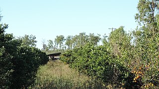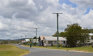
Eidsvold is a rural town and locality in the North Burnett Region, Queensland, Australia. The town is the self-proclaimed Beef Capital of the Burnett and is a hub for the regional cattle industry. In the 2016 census, the locality of Eidsvold had a population of 574 people.

Monto is a rural town and locality in the North Burnett Region, Queensland, Australia. In the 2021 census, the locality of Monto had a population of 1,156 people.

Mulgildie is a rural town and locality in the North Burnett Region, Queensland, Australia. In the 2016 census, Mulgildie had a population of 174 people.

The Shire of Monto was a local government area in the northern catchment of the Burnett River, Queensland, Australia. The shire covered an area of 4,320.8 square kilometres (1,668.3 sq mi), and existed as a local government area from 1932 until 2008, when it amalgamated with several other shires to form the North Burnett Region.

The Boyne Valley is a rural locality in Gladstone Region, Queensland, Australia. The locality contains four small towns: Nagoorin, Ubobo, Builyan, and Many Peaks. In the 2021 census, Boyne Valley had a population of 301 people.

Ceratodus is a rural town and locality in the North Burnett Region, Queensland, Australia. In the 2016 census the locality of Ceratodus had a population of 28 people.

Ideraway is a rural town and locality in the North Burnett Region, Queensland, Australia. In the 2016 census, the locality of Ideraway had a population of 38 people.

Didcot is a rural locality in the North Burnett Region, Queensland, Australia. In the 2016 census Didcot had a population of 60 people.
Humphery is a rural locality in the North Burnett Region, Queensland, Australia. In the 2016 census, Humphery had a population of 34 people.
Langley is a rural locality in the North Burnett Region, Queensland, Australia.

Kalpowar is a town in the North Burnett Region and a locality split between the North Burnett Region and the Bundaberg Region, in Queensland, Australia. In the 2016 census, the locality of Kalpowar had a population of 67 people.

Bancroft is a rural locality in the North Burnett Region, Queensland, Australia. In the 2016 census, Bancroft had a population of 96 people.

Brooklands is a rural locality in the South Burnett Region, Queensland, Australia. In the 2021 census, Brooklands had a population of 324 people.
Kapaldo is a rural town and locality in the North Burnett Region, Queensland, Australia. In the 2016 census, the locality of Kapaldo had a population of 43 people.

Mungungo is a rural town and locality in the North Burnett Region, Queensland, Australia. In the 2016 census, the locality of Mungungo had a population of 77 people.

Cania is a locality in the North Burnett Region, Queensland, Australia. In the 2021 census, Cania had a population of 27 people.
Dirnbir is a rural locality in the North Burnett Region, Queensland, Australia. In the 2021 census, Dirnbir had a population of 59 people.
Grosvenor is a locality in the North Burnett Region, Queensland, Australia. In the 2021 census, Grosvenor had a population of 29 people.
Monal is a locality in the North Burnett Region, Queensland, Australia. In the 2021 census, Monal had a population of 34 people.
Gladstone–Monto Road is a 132 kilometres (82 mi) road route in the Gladstone and North Burnett regions of Queensland, Australia. The entire route is signed as State Route 69.


