Chicago Heights, Illinois | |
---|---|
Coordinates: 41°30′43″N87°38′25″W / 41.51194°N 87.64028°W | |
Country | United States |
State | Illinois |
County | Cook |
Township | Bloom |
Incorporated | 1893 |
Government | |
• Type | Council–manager |
• Mayor | David A. Gonzalez |
Area | |
• Total | 10.30 sq mi (26.67 km2) |
• Land | 10.28 sq mi (26.63 km2) |
• Water | 0.01 sq mi (0.03 km2) 0.10% |
Population (2020) | |
• Total | 27,480 |
• Density | 2,672.37/sq mi (1,031.85/km2) |
Standard of living (2009–11) | |
• Per capita income | $17,548 |
• Median home value | $125,400 |
ZIP code(s) | 60411, 60412, 60413 |
Area code(s) | 708 |
Geocode | 17-14026 |
FIPS code | 17-14026 |
Website | cityofchicagoheights |
Chicago Heights is a city in Cook County, Illinois, United States. The population was 27,480 at the 2020 census. [2] It is part of the Chicago metropolitan area. Its nicknames include "The Crossroads of the Nation" and "The Heights". [3]
Chicago Heights lies on the high land of the Tinley Moraine, with the higher and older Valparaiso Moraine lying just to the south of the city.
According to the 2021 census gazetteer files, Chicago Heights has a total area of 10.30 square miles (26.68 km2), of which 10.28 square miles (26.63 km2) (or 99.87%) is land and 0.01 square miles (0.03 km2) (or 0.13%) is water. [4]
The city's major crossroads are at Dixie Highway (Illinois Route 1) and Lincoln Highway (U.S. Route 30).
Chicago Heights is about 30 miles (48 km) south of the Chicago Loop. [5]
Census | Pop. | Note | %± |
---|---|---|---|
1900 | 5,100 | — | |
1910 | 14,525 | 184.8% | |
1920 | 19,653 | 35.3% | |
1930 | 22,321 | 13.6% | |
1940 | 22,461 | 0.6% | |
1950 | 24,551 | 9.3% | |
1960 | 34,331 | 39.8% | |
1970 | 40,900 | 19.1% | |
1980 | 37,026 | −9.5% | |
1990 | 33,072 | −10.7% | |
2000 | 32,776 | −0.9% | |
2010 | 30,276 | −7.6% | |
2020 | 27,480 | −9.2% | |
U.S. Decennial Census [6] 2010 [7] 2020 [8] |
As of the 2020 census [9] there were 27,480 people, 9,736 households, and 6,708 families residing in the city. The population density was 2,669.00 inhabitants per square mile (1,030.51/km2). There were 10,663 housing units at an average density of 1,035.64 per square mile (399.86/km2). The racial makeup of the city was 42.50% African American, 21.05% White, 1.27% Native American, 0.30% Asian, 0.13% Pacific Islander, 23.35% from other races, and 11.41% from two or more races. Hispanic or Latino of any race were 38.99% of the population.
There were 9,736 households, out of which 34.5% had children under the age of 18 living with them, 37.53% were married couples living together, 20.75% had a female householder with no husband present, and 31.10% were non-families. 28.29% of all households were made up of individuals, and 14.07% had someone living alone who was 65 years of age or older. The average household size was 3.67 and the average family size was 2.96.
The city's age distribution consisted of 26.9% under the age of 18, 10.7% from 18 to 24, 24.2% from 25 to 44, 23.4% from 45 to 64, and 14.9% who were 65 years of age or older. The median age was 35.4 years. For every 100 females, there were 94.5 males. For every 100 females age 18 and over, there were 95.8 males.
The median income for a household in the city was $49,880, and the median income for a family was $59,536. Males had a median income of $35,142 versus $26,790 for females. The per capita income for the city was $21,948. About 18.6% of families and 24.3% of the population were below the poverty line, including 33.0% of those under age 18 and 22.7% of those age 65 or over.
Race / Ethnicity (NH = Non-Hispanic) | Pop 2010 [7] | Pop 2020 [8] | % 2010 | % 2020 |
---|---|---|---|---|
White (NH) | 7,062 | 4,438 | 23.33% | 16.15% |
Black or African American (NH) | 12,370 | 11,487 | 40.86% | 41.80% |
Native American or Alaska Native (NH) | 44 | 30 | 0.15% | 0.11% |
Asian (NH) | 87 | 74 | 0.29% | 0.27% |
Pacific Islander (NH) | 8 | 23 | 0.03% | 0.08% |
Some Other Race (NH) | 51 | 103 | 0.17% | 0.37% |
Mixed Race/Multi-Racial (NH) | 400 | 611 | 1.32% | 2.22% |
Hispanic or Latino (any race) | 10,254 | 10,714 | 33.87% | 38.99% |
Total | 30,276 | 27,480 | 100.00% | 100.00% |
Chicago Heights School District 170 operates twelve schools, with a student population of 3,600. Highland is the district's pre-school for children aged three and four; Garfield, Grant, Greenbriar, Jefferson, Kennedy, Lincoln, Roosevelt, Washington-McKinley, and Wilson are neighborhood schools that serve students from kindergarten through fifth grade. After elementary school/5th grade, students attend Chicago Heights Middle School for grades 6-8.
Chicago Heights is home to Bloom High School, which all students of District 170 attend after 8th grade, and Bloom Trail High School, which shares its athletic programs with Bloom. Many students from neighboring communities including Steger, South Chicago Heights, Ford Heights, Sauk Village and Glenwood attend high school at Bloom.
Parts of Chicago Heights are included in Flossmoor School District 161 which includes Serena Hills Elementary School in Chicago Heights. After Serena, students attend Parker Jr. High School—also a part of Flossmoor School District 161. Only some students who complete middle school at Parker Jr. High School move on to Homewood-Flossmoor High School; the remainder attend Bloom High School.
Parts of Chicago Heights are also served by Park Forest – Chicago Heights School District 163, [10] and Beacon Hill Primary Center is located in the Beacon Hill neighborhood. After Beaker, students attend Michelle Obama School of Arts and Technology for middle school (6-8). Students from this neighborhood attend Rich Township High School, part of Rich Township High School District 227. [11]
Marian Catholic High School, affiliated with the Roman Catholic Archdiocese of Chicago, is a private high school located in city.
Prairie State College is a community college located in Chicago Heights.
There are also many elementary schools that operate at church locations.
On May 20, 1901, many Chicago Heights residents signed a petition asking for the mayor and aldermen to select a board of directors that would be responsible for founding and running a free public library in Chicago Heights. On June 28, 1901, the first library board members were sworn in, including Sam W. Lea, F.W. Schact, W.E. Canady, James Bowie, David Wallace, Joseph Caldwell, C.W. Salisbury, A.J. Sorensen, and A.W. McEldowney. The library was opened in a small room in the new city building on February 20, 1902. That month, the library board wrote to industrialist Andrew Carnegie seeking funds to build a library building in Chicago Heights. In July, the board was notified that Carnegie had proposed $15,000 toward the cost of a library building as long as the city could provide a free site for the building and if the council could promise $1,500 a year to keep the library running. The Carnegie Library in Chicago Heights was designed by Richard E. Schmidt. The library was located at 1627 Halsted Street and opened on September 11, 1903, with a staff of two and 1,643 volumes. A bigger library was eventually needed, and on August 5, 1972, the present building at 15th Street and Chicago Road was opened. The Chicago Heights Free Public Library was a million-dollar building that opened with 60,000 books, records, and other materials.
Chicago Heights was once home to a number of major industrial concerns, including the Thrall Car Manufacturing Company, manufacturer of freight cars, run for many years by chief executive officer Richard L. Duchossois. The city was also the original home of the Inland Steel Company.
Ford Motor Company operates a metal stamping plant located along Lincoln Highway in Chicago Heights. This facility produces automobile body panels that are shipped to Ford's Chicago Assembly plant approximately 15 miles (24 km) to the north in the Hegewisch community area of Chicago.
Chicago Heights is served by six Pace bus routes and the Pace Chicago Heights Terminal. [12]
There was a Well Group Clinic (part of St. James) located on Dixie Highway. Well Group was previously known as Suburban Heights Medical Center. There are also two Aunt Martha's health centers in Chicago Heights. [13]
In September 2018, St. James Hospital closed after more than 100 years. [14]
Chicago Heights has 4 sister cities.: [18]
Arlington Heights is a village in Cook County, Illinois, United States. A northwestern suburb of Chicago, it lies about 25 miles (40 km) northwest of the city's downtown. As of the 2020 census, the village's population was 77,676, making it the 15th-most populous municipality in Illinois.
Country Club Hills is a city in Cook County, Illinois, United States. It is a suburb and south of Chicago. The population was 16,775 at the 2020 census.
Flossmoor is a village in Cook County, Illinois, United States. The population was 9,704 at the 2020 census. Flossmoor is approximately 24 miles south of The Loop/Downtown Chicago. It is closely tied to neighboring Homewood, sharing a high school and park district.
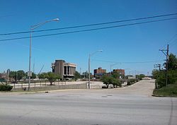
Ford Heights is a village and a suburb of Chicago in Cook County, Illinois, United States. The population was 1,813 at the 2020 census. Many of the area’s first settlers were African American and since its incorporation in 1949 the village has remained predominantly Black. Due to the lack of commercial activity and financial stability, the village has declined over the years. Urban renewal efforts were attempted in the 1960s, although the village has continued to decline.
Glenwood is a village in Cook County, Illinois, United States. The population was 8,662 at the 2020 census.
Hazel Crest is a village in Cook County, Illinois, United States. The population was 13,382 at the 2020 census.
Homewood is a village in Cook County, Illinois, United States. The population was 19,463 at the 2020 census.
Matteson is a village in Cook County, Illinois, United States. The population was 19,073 at the 2020 census. It is a suburb of Chicago.
Mount Prospect is a village in Elk Grove Village and Wheeling Townships in Cook County, Illinois, about 20 miles (32 km) northwest of downtown Chicago, and approximately 4 miles north of O'Hare International Airport. As of the 2020 census, the village had a total population of 56,852.
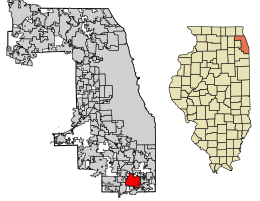
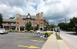
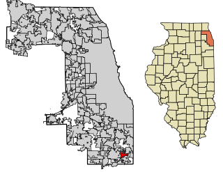
Olympia Fields is a village in Cook County, Illinois, United States. The population was 4,718 as of the 2020 census. It is a southern suburb of Chicago. The municipality grew up around the prestigious Olympia Fields Country Club, originally established in 1915.
Palos Heights is a city in Cook County, Illinois, United States. It is a southwest suburb of Chicago. Per the 2020 census, the population was 12,068.
Prospect Heights is a city in Cook County, Illinois, United States and is a suburb of Chicago. Per the 2020 census, the population was 16,058.
Rolling Meadows is a city in Cook County, Illinois, United States. Per the 2020 census, the population was 24,200.
Wheeling is a village in Cook and Lake counties in the U.S. state of Illinois. A suburb of Chicago, it is primarily in Cook County, approximately 23 mi (37 km) northwest of downtown Chicago. Per the 2020 census, the population was 39,137. Wheeling is named after Wheeling, West Virginia.
Glendale Heights is a village in DuPage County, Illinois, United States. Per the 2020 census, the population was 33,176. The village is almost entirely residential, and is a far west suburb of Chicago.
Mundelein is a village in Lake County, Illinois, United States and a northern suburb of Chicago. Per the 2020 census, the population was 31,560. It is approximately thirty-five miles northwest of Chicago.
Cary is a village located in Algonquin Township, McHenry County, Illinois, and Cuba Township, Lake County, Illinois, United States. Per the 2020 census, the population was 17,826.
Hebron is a village in McHenry County, Illinois, United States. It is a commuter village within the Chicago metropolitan area. Per the 2020 census, the population was 1,368. It is also the headquarters of Vaughan Manufacturing, one of the largest manufacturers of striking tools in the world.
Bloom Township is one of 29 townships in Cook County, Illinois, USA. As of the 2020 census, its population was 86,018 and it contained 33,964 housing units.
Rich Township is one of 29 townships in Cook County, Illinois, United States located south of Chicago. As of the 2020 census, its population was 76,138. Richton Park serves as the governmental seat for the township.
{{cite web}}
: CS1 maint: archived copy as title (link)