Dene, Newcastle upon Tyne

Last updated

Dene, Newcastle upon Tyne
Tyne and Wear UK location map.svg
Red pog.svg
Dene, Newcastle upon Tyne
Red pog.svg Dene, Newcastle upon Tyne shown within Tyne and Wear
OS grid reference NZ261660
Coordinates 54°59′17″N1°35′35″W / 54.988°N 1.593°W / 54.988; -1.593 Coordinates: 54°59′17″N1°35′35″W / 54.988°N 1.593°W / 54.988; -1.593
List of places
UK
England
Tyne and Wear

Dene is an electoral ward of Newcastle upon Tyne in North East England. The ward takes its name from the nearby gorge at Jesmond Dene. Contained within the ward are government offices of the Department for Work and Pensions and the Freeman Hospital. The population of the ward is 9,554, increasing to 9,667 at the 2011 Census, [1] 3.7% of the total population of Newcastle upon Tyne. Car ownership in the area is 74.8% much higher than the city average of 54.7%.

Newcastle upon Tyne City and metropolitan borough in England

Newcastle upon Tyne, commonly known as Newcastle, is a city in Tyne and Wear, North East England, 103 miles (166 km) south of Edinburgh and 277 miles (446 km) north of London on the northern bank of the River Tyne, 8.5 mi (13.7 km) from the North Sea. Newcastle is the most populous city in the North East, and forms the core of the Tyneside conurbation, the eighth most populous urban area in the United Kingdom. Newcastle is a member of the UK Core Cities Group and is a member of the Eurocities network of European cities.

North East England Place in England

North East England is one of nine official regions of England at the first level of NUTS for statistical purposes. It covers Northumberland, County Durham, Tyne and Wear, and the area of the former county of Cleveland in North Yorkshire. The region is home to three large conurbations: Teesside, Wearside, and Tyneside, the last of which is the largest of the three and the eighth most populous conurbation in the United Kingdom. There are three cities in the region: Newcastle upon Tyne, the largest, with a population of just under 280,000; Sunderland, also in the metropolitan county of Tyne and Wear; and Durham. Other large towns include Darlington, Gateshead, Hartlepool, Middlesbrough, South Shields, Stockton-on-Tees and Washington.

England Country in north-west Europe, part of the United Kingdom

England is a country that is part of the United Kingdom. It shares land borders with Wales to the west and Scotland to the north-northwest. The Irish Sea lies west of England and the Celtic Sea lies to the southwest. England is separated from continental Europe by the North Sea to the east and the English Channel to the south. The country covers five-eighths of the island of Great Britain, which lies in the North Atlantic, and includes over 100 smaller islands, such as the Isles of Scilly and the Isle of Wight.

Contents

Education

Within the ward are four schools including two primary schools, Cragside Primary School and Benton Park Primary School. The ward is the home of the Coach Lane campus of Northumbria University.

Northumbria University university in Newcastle upon Tyne, England

Northumbria University, is a university located in Newcastle upon Tyne in the North East of England. A former polytechnic, it was established as one of the new universities in 1992.

Recreation and leisure

Jesmond Dene is in the south east of the ward and on Freeman Road is the Paddy Freeman park. Facilities there include a bowling green, two tennis courts, a fenced playground with swings, slides, climbing frames and spring toys. Additionally, a number of private owned leisure facilities are in the ward including the David Lloyd Tennis Club, Novocastrians R.F.C., Heaton & Stannington F.C. and the University Playing Fields.

Boundary

The wards boundaries go from the north east edge of the ward, following the overall northern city boundary west until reaching the metro line at the rear of Gallalaw Terrace. It then heads south following the Ouseburn, past Haddricksmill Bridge and Dene Bridge, down to Red Walk. It then turns east crossing Jesmond Dene to the Pond which lies west of Freeman Road/Jesmond Road. At the roundabout it heads east along Newton Road and continues east along Cragside to the Benton Road roundabout and to the rear of the properties on Cornel Road. At Cochrane Park sports ground it heads north and east around its boundary to Red Hall Drive/Coach Lane, then south along the eastern side of Red Hall Drive to Meridan Way. It then continues east along the north of Meridian Way turning south to the rear of numbers 2 to 46 Slingsby Gardens and onto the Coast Road, heading east past the front of the Wills Building to the East Coast Main Line. It then heads north, adjacent to the main line, then turns east to the rear of the properties on Westminster Way to the junction with Coach Lane. It then continues north along Coach Lane turning west along Rosemont Way to the rear of Spalding/ Penfold and Dunlop Closes to Benton Road. Heading north along the east side of Benton Road to Four Lane Ends Metro station, it then follows the metro line back along to Gallalaw Terrace/ Killingworth Road.

East Coast Main Line railway link between London and Edinburgh

The East Coast Main Line (ECML) is a 393-mile long (632 km) major railway between London and Edinburgh via Peterborough, Doncaster, York, Darlington, Durham and Newcastle; it is electrified along the whole route. The route is a key transport artery on the eastern side of Great Britain and broadly paralleled by the A1 road.

Charts and tables

Age groupNumber
Under 161,718
16-241,339
25-443,009
45-642,640
65-74658
75+537
EthnicityNumber%
White8,69291.1
Afro-Caribbean560.6
South Asian4404.6
Chinese1751.8
Other1751.8

The ward has 3,910 housing spaces of which 3.6% are vacant this is much lower than the city average of 5.3%. Owner occupied property stands at 83.6% much higher than the city average of 53.3%. The properties are as follows.

Property typeNumber%
Detached93924
Semi-detached1,92349.1
Terraced2366
Flats81220.8
Other30.1

Related Research Articles

Jesmond Dene

Jesmond Dene, a public park in the east end of Newcastle upon Tyne, England, occupies the narrow steep-sided valley of a small river known as the Ouseburn, flowing south to join the River Tyne: in north-east England, such valleys are commonly known as denes. In fact the name 'Jesmond' means 'mouth of the Ouseburn'.

Longbenton human settlement in United Kingdom

Longbenton is a district of North Tyneside, England. It is largely occupied by an extensive estate originally built as municipal housing by Newcastle City Council in the 1950s and 1960s. It is served by the Tyne and Wear Metro stations Longbenton Metro station and Four Lane Ends Metro Station. Nearby places are Killingworth, Forest Hall, Four Lane Ends, West Moor, Heaton and South Gosforth, in Newcastle upon Tyne. The Longbenton and Killingworth Urban Area had a population of 34,878 in 2001. This figure increased to 37,070 in 2011.

Fawdon

Fawdon is an electoral ward of Newcastle upon Tyne. It is also close to the A1 western bypass. The population of the ward is 10,890, reducing to 10,090 at the 2011 Census, 5.7% of the total population of Newcastle upon Tyne. Car ownership in the area is 53.6% this is lower than the city average of 54.7%.

Byker electoral ward of Newcastle City Council

Byker is an inner city electoral ward in the city of Newcastle upon Tyne in Tyne and Wear, England. It is in the east of the city, south of the Heaton area and north of St Peter's. Byker Metro station serves the area. The area also contains the Byker Wall estate. The population of the ward is 11,339, increasing to 12,206 at the 2011 Census, which is 4.4% of the city's total. Car ownership stands at 35.4%, much lower than the city average of 54.7%.

Woolsington village in United Kingdom

Woolsington is a village in and also a civil parish of the City of Newcastle upon Tyne, England. It is north-west of the city centre, and covers a large geographical area. It is one of the city's 26 electoral wards, although the ward is slightly larger than the civil parish, extending slightly further south. The parish also includes Newbiggin Hall, Woolsington village and Newcastle Airport. It has a population of 11,160 as of the 2011 Census.

Newcastle upon Tyne East (UK Parliament constituency) Parliamentary constituency in the United Kingdom

Newcastle upon Tyne East is a constituency represented in the House of Commons of the UK Parliament since its 2010 recreation by Nick Brown of the Labour Party.

Heaton, Newcastle suburb in the east end of Newcastle upon Tyne, England

Heaton is a suburb in the east end of Newcastle upon Tyne, England, about 2 miles (3 km) from the city centre. It is bordered by the neighbouring areas of High Heaton and Cochrane Park to the north, Walker and Walkergate to the east, Byker to the south and Jesmond and Sandyford to the west. The name Heaton means high town, referring to the area "being situated on hills above the Ouseburn, a tributary of the River Tyne."

Sandyford, Newcastle upon Tyne human settlement in United Kingdom

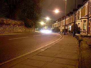
Sandyford is a district of Newcastle upon Tyne, located in the east end of the city. It is bordered by the City Centre and the districts of Jesmond and Heaton.

Blakelaw electoral ward of Newcastle City Council

Blakelaw is an electoral ward situated in the West End of the city of Newcastle upon Tyne in North East England. The population of the ward is 11,186, which is 4.6% of the city's population. Car ownership in the area is 50.6%: this is lower than the city average of 54.7%, increasing to 11,507 at the 2011 Census. House prices in this area average at £114,000.

Kenton, Newcastle upon Tyne

Kenton is a suburb and electoral ward in the north west of Newcastle upon Tyne, England. It borders the Town Moor and Gosforth. Kenton also has close road links to Newcastle Airport. The ward population at the 2011 Census was 11,605.

Castle, Newcastle upon Tyne electoral ward of Newcastle City Council

Castle is a ward of the city of Newcastle upon Tyne in North East England. The ward encompasses the villages of Brunswick, Dinnington and Hazlerigg. Castle ward borders the neighbouring authorities of North Tyneside and Northumberland. The population of the ward is 9,912 making up 3.8% of the total population of the city. The population of the ward had increased to 10,069 at the 2011 Census. Car ownership stands at 76.2% much higher than Newcastle’s average of 54.7%. House prices in the area average at £189,400.

Denton, Newcastle upon Tyne human settlement in United Kingdom

Denton is an electoral ward of Newcastle upon Tyne in North East England. The ward encompasses the Chapel House and West Denton housing areas. The population of the ward is 10,857, reducing to 10,500 at the 2011 Census, 4.2% of the total population of Newcastle upon Tyne. Car ownership in the area is 56.6%, slightly higher than the city average of 54.7%.

Benwell and Scotswood electoral ward of Newcastle City Council

Benwell and Scotswood is an electoral ward of Newcastle upon Tyne in North East England. The ward encompasses the Benwell and Scotswood housing areas, as well as the Newcastle Business Park, which is located on the banks of the River Tyne and houses offices of companies such as British Airways and the Automobile Association. The population of the ward is 13,759, which is 5.3% of the total population of Newcastle upon Tyne. Car ownership in the area is 45.1%, lower than the city average of 54.7%. The 2011 Census gave a population of 12,694.

Benton, Newcastle upon Tyne village in United Kingdom

Benton is a district 4 miles (6 km) to the north east of Newcastle upon Tyne. A section of this district is administratively part of the City, but the greater part, which lies inside the Parish of St Bartholomew, Longbenton, is within North Tyneside. The population of the North Tyneside Ward taken at the Census 2011 was 10,359.

East Gosforth human settlement in United Kingdom

East Gosforth also known as Gosforth East is an electoral ward in Newcastle upon Tyne, Tyne and Wear, UK. It was created in 2004. The population of the ward is 8,981, increasing to 10,145 at the 2011 Census, 3.5% of the total population of Newcastle upon Tyne. Car ownership in the area is 68.8%, higher than the city average of 54.7%. It is one half of Gosforth's wards, along with the West Gosforth ward.

West Gosforth

West Gosforth is an electoral ward in the north of Newcastle upon Tyne, Tyne and Wear, England. It was created in 2004. The population of the ward is 9,681, increasing to 9,991 at the 2011 Census, 3.7% of the total population of Newcastle upon Tyne. Car ownership in the area is 78.1%, higher than the city average of 54.7%.

Newcastle City Centre city centre of Newcastle upon Tyne, England

Newcastle City Centre, is the city centre of Newcastle upon Tyne, England. Newcastle city centre is the historical heart of the city and the main cultural and commercial centre of North East England. Along with nearby Gateshead town centre, which lies on the opposite side of the River Tyne, the city centre forms the central core of the Tyneside conurbation.

Jesmond residential suburb in Newcastle upon Tyne, England

Jesmond is a residential suburb and is split into two electoral wards just north of the centre of Newcastle upon Tyne, England. The population is about 12,000. Historically part of Northumberland, it is adjacent to the East side of the Town Moor, providing pedestrian and cycle paths to Spital Tongues and the city's two universities. It is widely considered to be the most affluent suburb of Newcastle.

Monument, Newcastle upon Tyne electoral ward of Newcastle City Council

Monument is an electoral ward of Newcastle upon Tyne in North East England. Created in 2018, the ward takes its name from Grey's Monument in Newcastle City Centre. It replaced most of Westgate ward and parts of South Jesmond and Ouseburn wards.

References

  1. "Ward population 2011" . Retrieved 5 July 2015.