
Gosford is a waterfront city at the northern end of Brisbane Water on the Central Coast in the state of New South Wales, Australia. The Gosford waterfront is known for its boating and scenic views on the shores of Brisbane Water. Gosford is the main commercial hub and gateway of the Central Coast. It is situated approximately 77 km (48 mi) north of Sydney and 86 km (53 mi) south of Newcastle. Gosford is located in the local government area of the Central Coast Council.
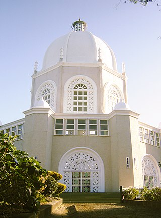
Ingleside is a suburb in Northern Sydney, in the state of New South Wales, Australia. Ingleside is located 28 kilometres north of the Sydney central business district, in the local government area of Northern Beaches Council. Ingleside is part of the Forest District region, about 2 kilometres from the coast at Mona Vale. Ingleside Heights and Tumbledown Dick are localities in the west of the suburb.

Coolaroo is a suburb in Melbourne, Victoria, Australia, 18 km (11 mi) north of Melbourne's Central Business District, located within the City of Hume local government area. Coolaroo recorded a population of 3,193 at the 2021 census.

Erina is a suburb located in the Central Coast region of New South Wales, Australia. Erina is the largest commercial hub of the Central Coast and is home to the largest single level shopping centre in the Southern Hemisphere that is called Erina Fair. It is part of the Central Coast Council local government area.

Allambie Heights is a suburb of Northern Sydney, in the state of New South Wales, Australia 17.5 kilometres north-east of the Sydney central business district in the local government area of Northern Beaches Council. It is part of the Northern Beaches region.
Elanora Heights is a suburb in northern Sydney, in the state of New South Wales, Australia. Elanora Heights is 27 kilometres north-east of the Sydney central business district, in the local government area of Northern Beaches Council. Elanora Heights is part of the Northern Beaches region.

Wyoming is a suburb of the Central Coast region of New South Wales, Australia, located 4 kilometres (2 mi) northeast of Gosford's central business district. It is part of the Central Coast Council local government area.
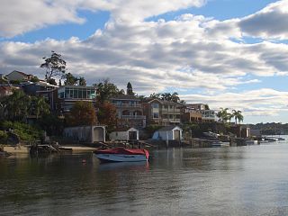
Sylvania is a suburb in southern Sydney, New South Wales, Australia, 22 kilometres south of the Sydney central business district in the Sutherland Shire. It is well known for its large waterfront properties and restaurants.

Bonnyrigg is a suburb of Sydney, in the state of New South Wales, Australia 36 kilometres west of the Sydney central business district, in the local government area of the City of Fairfield. It is part of the Greater Western Sydney region.
Burwood Heights is a suburb in the Inner West of Sydney, in the state of New South Wales, Australia. It is located 10 kilometres west of the Sydney central business district and is situated within the local government area of Municipality of Burwood.
Canley Heights is a suburb of Sydney, in the state of New South Wales, Australia 31 kilometres west of the Sydney central business district, in the local government area of the City of Fairfield and is part of the South-western Sydney region.

Terrigal is a coastal town on the Central Coast of New South Wales, Australia, located 12 kilometres (7 mi) east of Gosford on the Pacific Ocean. It is part of the Central Coast Council local government area.
Jerrabomberra is a suburb of Queanbeyan in south eastern New South Wales, Australia. Jerrabomberra consists of three sections, The Park, The Heights, and Lakeview. The Park and the Heights are divided by Edwin Land Parkway. At the 2021 census, it had 9,601 people, up from 9,508 in 2016, 9,420 in 2011, and 8,747 in 2006. Jerrabomberra is derived from the local Aboriginal place name meaning "boy frightened by storm".

Darling Heights is a rural residential locality in the Toowoomba Region, Queensland, Australia. In the 2021 census, Darling Heights had a population of 5,157 people.

Berkeley Vale is a suburb of the Central Coast region of New South Wales, Australia. Berkeley Vale is commuting distance from Sydney. It is part of the Central Coast Council local government area and part of the federal division of Dobell.

Chittaway Bay is a suburb of the Central Coast region of New South Wales, Australia. It is part of the Central Coast Council local government area.

Avoca Beach is a coastal suburb of the Central Coast region of New South Wales, Australia, about 95 kilometres (59 mi) north of Sydney. Avoca Beach is primarily a residential suburb, Avoca Beach is also a popular tourist destination. Avoca Beach is known for its surfing and state (regional) surf competitions. It is located within the Central Coast Council local government area.

East Gosford is a suburb of the Central Coast region of New South Wales, Australia, located immediately south-east of Gosford's town centre. It is part of the Central Coast Council local government area, and occupies an area previously inhabited by the Guringai (Wanangine) People. East Gosford is named after the Archibald Acheson, 2nd Earl of Gosford, with whom New South Wales Governor George Gipps served in Canada. Archibald Acheson was appointed Governor of British North America in 1835, and conducted a royal commission into the state of affairs in Lower Canada.

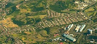
West Gosford is a suburb of the Central Coast region of New South Wales, Australia. It is part of the Central Coast Council local government area. West Gosford is home to the Henry Kendall cottage and was home to the Gosford Classic Car Museum prior to its 2019 closure. While there are some residential areas, West Gosford is known as a retail and industry hub. Bunnings, Spotlight, Anaconda and Officeworks join the Gosford RSL and a Reliance Super Clinic along the Central Coast Highway.
Cringila is a southern suburb of the city of Wollongong, New South Wales, Australia. The suburb is bounded by Berkeley, Unanderra, Lake Heights and Warrawong.

