Flemingsburg, Kentucky | |
---|---|
Motto: "The friendly town that hospitality built" | |
Coordinates: 38°25′20″N83°44′50″W / 38.42222°N 83.74722°W | |
Country | United States |
State | Kentucky |
County | Fleming |
Area | |
• Total | 2.70 sq mi (7.00 km2) |
• Land | 2.69 sq mi (6.97 km2) |
• Water | 0.01 sq mi (0.03 km2) |
Elevation | 814 ft (248 m) |
Population (2020) | |
• Total | 2,953 |
• Estimate (2022) [3] | 2,969 |
• Density | 1,097.36/sq mi (423.67/km2) |
Time zone | UTC-5 (Eastern (EST)) |
• Summer (DST) | UTC-4 (EDT) |
ZIP code | 41041 |
Area code | 606 |
FIPS code | 21-27856 |
GNIS feature ID | 2403616 [2] |
Website | www |
Flemingsburg is a home rule-class city [4] in Fleming County, Kentucky, in the United States. The population was 2,953 at the 2020 census [5] , up from 2,658 at the 2010 census. [6] It is the seat of Fleming County. [7]
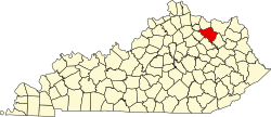
Flemingsburg is located northwest of the center of Fleming County in northeastern Kentucky, 17 miles (27 km) south of Maysville, 31 miles (50 km) northeast of Mt. Sterling, and 38 miles (61 km) northeast of Paris.
According to the United States Census Bureau, Flemingsburg has a total area of 2.0 square miles (5.3 km2), of which 0.01 square miles (0.02 km2), or 0.33%, is water. [6]
The climate in this area is characterized by hot, humid summers and generally mild to cool winters. According to the Köppen Climate Classification system, Flemingsburg has a humid subtropical climate, abbreviated "Cfa" on climate maps. [8]
Flemingsburg was founded in 1797 by George S. Stockton, a native Virginian, who named the town and county after his half-brother Colonel John Fleming. [9] It has been the seat of Fleming County since its formation and was formally incorporated by the state assembly in 1812. [10] [11]
Census | Pop. | Note | %± |
---|---|---|---|
1800 | 123 | — | |
1830 | 648 | — | |
1840 | 591 | −8.8% | |
1850 | 759 | 28.4% | |
1870 | 425 | — | |
1880 | 811 | 90.8% | |
1890 | 1,172 | 44.5% | |
1900 | 1,268 | 8.2% | |
1910 | 1,219 | −3.9% | |
1920 | 1,562 | 28.1% | |
1930 | 1,265 | −19.0% | |
1940 | 1,542 | 21.9% | |
1950 | 1,502 | −2.6% | |
1960 | 2,067 | 37.6% | |
1970 | 2,483 | 20.1% | |
1980 | 2,835 | 14.2% | |
1990 | 3,071 | 8.3% | |
2000 | 3,010 | −2.0% | |
2010 | 2,658 | −11.7% | |
2020 | 2,953 | 11.1% | |
2022 (est.) | 2,969 | [12] | 0.5% |
U.S. Decennial Census [13] |
As of the census [5] of 2000, there were 3,010 people, 1,294 households, and 821 families residing in the city. The population density was 1,178.2 inhabitants per square mile (454.9/km2). There were 1,434 housing units at an average density of 561.3 per square mile (216.7/km2). The racial makeup of the city was 92.72% White, 5.05% African American, 0.10% Native American, 0.40% Asian, 0.43% from other races, and 1.30% from two or more races. Hispanic or Latino of any race were 1.03% of the population.
There were 1,294 households, out of which 29.3% had children under the age of 18 living with them, 45.5% were married couples living together, 14.8% had a female householder with no husband present, and 36.5% were non-families. 33.9% of all households were made up of individuals, and 18.2% had someone living alone who was 65 years of age or older. The average household size was 2.25 and the average family size was 2.87.
In the city, the population was spread out, with 23.3% under the age of 18, 7.9% from 18 to 24, 25.2% from 25 to 44, 23.2% from 45 to 64, and 20.5% who were 65 years of age or older. The median age was 41 years. For every 100 females, there were 81.3 males. For every 100 females age 18 and over, there were 74.1 males.
The median income for a household in the city was $23,708, and the median income for a family was $33,365. Males had a median income of $26,550 versus $21,165 for females. The per capita income for the city was $14,914. About 15.0% of families and 19.0% of the population were below the poverty line, including 23.5% of those under age 18 and 26.8% of those age 65 or over.
Flemingsburg has a lending library, the Fleming County Public Library. [14]
Robertson County is a county located in the U.S. Commonwealth of Kentucky. As of the 2020 census, the population was 2,193. Its county seat is Mount Olivet. The county is named for George Robertson, a Kentucky Congressman from 1817 to 1821. It is Kentucky's smallest county by both total area and by population.
Fleming County is a county located in the U.S. state of Kentucky. As of the 2020 census, the population was 15,082. Its county seat is Flemingsburg. The county was formed in 1798 and named for Colonel John Fleming, an Indian fighter and early settler. It is a moist county. In 1998, the Kentucky General Assembly designated Fleming County as the Covered Bridge Capital of Kentucky.
Whiteland is a town in Pleasant, Franklin and Clark townships, Johnson County, Indiana, United States. The population was 4,599 at the 2020 census.
Sharpsburg is a home rule-class city in Bath County, Kentucky, in the United States. The population was 323 as of the 2010 U.S. census. It is part of the Mount Sterling micropolitan area.
Liberty is a home rule-class city in Casey County, Kentucky, in the United States. It is the seat of its county. Its population was 2,168 at the 2010 U.S. census.
Albany is a home rule-class city in Clinton County, Kentucky, in the United States. The population was 2,033 at the 2010 census. It is the county seat of Clinton County. It is located on U.S. Route 127, about 6 miles (10 km) north of the Tennessee border.
Ewing is a home rule-class city in Fleming County, Kentucky, in the United States. The population was 264 at the 2010 census.
Lancaster is a home rule-class city in Garrard County, Kentucky, in the United States. It is the seat of its county. As of the year 2020 U.S. census, the city population was 3,901.
Blaine is a home rule-class city in Lawrence County, Kentucky, United States. The population was 47 at the 2010 census, down from 245 at the 2000 census.
Fleming-Neon also known as Neon, is a home rule-class city in Letcher County, Kentucky, in the United States. The population was 770 at the 2010 census, down from 840 at the 2000 census.
Kuttawa is a home rule-class city in Lyon County, Kentucky, in the United States. The population was 649 as of the 2010 census, up from 596 in 2000.
Calhoun is a home rule-class city in McLean County, Kentucky, United States. The population was 725 at the 2020 census. It is the county seat of McLean County. It is included in the Owensboro, Kentucky Metropolitan Statistical Area.
Frenchburg is a home rule-class city in Menifee County, Kentucky, in the United States. The population was 601 at the 2020 census, up from 486 in 2010. It is the seat and only incorporated city in its rural county. It is located at the junction of U.S. Route 460 and Kentucky Route 36. Logging is the primary industry.
Edmonton is a home rule-class city in and the county seat of Metcalfe County, Kentucky, United States. It is part of the Glasgow Micropolitan Statistical Area. The population was 1,671 at the 2020 census.
Mount Sterling, often written as Mt. Sterling, is a home rule-class city in Montgomery County, Kentucky, United States. The population was 7,558 as of the 2020 census, up from 6,895 in 2010. It is the county seat of Montgomery County and the principal city of the Mount Sterling micropolitan area.
Beaver Dam is a home rule-class city in Ohio County, Kentucky, in the United States. The population was 3,409 at the 2010 census, and it is the most populous community in the county. It is named for the Beaver Dam Baptist Church which predates the town by several decades. The city was formally incorporated by the state assembly in 1873.
Jamestown is a home rule-class city in Russell County, Kentucky, in the United States. It is the seat of its county. The population was 1,794 at the 2010 U.S. census.
Taylorsville is a home rule-class city in Spencer County, Kentucky, United States. It is the county seat of Spencer County. As of the 2020 census, the city had a total population of 1,256. It was incorporated in 1829.
Elkton is a home rule-class city in and the county seat of Todd County, Kentucky, United States. The population was 2,062 at the 2010 census.
Williamstown is a home-rule-class city in Grant and Pendleton counties in the U.S. state of Kentucky. The population was 3,925 at the 2010 census, up from 3,227 as of the 2000 census. It is the county seat of Grant County.