Fruitdale, California

Last updated
Fruitdale
Santa Clara County California Incorporated and Unincorporated areas Fruitdale Highlighted.svg
Location in Santa Clara County and the state of California
Usa edcp location map.svg
Red pog.svg
Fruitdale
Location in the United States
Coordinates: 37°18′46″N121°56′9″W / 37.31278°N 121.93583°W / 37.31278; -121.93583 Coordinates: 37°18′46″N121°56′9″W / 37.31278°N 121.93583°W / 37.31278; -121.93583
Country Flag of the United States.svg  United States
State Flag of California.svg  California
County Santa Clara
Area
[1]
  Total0.269 sq mi (0.697 km2)
  Land0.269 sq mi (0.697 km2)
  Water0 sq mi (0 km2)  0%
Elevation
144 ft (44 m)
Population
 (2010)
  Total935
  Density3,500/sq mi (1,300/km2)
Time zone UTC-8 (PST)
  Summer (DST) UTC-7 (PDT)
ZIP code
95128
Area codes 408/669
FIPS code 06-27080
GNIS feature ID1877235

Fruitdale is a census-designated place in Santa Clara County, California, United States. The population was 935 at the 2010 census.

Contents

Geography

Fruitdale is located at 37°18′46″N121°56′9″W / 37.31278°N 121.93583°W / 37.31278; -121.93583 (37.312743, -121.935837). [2] It is bordered on the north, west, and east by San Jose, California, and on the south by Campbell, California.

According to the United States Census Bureau, the CDP has a total area of 0.3 square miles (0.78 km2), all of it land.

Demographics

Historical population
CensusPop.
U.S. Decennial Census [3]

2010

The 2010 United States Census [4] reported that Fruitdale had a population of 935. The population density was 3,475.3 people per square mile (1,341.8/km2). The racial makeup of Fruitdale was 633 (67.7%) White, 31 (3.3%) African American, 11 (1.2%) Native American, 110 (11.8%) Asian, 4 (0.4%) Pacific Islander, 88 (9.4%) from other races, and 58 (6.2%) from two or more races. Hispanic or Latino of any race were 244 persons (26.1%).

The Census reported that 861 people (92.1% of the population) lived in households, 26 (2.8%) lived in non-institutionalized group quarters, and 48 (5.1%) were institutionalized.

There were 361 households, out of which 92 (25.5%) had children under the age of 18 living in them, 135 (37.4%) were opposite-sex married couples living together, 39 (10.8%) had a female householder with no husband present, 25 (6.9%) had a male householder with no wife present. There were 24 (6.6%) unmarried opposite-sex partnerships, and 5 (1.4%) same-sex married couples or partnerships. 118 households (32.7%) were made up of individuals, and 29 (8.0%) had someone living alone who was 65 years of age or older. The average household size was 2.39. There were 199 families (55.1% of all households); the average family size was 3.11.

The population was spread out, with 171 people (18.3%) under the age of 18, 80 people (8.6%) aged 18 to 24, 271 people (29.0%) aged 25 to 44, 325 people (34.8%) aged 45 to 64, and 88 people (9.4%) who were 65 years of age or older. The median age was 41.7 years. For every 100 females, there were 100.2 males. For every 100 females age 18 and over, there were 97.9 males.

There were 379 housing units at an average density of 1,408.7 per square mile (543.9/km2), of which 195 (54.0%) were owner-occupied, and 166 (46.0%) were occupied by renters. The homeowner vacancy rate was 1.0%; the rental vacancy rate was 2.9%. 507 people (54.2% of the population) lived in owner-occupied housing units and 354 people (37.9%) lived in rental housing units.

2000

As of the census [5] of 2000, there were 895 people, 348 households, and 212 families residing in the CDP. The population density was 1,279.9/km2 (3,364.9/mi2). There were 356 housing units at an average density of 509.1/km2 (1,338.4/mi2). The racial makeup of the CDP was 76.54% White, 1.90% African American, 1.12% Native American, 5.47% Asian, 0.34% Pacific Islander, 7.15% from other races, and 7.49% from two or more races. Hispanic or Latino of any race were 16.76% of the population.

There were 348 households, out of which 30.7% had children under the age of 18 living with them, 46.8% were married couples living together, 10.6% had a female householder with no husband present, and 38.8% were non-families. 28.2% of all households were made up of individuals, and 7.2% had someone living alone who was 65 years of age or older. The average household size was 2.49 and the average family size was 3.07.

In the CDP, the population was spread out, with 21.8% under the age of 18, 6.6% from 18 to 24, 39.1% from 25 to 44, 22.7% from 45 to 64, and 9.8% who were 65 years of age or older. The median age was 37 years. For every 100 females, there were 95.4 males. For every 100 females age 18 and over, there were 94.4 males.

The median income for a household in the CDP was $58,750, and the median income for a family was $94,224. Males had a median income of $45,781 versus $37,031 for females. The per capita income for the CDP was $30,724. About 3.0% of families and 6.6% of the population were below the poverty line, including 4.2% of those under age 18 and 25.0% of those age 65 or over.

Government

In the California State Legislature, Fruitdale is in the 15th Senate District , represented by Democrat Dave Cortese, and in the 28th Assembly District , represented by Democrat Evan Low. [6]

In the United States House of Representatives, Fruitdale is in California's 18th congressional district , represented by Democrat Anna Eshoo. [7]

Related Research Articles

Mountain View, Contra Costa County, California Census designated place in California, United States

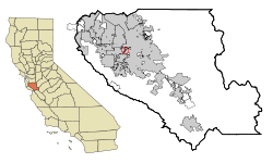
Mountain View is a census designated place (CDP) in Contra Costa County, California, United States. The population was 2,372 at the 2010 census.

Bowles, California census-designated place in California, United States

Bowles is a census-designated place (CDP) in Fresno County, California, United States. The population was 166 at the 2010 census, down from 182 at the 2000 census. Bowles is located 11 miles (18 km) south of downtown Fresno, at an elevation of 279 feet.

Del Rey, California census-designated place in California, United States

Del Rey is a census-designated place (CDP) in Fresno County, California, United States. The population was 1,639 at the 2010 census, up from 950 at the 2000 census. Del Rey is located 3.5 miles (5.6 km) south-southwest of Sanger, at an elevation of 344.

Easton, California census-designated place in California, United States

Easton is a census-designated place (CDP) in Fresno County, California, United States. The population was 2,083 at the 2010 census, up from 1,966 at the 2000 census. Easton is located 7.5 miles (12.1 km) south of downtown Fresno, at an elevation of 276 feet.

Cartago, California census-designated place in California, United States

Cartago is a census-designated place in Inyo County, California, United States. Cartago is located on the west side of Owens Lake 3 miles (4.8 km) north-northwest of Olancha, at an elevation of 3629 feet. The population was 92 at the 2010 census, down from 109 at the 2000 census.

Dixon Lane-Meadow Creek, California Census-designated place in California, United States

Dixon Lane-Meadow Creek is a census-designated place (CDP) in Inyo County, California, United States. The population was 2,645 at the 2010 census, down from 2,702 at the 2000 census.

Wilkerson, California census-designated place in California, United States

Wilkerson is a census-designated place (CDP) in Inyo County, California, United States. The population was 563 at the 2010 census, up from 562 at the 2000 census.

East San Gabriel, California census-designated place in California, United States

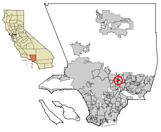
East San Gabriel is a census-designated place (CDP) in Los Angeles County, California, United States. The population was 14,874 at the 2010 census, up from 14,512 at the 2000 census.

West Rancho Dominguez, California Census designated place in California, United States

West Rancho Dominguez is an unincorporated census-designated place (CDP) located in southern Los Angeles County, California. The population was 5,669 at the 2010 census, up from 5,435 at the 2000 census. The community lies to the west of the city of Compton. The ZIP Codes encompassing the CDP area are 90220 & 90248.

Talmage, California census-designated place in California, United States

Talmage is a census-designated place (CDP) in Mendocino County, California, United States. Talmage is located 2.5 miles (4 km) east-southeast of Ukiah, at an elevation of 627 feet. The population was 1,130 at the 2010 census, down from 1,141 at the 2000 census. It lies on the Southeastern region of Ukiah Valley and is home to the famous City of Ten Thousand Buddhas, one of the largest Chinese Zen Buddhist temples in the United States. The town's name honors early settler Junius Talmage.

Las Lomas, California Census-designated place in California, United States

Las Lomas is a census-designated place (CDP) in Monterey County, California, United States. Las Lomas is located 7 miles (11 km) north-northwest of Prunedale. The elevation is 43 feet. The population was 3,024 at the 2010 census, down from 3,078 at the 2000 census.

North Auburn, California census-designated place in California, United States

North Auburn is a census-designated place (CDP) in Placer County, California, United States. It is part of the Sacramento–Arden-Arcade–Roseville Metropolitan Statistical Area. The population was 13,022 at the 2010 census, up from 11,847 at the 2000 census.

Greenhorn, California census-designated place in California, United States

Greenhorn is a census-designated place (CDP) in Plumas County, California, United States. The population was 236 at the 2010 census, up from 146 at the 2000 census.

Foothill Farms, California census-designated place in California, United States

Foothill Farms is a census-designated place (CDP) and unincorporated community in Sacramento County, California, USA. It is part of the Sacramento–Arden-Arcade–Roseville Metropolitan Statistical Area. The population was 33,121 at the 2010 census, up from 17,426 at the 2000 census. Foothill Farms is part of the greater North Highlands-Foothill Farms community, and comprises the zip codes 95841 and 95842. Susan Ual services as President of the New Foothill Farms Community Association while Michael Baker services as the President of the Old Foothill Farms Community Association

www.oldfoothillfarms.org
Lenwood, California census-designated place in California, United States

Lenwood is a census-designated place (CDP) in the Mojave Desert near Barstow, in San Bernardino County, California.

Manton, California census-designated place in California, United States

Manton is a census-designated place (CDP) partially in Tehama County, California, United States. It is also in Shasta County. The population in the Tehama County portion was 347 at the 2010 census, down from 372 at the 2000 census.

Jamestown, California census-designated place in California, United States

Jamestown is a census-designated place (CDP) in Tuolumne County, California, United States. The population was 3,433 at the 2010 census, up from 3,017 at the 2000 census. Formerly a California Gold Rush town, Jamestown is now a California Historical Landmark. Jamestown is the home of Railtown 1897 State Historic Park and the Sierra Railway, which operates steam passenger trains.

Hillsmere Shores, Maryland Former census-designated place in Maryland, United States

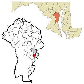
Hillsmere Shores was a census-designated place (CDP) in Anne Arundel County, Maryland, United States. It is a suburb of Annapolis. The population was 2,977 at the 2000 census. It was included in the Annapolis Neck CDP at the 2010 census. Built in phases, beginning in 1960, the community has been home to The Key School, a non-sectarian private school, since the 1960s.

Mehlville, Missouri CDP in Missouri, United States

Mehlville is a census-designated place (CDP) in south St. Louis County, Missouri, United States, and an inner-ring suburb of St. Louis. The population was 28,380 at the 2010 census.

Harbeck-Fruitdale, Oregon CDP in Oregon, United States

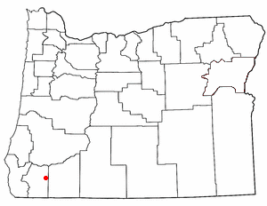
Harbeck-Fruitdale was formerly a census-designated place (CDP) in Josephine County, Oregon, United States, near Grants Pass. As of the 2000 census, the CDP population was 3,780. It includes the community of Fruitdale.

References

  1. "2010 Census U.S. Gazetteer Files – Places – California". United States Census Bureau.
  2. "US Gazetteer files: 2010, 2000, and 1990". United States Census Bureau. 2011-02-12. Retrieved 2011-04-23.
  3. "Census of Population and Housing". Census.gov. Retrieved June 4, 2016.
  4. "2010 Census Interactive Population Search: CA - Fruitdale CDP". U.S. Census Bureau. Archived from the original on July 15, 2014. Retrieved July 12, 2014.
  5. "U.S. Census website". United States Census Bureau . Retrieved 2008-01-31.
  6. "Statewide Database". UC Regents. Archived from the original on February 1, 2015. Retrieved December 7, 2014.
  7. "California's 18th Congressional District - Representatives & District Map". Civic Impulse, LLC. Retrieved March 14, 2013.