
The Ivy League is an American collegiate athletic conference of eight private research universities in the Northeastern United States. The term Ivy League is used more broadly to refer to the eight schools that belong to the league, which are globally-renowned as elite colleges associated with academic excellence, highly selective admissions, and social elitism. The term was used as early as 1933, and it became official in 1954 following the formation of the Ivy League athletic conference.

Union County is a county located in the north central portion of the U.S. state of Georgia. As of the 2020 census, the population was 24,632. The county seat is Blairsville.

Young Harris is a city in Towns County, Georgia, United States. The population was 899 at the 2010 census. Young Harris is home to Young Harris College, after which it was named.

Lake Nipissing is a lake in the Canadian province of Ontario. It has a surface area of 873.3 km2 (337.2 sq mi), a mean elevation of 196 m (643 ft) above sea level, and is located between the Ottawa River and Georgian Bay. Lake Nipissing is the third-largest lake entirely in Ontario. It is relatively shallow for a large lake, with an average depth of only 4.5 m (15 ft). The shallowness of the lake makes for many sandbars along the lake's irregular shoreline. The lake reaches a maximum depth of 64 m (210 ft) near the mouth of the French River, off the shore of Blueberry Island. The lake has many islands most of which are protected under the Protection of Significant Wetlands scheme, controlled by the Ministry of Natural Resources and Forestry.

The Tallulah River is a 47.7-mile-long (76.8 km) river in Georgia and North Carolina. It begins in Clay County, North Carolina, near Standing Indian Mountain in the Southern Nantahala Wilderness and flows south into Georgia, crossing the state line into Towns County. The river travels through Rabun County and ends in Habersham County. It cuts through the Tallulah Dome rock formation to form the Tallulah Gorge and its several waterfalls. The Tallulah River intersects with the Chattooga River to form the Tugaloo River at Lake Tugalo in Habersham County. It joins South Carolina's Seneca River at Lake Hartwell to form the Savannah River, which flows southeastward into the Atlantic Ocean.

The Etowah River is a 164-mile-long (264 km) waterway that rises northwest of Dahlonega, Georgia, north of Atlanta. On Matthew Carey's 1795 map the river was labeled "High Town River". On later maps, such as the 1839 Cass County map, it was referred to as "Hightower River", a name that was used in most early Cherokee records.

Six Flags Over Georgia is a 290-acre (1.2 km2) theme park located in Austell. Opened in 1967, it is the second park in the Six Flags chain following the original Six Flags Over Texas, which opened in 1961.

Rydal is an unincorporated community in Bartow County, Georgia, United States, located thirteen miles north of Cartersville. This still predominantly rural area includes the historic town of Pine Log. The Pine Log post office is open today and the town and the surrounding area is now frequently referred to as Rydal. In 2000 the population of the greater Rydal area was 2,960. Several historic churches, homes and the Pine Log Elementary School still remain in the community. The community has experienced population growth from the continuing expansion of the Atlanta Metropolitan Area. The total number of inhabitants has risen in the past years and, since the 1990s, several subdivisions and factories have been built in the area.
"Public Ivy" is an informal term to refer to public colleges and universities in the United States that are perceived to provide a collegiate experience on the level of Ivy League universities. There is no trademark for the term, and the list of schools associated with the classification has changed over time.

Richard Peters was an American railroad man and a founder of Atlanta, Georgia, in the 1840s.
Chattahoochee River National Recreation Area (CRNRA) preserves a series of sites between Atlanta and Lake Sidney Lanier along the Chattahoochee River in Georgia, U.S. The 48-mile (77 km) stretch of the river affords public recreation opportunities and access to historic sites. The national recreation area, a National Park Service unit, was established on August 15, 1978, by President Jimmy Carter.
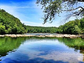
State Route 325 (SR 325) is an arc-shaped 11.1-mile-long (17.9 km) state highway completely within the Chattahoochee-Oconee National Forest in Union County in the extreme northern part of the U.S. state of Georgia. It hugs the western and northern shores of Lake Nottely, and is known as Nottely Dam Road for its entire length.

State Route 60 (SR 60) is a 90.1-mile-long (145.0 km) state highway that travels southeast-to-northwest through portions of Jackson, Hall, Lumpkin, Union, and Fannin counties in the north-central part of the U.S. state of Georgia. The highway connects the Braselton area with McCaysville at the Tennessee state line, via Gainesville and Dahlonega.

USS Barbican (ACM-5) was a Chimo-class minelayer in the United States Navy. Barbican was later commissioned in U.S. Coast Guard as USCGC Ivy.
Hardy Ivy (1779–1842) is said to be the first person of European descent to permanently settle in what is now the city of Atlanta, Georgia.

The Edward C. Peters House, also known as Ivy Hall, is a Queen Anne style house in Atlanta, Georgia. It occupies a lot covering an entire city block on the southeast corner of Piedmont Avenue and Ponce de Leon Avenue in Midtown Atlanta, just north of the SoNo neighborhood. Its current owner is the Savannah College of Art and Design.

U.S. Highway 19 (US 19) is a 349-mile-long (562 km) United States Numbered Highway in the U.S. state of Georgia. It travels from the Florida state line south-southeast of Thomasville through Albany and Atlanta, to the North Carolina state line at a point north of Lake Nottely.

U.S. Route 129 (US 129) is a 375-mile-long (604 km) U.S. Highway in the U.S. state of Georgia. It travels south-to-north from the Florida state line, south of Statenville, to the North Carolina state line, northwest of Blairsville.

Pine Log Mountain is located in the U.S. state of Georgia with a summit elevation of 2,338 feet (713 m). The peak is three miles west of the town of Waleska separated only by the gated community of Lake Arrowhead. The summit falls within Cherokee County, although the majority of the mountain range trails into Bartow County including other peaks of Little Pine Log Mountain, Bear Mountain and Hanging Mountain. Pine Log and these other summits within its range are the last mountains over 2,000 feet (600 m) in the Appalachians of north Georgia. The Appalachian range does not rise above 2,000 feet again until many miles further southwest in the Talladega National Forest in Alabama.

Cherry Log is an unincorporated community and census-designated place (CDP) in Gilmer County, Georgia, United States. Its population was 99 as of the 2020 census. Cherry Log has a post office with ZIP code 30522. U.S. Route 76 passes through the community. Through the heart of Cherry Log runs Cherry Log Street, on which is found the Post Office, Cornerstone Baptist Church, Cherry Log Christian Church, and the Pink Pig, a restaurant in operation since 1950.


