Sierra Leone is located on the west coast of Africa, between the 7th and 10th parallels north of the equator. Sierra Leone is bordered by Guinea to the north and northeast, Liberia to the south and southeast, and the Atlantic Ocean to the west.

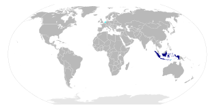
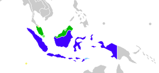
Riau, is a province of Indonesia. It is located in the central eastern coast of Sumatra along the Strait of Malacca. Until 2004 the province included the offshore Riau Islands, a large group of small islands located east of Sumatra Island and south of Singapore, before these islands were split off as Riau Islands Province in July 2004. The provincial capital of Riau Province and its largest city is Pekanbaru. The province shares land borders with North Sumatra to the northwest, West Sumatra to the west, and Jambi to the south.

Minangkabau is an Austronesian language spoken by the Minangkabau of West Sumatra, the western part of Riau, South Aceh Regency, the northern part of Bengkulu and Jambi, also in several cities throughout Indonesia by migrated Minangkabau. The language is also a lingua franca along the western coastal region of the province of North Sumatra, and is even used in parts of Aceh, where the language is called Aneuk Jamee. It is also spoken in some parts of Malaysia, especially Negeri Sembilan.

Srivijaya, was a dominant thalassocratic Indonesian city-state based on the island of Sumatra, Indonesia, which influenced much of Southeast Asia. Srivijaya was an important centre for the expansion of Buddhism from the 8th to the 12th century. Srivijaya was the first unified kingdom to dominate much of the Indonesian archipelago. The rise of the Srivijayan Empire is seen to run parallel to the end of the Malay sea-faring period. Due to its location, this once powerful state developed complex technology utilizing maritime resources. In addition, its economy became progressively reliant on the booming trade in the region, thus transforming it into a prestige goods based economy.

South Sumatra is a province of Indonesia. It is located in the southeast of the island of Sumatra, The province spans 91,592.43 km2 (35,364 sq mi) and had a population of 7,450,394 at the 2010 Census; the latest official estimate is 10,675,862. The capital of the province is Palembang. The province borders Jambi to the north, Bengkulu to the west and Lampung to the south. The Bangka Strait in the east separates South Sumatra and the island of Bangka, which is part of the Bangka Belitung Islands province. This province is rich in natural resources, such as petroleum, natural gas and coal. The province is very diverse, as it is inhabited by many different ethnic groups. The Malays is the dominant ethnic group in the province. Most of them spoke the Palembang Malay, which is mutually unintelligible to both Indonesian and Standard Malay. Other ethnic groups also inhabits the province, such as the Javanese, Sundanese, Minangkabau and Chinese. Most of them are concentrated around urban areas, as they are mostly immigrants from other parts of Indonesia.

Lampung is a province of Indonesia, occupying the southern tip of the island of Sumatra. It has a short border with the province of Bengkulu to the northwest, and a longer border with the province of South Sumatra to the north. It is the original home of the Lampung people, who speak their own language, and possess their own written script. Its capital is Bandar Lampung.
History Jambi is a province of Indonesia. It is located on the east coast of central Sumatra and spans to the Barisan Mountains in the west. Its capital and largest city is Jambi. The province has a land area of 50,058 km2, and it has a population of 3,092,265 according to the 2010 Census; by January 2014 this had risen to 3,412,459.

Bengkulu is a province of Indonesia, located in the southwest coast of Sumatra. It was formed on 18 November 1968 by separating out the former Bengkulu Residency area from the province of South Sumatra under Law No. 9 of 1967 and was finalised by Government Regulation No. 20 of 1968. Spread over 19,813 km2, it is bordered by the provinces of West Sumatra to the north, Jambi to the northeast, Lampung to the southeast, South Sumatra to the east, and the Indian Ocean to the northwest, south, southwest, and west.
The Bangka Belitung Islands is a province of Indonesia. Lying off the southeastern coasts of Sumatra, the province comprises two main islands, Bangka and Belitung, and several smaller ones. Bangka Belitung is bordered by the Bangka Strait to the west, the Natuna Sea to the north, the Java Sea is to the south, and the Karimata Strait to the east. The capital and the largest city is Pangkal Pinang. As of the 2015 census, the population of Bangka Belitung was 1,372,813.
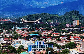
Padang is the capital of the province of West Sumatra in Indonesia. With an area of 695 square kilometres (268 sq mi) and a population of 914,970 in 2016, it is the 10th-most populated urban centres in Indonesia, the most populated city on Sumatra's western coast, and fourth-most populated city on Sumatra.

The Kapuas River is a river in the Indonesian part of Borneo island, at the geographic center of Maritime Southeast Asia. At 1,143 kilometers (710 mi) in length, it is the longest river of Indonesia and one of the world's longest island rivers. It originates in the Müller mountain range at the center of the island and flows west into the South China Sea creating an extended marshy delta. The delta is located west-southwest of Pontianak, the capital of the West Kalimantan province. This Kapuas River should be distinguished from another Kapuas River, which starts on the other side of the same mountain range in central Borneo, but flows to the south, merging with the Barito River and discharging into the Java Sea.
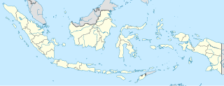
Muaro Jambi Regency is a regency of Jambi Province, Sumatra, Indonesia. From the 4th until the 13th century, it was the seat of the Hindu-Buddhist Melayu Kingdom. It has an area of 5,326 km² and had a population of 342,952 at the 2010 Census; the latest official estimate was 378,464.

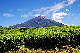
Kerinci is a regency (kabupaten) in Jambi province, on the island of Sumatra, Indonesia. The regency has an area of 3,808.5 km2 (1,470.5 sq mi). At the 2010 Census, Kerinci Regency had a population of 229,387; the latest estimate is 253,258. The capital is Siulak. Kerinci is located 50 km (31 mi) from Jambi City, the capital of Jambi Province.

The Batang Hari is the longest river in Jambi province, Sumatra island, Indonesia, about 600 km northwest of the capital Jakarta.
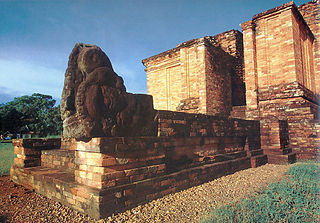
Muaro Jambi is a Buddhist temple complex, in Muaro Jambi Regency, Jambi province, Sumatra, Indonesia. It is situated 26 kilometers east from the city of Jambi. The temple complex was built by the Melayu Kingdom, with its surviving temples and other archaeological remains estimated to date from the 7th to 13th century CE. The archaeological site includes eight excavated temple sanctuaries and covers about 12 square kilometers, stretches 7.5 kilometers along the Batang Hari River, 80 menapos or mounds of temple ruins, are not yet restored. It is one of the largest and best-preserved ancient temple complexes in South East Asia.

Musi Banyuasin Regency is a regency of South Sumatra province, in Indonesia. It has a total area of 14,477 km2 (5,590 sq mi) and a population of 562,584 at the 2010 Census; the latest official estimate is 602,615.

Merangin River is a river in Jambi province, Sumatra island, Indonesia, about 600 km northwest of the capital Jakarta. It is a tributary of the Batang Hari River, through Tembesi River.

East Tanjung Jabung Regency is a regency of Jambi Province, Indonesia. It is located on the island of Sumatra. The regency has an area of 5,445 km² and had a population of 205,272 at the 2010 Census; the latest official estimate is 226,527. It contains 6 kecamatan and 60 desa. The capital lies at Muara Sabak.
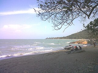
Tembilahan is a subdistrict of Indragiri Hilir Regency, Riau province of Indonesia. It is also the capital of the regency. Tembilahan subdistrict has an area of 197.37 km², consisting of 6 Administrative village. Tembilahan number of subdistrict residents in 2010 was 69.498 inhabitants.