Jambin, Queensland

Last updated

Map all coordinates using: OpenStreetMap
Jambin
Queensland
StateLibQld 1 123598 Jambin Hotel at Jambin, ca. 1920.jpg
Jambin Hotel, circa 1920
Australia Queensland location map.svg
Red pog.svg
Jambin
Coordinates 24°10′23″S150°22′29″E / 24.1730°S 150.3747°E / -24.1730; 150.3747 (Jambin (town centre))
Population207 (SAL 2021) [1]
Postcode(s) 4702
Area279.5 km2 (107.9 sq mi)
Time zone AEST (UTC+10:00)
Location
LGA(s) Shire of Banana
State electorate(s) Callide
Federal division(s) Flynn
Localities around Jambin:
Goovigen Ulogie Dumgree
Goovigen Jambin Dumgree
Greycliffe Orange Creek Callide

Jambin is a rural town and locality in the Shire of Banana, Queensland, Australia. [2] [3] In the 2021 census, the locality of Jambin had a population of 207 people. [4]

Contents

Geography

Jambin is located in Central Queensland on the Burnett Highway which runs roughly north-south through the town. Callide Creek is immediately to the west of the town; it is a tributary of the Don River. [5]

The Callide Valley railway line passed through the locality with Jambin railway station ( 24°11′44″S150°22′11″E / 24.1955°S 150.3697°E / -24.1955; 150.3697 (Jambin railway station (former)) ) serving the town. That section of the line is now closed and the station abandoned. [6]

However, other parts of the Callide Valley line in Jamin were integrated into the Moura railway line, which serves the mining industry, connecting mines with the Port of Gladstone. [7] The following stations in Jambin are on the Moura line (from north to south):

All of these stations are operational apart from Argoon which is now abandoned. [6] Boundary Hill station is on a balloon loop that serves the Boundary Hill coal mine (in neighbouring Callide). [5]

History

The town takes its name from the Jambin railway station, which in turn was named on 27 April 1923 by the Queensland Railway Department and is believed to be an Aboriginal word meaning echidna . [2]

Callide Provisional School opened on 24 November 1925. On 1 June 1927, it became Callide State School. It closed in 1971. [8] It was on Callide Road ( 24°18′04″S150°27′32″E / 24.3012°S 150.4588°E / -24.3012; 150.4588 (Callide State School (former)) ). [9] Although it is within the town of Callide, it is within the present-day boundaries of Jambin. [5]

The town first appears on a 1949 survey map. [2]

Jambin was originally established as a supply depot for the railway, which was established in 1924. [10] This opened up the area for new settlers, many of them pursuing dairying. [11] Cream was sent to the butter factory at Wowan. [12]

Jambin Post Office opened on 1 February 1926 (a receiving office had been open from 1924). [13]

Original school building at Jambin State School, circa 1930 Jambin State School, original school building.jpg
Original school building at Jambin State School, circa 1930

Jambin State School opened on 11 February 1929 with 16 students under principal Kate Collins. [14] The first school building was a high-set two-room structure with a semi-enclosed verandah. [14]

Arogoon (also written as Argoon) State School opened on 30 July 1936, but was renamed Earlsfield State School by October 1936. It closed in 1958. [8] [15] It was on the northern corner of Earlsfield Road and Earlsfield Pit Road ( 24°12′19″S150°26′01″E / 24.2052°S 150.4336°E / -24.2052; 150.4336 (Earlsfield State School (former)) ). [16] [17] [5]

The mobile library service commenced in 2004. [18]

Demographics

The locality of Jambin was created 25 November 2016. The northern part of the new locality was formerly the locality of Smoky Creek and the southern part of the new locality was formerly the locality of Argoon. [2] Therefore, there is no census data available for the locality of Jambin prior to this time. However, in the 2011 census, Smoky Creek had a population of 308 people [19] and Argoon had a population of 295, [20] while in the 2016 census, Smoky Creek had a population of 179 people [21] and Argoon had a population of 151. [22]

In the 2021 census, the locality of Jambin had a population of 207 people. [4]

Heritage listings

Jambin has a number of heritage-listed sites, including:

Education

Jambin State School is a government primary (Prep-6) school for boys and girls at 25 Jambin Three Ways Road, adjacent to the Burnett Highway ( 24°10′26″S150°22′30″E / 24.1738°S 150.3751°E / -24.1738; 150.3751 (Jambin State School) ). [24] [25] [5] In 2017, the school had an enrolment of 26 students with 3 teachers and 5 non-teaching staff (3 full-time equivalent). [26]

Amenities

Banana Shire Council operate a fortnightly mobile library service to Jambin and the school. [27] [28]

The Jambin branch of the Queensland Country Women's Association meets in the QCWA Room in the Jambin Hall at 180 Burnett Highway. [29]

Events

Jambin hosts its annual Champagne Campdraft in May each year. [30]

The annual Working Cattle Dog trials are held in June. [30]

Since 2017, the annual King and Queen of CQ Boar Hunting Competition has been held over three days in either late May or early June. [31] In what is claimed to be Australia's largest boar hunting competition, hundreds of competitors compete for prizes in an attempt to cull the boar population while raising money for schools in Jambin and Goovigen. [32] Almost 900 pigs were killed in the 2021 competition which attracted hunters from New South Wales and North Queensland. [33]

The novel "Dust" by Christine Bongers is set around the town of Jambin. In the novel the main character's family, the Vanderbomms, attend church at Jambin. [34]

Related Research Articles

<span class="mw-page-title-main">Biloela</span> Town in Queensland, Australia

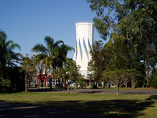
Biloela is a rural town and locality in the Shire of Banana, Central Queensland, Australia. It is situated 120 kilometres (75 mi) inland from the port city of Gladstone at the junction of the Burnett and Dawson highways. Biloela is the administrative centre of Banana Shire, which has an area of 15,729 square kilometres (6,073 sq mi). In the 2021 census, the locality of Biloela had a population of 5,692 people.

<span class="mw-page-title-main">Banana, Queensland</span> Town in Queensland, Australia

Banana is a rural town and locality in the Shire of Banana, Queensland, Australia. In the 2016 census, the locality of Banana had a population of 356 people.

<span class="mw-page-title-main">Westwood, Queensland</span> Town in Queensland, Australia

Westwood is a town in the Rockhampton Region and a locality split between the Rockhampton Region and the Shire of Banana in Queensland, Australia. It was the first town that was gazetted by the Queensland Government. In the 2021 census, the locality of Westwood had a population of 199 people.

<span class="mw-page-title-main">Dululu</span> Town in Queensland, Australia

Dululu is a rural town and locality in the Shire of Banana, Queensland, Australia.In the 2021 census, the locality of Dululu had a population of 97 people.

<span class="mw-page-title-main">Thangool</span> Town in Queensland, Australia

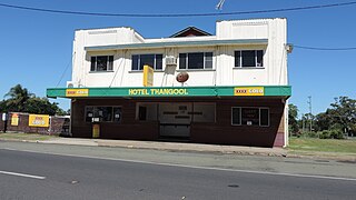
Thangool is a rural town and locality in the Shire of Banana, Queensland, Australia. In the 2016 census, the locality of Thangool had a population of 741 people.

<span class="mw-page-title-main">Goovigen</span> Town in Queensland, Australia

Goovigen is a rural town and locality in the Shire of Banana, Queensland, Australia. In the 2016 census, the locality of Goovigen had a population of 215 people.

<span class="mw-page-title-main">Wowan, Queensland</span> Town in Queensland, Australia

Wowan is a rural town and locality in the Shire of Banana, Queensland, Australia. In the 2016 census, the locality of Wowan had a population of 216 people.

<span class="mw-page-title-main">Rannes, Queensland</span> Town in Queensland, Australia

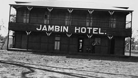
Rannes is a rural town in the west of the locality of Goovigen in the Shire of Banana, Queensland, Australia.

The Callide Valley railway line ran from Rannes to Lawgi in Queensland, Australia. The Callide Valley lies to the south-west of Rockhampton in Central Queensland.

<span class="mw-page-title-main">Moura railway line</span> Railway line in Queensland, Australia

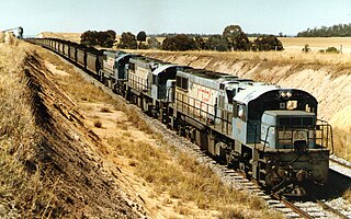
The Moura railway line is a railway in central Queensland, connecting several coal mines to the port of Gladstone. It connects the remnants of several lines that previously connected to Rockhampton, originally by a rack railway.

Camboon is a rural locality in the Shire of Banana, Queensland, Australia. In the 2021 census, Camboon had a population of 76 people.

<span class="mw-page-title-main">Mount Murchison, Queensland</span> Suburb of Shire of Banana, Queensland, Australia

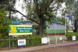
Mount Murchison is a rural locality in the Shire of Banana, Queensland, Australia.

<span class="mw-page-title-main">Mount Chalmers, Queensland</span> Town in Queensland, Australia

Mount Chalmers is a rural town and locality in the Livingstone Shire, Queensland, Australia. In the 2016 census, the locality of Mount Chalmers had a population of 235 people.

<span class="mw-page-title-main">The Caves, Queensland</span> Town in Queensland, Australia

The Caves is a rural town and locality in the Livingstone Shire, Queensland, Australia. In the 2016 census the locality of The Caves had a population of 718 people.

Callide is a rural town and locality in the Shire of Banana, Queensland, Australia. In the 2016 census, the locality of Callide had a population of 86 people.

Greycliffe is a rural locality in the Shire of Banana, Queensland, Australia. In the 2016 census, Greycliffe had a population of 22 people.

<span class="mw-page-title-main">Lawgi Dawes</span> Suburb of Shire of Banana, Queensland, Australia

Lawgi Dawes is a rural locality in the Shire of Banana, Queensland, Australia. In the 2016 census, Lawgi Dawes had a population of 144 people. It contains the neighbourhood of Lawgi, a former town.

Dakenba is a rural locality in the Shire of Banana, Queensland, Australia. In the 2016 census, Dakenba had a population of 116 people.

Orange Creek is a rural locality in the Shire of Banana, Queensland, Australia. In the 2021 census, Orange Creek had a population of 197 people.

<span class="mw-page-title-main">Kianga, Queensland</span> Suburb of Shire of Banana, Queensland, Australia

Kianga is a rural locality in the Shire of Banana, Queensland, Australia. In the 2021 census, Kianga had a population of 219 people.

References

  1. Australian Bureau of Statistics (28 June 2022). "Jambin (suburb and locality)". Australian Census 2021 QuickStats. Retrieved 28 June 2022.  OOjs UI icon edit-ltr-progressive.svg
  2. 1 2 3 4 "Jambin – town in Shire of Banana (entry 17026)". Queensland Place Names. Queensland Government . Retrieved 26 December 2020.
  3. "Jambin – locality in Shire of Banana (entry 49780)". Queensland Place Names. Queensland Government . Retrieved 26 December 2020.
  4. 1 2 Australian Bureau of Statistics (28 June 2022). "Jambin (SAL)". 2021 Census QuickStats. Retrieved 28 February 2023. OOjs UI icon edit-ltr-progressive.svg
  5. 1 2 3 4 5 "Queensland Globe". State of Queensland . Retrieved 1 February 2024.
  6. 1 2 3 4 5 6 7 "Railway stations and sidings - Queensland". Queensland Open Data. Queensland Government. 2 October 2020. Archived from the original on 5 October 2020. Retrieved 5 October 2020.
  7. "What We Deliver". Aurizon . Archived from the original on 6 December 2020. Retrieved 3 January 2021.
  8. 1 2 Queensland Family History Society (2010), Queensland schools past and present (Version 1.01 ed.), Queensland Family History Society, ISBN   978-1-921171-26-0
  9. "8949-II-N Callide" (Map). Queensland Government. 1972. Archived from the original on 12 June 2022. Retrieved 13 June 2022.
  10. "Jambin". The Gladstone Region. Tourism Queensland. Archived from the original on 27 June 2014. Retrieved 7 June 2014.
  11. "CALLIDE-NEW SETTLERS". Morning Bulletin (Rockhampton, Qld. : 1878 - 1954) . Rockhampton, Qld.: National Library of Australia. 20 February 1924. p. 3. Archived from the original on 12 June 2022. Retrieved 8 June 2014.
  12. "DAWSON VALLEY NEWS". Morning Bulletin (Rockhampton, Qld. : 1878 - 1954) . Rockhampton, Qld.: National Library of Australia. 1 March 1924. p. 10. Archived from the original on 12 June 2022. Retrieved 8 June 2014.
  13. Premier Postal History. "Post Office List". Premier Postal Auctions. Archived from the original on 15 May 2014. Retrieved 10 May 2014.
  14. 1 2 "Opening and closing dates of Queensland Schools". Queensland Government . Retrieved 4 June 2014.
  15. "Agency ID 5902, Earlsfield State School". Queensland State Archives . Retrieved 1 February 2024.
  16. "Queensland Two Mile series sheet 2m201" (Map). Queensland Government. 1964. Retrieved 1 February 2024.
  17. "Rannes" (Map). Queensland Government. 1944. Retrieved 1 February 2024.
  18. "Public Libraries Statistical Bulletin 2016-17" (PDF). Public Libraries Connect. State Library of Queensland. November 2017. p. 11. Archived (PDF) from the original on 30 January 2018. Retrieved 29 January 2018.
  19. Australian Bureau of Statistics (31 October 2012). "Smoky Creek (SSC)". 2011 Census QuickStats. Retrieved 4 June 2014. OOjs UI icon edit-ltr-progressive.svg
  20. Australian Bureau of Statistics (31 October 2012). "Argoon (SSC)". 2011 Census QuickStats. Retrieved 4 June 2014. OOjs UI icon edit-ltr-progressive.svg
  21. Australian Bureau of Statistics (27 June 2017). "Smoky Creek (SSC)". 2016 Census QuickStats. Retrieved 24 May 2019. OOjs UI icon edit-ltr-progressive.svg
  22. Australian Bureau of Statistics (27 June 2017). "Argoon (SSC)". 2016 Census QuickStats. Retrieved 24 May 2017. OOjs UI icon edit-ltr-progressive.svg
  23. "Kilbirnie Homestead (entry 600016)". Queensland Heritage Register . Queensland Heritage Council. Retrieved 6 July 2013.
  24. "State and non-state school details". Queensland Government. 9 July 2018. Archived from the original on 21 November 2018. Retrieved 21 November 2018.
  25. "Jambin State School". Jambin State School. 29 November 2020. Retrieved 1 February 2024.
  26. "ACARA School Profile 2017". Archived from the original on 22 November 2018. Retrieved 22 November 2018.
  27. "Library: Branches & Opening hours". Banana Shire Council. Archived from the original on 19 March 2017. Retrieved 8 May 2017.
  28. "Banana Shire Mobile Library Timetable" (PDF). Banana Shire Council. Retrieved 8 May 2017.[ permanent dead link ]
  29. "Branch Locations". Queensland Country Women's Association. Archived from the original on 26 December 2018. Retrieved 26 December 2018.
  30. 1 2 "Simple Pleasures: Banana Shire" (PDF). The Gladstone Region. Tourism Queensland. p. 3. Archived (PDF) from the original on 15 July 2014. Retrieved 8 June 2014.
  31. "Family fun day of hunting pigs for $10k in prizes". Central Telegraph . 9 May 2017. Archived from the original on 11 June 2021. Retrieved 11 June 2021.
  32. Robinson, Paul (4 June 2018). "Hundreds of feral pigs caught and killed in Australia's largest hunting competition". ABC News . Archived from the original on 12 June 2021. Retrieved 11 June 2021.
  33. Jurss-Lewis, Tobias (11 June 2021). "Hunting feral boars in central Queensland in guerrilla war on damaging pest". ABC News. Archived from the original on 11 June 2021. Retrieved 11 June 2021.
  34. "Dust settles as Jambin book launched". Central Telegraph . 13 August 2009. Archived from the original on 14 July 2014. Retrieved 7 June 2014.

Further reading