The SA1 statistical area had a population of 249 in the 2023 New Zealand census, an increase of 66 people (36.1%) since the 2018 census, and an increase of 60 people (31.7%) since the 2013 census. There were 129 males, and 120 females in 87 dwellings.[5] 1.2% of people identified as LGBTIQ+. The median age was 42.8 years (compared with 38.1 years nationally). There were 48 people (19.3%) aged under 15 years, 48 (19.3%) aged 15 to 29, 111 (44.6%) aged 30 to 64, and 42 (16.9%) aged 65 or older.[4]
People could identify as more than one ethnicity. The results were 81.9% European (Pākehā), 34.9% Māori, 1.2% Pasifika, 1.2% Asian, and 2.4% other, which includes people giving their ethnicity as "New Zealander". English was spoken by 94.0%, Māori language by 8.4%, and other languages by 6.0%. No language could be spoken by 2.4% (e.g. too young to talk). The percentage of people born overseas was 10.8, compared with 28.8% nationally.
Religious affiliations were 25.3% Christian, 1.2% Māori religious beliefs, and 1.2% New Age. People who answered that they had no religion were 60.2%, and 10.8% of people did not answer the census question.
Of those at least 15 years old, 27 (13.4%) people had a bachelor's or higher degree, 114 (56.7%) had a post-high school certificate or diploma, and 54 (26.9%) people exclusively held high school qualifications. The median income was $32,800, compared with $41,500 nationally. 9 people (4.5%) earned over $100,000 compared to 12.1% nationally. The employment status of those at least 15 was that 102 (50.7%) people were employed full-time, 18 (9.0%) were part-time, and 12 (6.0%) were unemployed.[4]
Education
Kaingaroa School is a coeducational full primary (years 1–8) school[6] with a roll of 118 as of August 2024.[7] The school was established in 1873–74 as Mangatete Maori School.[8]
Matamata-Piako District is a local government area in the Waikato region of New Zealand. It lies to the east of the city of Hamilton.
The South Wairarapa District is a district at the south-east tip of the North Island of New Zealand, governed by the South Wairarapa District Council. The district comprises the southernmost part of the Wairarapa, and is part of the Wellington Region.
The Thames-Coromandel District is a territorial authority district in the North Island of New Zealand, covering all the Coromandel Peninsula and extending south to Hikutaia.
Hauraki District is a territorial authority governed by the Hauraki District Council within the Waikato region of New Zealand. The seat of the council is at Paeroa.
The Far North District is the northernmost territorial authority district of New Zealand, consisting of the northern part of the Northland Peninsula in the North Island. It stretches from North Cape / Otou and Cape Reinga / Te Rerenga Wairua in the north, down to the Bay of Islands, the Hokianga and the town of Kaikohe.
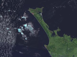
The Aupōuri Peninsula is a tombolo at the northern tip of the North Island of New Zealand. It projects between the Tasman Sea to the west and the Pacific Ocean to the east. It constitutes the northern part of the Far North District, incorporating North Cape, Houhora and the northern half of Awanui.
Central Otago District is local government district in New Zealand. It is administered by the Central Otago District Council, and it is in the Otago region, the top tier of local government in New Zealand. The major towns in the district are Alexandra, Cromwell, Roxburgh, Clyde and Ranfurly. The district covers 9,968 km2 (3,849 sq mi), making it the fourth-largest district in New Zealand by area, and is home to 26,500 people as of June 2024.
Clutha District is a local government district of southern New Zealand, with its headquarters in the Otago town of Balclutha. Clutha District has a land area of 6,334.47 km2 (2,445.75 sq mi) and an estimated population of 19,300 as of June 2024. Clutha District occupies the majority of the geographical area known as South Otago.
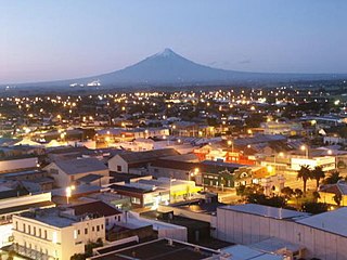
South Taranaki is a territorial authority on the west coast of New Zealand's North Island that contains the towns of Hāwera, Manaia, Ōpunake, Patea, Eltham, and Waverley. The District has a land area of 3,575.46 km2 and a population of 30,400. It is part of the greater Taranaki Region.
Taupō District is a territorial authority district in New Zealand. It covers 6,333 km² of land, and a further 610 km² of lake area, including Lake Taupō, New Zealand's largest lake, and Lake Rotoaira. The district stretches from the small town of Mangakino in the northwest to the Tongariro National Park in the south, and east into the Kaingaroa Forest. The district's population is largely located in the two main centres, Taupō and Tūrangi.
Pamapuria is a locality in Northland, New Zealand. It lies on State Highway 1 about 10 km east of Kaitaia.
Pukepoto is a town in Northland, New Zealand. It lies south west of Kaitaia and north east of Ahipara. The Herekino Forest lies to the south east.
The Karikari Peninsula on the east coast of the far north of Northland, New Zealand, is between Rangaunu Harbour to the west, and Doubtless Bay to the southeast. It is a right-angled land mass of two relatively distinct parts. The rocky northern part, which has an east–west orientation and is approximately 17 km long, was originally an island but is now connected to the mainland by a low sandy tombolo approximately 11 km long, which has a north–south orientation. The spiritually significant Puwheke sits high above the north-facing beaches.
Waiharara is a community at the base of the Aupouri Peninsula in Northland, New Zealand. State Highway 1 runs through the community. To the west is Aupouri Forest, and beyond that Ninety Mile Beach. To the east is Rangaunu Harbour. Houhora is 22 km north west, and Awanui is 16 km south east. Lake Waiparera, 35 metres above sea level, is immediately to the north west.
Whangarei District is a territorial authority district in the Northland Region of New Zealand that is governed by the Whangarei District Council. The district is made up in area largely by rural land, and includes a fifth of the Northland Region. It extends southwards to the southern end of Bream Bay, northwards to Whangaruru and almost to the Bay of Islands, and westwards up the Mangakahia River valley past Pakotai and almost to Waipoua Forest. It includes the Hen and Chicken Islands and the Poor Knights Islands.
Ōtorohanga District is a territorial authority in the King Country area and Waikato region of the North Island of New Zealand. It is a mostly rural area, with Ōtorohanga town being by far the biggest urban area, with a population nearing 3,000. The District was called Otorohanga County from 1971 to 1979.
Wairoa District is a territorial authority district within the Hawke's Bay Region in the North Island of New Zealand. The Wairoa District Council is headquartered in the largest town, Wairoa. The district covers the northern half of the Hawke's Bay coast, extending from Māhia Peninsula to Lake Waikaremoana, and south to the mouth of the Waikare River.
Ashburton District is a territorial authority district in the Canterbury Region of the South Island of New Zealand. It encompasses the town of Ashburton, a number of small towns and settlements and the surrounding rural area, roughly coterminous with Mid Canterbury. The district had a population of 38,400 as of June 2024.
Paparore is a small coastal settlement near the north of Waipapakauri, adjacent to Rangaunu Harbour. It has a marae and cemetery.
Tokerau Beach is a settlement on the northwestern side of Doubtless Bay on the Karikari Peninsula of Northland, New Zealand.
This page is based on this Wikipedia article Text is available under the CC BY-SA 4.0 license; additional terms may apply. Images, videos and audio are available under their respective licenses.