Pakaraka

Last updated • 6 min readFrom Wikipedia, The Free Encyclopedia

Pakaraka
Pakaraka
Coordinates: 35°21′27″S173°57′23″E / 35.35750°S 173.95639°E / -35.35750; 173.95639
CountryNew Zealand
Region Northland Region
District Far North District
WardBay of Islands/Whangaroa
CommunityBay of Islands-Whangaroa
SubdivisionPaihia
Electorates
Government
  Territorial Authority Far North District Council
  Regional council Northland Regional Council
   Mayor of Far North Moko Tepania
   Northland MP Grant McCallum
   Te Tai Tokerau MP Mariameno Kapa-Kingi

Pakaraka is a settlement in Northland, New Zealand, at the junction of State Highway 1 and 10, in the district the Ngāpuhi tribe called Tai-a-mai. [1]

Contents

Demographics

Pakaraka statistical area covers 72.44 km2 (27.97 sq mi) [2] and had an estimated population of 750 as of June 2024, [3] with a population density of 10.4 people per km2.

Historical population
YearPop.±% p.a.
2006507    
2013555+1.30%
2018666+3.71%
2023702+1.06%
Source: [4] [5]

Pakaraka had a population of 702 in the 2023 New Zealand census, an increase of 36 people (5.4%) since the 2018 census, and an increase of 147 people (26.5%) since the 2013 census. There were 345 males, 357 females and 6 people of other genders in 243 dwellings. [6] 2.6% of people identified as LGBTIQ+. The median age was 41.9 years (compared with 38.1 years nationally). There were 165 people (23.5%) aged under 15 years, 78 (11.1%) aged 15 to 29, 318 (45.3%) aged 30 to 64, and 141 (20.1%) aged 65 or older. [5]

People could identify as more than one ethnicity. The results were 84.2% European (Pākehā); 34.6% Māori; 1.3% Pasifika; 0.9% Asian; 0.9% Middle Eastern, Latin American and African New Zealanders (MELAA); and 2.6% other, which includes people giving their ethnicity as "New Zealander". English was spoken by 97.9%, Māori language by 9.4%, and other languages by 6.4%. No language could be spoken by 2.1% (e.g. too young to talk). New Zealand Sign Language was known by 0.4%. The percentage of people born overseas was 15.8, compared with 28.8% nationally.

Religious affiliations were 26.5% Christian, 2.6% Māori religious beliefs, 0.4% Buddhist, and 1.3% other religions. People who answered that they had no religion were 61.1%, and 8.5% of people did not answer the census question.

Of those at least 15 years old, 81 (15.1%) people had a bachelor's or higher degree, 318 (59.2%) had a post-high school certificate or diploma, and 114 (21.2%) people exclusively held high school qualifications. The median income was $33,700, compared with $41,500 nationally. 36 people (6.7%) earned over $100,000 compared to 12.1% nationally. The employment status of those at least 15 was that 267 (49.7%) people were employed full-time, 102 (19.0%) were part-time, and 6 (1.1%) were unemployed. [5]

History and culture

Henry Williams' Holy Trinity Church, Pakaraka Holy Trinity, Pakaraka.jpg
Henry Williams' Holy Trinity Church, Pakaraka

Pre-European history

A was located at the base, and on the slopes, of Pouerua, a 270 metres (890 ft) high basaltic scoria cone. The pā was studied during a major archeological project in the 1980s. [7]

Modern history

Parts of the Flagstaff War were fought around Pakaraka in 1845. [8] After the Battle of Ōhaeawai on 23 June 1845 the British troops destroyed Te Haratua's pā at Pakaraka on 16 July 1845. [9]

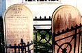
Mount Pouerua is registered with the Heritage New Zealand as a traditional site. Holy Trinity Church. The Retreat and the Store are also registered with the trust. [10]

Marae

The local Kahukura Ariki Marae and Kahukura Ariki meeting house are affiliated with the Ngāti Kahu ki Whangaroa hapū of Hāhi Katorika, and the Ngāpuhi / Ngāti Kahu ki Whaingaroa hapū of Ngāti Kohu. [11] [12]

Education

Pakaraka School is a coeducational full primary (years 1–8) school with a roll of 37 students as of August 2024. [13] [14] In 2024, all of the students were Māori. [15] The school opened in 1911. [16]

Notable people

Notes

  1. Best, Elsdon (1927). "Old Forts of the Taiamai District, Bay of Islands". The Pa Maori. Whitcombe and Tombs Limited.
  2. "ArcGIS Web Application". statsnz.maps.arcgis.com. Retrieved 25 December 2023.
  3. "Aotearoa Data Explorer". Statistics New Zealand . Retrieved 26 October 2024.
  4. "Statistical area 1 dataset for 2018 Census". Statistics New Zealand. March 2020. Pakaraka (103600). 2018 Census place summary: Pakaraka
  5. 1 2 3 "Totals by topic for individuals, (RC, TALB, UR, SA3, SA2, Ward, Health), 2013, 2018, and 2023 Censuses". Stats NZ – Tatauranga Aotearoa – Aotearoa Data Explorer. Pakaraka (103600). Retrieved 3 October 2024.
  6. "Totals by topic for dwellings, (RC, TALB, UR, SA3, SA2, Ward, Health), 2013, 2018, and 2023 Censuses". Stats NZ – Tatauranga Aotearoa – Aotearoa Data Explorer. Retrieved 3 October 2024.
  7. Sutton, Doug G.; Furey, Louise; Marshall, Yvonne M. (2003). The Archaeology of Pouerua. Auckland: Auckland University Press. ISBN   978-1-86940-292-1.
  8. Reverend Robert Burrows (1886). "Extracts from a Diary during Heke's War in the North in 1845".
  9. Cowan, James (1922). "Volume I: 1845–1864". The New Zealand Wars: a history of the Maori campaigns and the pioneering period. Wellington: R.E. Owen. pp. 73–144.
  10. "New Zealand Heritage List/Rārangi Kōrero". Historic Places Trust. Retrieved 28 January 2015.
  11. "Te Kāhui Māngai directory". tkm.govt.nz. Te Puni Kōkiri.
  12. "Māori Maps". maorimaps.com. Te Potiki National Trust.
  13. "New Zealand Schools Directory". New Zealand Ministry of Education. Retrieved 17 September 2024.
  14. Education Counts: Pakarata School
  15. "Pakaraka School". Education Review Office. 2 May 2024.
  16. De Graaf, Peter (15 November 2011). "Stalwarts return to school for centenary". Northern Advocate.
  17. "Heke Pokai, Hone Wiremu". Dictionary of New Zealand Biography .
  18. "The Church Missionary Gleaner, May 1874" . Opening of a new church in New Zealand. Adam Matthew Digital . Retrieved 24 October 2015.
  19. "Holy Trinity, Pakaraka, Northland". Don Donovan. 26 July 2009.
  20. "The Retreat (Pakaraka)". Henry and William Williams Memorial Museum Trust. Retrieved 28 January 2015.

Related Research Articles

<span class="mw-page-title-main">Russell, New Zealand</span> Town in the Northland Region of New Zealand

Russell, also known by the Māori name Kororāreka, is a town in the Bay of Islands, in New Zealand's far north. It was the first permanent European settlement and seaport in New Zealand.

<span class="mw-page-title-main">Kerikeri</span> Town in the Northland Region of New Zealand

Kerikeri is the largest town in Northland, New Zealand. It is a tourist destination 240 kilometres (150 mi) north of Auckland and 80 kilometres (50 mi) north of Northland's only city, Whangārei. It is sometimes called the Cradle of the Nation, as it was the site of the first permanent mission station in the country, and it has some of the most historic buildings in the country.

<span class="mw-page-title-main">Tasman District</span> Government district of New Zealand

Tasman District is a local government district in the northwest of the South Island of New Zealand. It borders the Canterbury Region, West Coast Region, Marlborough Region and Nelson City. It is administered by the Tasman District Council, a unitary authority, which sits at Richmond, with community boards serving outlying communities in Motueka and Golden Bay / Mohua. The city of Nelson has its own unitary authority separate from Tasman District, and together they comprise a single region in some contexts, but not for local government functions or resource management (planning) functions.

<span class="mw-page-title-main">Waipā District</span> Territorial authority district in Waikato, New Zealand

Waipa District is a municipality in the Waikato region of New Zealand that is administered by the Waipa District Council. Its most populous town is Cambridge. The seat of the council is at the second most populous town, Te Awamutu. The district is south and south-east of the city of Hamilton. It has five wards: Te Awamutu, Cambridge, Pirongia, Maungatautari and Kakepuku.

<span class="mw-page-title-main">South Waikato District</span> Territorial authority district in Waikato, New Zealand

South Waikato District is a local government district in the Waikato Region of the North Island of New Zealand. It is located between the cities of Hamilton to the north, Rotorua to the east, Taupō to the south and Ruapehu District to the west.

<span class="mw-page-title-main">Kaikohe</span> Town in the Northland Region of New Zealand

Kaikohe is the seat of the Far North District of New Zealand, situated on State Highway 12 about 260 kilometres (160 mi) from Auckland, and about 85 kilometres (53 mi) from Whangārei. It is the largest inland town and highest community above sea level in the Northland Region. With a population of over 4000 people, Kaikohe is a shopping and service centre for an extensive farming district and is sometimes referred to as "the hub of the north".

<span class="mw-page-title-main">Paihia</span> Town in Northland Region, New Zealand

Paihia is the main tourist town in the Bay of Islands in the Northland Region of the North Island of New Zealand. It is 60 kilometres north of Whangārei, located close to the historic towns of Russell and Kerikeri. Missionary Henry Williams named the mission station Marsden's Vale. Paihia eventually became the accepted name of the settlement.

<span class="mw-page-title-main">Taipa-Mangonui</span> Place in Northland Region, New Zealand

Taipa-Mangonui or Taipa Bay-Mangonui is a string of small resort settlements – Taipa, Cable Bay, Coopers Beach, and Mangōnui – that lie along the coast of Doubtless Bay and are so close together that they have run together to form one larger settlement.

<span class="mw-page-title-main">Buller District</span> Territorial authority district in West Coast Region, New Zealand

Buller District is one of 53 districts of New Zealand, and is within the West Coast Region. It covers Westport, Karamea, Reefton and Inangahua Junction.

<span class="mw-page-title-main">South Taranaki District</span> Territorial authority district in Taranaki, New Zealand

South Taranaki is a territorial authority on the west coast of New Zealand's North Island that contains the towns of Hāwera, Manaia, Ōpunake, Patea, Eltham, and Waverley. The District has a land area of 3,575.46 km2 and a population of 30,400. It is part of the greater Taranaki Region.

<span class="mw-page-title-main">Opononi</span> Place in Northland Region, New Zealand

Opononi is a settlement on the south shore of Hokianga Harbour in Northland, New Zealand. State Highway 12 runs through Opononi. Ōmāpere is on the shore to the south of Opononi and Pakanae is to the northeast.

<span class="mw-page-title-main">Ōhaeawai</span> Place in Northland Region, New Zealand

Ōhaeawai is a small village at the junction of State Highway 1 and State Highway 12 in the Far North District of New Zealand, some 250 km (160 mi) from Auckland. The town of Kaikohe is 10.4 km (6.5 mi) to the west, and the Bay of Islands is a short drive to the east.

<span class="mw-page-title-main">Waimate North</span> Place in Northland Region, New Zealand

Waimate North is a small settlement in Northland, New Zealand. It is situated between Kerikeri and Lake Ōmāpere, west of the Bay of Islands.

<span class="mw-page-title-main">Horeke</span> Place in Northland Region, New Zealand

Horeke is a settlement in the upper reaches of the Hokianga Harbour in Northland, New Zealand. Kohukohu is just across the harbour. The Horeke basalts are located near the town, and can be viewed on an easy stroll through the Wairere Boulders, a commercial park.

Tautoro is a locality about 8 km (5.0 mi) south-southeast of Kaikohe in Northland, New Zealand. Further to the south is the Awarua rural community. The eastern part of the locality has a hill Tautoro at 463 m (1,519 ft) in height, and Lake Tauanui which has sometimes also been given the locality's name.

Waikare is a locality in Northland, New Zealand. The Waikare River flows from the Russell Forest past Waikare and into the Waikare Inlet, which leads into the Bay of Islands.

<span class="mw-page-title-main">Purerua Peninsula</span> Peninsula on the northwest side of the Bay of Islands in Northland, New Zealand

Purerua Peninsula is a peninsula on the northwest side of the Bay of Islands in Northland, New Zealand. Te Puna Inlet lies to the south of the peninsula. Communities on the peninsula are Purerua, Te Tii and Taronui Bay. Rangihoua Bay is at the southern end of the peninsula.

<span class="mw-page-title-main">Whangarei District</span> Territorial authority district in Northland, New Zealand

Whangarei District is a territorial authority district in the Northland Region of New Zealand that is governed by the Whangarei District Council. The district is made up in area largely by rural land, and includes a fifth of the Northland Region. It extends southwards to the southern end of Bream Bay, northwards to Whangaruru and almost to the Bay of Islands, and westwards up the Mangakahia River valley past Pakotai and almost to Waipoua Forest. It includes the Hen and Chicken Islands and the Poor Knights Islands.

<span class="mw-page-title-main">Mangōnui</span> Place in Northland Region, New Zealand

Mangōnui is a settlement on the west side of Mangōnui Harbour in Northland, New Zealand. State Highway 10 runs through it. It is the easternmost of the Taipa-Mangonui string of settlements, separated from Coopers Beach to the northwest by Mill Bay Road.

Puketona is a locality at the junction of State Highway 10 and State Highway 11 in the Far North District of New Zealand. Kerikeri is 10 kilometres north, Paihia is 14 kilometres east, Moerewa is 15 kilometres southeast, and Kaikohe is 20 kilometres southwest.