History
Houhora Mountain was the first part of New Zealand that the early explorer Kupe saw, but he thought it was a whale, according to Māori legend. [6] Houhora was a Māori base settlement in the early 14th century. [7] Snapper, seals, dolphins, moa and other birds were food sources. [8]
James Cook named Mt Camel, on the north head of Houhora Harbour, on 10 December 1769. He described it in his log as "a high mountain or hill standing upon a desert shore." [9]
Te Houtaewa was a Te Aupōuri athlete who was killed at Pukenui during the Musket Wars of the early 19th century. [10]
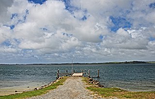
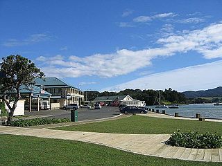
In the 19th century, Houhora Harbour provisioned whalers, and residents mounted their own whaling expeditions in open boats. [9] Three families – Wagener, Subritzky and Yates – settled in the area to farm and trade. [11] The Subritzky family, who arrived near Motueka in 1843, claim to be New Zealand's first Polish settlers. They moved to Australia and then to Houhora Heads. [12] Their homestead there took two years to build in the 1860s. It was sold to a member of the Wagener family in 1897. [9] The homestead, now largely restored, is open to the public. [13] The Wagener Museum at Houhora Heads, built by W. E. Wagener, [9] was built near the homestead. It contained an eclectic collection of artefacts, but closed in 2003 and a substantial part of the collection was sold off. [14]
A lifeboat from SS Elingamite, which was wrecked on the Three Kings Islands on 9 November 1902, arrived in Houhora the following day with 52 survivors. One of the whalers immediately was dispatched to intercept any vessel along the coast to divert it to the Three Kings. This mission was successful. [9]
In the latter 19th century and early 20th century, land around Houhora was used for the kauri gum digging trade. By the 1910s, the kauri gum industry was centred in Houhora and Ahipara. [15]
Demographics
Houhora is in an SA1 statistical area which covers 26.05 km2 (10.06 sq mi). [1] The SA1 area is part of the larger North Cape statistical area. [16]
Historical population| Year | Pop. | ±% p.a. |
|---|
| 2006 | 111 | — |
|---|
| 2013 | 144 | +3.79% |
|---|
| 2018 | 174 | +3.86% |
|---|
| Source: [2] |
The SA1 statistical area had a population of 174 at the 2018 New Zealand census, an increase of 30 people (20.8%) since the 2013 census, and an increase of 63 people (56.8%) since the 2006 census. There were 60 households, comprising 78 males and 93 females, giving a sex ratio of 0.84 males per female. The median age was 50.2 years (compared with 37.4 years nationally), with 42 people (24.1%) aged under 15 years, 18 (10.3%) aged 15 to 29, 78 (44.8%) aged 30 to 64, and 30 (17.2%) aged 65 or older.
Ethnicities were 48.3% European/Pākehā, 58.6% Māori, and 6.9% Pacific peoples. People may identify with more than one ethnicity.
Of those people who chose to answer the census's question about religious affiliation, 31.0% had no religion, 44.8% were Christian and 6.9% had Māori religious beliefs.
Of those at least 15 years old, 6 (4.5%) people had a bachelor or higher degree, and 36 (27.3%) people had no formal qualifications. The median income was $21,600, compared with $31,800 nationally. 9 people (6.8%) earned over $70,000 compared to 17.2% nationally. The employment status of those at least 15 was that 48 (36.4%) people were employed full-time, 18 (13.6%) were part-time, and 6 (4.5%) were unemployed. [2]

The Northland Region is the northernmost of New Zealand's 16 local government regions. New Zealanders sometimes refer to it as the Winterless North because of its mild climate all throughout the year. The main population centre is the city of Whangārei, and the largest town is Kerikeri. At the 2018 New Zealand census, Northland recorded a population growth spurt of 18.1% since the previous 2013 census, placing it as the fastest growing region in New Zealand, ahead of other strong growth regions such as the Bay of Plenty Region and Waikato.
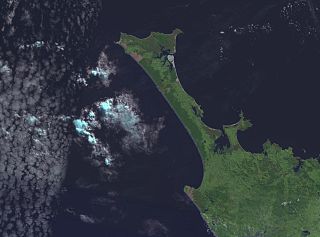
The Aupōuri Peninsula is a tombolo at the northern tip of the North Island of New Zealand. It projects between the Tasman Sea to the west and the Pacific Ocean to the east. It constitutes the northern part of the Far North District, incorporating North Cape, Houhora and the northern half of Awanui.
Parengarenga Harbour is a natural harbour close to the northernmost point on the North Island of New Zealand. Located at the northern end of the Aupōuri Peninsula, it extends inland for over 10 kilometres, almost severing the northern tip of the island from the rest of the peninsula. The harbour's mouth is towards the northern end of Great Exhibition Bay. The island's northernmost point, at the Hikurua / de Surville Cliffs is only about 10 kilometres north of the harbour. Te Hāpua is a settlement at the western side of the harbour.

Ahipara is a town and locality in Northland, New Zealand at the southern end of Ninety Mile Beach, with the Tauroa Peninsula to the west and Herekino Forest to the east. Ahipara Bay is to the north west. Kaitaia is 14 km to the north east, and Pukepoto is between the two.
Awanui is an historical river port in the far north of New Zealand, on the banks of the Awanui River just before it flows into Rangaunu Bay. Awanui lies at the south end of the Aupouri Peninsula in the Far North District Council of the Northland Region, approximately 7 km north of Kaitaia. The river port has ceased operation and a recreational wharf is located at Unahi, on the shore of Rangaunu Bay, approximately 3 km north of the township. The traditional name of Awanui was Kaiwaka and Awanui proper refers to the "River at Kaiwaka". According to the 2013 New Zealand census, Awanui has a population of 339, a decrease of 9 people since the 2006 census.

Herekino is a locality in Northland, New Zealand. It lies 26 km south west of Kaitaia. The Herekino Harbour, also called the Herekino River, is an estuary and inlet from the Tasman Sea to the west. The Herekino Forest, which contains a stand of large kauri, is to the north, and the Tauroa Peninsula lies to the north west.
Ngataki is a community on the Aupouri Peninsula in Northland, New Zealand. State Highway 1 runs through the area. To the east is Rarawa Beach, a mile-long strip of clean silver sand, gently shelving and backed by sand dunes. To the north-east is the Great Exhibition Bay and Rarawa Bay and to the south-west is the long Ninety Mile Beach coastline.
Te Kao is a village on the Aupouri Peninsula of Northland, New Zealand. Te Aupōuri are mana whenua over Te Kao and the surrounding district, and it is the principal settlement of the iwi (tribe). Te Aupōuri's Post-Settlement Governance Entity, Te Runanga Nui o Te Aupōuri, has an office at Te Kao, along with the iwi's marae and urupa. State Highway 1 passes through the district. Cape Reinga is 46 km to the north, and Houhora is 24 km to the south. The Aupouri Forest and Ninety Mile Beach are to the west.

The Karikari Peninsula on the east coast of the far north of Northland, New Zealand, is between Rangaunu Harbour to the west, and Doubtless Bay to the southeast. It is a right-angled land mass of two relatively distinct parts. The rocky northern part, which has an east–west orientation and is approximately 17 km long, was originally an island but is now connected to the mainland by a low sandy tombolo approximately 11 km long, which has a north–south orientation. The spiritually significant Puwheke sits high above the north-facing beaches.

Whangape Harbour is a harbour on the west coast of Northland, New Zealand. There is a settlement called Whangape on the northern side of the harbour. Another, called Pawarenga, is located on the southern side. Kaitaia is 42 km north east.
Panguru is a community in the northern Hokianga harbour, in Northland, New Zealand. The Whakarapa Stream flows from the Panguru Range in the Warawara Forest to the west, through Panguru and into the Hokianga.
Waiharara is a community at the base of the Aupouri Peninsula in Northland, New Zealand. State Highway 1 runs through the community. To the west is Aupouri Forest, and beyond that Ninety Mile Beach. To the east is Rangaunu Harbour. Houhora is 22 km north west, and Awanui is 16 km south east. Lake Waiparera, 35 metres above sea level, is immediately to the north west.
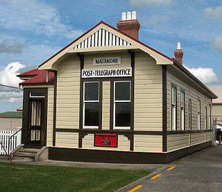
Matakohe is a settlement in Northland, New Zealand. The Matakohe River is a short river which runs from the north into the Arapaoa River, which is part of the Kaipara Harbour. State Highway 12 passes through Matakohe. Ruawai is 16 km to the west, and Paparoa is 6 km north east. The Hukatere Peninsula extends south into the Kaipara Harbour.

Tinopai is a settlement on the Komiti Bay, part of the Hukatere Peninsula in the northern Kaipara Harbour in Northland, New Zealand. The Otamatea River flows from the north east past Tinopai and into the harbour. Matakohe is 23 km (14 mi) to the north.
Rangaunu Harbour is a shallow harbour in the far north of New Zealand. It is situated on the east coast at the base of the Aupouri Peninsula. The name in Māori means "To pull out a shoal of fish". With an area of 115 square kilometres (44 sq mi) it is the fifth-largest harbour in New Zealand.
Kaimaumau is a locality on the northwest side of Rangaunu Harbour and on east side of the Aupouri Peninsula of Northland, New Zealand.
Mangōnui is a settlement on the west side of Mangōnui Harbour in Northland, New Zealand. State Highway 10 runs through it. It is the easternmost of the Taipa-Mangonui string of settlements, separated from Coopers Beach to the northwest by Mill Bay Road.
Waipapakauri is a small settlement in the Far North District of New Zealand. It is located on State Highway 1 at the isthmus of the Aupouri Peninsula. The larger settlement of Awanui lies to the southeast. Waipapakauri is some 12 kilometres to the north of Kaitaia, the nearest town.

Ngāwini Yates was a part-Māori New Zealander, who was a storekeeper, farmer and businesswoman in the far north of New Zealand in the later part of the 19th century.
Samuel Yates was an English-born New Zealander, who was a storekeeper, farmer and businessman in the far north of New Zealand in the later part of the 19th century. His land holdings were so extensive, he was known as the "King of the North".


