de Surville
French explorer Jean-François-Marie de Surville and his crew in the ship St Jean Baptiste were the first Europeans to enter Doubtless Bay, just 8 days after James Cook had named it. They anchored off Rangiawhia Pa, just north east of Whatuwhiwhi, on 17 December 1769, and gathered cresses and green plants from the shore. Here Father Paul-Antoine Léonard de Villefeix (chaplain on the St Jean Baptiste) conducted the first Christian service in New Zealand waters when he celebrated Mass on Christmas Day 1769. A storm on 27 December stranded a party of men on shore at Whatuwhiwhi, where they were treated hospitably by the local Māori. In the same storm, the ship dragged her anchors, which had to be cut. [6] The ship's yawl, which was in tow, struck rocks and was also cut free.
After the storm, and the stranded party had returned to the ship, on 31 December 1769, the yawl was spotted ashore on Tokerau Beach surrounded by Māori, and an armed party set off to retrieve it. They found a group of Māori carrying spears, and the chief, Ranginui, approached de Surville carrying a twig of green leaves as a sign of peace. De Surville arrested Ranginui for the theft of his boat. His party burned about 30 huts, destroyed one canoe filled with nets, and confiscated another. They brought Ranginui back to their ship, where the crew members who had been stranded during the storm identified him as the chief who had been hospitable to them. However, De Surville was determined to keep his captive, and St Jean Baptiste sailed for Peru the same day with Ranginui on board. He died of scurvy, 12 weeks later. [7]
A plaque commemorating this visit was unveiled at Whatuwhiwhi in 1969. The anchors abandoned during the storm were located and raised in a community effort on 21 December 1974. [8] [9] [10]
Demographics
Statistics New Zealand describes Karikari, which corresponds to Whatuwhiwhi, as a rural settlement. It covers 6.66 km2 (2.57 sq mi). [1] Whatuwhiwhi is part of the larger Karikari Peninsula statistical area. [11]
Historical population| Year | Pop. | ±% p.a. |
|---|
| 2006 | 399 | — |
|---|
| 2013 | 468 | +2.30% |
|---|
| 2018 | 492 | +1.01% |
|---|
| Source: [2] |
Whatuwhiwhi had a population of 492 at the 2018 New Zealand census, an increase of 24 people (5.1%) since the 2013 census, and an increase of 93 people (23.3%) since the 2006 census. There were 171 households, comprising 240 males and 252 females, giving a sex ratio of 0.95 males per female, with 99 people (20.1%) aged under 15 years, 51 (10.4%) aged 15 to 29, 210 (42.7%) aged 30 to 64, and 141 (28.7%) aged 65 or older.
Ethnicities were 52.4% European/Pākehā, 57.9% Māori, 8.5% Pacific peoples, 1.2% Asian, and 2.4% other ethnicities. People may identify with more than one ethnicity.
Of those people who chose to answer the census's question about religious affiliation, 40.9% had no religion, 49.4% were Christian, 1.2% had Māori religious beliefs, 0.6% were Hindu, 0.6% were Muslim and 1.2% had other religions.
Of those at least 15 years old, 30 (7.6%) people had a bachelor or higher degree, and 96 (24.4%) people had no formal qualifications. 24 people (6.1%) earned over $70,000 compared to 17.2% nationally. The employment status of those at least 15 was that 132 (33.6%) people were employed full-time, 63 (16.0%) were part-time, and 33 (8.4%) were unemployed. [2]
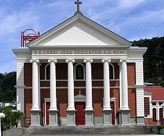
The Catholic Church in New Zealand is part of the worldwide Catholic Church under the leadership of the Pope in Rome, assisted by the Roman Curia, and with the New Zealand bishops.
Thames is a town at the southwestern end of the Coromandel Peninsula in New Zealand's North Island. It is located on the Firth of Thames close to the mouth of the Waihou River. The town is the seat of the Thames-Coromandel District Council. The Māori iwi are Ngāti Maru, who are descendants of Marutuahu's son Te Ngako. Ngāti Maru is part of the Ngati Marutuahu confederation of tribes or better known as Hauraki Iwi.

Jean-François Marie de Surville was a merchant captain with the French East India Company. He commanded a voyage of exploration to the Pacific in 1769–70.

Ōpunake is a small town on the southwest coast of Taranaki in New Zealand's North Island. It is located 45 kilometres southwest of New Plymouth. Rahotu is 16 km to the northwest. Manaia is 29 km to the southeast. State Highway 45 passes through the town. The town has a population of 1,440.
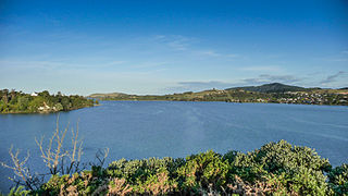
Taipa-Mangonui or Taipa Bay-Mangonui is a string of small resort settlements – Taipa, Cable Bay, Coopers Beach, and Mangōnui – that lie along the coast of Doubtless Bay and are so close together that they have run together to form one larger settlement.
Ngā Tamatoa was a Māori activist group that operated throughout the 1970s to promote Māori rights, fight racial discrimination, and confront injustices perpetrated by the New Zealand Government, particularly violations of the Treaty of Waitangi.
A taua is a war party in the tradition of the Māori, the indigenous people of New Zealand. Contemporary knowledge of taua is gleaned from missionary observations and writings during the Musket Wars of the early 19th century and the later New Zealand wars. The reason to gather a taua may be for reasons of seeking revenge (utu) or seeking compensation for an offence against an individual, community or society (muru).
Christianity in New Zealand dates to the arrival of missionaries from the Church Missionary Society who were welcomed onto the beach at Rangihoua Bay in December 1814. It soon became the predominant belief amongst the indigenous people with over half of Māori regularly attending church services within the first 30 years. Christianity remains New Zealand's largest religious group, but no one denomination is dominant and there is no official state church. According to the 2018 census while 37.3% of the population identified as Christian. The largest Christian groups are Anglican, Catholic and Presbyterian. Christian organisations are the leading non-government providers of social services in New Zealand.

Peria is a locality in Northland, New Zealand. It lies south of Taipa and east of Kaitaia. The area was once known as Oruru Valley.

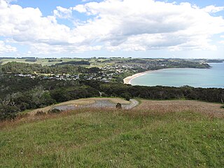
The Karikari Peninsula on the east coast of the far north of Northland, New Zealand, is between Rangaunu Harbour to the west, and Doubtless Bay to the southeast. It is a right-angled land mass of two relatively distinct parts. The rocky northern part, which has an east–west orientation and is approximately 17 km long, was originally an island but is now connected to the mainland by a low sandy tombolo approximately 11 km long, which has a north–south orientation. The spiritually significant Puwheke sits high above the north-facing beaches.

Ngāti Kahu is a Māori iwi of Northland, New Zealand. The iwi is one of the six Muriwhenua iwi of the far north of the North Island. Ngāti Kahu take their name from their founding ancestress, Kahutianui, and link their ancestry back to the waka Māmaru. The captain of Māmaru was Te Parata who married Kahutianui.
The first humans are thought to have arrived in New Zealand from Polynesia some time around 1300 AD. The people, who later became known as Māori, eventually travelled to almost every part of the country. Their arrival had a significant impact on the local fauna, particularly the flightless birds such as moa.
Paul-Antoine Léonard de Villefeix OP was a French Dominican priest. He conducted the first Christian service in New Zealand. He was the chaplain of French navigator and explorer Jean-François-Marie de Surville when de Surville, in his ship, the Saint Jean Baptiste, sighted the North Island of New Zealand in 1769. De Surville remained two weeks in Doubtless Bay, near Whatuwhiwhi, where Villefeix celebrated the first Mass in New Zealand waters on Christmas Day 1769.
Doubtless Bay is a bay on the east coast of the Northland Region, north-east of Kaitaia, in New Zealand. It extends from Knuckle Point on Karikari Peninsula in the north to Berghan Point at Hihi in the south. There are rocky headlands, backed by many extensive beaches, such as Tokerau Beach, Taipa, Cable Bay, Coopers Beach, and Mangonui Harbour.
Te Waharoa was the leader of the Ngāti Hauā iwi of the eastern Waikato in New Zealand in the 1820s and 1830s.
Waioeka is a rural community in the Ōpōtiki District and Bay of Plenty Region of New Zealand's North Island. It is on the east bank of the Waioeka River.
Welcome Bay is a suburb of Tauranga, New Zealand. It is located 7 kilometres (4.3 mi) from central Tauranga. Neighbouring suburbs include Hairini and Maungatapu. There are a number of schools in Welcome Bay, including three primary schools.
Hairini is a suburb of Tauranga in the Bay of Plenty region of New Zealand's North Island.

Te Kitohi "Kito" Wiremu Pikaahu is a Māori Anglican bishop. He has been the incumbent of the Episcopal polity of Te Pīhopatanga o Te Tai Tokerau since 2002.
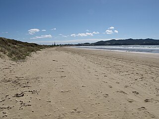
Tokerau Beach is a settlement on the northwestern side of Doubtless Bay on the Karikari Peninsula of Northland, New Zealand.


