List of shipwrecks of Canada

Last updated

This is a list of shipwrecks located in or off the coast of Canada.

Contents

The Norwegian steamship Imo (damaged in the Halifax Explosion in 1917) Halifax explosion - Imo.jpg
The Norwegian steamship Imo (damaged in the Halifax Explosion in 1917)


British Columbia

ShipFlagSunk dateNotesCoordinates
HMCS Annapolis Naval ensign of Canada.svg  Royal Canadian Navy 4 April 2015A decommissioned Annapolis-class destroyer scuttled to form an artificial reef in Halkett Bay Provincial Park off Gambier Island in Howe Sound, British Columbia, Canada. 49°26′57″N123°19′51″W / 49.44917°N 123.33083°W / 49.44917; -123.33083 (HMCS Annapolis (DDH 265))
Anscomb Flag of Canada (Pantone).svg  Canada January 2003The ferry was docked at Woodbury marina by the private owner and sunk from a frozen cracked pipe at Woodbury, British Columbia.
Beaver Canadian Red Ensign (1868-1921).svg  Canada 25 July 1888A steamship run aground on rocks at Prospect Point in Vancouver's Stanley Park.
Bonnington Canadian Red Ensign (1957-1965).svg  Canada 1960A steamboat that retired from service and was partially dismantled before sinking off the shore off Beaton.
USAT Brigadier General M. G. Zalinski Flag of the United States (1912-1959).svg United States Army 26 September 1946A troopship that struck the rocks and sank off Pitt Island.
HMCS Charlottetown Naval Ensign of the United Kingdom.svg  Royal Canadian Navy 1947A River-class frigate that was scuttled as a breakwater in Oyster Bay.
HMCS Chaudière Flag of Canada (WFB 2000).png  Maritime Command 1992A Restigouche-class destroyer sunk as an artificial reef in Sechelt Inlet.
City of Ainsworth Canadian Red Ensign (1868-1921).svg  Canada 29 November 1898A paddle steamer sternwheeler sunk during a storm in Kootenay Lake.
Clallam 8 January 1904A steamboat that sunk in a storm in the Strait of Juan de Fuca.
HMCS Columbia Flag of Canada (WFB 2000).png  Maritime Command 1996A Restigouche-class destroyer that was sunk as an artificial reef.
Cowichan Canadian Red Ensign (1921-1957).svg  Canada 27 December 1925A steamship that sank in a collision with Lady Cynthia near the Whyte Rocks.
Eaglescliffe Hall Canadian Red Ensign (1957-1965).svg  Canada 25 October 1961A bulk freighter that served in World War II and later sank while under tow.
Ericsson 22 November 1892Blown aground at the entrance to Barkley Sound, designed by inventor John Ericsson in 1851
Florence Flag of the United States (1896-1908).svg  United States December 1902A clipper believed to have foundered in a storm off Cape Flattery.
HMS Grappler Naval Ensign of the United Kingdom.svg  Royal Navy 3 May 1883An Albacore-class gunboat that caught fire and sank in Discovery Passage.
HMCS Huron Flag of Canada (WFB 2000).png  Maritime Command 14 May 2007An Iroquois-class destroyer sunk as a target.
HMCS Mackenzie 16 September 1995A Mackenzie-class destroyer scuttled as an artificial reef off Sidney. 48°40.094′N123°17.17′W / 48.668233°N 123.28617°W / 48.668233; -123.28617 (HMCS Mackenzie (DDE 261))
Malahat Canadian Red Ensign (1921-1957).svg  Canada March 1944A schooner and rum-runner during the Prohibition era, that foundered in Barkley Sound and was towed to Powell River.
Mariposa Canadian Red Ensign (1905-1922).svg  Canada 18 December 1917Ran aground in the Salish Sea.
Mount Royal Canadian Red Ensign (1907-1921).png  Canada 6 July 1907A Canadian sternwheeler sunk in the Skeena River.
Nechacco April 1911A sternwheeler that broke apart in ice on the Fraser River.
Pacific Canadian Red Ensign (1905-1922).svg  Canada 4 November 1875A sidewheel steamer sunk following a collision with SS Orpheus.
Princess Sophia Canadian Red Ensign (1907-1921).png  Canada 25 October 1918A steamer that ran aground on Vanderbilt Reef and sank the following day. 58°36′08″N135°01′25″W / 58.6022°N 135.0236°W / 58.6022; -135.0236 (Princess Sophia (steamer))
Queen of the North Flag of Canada (Pantone).svg  Canada 22 March 2006A ro-ro ferry run aground on Gil Island in Wright Sound. 53°19.917′N129°14.729′W / 53.331950°N 129.245483°W / 53.331950; -129.245483 (MV Queen of the North)
Quesnel Canadian Red Ensign (1921-1957).svg  Canada 13 May 1921A sternwheeler that was wrecked on the Fraser River.
San Pedro Canadian Red Ensign (1868-1921).svg  Canada 24 November 1891A 3,119-ton iron steamship built 1882 by William Cramp & Sons, Philadelphia ran aground Brotchie Ledge Victoria, British Columbia [1] 48°24′23″N123°23′17″W / 48.4065°N 123.3880°W / 48.4065; -123.3880 (SS San Pedro)
HMCS Saskatchewan Flag of Canada (WFB 2000).png  Maritime Command 14 June 1997A Mackenzie-class destroyer scuttled as an artificial reef off Nanaimo.
Sechelt Canadian Red Ensign (1907-1921).png  Canada 24 March 1911A steamboat that sank off Race Rocks Light.
USS South Dakota Flag of the United States.svg  United States Navy 18 February 1961A Pennsylvania-class armored cruiser that was sold for scrap and sunk in Powell River.
USS Tattnall Flag of the United States (1912-1959).svg  United States Navy 1946A Wickes-class destroyer sunk a breakwater off Royston.
Tonquin Flag of the United States (1795-1818).svg  United States June 1811An American merchant ship blown up at Clayoquot Sound, Vancouver Island.
Valencia Canadian Red Ensign (1905-1922).svg  Canada 23 January 1906A passenger steamer wrecked off the coast of Vancouver Island. 48°42′20″N125°00′21″W / 48.70556°N 125.00583°W / 48.70556; -125.00583 (SS Valencia)
Vanlene14 March 1972A 10,500-ton freighter carrying cars, built in 1951. The ship ran aground near Austin Island in Barkley Sound due to navigation error. [2]

Manitoba

ShipFlagSunk dateNotesCoordinates
Alpha Canadian Red Ensign (1868-1921).svg  Canada 1885A riverboat grounded in the Assiniboine River
Graham Bell Flag of Canada (Pantone).svg  Canada 1992A tugboat grounded near Churchill, Manitoba; Later scuttled 1992 as Canada's first Arctic Underwater Research Station
Ithaka Flag of Greece.svg  Greece 14 September 1960A cargo ship that ran aground near Churchill. 58°46′9″N93°53′21″W / 58.76917°N 93.88917°W / 58.76917; -93.88917 (SS Ithaka)
Port Nelson Canadian Red Ensign (1921-1957).svg  Canada 1924A large dredge grounded on the abandoned pier at Port Nelson, Manitoba
Princess Canadian Red Ensign (1868-1921).svg  Canada 24 August 1906A steamboat that was wrecked in a storm off George Island.

New Brunswick

ShipFlagSunk dateNotesCoordinates
Transpet Flag of Panama.svg  Panama 30 October 1951A tanker that suffered an internal explosion off Miscou Island.
Walton Canadian Red Ensign (1868-1921).svg  Canada 14 September 1878A barque that ran aground in fog off Grand Manan Island.

Newfoundland and Labrador

ShipFlagSunk dateNotesCoordinates
Abyssinia Canadian Red Ensign (1868-1921).svg  Canada 18 December 1891A steamship destroyed by a fire in the cargo hold.
AdministratrixCanadian Red Ensign (1921-1957).svg  Canada 1948A motor vessel that collided with Lovadal in fog near Cape Race.
HMS Aeneas Naval Ensign of the United Kingdom.svg  Royal Navy 23 October 1805A troopship that ran ashore near the Isle aux Morts with the loss of over 200 lives.
Anglo Saxon Civil Ensign of the United Kingdom.svg  United Kingdom 27 April 1863A British Allan liner that ran aground off Cape Race, with 237 deaths.
Anton van Driel Flag of the Netherlands.svg  Netherlands 1919A Dutch steamboat that sank near Cape Race.
Arctic Flag of the United States (1851-1858).svg  United States 27 September 1854A paddle steamer that collided with the steamer Vesta and sank near Cape Race.
Arctic Explorer Flag of Canada (Pantone).svg  Canada 3 July 1981An icebreaker that sank off the Strait of Belle Isle, three hours after departing St Anthony.
Argo Government Ensign of the United Kingdom.svg  United Kingdom 28 June 1859A steamboat that ran aground on a reef at Trepassey Bay.
Azariah 16 March 1831A sealing ship from Cupids that ran aground on Baccalieu Island.
Belgian Civil Ensign of the United Kingdom.svg  United Kingdom 27 June 1941A steamboat that was torpedoed by U-96 near the Peckford Reef. 49°30′38″N53°51′30″W / 49.51056°N 53.85833°W / 49.51056; -53.85833 (SS Belgian)
Bristol City 5 May 1943A cargo ship that was torpedoed by U-358 east of Newfoundland, Canada. 54°00′N43°55′W / 54.000°N 43.917°W / 54.000; -43.917 (Bristol City (1920))
Caribou Dominion of Newfoundland Red Ensign.svg  Newfoundland 14 October 1942A Newfoundland Railway ferry that was torpedoed by U-69 off Port aux Basques. 47°19′N59°29′W / 47.317°N 59.483°W / 47.317; -59.483 (SS Caribou)
City of Philadelphia Civil Ensign of the United Kingdom.svg  United Kingdom 9 September 1854A British steamboat that ran aground and sunk in fog near Cape Race.
HMS Comus Naval Ensign of the United Kingdom.svg  Royal Navy 24 October 1816A Laurel-class post ship that ran aground and sank in fog near Cape Race.
HMS Crusader 14 September 1942A C-class destroyer that was torpedoed by German submarine U-91 off St. John's.
Delmar Civil Ensign of the United Kingdom.svg  United Kingdom 1901A Scottish steamer that sank near Cape Race in 1901.
HMS Despatch Naval Ensign of the United Kingdom.svg  Royal Navy 10 July 1828A British brig that sank near Isle aux Morts.
HMS Drake 1822Ran aground and sank near St. Shotts.
HMS Duchess of Cumberland Naval Ensign of Great Britain (1707-1800).svg  Royal Navy 22 September 1781A sloop that was wrecked near Cape Ray.
Duchess of Fife 1907A schooner that sank near Bonavista.
Dunbrody 1875A barque that foundered off the Labrador coast.
Earlshall Dominion of Newfoundland Red Ensign.svg  Newfoundland 24 January 1915A Job Bros. & Co iron-hulled barque that ran aground and sank off Petty Harbour-Maddox Cove during a winter storm. No loss of life.
Erik Civil Ensign of the United Kingdom.svg  United Kingdom 25 August 1918A sealing/whaling steamer that was torpedoed off St. Pierre and Miquelon by U-156.
Ethie Canadian Red Ensign (1907-1921).png  Canada 11 December 1919A coastal steamship that ran aground in a fierce storm.
Flare Flag of Cyprus.svg  Cyprus 16 January 1998A bulk carrier that sank in a storm near Saint Pierre and Miquelon.
Florence Flag of the United States (1837-1845).svg  United States 9 August 1840An American brig of 200 tons, out of Rotterdam, that sank in the fog near Cape Race with 50 dead.
Florizel Dominion of Newfoundland Red Ensign.svg  Newfoundland 23 February 1918The passenger ship ran aground at Horn Head Point, Cappahayden and was wrecked with the loss of 94 lives 46°50′56″N52°56′20″W / 46.84889°N 52.93889°W / 46.84889; -52.93889 (SS Florizel)
SS Flynderborg Civil Ensign of the United Kingdom.svg  United Kingdom 3 November 1941A merchant ship that was torpedoed by U-202 northeast of Notre Dame Bay, Newfoundland. 51°21′N51°45′W / 51.350°N 51.750°W / 51.350; -51.750 (SS Flynderborg)
George Cromwell 1877A British steamer that sank near Cape Race.
George Washington Flag of the United States (1867-1877).svg  United States 1877An American steamer that sank near Cape Race.
Germania Flag of the German Empire.svg  Germany 1869A German steamer that sank in fog near Cape Race.
Greenland Canadian Red Ensign (1868-1921).svg  Canada 1898A sealing steamer that lost 48 men on the ice.
Harcourt Kent Canadian Red Ensign (1921-1957).svg  Canada 1949A motor ship that sank near Cape Race.
HarpoonerGovernment Ensign of the United Kingdom.svg  United Kingdom 1816A British transport that ran aground and sank in fog near Cape Race. [3] She was on a voyage from Quebec City, Lower Canada, British North America to an English port. [4]
Harvest Home Civil Ensign of the United Kingdom.svg  United Kingdom 1833A British ship that sank off Cape Race.
Helgoland Flag of the German Empire.svg  Germany 1900A German steamer that sank near Cape Race.
Indian Civil Ensign of the United Kingdom.svg  United Kingdom 1859A British Allan liner that sank off Cape Race.
Kristianiafjord Flag of Norway.svg  Norway 15 June 1917A Norwegian liner that ran aground in fog near Cape Race.
Kyle Flag of Canada (Pantone).svg  Canada 4 February 1967A troopship that ran aground in Harbour Grace.
Labrador Civil Ensign of the United Kingdom.svg  United Kingdom 3 March 1913Built for the Hudson Bay Company in 1891 by Watson of Sunderland England, purchased in 1909 by James Baird Ltd. of St. John’s for the seal fishery. Sprang a leak while butting through slob ice in heavy seas. Engineers kept it afloat for 30 hours to reach St. Mary's Bay, where it ran onto rocks at Branch. All crew were saved.
Lady of the Lake 11 May 1833A Scottish brig sunk near Cape St. Francis. 46°30′N47°06′W / 46.50°N 47.10°W / 46.50; -47.10 (Lady of the Lake (brig))
Lady Sherbrooke 9 August 1831A barque that sank in a gale near Port Aux Basques. The ship was wrecked on Mouse Island, in the Gulf of Saint Lawrence with the loss of 241 of the 273 people on board. She was on a voyage from Londonderry to Quebec, British North America. Her captain was subsequently found guilty of willfully wrecking the ship and was sentenced to death. [5] [6]
Lion 6 January 1882Reported missing in Baccalieu Tickle.
Lord Strathcona Canadian Red Ensign (1921-1957).svg  Canada 5 September 1942An iron-ore carrier that was torpedoed by U-513 off Bell Island. 47°35′18″N52°58′10″W / 47.58833°N 52.96944°W / 47.58833; -52.96944 (Lord Strathcona (ship))
Maggie6 November 1896A schooner that sank in the St.John's Narrows due to a collision with the Tiber [7]
Marsland Civil Ensign of the United Kingdom.svg  United Kingdom 2 July 1933An English cargo vessel that ran aground on the Vestal Rocks outside St. John's, Newfoundland.
Marvale Canadian Red Ensign (1921-1957).svg  Canada 1923A Canadian Pacific liner.
Marvita 15 July 1954A Canadian Customs boat that ran aground and foundered off Cape Ballard.
Ocean Ranger Flag of the United States.svg  United States 15 February 1982A semi-submersible offshore oil drilling unit that sank in a storm off St. John's. 46°43′33.53″N48°50′9.13″W / 46.7259806°N 48.8358694°W / 46.7259806; -48.8358694 (Ocean Ranger)
Phyllis Naval Ensign of Great Britain (1707-1800).svg  Royal Navy October 1795The ship was wrecked near the Burin Peninsula, with some loss of life.
P.L.M. 27 Civil Ensign of the United Kingdom.svg  United Kingdom 26 June 1941An iron-ore carrier that was torpedoed by U-123 off Bell Island.
USS Pollux Flag of the United States (1912-1959).svg  United States Navy 18 February 1942A supply ship that sank along with USS Truxtun in a storm. 46°54′1″N55°33′51″W / 46.90028°N 55.56417°W / 46.90028; -55.56417 (USS Pollux (AKS-2))
President Coaker Canadian Red Ensign (1921-1957).svg  Canada 1924A schooner sunk in a gale near Cape Race.
Queen of Swansea Civil Ensign of the United Kingdom.svg Canada 1867Ran aground and sunk in storm at Gull Island.
HMS Raleigh Naval Ensign of the United Kingdom.svg  Royal Navy 8 August 1922A Hawkins-class heavy cruiser that sank in fog at Point Amour in Strait of Belle Isle.
Regulus Dominion of Newfoundland Red Ensign.svg  Newfoundland 23 October 1910An A. Harvey & Company bulk carrier that ran aground and sank off Petty Harbour-Maddox Cove while under tow during a southeast gale. All 19 crew were lost.
Rose Castle Canadian Red Ensign (1921-1957).svg  Canada 2 November 1942An iron-ore carrier that was torpedoed by U-518 off Bell Island.
Royal Oak Civil Ensign of the United Kingdom.svg  United Kingdom 11 October 1823 to 19 October 1823300 tons burthen snow brig left Quebec on 11 October with timber cargo, struck by large wave off Seven Islands on 14 October and badly damaged, swept south by storm until 19 October off Cap Roziere, New Brunswick when four surviving crew members were rescued by the vessel Margaret passing en route to Quebec. Royal Oak presumed foundered. Reported in Quebec Courant.Source: Quebec Courant 30 Oct 1823.
Saganaga 5 September 1942An iron-ore carrier that was torpedoed by a U-513 off Wabana, Newfoundland.
San Juan de Pasajes Flag of the Basque Country.svg Basques December 1565While sitting at anchor in Red Bay bay with other whaling ships, she broke her moorings during a storm, struck an island and sank with a full load of 1,000 casks of oil. 51°43′55″N56°25′32″W / 51.73194°N 56.42556°W / 51.73194; -56.42556 (San Juan de Pasajes)
Santa Celia Flag of Spain (Civil).svg  Spain 22 November 1972Cod-fishing trawler, she burned in November 1972 in Saint Pierre and was sunk in the Gulf of St Lawrence. 46°33′N56°50′W / 46.550°N 56.833°W / 46.550; -56.833 (Santa Celia (ship))
HMS Sapphire English Red Ensign 1620.svg Kingdom of England 11 September 1696A fifth-rate warship that was scuttled to prevent capture by France.
Sea Clipper Civil Ensign of the United Kingdom.svg Canada 1867A schooner that sank in a storm near Spotted Island, Labrador.
HMCS Shawinigan Naval Ensign of the United Kingdom.svg  Royal Canadian Navy 25 November 1944A Flower-class corvette that was torpedoed by U-1228 off Channel-Port aux Basques. 47°34′N59°11′W / 47.567°N 59.183°W / 47.567; -59.183 (HMCS Shawinigan (K136))
Southern Cross Canadian Red Ensign (1907-1921).png  Canada 31 March 1914A Newfoundland sealing steamer that was lost in a blizzard.
RMS Titanic Government Ensign of the United Kingdom.svg  United Kingdom 15 April 1912A British passenger liner operated by the White Star Line that sank in the North Atlantic Ocean 320 nautical miles (590 km; 370 mi) south-southeast of Newfoundland, Canada on 15 April 1912, after striking an iceberg during her maiden voyage. 41°43′57″N49°56′49″W / 41.7325°N 49.946944°W / 41.7325; -49.946944
Titan Flag of the Bahamas.svg  Bahamas 18 June 2023Imploded during its descent in the North Atlantic Ocean, 320 nautical miles (590 km; 370 mi) off the coast of Newfoundland. 41°43′55″N49°56′45″W / 41.731944°N 49.945833°W / 41.731944; -49.945833
HMS Tweed Naval Ensign of the United Kingdom.svg  Royal Navy 5 November 1813Sunk in a storm near Bay Bulls.
U-174 War ensign of Germany (1938-1945).svg  Kriegsmarine 16 November 1942A Type IXC U-boat that was sunk by an American aircraft southwest of Newfoundland, Canada. 43°35′N56°18′W / 43.583°N 56.300°W / 43.583; -56.300 (German submarine U-174)
U-438 6 May 1943A Type VIIC U-boat sunk by depth charges off Newfoundland.
U-520 30 October 1942A Type IXC U-boat sunk by Canadian aircraft off St. John's. 47°47′N49°50′W / 47.783°N 49.833°W / 47.783; -49.833 (German submarine U-520)
U-656 1 March 1942A Type VIIC U-boat sunk by depth charges off Cape Race.
U-1229 20 August 1944A Type IXC/40 U-boat that was sunk by Allied aircraft southeast of Newfoundland. 42°20′N51°39′W / 42.333°N 51.650°W / 42.333; -51.650 (German submarine U-1229)
Viking Canadian Red Ensign (1921-1957).svg  Canada 15 March 1931A sealing barque that exploded off Horse Islands during the shooting of extra footage for the film The Viking, killing 27, including the film's producer.
Village Belle 1872A schooner that was lost at Cape St. Francis.
Waterwitch 1875Sunk near Pouch Cove.
William Carson Flag of Canada (Pantone).svg  Canada 3 June 1977A Canadian National ferry that struck an iceberg.

Northwest Territories

ShipFlagSunk dateNotesCoordinates
HMS Investigator Naval Ensign of the United Kingdom.svg  Royal Navy After 3 June 1853Arctic exploration ship, part of the McClure Arctic expedition. Icebound in Mercy Bay, abandoned June 1853. Found in the Beaufort Sea, July 2010. 74°05′04″N119°00′09″W / 74.084397°N 119.002619°W / 74.084397; -119.002619 (HMS Investigator (1848))

Nova Scotia

ShipFlagSunk dateNotesCoordinates
CGS Aberdeen Canadian Blue Ensign (1921-1957).svg  Canada 13 October 1923A buoy tender that ran aground on the wreck of Snipe off Seal Island.
Arctic Bear Flag of the United States.svg  United States 19 March 1963A steamship that foundered off Cape Sable Island while under tow. 42°40′N65°11′W / 42.667°N 65.183°W / 42.667; -65.183 (USS Bear (1874))
Arrow Flag of Canada (Pantone).svg  Canada 4 February 1970An oil tanker that ran aground off Isle Madame. 45°28′01″N61°06′16″W / 45.467049°N 61.104376°W / 45.467049; -61.104376 (SS Arrow)
Astrea Civil Ensign of the United Kingdom.svg  United Kingdom 8 May 1834The barque was wrecked 5 nautical miles (9.3 km) east of Louisbourg, Nova Scotia, British North America with the loss of 208 of the 211 people on board.
RMS Atlantic Government Ensign of the United Kingdom.svg  United Kingdom 1 April 1873A White Star Line ocean liner that ran aground near Meagher's Island. 44°27′55.9″N63°42′37.9″W / 44.465528°N 63.710528°W / 44.465528; -63.710528 (RMS Atlantic)
Auguste British-Red-Ensign-1707.svg  Great Britain 15 November 1761A full-rigged transport, run aground on the northeastern side of Cape Breton Island.
Capricieux Pavillon royal de la France.svg  France 21 July 1758A French warship that caught fire and burned in the siege of Louisbourg.
HMCS Cartier Naval Ensign of the United Kingdom.svg  Royal Canadian Navy 1957A hydrographic survey vessel and training ship that was scuttled off Sydney.
Célèbre Pavillon royal de la France.svg  France 21 July 1758A French warship that caught fire and burned in the siege of Louisbourg.
Chameau Pavillon royal de la France.svg  France 27 August 1725A French navy transport ship that was swept by a storm onto rocks near Louisbourg.
Charlottetown Canadian Red Ensign (1921-1957).svg  Canada 18 June 1941A CN Marine car ferry that ran aground and sank off Little Hope Island, near Port Mouton.
Christmas Seal Flag of Canada (Pantone).svg  Canada 13 May 1976A floating medical clinic that struck a reef off the Eastern Shore.
HMCS Clayoquot Naval Ensign of the United Kingdom.svg  Royal Canadian Navy 24 December 1944A Bangor-class minesweeper that was torpedoed by U-806 near Sambro Island Light. 44°25′N63°20′W / 44.417°N 63.333°W / 44.417; -63.333 (HMCS Clayoquot (J174))
Constantia Civil Ensign of the United Kingdom.svg  United Kingdom 13 May 1823The ship was built at Quebec in 1822, shifted her registry to Bristol, and was wrecked near Gabarus Bay, Cape Breton. No lives were lost; part of the cargo was saved.
Cyclops 11 January 1942A cargo ship that was torpedoed by U-123 southeast of Cape Sable Island, Canada. 41°51′N63°48′W / 41.850°N 63.800°W / 41.850; -63.800 (SS Cyclops (1906))
Empire Dabchick 3 December 1942A cargo ship that was torpedoed by U-183 about 200  nmi (370 km; 230 mi) east of Sable Island, Canada. 43°00′N58°17′W / 43.000°N 58.283°W / 43.000; -58.283 (SS Empire Dabchick)
Enterprise20 November 1802A brig that caught fire and only 3 of the 24 crew survived. [8]
Enterprise Flag of Canada (Pantone).svg  Canada 20 April 1970A Newfoundland herring seiner fishing vessel which sank during a storm off the northeast coast of Cape Breton Island. All eight crew were lost. The vessel Patrick Morris, while assisting in the search-and-rescue mission, also sank.
Entreprenant Pavillon royal de la France.svg  France 21 July 1758A French warship struck with cannon fire by the Royal Navy off Louisbourg, burned and exploded.
Erg Canadian Red Ensign (1921-1957).svg  Canada 24 August 1943A tugboat that sank in Halifax Harbour on 6 June 1943, when she collided with the freighter Norelg; she was raised so that the bodies of the dead could be recovered, then re-sunk on 24 August.
Esperanto 30 May 1921A schooner that hit a submerged wreck off Sable Island.
HMCS Esquimalt Naval Ensign of the United Kingdom.svg  Royal Canadian Navy 16 April 1945A Bangor-class minesweeper that was torpedoed by U-190 off Chebucto Head. 44°28′N63°10′W / 44.467°N 63.167°W / 44.467; -63.167 (HMCS Esquimalt (J272))
HMS Fantome Naval Ensign of the United Kingdom.svg  Royal Navy 24 November 1814A brig-sloop that ran aground near the village of Prospect.
HMS Feversham Naval Ensign of Great Britain (1707-1800).svg  Royal Navy 7 October 1711A fifth-rate warship that was wrecked off Louisbourg.
Hannah Civil Ensign of the United Kingdom.svg  United Kingdom 29 April 1849An Irish famine ship which was holed by ice between Nova Scotia and Newfoundland.
Havana Canadian Red Ensign (1905-1922).svg  Canada 26 April 1906A wooden schooner that was accidentally rammed by the steamer Strathcona off Point Pleasant Park.
Hungarian Civil Ensign of the United Kingdom.svg  United Kingdom 19 February 1860A steamship wrecked off Cape Sable Island, with the loss of 205 lives.
Imo Flag of Norway.svg  Norway 6 December 1917 Halifax Explosion: The cargo ship collided with Mont-Blanc (Flag of France.svg  France) at Halifax, Nova Scotia. Mont-Blanc caught fire and was obliterated in a massive explosion that killed approximately 2,000 people and drove Imo ashore. Imo subsequently was refloated, repaired, and returned to service.
USS Ingraham Flag of the United States (1912-1959).svg  United States Navy 22 August 1942A Gleaves-class destroyer that collided with USS Chemung.
La Bourgogne Flag of France.svg  France 4 July 1898A French ocean liner that sank in a collision off the coast of Sable Island, with a loss of 549 lives.
HMCS Long Branch Flag of Canada (Pantone).svg  Royal Canadian Navy 1966A Flower-class corvette that was scuttled off the coast of Nova Scotia.
Lord Clarendon Civil Ensign of the United Kingdom.svg Canada 13 November 1851A wooden cargo ship that ran aground at Low Point in Sydney harbour.
Maria Civil Ensign of the United Kingdom.svg  United Kingdom 10 May 1849An Irish famine ship which sank in Cabot Strait. They sailed from Limerick, Ireland for Quebec, carrying a crew of 10 plus 111 Irish emigrants. Sailing near midnight in a severe storm, the sailing ship sank immediately when it hit an iceberg, about 50 miles (80 km) from St. Paul Island. Only 12 on board survived.
Mont-Blanc Flag of France.svg  France 6 December 1917A freighter that collided with Imo in Halifax Harbour, causing a fire that detonated her cargo of military explosives. The resulting Halifax Explosion killed an estimated 2000 people, and fragments of Mont-Blanc were scattered across Halifax and Dartmouth. 44°40′09″N63°35′47″W / 44.66917°N 63.59639°W / 44.66917; -63.59639 (SS Mont-Blanc)
Patrick Morris Flag of Canada (Pantone).svg  Canada 20 April 1970A Canadian National Railways train ferry that sank in a storm off the northeast coast of Cape Breton Island while assisting in a search and rescue operation for the sinking fishing trawler Enterprise. Four crew, including the captain, were lost. 46°50′N59°56′W / 46.833°N 59.933°W / 46.833; -59.933 (MV Patrick Morris)
Prudent Pavillon royal de la France.svg  France 22 July 1758A French warship burned following the siege of Louisbourg.
Reo II Flag of Canada (Pantone).svg  Canada 22 February 1985A former rum runner and Royal Canadian Navy minesweeper, scuttled 35 miles (56 km) northeast of Halifax, Nova Scotia.
HMCS Saguenay Flag of Canada (WFB 2000).png  Maritime Command 1994A St. Laurent-class destroyer scuttled as an artificial reef off Lunenburg.
Sankaty Canadian Red Ensign (1957-1965).svg  Canada 1964A steamboat that sank en route to be sold for scrap at Sydney.
Tikoma Canadian Red Ensign (1907-1921).png  Canada 25 May 1909A barque that ran aground off Pictou.
HMS Tribune Naval Ensign of Great Britain (1707-1800).svg  Royal Navy 16 November 1797A frigate that sank off Herring Cove. 44°33′59.2″N63°33′11.7″W / 44.566444°N 63.553250°W / 44.566444; -63.553250 (HMS Tribune (1796))
Two Friends 22 October 1805A sailing ship wrecked on the coast of Cape Breton Island.
U-548 War ensign of Germany (1938-1945).svg  Kriegsmarine 19 April 1945A Type IXC/40 U-boat that was sunk by USS Reuben James and USS Buckley southeast of Nova Scotia. 42°19′N61°45′W / 42.317°N 61.750°W / 42.317; -61.750 (German submarine U-548)
U-754 31 July 1942A Type VIIC U-boat that was sunk by depth charges near Yarmouth.
U-866 18 March 1945A Type IXC/40 U-boat that was sunk by American destroyer escorts southeast of Nova Scotia, Canada. 43°18′N61°08′W / 43.300°N 61.133°W / 43.300; -61.133 (German submarine U-866)
USS West Gate Flag of the United States (1912-1959).svg  United States Navy 7 October 1918A cargo ship that collided with the U.S. Navy cargo ship USS American 250  nmi (460 km; 290 mi) south of Halifax. 40°35′N63°48′W / 40.583°N 63.800°W / 40.583; -63.800 (USS West Gate (ID-3216))
UnknownNaval Ensign of Great Britain (1707-1800).svg  Royal Navy 14 November 1760A troopship that carried members of the 43rd (Monmouthshire) Regiment of Foot.

Nunavut

ShipFlagSunk dateNotesCoordinates
Breadalbane Civil Ensign of the United Kingdom.svg  United Kingdom 21 August 1853A British barque sent to resupply Sir Edward Belcher's expedition to locate the missing Franklin expedition. Crushed by ice south of Beechey Island, August 1853. Found in Barrow Strait, August 1980. 74°41′N91°50′W / 74.683°N 91.833°W / 74.683; -91.833 (Breadalbane (ship))
HMS Erebus Naval Ensign of the United Kingdom.svg  Royal Navy After 22 April 1848A Hecla-class bomb vessel that was used for Arctic exploration, flagship of Sir John Franklin's lost expedition. Abandoned in Victoria Strait, April 1848. Found in Wilmot and Crampton Bay, September 2014.
HMS Fury 25 August 1825A Hecla-class bomb vessel that was used for Arctic exploration, and was abandoned in Prince Regent Inlet.
Maud Canadian Red Ensign (1921-1957).svg  Canada 1930An Arctic exploration vessel that froze up at Cambridge Bay in 1926, whereafter she was used as a floating warehouse and wireless station until she sank four years later. In 2016 she was raised and in 2017 began her return to Norway. 69°07′08″N105°01′12″W / 69.11889°N 105.02000°W / 69.11889; -105.02000 (Maud (ship))
Nascopie 21 July 1947A steamship that was wrecked near Cape Dorset.
HMS Terror Naval Ensign of the United Kingdom.svg  Royal Navy After 22 April 1848A Vesuvius-class bomb vessel that had participated in the Battle of Fort McHenry during the War of 1812, and later used for Arctic exploration. Part of Sir John Franklin's lost expedition. Abandoned in Victoria Strait, April 1848. Found in Terror Bay, September 2016.

Ontario

ShipFlagSunk dateNotesCoordinates
115 Flag of the United States (1912-1959).svg  United States 18 December 1899Ran aground on Pic Island. 48°41′53.48″N86°39′16.48″W / 48.6981889°N 86.6545778°W / 48.6981889; -86.6545778 (115)
America5 April 1854The sidewheel steamer ran aground on Pelee Island. 41°49′N82°38′W / 41.817°N 82.633°W / 41.817; -82.633 (America)
Arches11 November 1852Also known as Oneida, the package freighter sank in a storm off Long Point. 42°27′N80°01′W / 42.450°N 80.017°W / 42.450; -80.017 (Arches)
Argo Flag of the United States (1912-1959).svg  United States 20 October 1937The tank barge sank off Pelee Island with a cargo of heavy crude and benzole; considered one of the greatest pollution risks on the Great Lakes. Discovered in 2015. [9] 41°38′N82°30′W / 41.633°N 82.500°W / 41.633; -82.500 (Argo)
Argus 9 November 1913Wreckage found near Bayfield
Atlantic 20 August 1852Paddlewheel steamer rammed and sunk off Long Point in the fifth-worst single-vessel disaster to ever occur on the Great Lakes. 42°30′N80°05′W / 42.500°N 80.083°W / 42.500; -80.083 (Steamship Atlantic)
Brown Brothers 1959Sank off Long Point. 42°37′N80°00′W / 42.617°N 80.000°W / 42.617; -80.000 (Brown Brothers (ship))
Bruce Canadian Red Ensign (1868-1921).svg  Canada 1875A 99-foot (30 m) wooden rear paddle wheeler steamership that caught fire in front of the Rideau Canal in the Ottawa River and sank in Ottawa. It was relocated under the Rideau Canoe Club wharf at the beginning of the 1980s. Only the hull can be seen. 45°26′06″N75°42′01″W / 45.4349°N 75.7004°W / 45.4349; -75.7004 (Bruce)
Conestoga Flag of the United States (1912-1959).svg  United States 22 May 1922A wooden cargo ship that caught fire and sank off Cardinal.
Eastcliffe Hall Flag of Canada (Pantone).svg  Canada 14 July 1970A bulk carrier that sank in the Saint Lawrence River near Morrisburg.
Edmund Fitzgerald Flag of the United States (1959-1960).svg  United States 10 November 1975Edmund Fitzgerald was a 729-foot-long (222 m) freighter that sank of an unknown cause in a storm on Lake Superior. The Edmund Fitzgerald is the largest ship to sink on the lakes. 46°59.91′N85°06.61′W / 46.99850°N 85.11017°W / 46.99850; -85.11017 (SS Edmund Fitzgerald)
Glen Isle Canadian Red Ensign (1921-1957).svg  Canada 1930A 105-foot (32 m) schooner that caught fire and sank off Kettle Island, opposite Gatineau. 45°16′58″N75°22′53″W / 45.282730°N 75.381500°W / 45.282730; -75.381500 (Glen Isle (1911))
Ivy Canadian Red Ensign (1868-1921).svg  Canada 1890A 100-foot (30 m) paddle sidewheeler that caught fire, exploded and sunk at dock in Gatineau. 45°15′20″N75°25′21″W / 45.255487°N 75.422377°W / 45.255487; -75.422377 (Ivy (1871))
James B. Colgate Flag of the United States (1912-1959).svg  United States 20 October 1916A whaleback steamer that sank off Long Point, in a storm that also took Merida and Marshall F Butters. 25 people were lost, with one survivor. Wreckage was located in 1991. 42°05′N81°44′W / 42.083°N 81.733°W / 42.083; -81.733 (James B. Colgate (ship))
Jean Richard Flag of Canada (Pantone).svg  Canada 1987A 96-foot (29 m) wooden schooner, formerly Ville de Vanier, that was abandoned. 45°15′56″N75°25′18″W / 45.265580°N 75.421730°W / 45.265580; -75.421730 (Ville de Vanier Jean Richard (1959))
J.G. McGrath28 October 1878Foundered off Long Point. 42°40′N79°23′W / 42.667°N 79.383°W / 42.667; -79.383 (J.G. McGrath)
John B. King Canadian Red Ensign (1921-1957).svg  Canada 1930A drill-boat containing dynamite which was struck by lightning, resulting in an explosion which killed thirty people. 44°33′46″N75°42′42″W / 44.56283°N 75.71179°W / 44.56283; -75.71179 (John B. King explosion)
J. S. Seaverns Flag of the United States (1912-1959).svg  United States 10 May 1884Sank off Michipicoten, no lives lost. Wreck discovered in 2016. [10] [11] 47°57′01″N84°52′39″W / 47.9502778°N 84.87743611°W / 47.9502778; -84.87743611 (J. S. Seaverns)
Lillie Parsons Canadian Red Ensign (1868-1921).svg  Canada 5 August 1877A schooner that hit rocks and sank near Brockville. 44°33′22″N75°43′08″W / 44.55618°N 75.71878°W / 44.55618; -75.71878 (Lillie Parsons)
Lycoming21 October 1910The steamer burned at her dock in Morpeth.c
Maggie Bell Canadian Red Ensign (1868-1921).svg  Canada 1874The wooden paddle steamer sank in Ottawa 45°16′31″N75°24′11″W / 45.275287°N 75.402961°W / 45.275287; -75.402961 (Maggie Bell (1874))
Manasoo Canadian Red Ensign (1921-1957).svg  Canada 1928Discovered 200 feet below the Georgian Bay in excellent condition with a 1927 Chevrolet Coupe inside.
Mansfield Canadian Red Ensign (1868-1921).svg  Canada 1896The 104-foot (32 m) steamer caught fire and sank in Ottawa 45°15′51″N75°24′50″W / 45.264186°N 75.413805°W / 45.264186; -75.413805 (Mansfield (1888))
Mary Ward 24 November 1872A steamboat wrecked on a reef near Collingwood.
Mayflower Canadian Red Ensign (1907-1921).png  Canada 12 November 1912The vessel sank in Kamaniskeg Lake in a winter storm, with nine people killed.
Merida 16 October 1916A Ward Line steamer that sank off Long Point in a storm that also took James B. Colgate and Marshall F. Butters. 42°13′N81°20′W / 42.217°N 81.333°W / 42.217; -81.333 (Meria (ship))
Metamora Canadian Red Ensign (1907-1921).png  Canada 30 September 1907A wooden tug that burned to the waterline near Pointe au Baril, Georgian Bay. 45°31′43.39″N80°24′26.61″W / 45.5287194°N 80.4073917°W / 45.5287194; -80.4073917 (Metamora (shipwreck))
Minnie Canadian Red Ensign (1921-1957).svg  Canada 1930The 95-foot (29 m) barge leaked and sank in Ottawa at the west exit of the eight locks of the Rideau Canal, near Parliament Hill 22°27′09″N41°56′42″W / 22.4525595°N 41.945°W / 22.4525595; -41.945 (Minnie (1873))
HMS Nancy Naval Ensign of the United Kingdom.svg  Royal Navy 14 August 1814A schooner that was scuttled in the Nottawasaga River to prevent capture, during the War of 1812. 44°31′09″N80°01′12″W / 44.519214°N 80.019951°W / 44.519214; -80.019951 (HMS Nancy (1789))
Otter Canadian Red Ensign (1868-1921).svg  Canada 1870The 102-foot (31 m) tugboat caught fire and sank in Ottawa at the west exit of the eight locks of the Rideau Canal, near Parliament Hill
Oxford Civil Ensign of the United Kingdom.svg Canada 30 May 1856Sank after a collision off Long Point. 42°28′N79°51′W / 42.467°N 79.850°W / 42.467; -79.850 (Oxford)
Pascal P. Pratt 1908Ran aground off Long Point. 42°33′N80°05′W / 42.550°N 80.083°W / 42.550; -80.083 (Pascal P. Pratt (ship))
Princess Louise Canadian Red Ensign (1868-1921).svg  Canada 1883Wrecked in the Flood of 1883, London, Ontario.
Quinte Queen Canadian Red Ensign (1907-1921).png  Canada 1920A 100-foot (30 m) wooden steamship, formerly Salaberry, that leaked and sank in Ottawa. 45°16′31″N75°24′08″W / 45.2752°N 75.4021°W / 45.2752; -75.4021 (Quinte Queen (1902))
Resolute Canadian Red Ensign (1868-1921).svg  Canada 1890The 56-foot (17 m) tugboat caught fire and sank in Ottawa 54°27′10″N75°24′58″W / 54.4526858°N 75.41612°W / 54.4526858; -75.41612 (Resolute (1875))
Robert26 September 1982The tug sank after a collision off Chatham-Kent. 42°15′N81°49′W / 42.25°N 81.81°W / 42.25; -81.81 (Robert)
R.R. Foster Canadian Red Ensign (1921-1957).svg  Canada 1948A 78-foot (24 m) ship that leaked and sank in Ottawa. 45°16′58″N75°22′29″W / 45.282670°N 75.374600°W / 45.282670; -75.374600 (R.R. Foster (1912))
Sand scow Canadian Red Ensign (1907-1921).png  Canada 6 August 1918Stranded on the Canadian side of Niagara River above Horseshoe Falls.
Scotiadoc Canadian Red Ensign (1921-1957).svg  Canada 20 June 1953Rammed by the freighter Burlington in heavy fog off Trowbridge Island, near the Sleeping Giant. 48°16′19″N88°56′57″W / 48.271936°N 88.949157°W / 48.271936; -88.949157 (Scotiadoc)
HMS Speedy Naval Ensign of the United Kingdom.svg  Royal Navy 8 October 1804A schooner that sank off Brighton, Lake Ontario. 43°48′50″N76°47′20″W / 43.814°N 76.789°W / 43.814; -76.789 (HMS Speedy (1798))
HMS St Lawrence A wooden warship that served in the War of 1812. The ship was decommissioned and her hull was used as a storage facility by Morton's Brewery in Kingston. In January 1832, the hull was sold to Robert Drummond for £25. Later, it was sunk close to shore, and is now a popular diving attraction. 44°13′14″N76°30′18″W / 44.22056°N 76.50500°W / 44.22056; -76.50500 (HMS St Lawrence (1814))
Sweepstakes Canadian Red Ensign (1868-1921).svg  Canada September 1885A schooner that sank at Big Tug Harbour after being damaged in August 1885.
HMS Toronto Naval Ensign of the United Kingdom.svg  Royal Navy 1811A schooner that sank off Hanlan's Point, Toronto Islands, Lake Ontario.
True North II Flag of Canada (Pantone).svg  Canada 16 June 2000A glass-bottomed tour boat that sank in Georgian Bay, killing two students.
Victoria Canadian Red Ensign (1868-1921).svg  Canada 1881A ferry that capsized and sank near London, Ontario, with the loss of 181 lives. [12]
Waubuno 22 November 1879A side-wheel paddle steamer lost in a storm in Georgian Bay. 45°07′15″N80°09′58″W / 45.12083°N 80.16611°W / 45.12083; -80.16611 (=PS Waubuno)
William King Civil Ensign of the United Kingdom.svg Canada 1841A 95-foot (29 m) paddle wheeler that was abandoned and sank in Ottawa. 45°27′09″N75°25′13″W / 45.4526141°N 75.42026°W / 45.4526141; -75.42026 (William King (1826))
HMS Wolfe (later HMS Montreal)Naval Ensign of the United Kingdom.svg  Royal Navy A freshwater sloop of war that served in the War of 1812. She was ordered broken up and sold in 1831, and is presumed to have rotted and sunk at Kingston. The wreck, identified as HMS Montreal by Parks Canada in 2006, lies near the Royal Military College of Canada. 44°13′N76°27′W / 44.217°N 76.450°W / 44.217; -76.450 (HMS Wolfe (1813))
Wolfe Islander II Flag of Canada (Pantone).svg  Canada 21 September 1985Car ferry scuttled to provide scuba attraction off Dawson's Point, Wolfe Island

Prince Edward Island

ShipFlagSunk dateNotesCoordinates
HMS Alert Naval Ensign of the United Kingdom.svg  Royal Navy 1791A 4-gun schooner that was wrecked in Charlottetown harbour or Hillsborough Bay, possibly salvaged and broken up in 1799.
Eagle Canadian Red Ensign (1921-1957).svg  Canada 1 September 1922A cargo ship that was crushed by pack ice and sank 28 kilometres (15 nmi) off North Cape.
George N Orr Flag of the United States.svg  United States 4 December 1917A Great Lakes freighter sold by Canada to the United States for coastal service during World War I. After losing its steering gear off East Point she drifted until running aground off Savage Harbour.
HMCS Assiniboine Naval Ensign of the United Kingdom.svg  Royal Canadian Navy 10 November 1945Canadian River-class destroyer that was sold for scrap after seeing action in the Battle of the Atlantic and ran aground after breaking away from her tow off East Point.
Marco Polo Canadian Red Ensign (1868-1921).svg  Canada 22 July 1883A clipper that ran aground on a beach at Cavendish.
Olga 5 November 1906A 1,100-tonne steel-hulled barque that ran aground and sank off Hermanville in the Yankee Gale of 1906.
HMS Phoenix Naval Ensign of the United Kingdom.svg  Royal Navy 12 September 1882A Doterel-class sloop that ran aground off East Point. 46°28.5′N61°58′W / 46.4750°N 61.967°W / 46.4750; -61.967 (HMS Phoenix (1879))
Sovinto Canadian Red Ensign (1905-1922).svg  Canada 5 November 1906A four-masted barque that ran aground and sank off Priest Pond in the Yankee Gale of 1906.
True Friends Civil Ensign of the United Kingdom.svg Canada 25 September 1824A passenger cargo ship that struck a reef and sank off East Point.
Tunstall Canadian Red Ensign (1868-1921).svg  Canada 11 May 1884
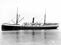
A steamer owned by Black Diamond Line, which was carrying coal from Pictou, Nova Scotia, to Montreal, Quebec, when it sank after being crushed in the ice off Covehead. All the crew aboard Tunstall made it safely ashore and the wreck is now a popular site for scuba divers.

Quebec

ShipFlagSunk dateNotesCoordinates
HMCS Charlottetown Naval Ensign of the United Kingdom.svg  Royal Canadian Navy 11 September 1942A Flower-class corvette that was torpedoed and sunk off Cap Chat by U-517. 49°10′N66°50′W / 49.167°N 66.833°W / 49.167; -66.833 (HMCS Charlottetown (1941))
HMCS Chedabucto 31 October 1943A Bangor-class minesweeper that collided with Lord Kelvin off Rimouski. 48°14′N69°16′W / 48.233°N 69.267°W / 48.233; -69.267 (HMCS Chedabucto (J168))
Cimba Canadian Red Ensign (1907-1921).png  Canada 26 July 1915A clipper that sank in fog near Pointe des Monts.
RMS Empress of Ireland Government Ensign of the United Kingdom.svg  United Kingdom 29 May 1914A transatlantic ocean liner that was hit by the coal freighter SS Storstad in the Saint Lawrence River and sank with heavy loss of life. 48°37.5′N68°24.5′W / 48.6250°N 68.4083°W / 48.6250; -68.4083 (RMS Empress of Ireland (1906))
HMS Leopard Naval Ensign of the United Kingdom.svg  Royal Navy 28 June 1814A troopship that ran aground on Anticosti Island.
CGS Montmagny Canadian Red Ensign (1907-1921).png  Canada 18 September 1914A buoy/lighthouse tender that sank near Montmagny after a collision with the coal carrier Lingan. The incident left 15 dead (one navigation officer and two lightkeeper's families (wives and children)).
NorsyaCanadian Red Ensign (1921-1957).svg  Canada 19 September 1953Former HMCS Shulamite, renamed Norsya and later foundered off Matane.
HMS Penelope Naval Ensign of the United Kingdom.svg  Royal Navy 27 April 1815A fifth-rate frigate that ran aground and broke apart near Pointe-à-la-Frégate in Cloridorme.
CGS Simcoe Canadian Red Ensign (1907-1921).png  Canada 7 December 1917A buoy tender that sank in a storm near Iles-de-la-Madeleine with all hands on board (44 people).
HMCS West York Naval Ensign of the United Kingdom.svg  Royal Canadian Navy 7 November 1945A Flower-class corvette that was struck by Polaris at dock in Montreal.

Saskatchewan

ShipFlagSunk dateNotesCoordinates
City of Medicine Hat Canadian Red Ensign (1907-1921).png  Canada 7 June 1908A paddle steamer that crashed into the newly built Traffic Bridge on the South Saskatchewan River.

Yukon

ShipFlagSunk dateNotesCoordinates
A. J. Goddard Canadian Red Ensign (1868-1921).svg  Canada 22 October 1901A sternwheeler that sank in a storm on Lake Laberge. 61°01′33″N135°07′09″W / 61.0259°N 135.1191°W / 61.0259; -135.1191 (A. J. Goddard)
Klondike ICanadian Red Ensign (1921-1957).svg  Canada June 1936A sternwheeler that hit a rock wall when going around a bend in the Yukon River. It then lost control, ran aground, and sank on a gravel bar.61°40′17″N 134°52′22″W

See also

References [13]

  1. "SAN PEDRO CARGO SHIP 1882-1891". wrecksite.eu. Retrieved 27 November 2014.
  2. "The Wreck of the Vanlene - BC History Online". Archived from the original on 2014-03-16. Retrieved 26 November 2014.
  3. Adams, W.H.D. (1877). Great shipwrecks: a record of perils and disasters at sea, 1544-1877 [by W.H.D. Adams]. p. 340. Retrieved 26 November 2014.
  4. "The Marine List". Lloyd's List (5134). 13 December 1816.
  5. "Dreadful Shipwreck". The Belfast News-Letter. No. 9831. 2 September 1831.
  6. "MISCELLANEOUS". The Bury and Norwich Post: Or, Suffolk and Norfolk Telegraph, Essex, Cambridge, & Ely Intelligencer. No. 2574. 26 October 1831.
  7. ″An Ocean Horror Within Sight of the City″, Evening Herald November 7, 1896 Volume 262
  8. Gentleman's Magazine. Vol. 91.
  9. MacDonald, Evan (October 26, 2015) [Originally published October 25, 2015]. "Crews working to identify leak in shipwreck suspected to be the Argo". cleveland.com . Retrieved November 30, 2023.
  10. "J. S. Seaverns (Propeller), sunk, 10 May 1884" . Retrieved November 30, 2023 via Maritime History of the Great Lakes.
  11. Krueger, Andrew (November 15, 2016) [Originally published November 2, 2016]. "Lake Superior shipwreck discovered, and even the dishes survived". St. Paul Pioneer Press . Sault Ste. Marie, Ontario. Retrieved November 30, 2023.
  12. "Victoria (Steamboat), capsized, 24 May 1881" . Retrieved 6 February 2012.
  13. Parks Canada Agency, Government of Canada (2020-10-22). "S.S. Klondike - S.S. Klondike National Historic Site". www.pc.gc.ca. Retrieved 2021-07-20.

Commons-logo.svg Media related to Shipwrecks in Canada at Wikimedia Commons

Related Research Articles

<span class="mw-page-title-main">Thunder Bay National Marine Sanctuary</span> Aquatic protected area in Michigan, USA

Thunder Bay National Marine Sanctuary and Underwater Preserve is a United States National Marine Sanctuary on Lake Huron's Thunder Bay, within the northeastern region of the U.S. state of Michigan. It protects an estimated 116 historically significant shipwrecks ranging from nineteenth-century wooden side-wheelers to twentieth-century steel-hulled steamers. There are a great many wrecks in the sanctuary, and their preservation and protection is a concern for national policymakers. The landward boundary of the sanctuary extends from the western boundary of Presque Isle County to the southern boundary of Alcona County. The sanctuary extends east from the lakeshore to the international border. Alpena is the largest city in the area.

<span class="mw-page-title-main">National Register of Historic Places listings in Keweenaw County, Michigan</span>

The following is a list of Registered Historic Places in Keweenaw County, Michigan.
     This National Park Service list is complete through NPS recent listings posted March 29, 2024.

<span class="mw-page-title-main">Dicky Beach, Queensland</span> Suburb of Caloundra, Queensland, Australia

Dicky Beach is both a beach and coastal suburb of Caloundra in the Sunshine Coast Region, Queensland, Australia. In the 2016 census, Dicky Beach had a population of 1,895 people.

<span class="mw-page-title-main">National Register of Historic Places listings in Door County, Wisconsin</span>

This is a list of the National Register of Historic Places listings in Door County, Wisconsin. It is intended to provide a comprehensive listing of entries in the National Register of Historic Places that are located in Door County, Wisconsin. The locations of National Register properties for which the latitude and longitude coordinates are included below may be seen in a map.

<span class="mw-page-title-main">Whitefish Point Underwater Preserve</span> Reserve to protect and conserve shipwrecks and historical resources in Lake Superior

The Whitefish Point Underwater Preserve was established in 1987 to protect and conserve shipwrecks and historical resources on 376 square miles (970 km2) of Lake Superior bottomlands in Whitefish Bay and around Whitefish Point, Michigan. The formation of the Michigan Underwater Preserves helped stop controversy over artifact removal from shipwrecks of this area. The preserve is now known for deep, well preserved shipwrecks in clear water accessible to scuba divers with technical skill and experience. The preserve is one of the last places in the Great Lakes to observe shipwrecks without zebra mussel encrustation.

<span class="mw-page-title-main">National Register of Historic Places listings in Bayfield County, Wisconsin</span>

This is a list of the National Register of Historic Places listings in Bayfield County, Wisconsin. It is intended to provide a comprehensive listing of entries in the National Register of Historic Places that are located in Bayfield County, Wisconsin. The locations of National Register properties for which the latitude and longitude coordinates are included below may be seen in a map.

<span class="mw-page-title-main">National Register of Historic Places listings in Manitowoc County, Wisconsin</span>

This is a list of the National Register of Historic Places listings in Manitowoc County, Wisconsin. It is intended to provide a comprehensive listing of entries in the National Register of Historic Places that are located in Manitowoc County, Wisconsin. The locations of National Register properties for which the latitude and longitude coordinates are included below may be seen in a map.

<span class="mw-page-title-main">National Register of Historic Places listings in Presque Isle County, Michigan</span>

This is a list of the National Register of Historic Places listings in Presque Isle County, Michigan.