Llangattock Lingoed

Last updated

Llangattock Lingoed
  • Welsh: Llangatwg Lingoed
Llangattock Lingoed church.jpg
Church of St Cadoc
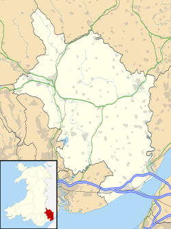
Monmouthshire UK location map.svg
Red pog.svg
Llangattock Lingoed
Location within Monmouthshire
OS grid reference SO362201
Principal area
Ceremonial county
Country Wales
Sovereign state United Kingdom
Post town ABERGAVENNY
Postcode district NP7
Dialling code 01873
Police Gwent
Fire South Wales
Ambulance Welsh
UK Parliament
List of places
UK
Wales
Monmouthshire
51°52′32″N2°55′43″W / 51.875428°N 2.928747°W / 51.875428; -2.928747 Coordinates: 51°52′32″N2°55′43″W / 51.875428°N 2.928747°W / 51.875428; -2.928747

Llangattock Lingoed (Welsh : Llangatwg Lingoed) is a small rural village in Monmouthshire, south east Wales. It is located approximately five miles north of Abergavenny, between Abergavenny and Grosmont, a few miles south of the Wales-England border. Offa's Dyke Path passes through the village. The village is near the Black Mountains and the Brecon Beacons National Park.

Contents

Amenities and history

The parish church is St Cadoc's and both the village and the church have a long and interesting history sandwiched as they are in the Welsh Marches between border castles and the historical personalities holding sway at any given time. [1]

The Old Court is a Grade II* listed building situated in the village. [2]

The Cistercian Way long distance footpath that circumnavigates all of Wales also passes through the village.
Related Research Articles

Monmouthshire County

Monmouthshire is a principal area in Wales. The name derives from the historic county of Monmouthshire of which it covers the eastern three-fifths. The largest town is Abergavenny. Other towns and large villages are Caldicot, Chepstow, Monmouth, Magor and Usk. It borders Torfaen, Newport and Blaenau Gwent to the west; Herefordshire and Gloucestershire to the east; and Powys to the north.

Raglan, Monmouthshire village in Monmouthshire, Wales

Raglan is a village and community in Monmouthshire, south east Wales, United Kingdom. It is located some 9 miles south-west of Monmouth, midway between Monmouth and Abergavenny on the A40 road very near to the junction with the A449 road. The fame of the village derives from its castle, Raglan Castle, built for William ap Thomas and now maintained by Cadw. The community includes the villages of Llandenny and Pen-y-clawdd. Raglan itself has a population of 1,183.

Grosmont, Monmouthshire Human settlement in Wales

Grosmont is a village and community near Abergavenny in Monmouthshire, Wales. The population taken at the 2011 census was 920. The wider community (parish) includes the villages of Llangattock Lingoed, Llangua and Llanvetherine.

Llanvihangel Crucorney Human settlement in Wales

Llanvihangel Crucorney is a small village in the community (parish) of Crucorney, Monmouthshire, Wales. It is located 5 miles (8.0 km) north of Abergavenny and 18 miles (29 km) south-west of Hereford, England on the A465 road.

Llantilio Crossenny Human settlement in Wales

Llantilio Crossenny is a small village and much larger community in Monmouthshire, south east Wales, in the United Kingdom. It is situated between the two towns of Abergavenny and Monmouth on the B4233 road. The community includes Penrhos, and Llanvihangel-Ystern-Llewern.

Llangattock-Vibon-Avel Human settlement in Wales

Llangattock-Vibon-Avel is a rural parish and community in Monmouthshire, south-east Wales, in the United Kingdom. It is located 5 miles (8.0 km) west of Monmouth and some 13 miles (21 km) east of Abergavenny, just off the B4233 old road between the two. Villages within the community include Llangattock itself, Skenfrith, Rockfield, and Newcastle.

Llanvihangel-Ystern-Llewern Human settlement in Wales

Llanvihangel-Ystern-Llewern is a village in Monmouthshire, south east Wales. It is located between Abergavenny and Monmouth and north of Raglan. The River Trothy passes close by.

Cwmcarvan Human settlement in Wales

Cwmcarvan is a small rural village in Monmouthshire, south east Wales. It is located 4 miles south west of Monmouth and about 4 miles east of Raglan, off the old A40 road not far from Trellech.

St. Maughans

St. Maughans is a village in Monmouthshire, south east Wales, United Kingdom.

Rockfield, Monmouthshire Human settlement in Wales

Rockfield is a small village in Monmouthshire, Southeast Wales. It is located beside the River Monnow, about 2 miles (3.2 km) north-west of Monmouth, at the junction of the B4233 to Abergavenny and the B4347 to Grosmont. Rockfield Studios is situated just south of the village.

Llangua

Llangua is a village in Monmouthshire, south-east Wales, United Kingdom. Saint Ciwa is said to have built a church there in the VIIth century.

Pandy, Monmouthshire

Pandy is a hamlet in Monmouthshire, south east Wales, United Kingdom.

St Cadocs Church, Caerleon

St Cadoc's Church is a Church in Wales church located in Caerleon, Newport, Wales and is Grade II* listed. It is one of many buildings associated with the travels of St Cadoc.

St Cadocs Church, Llangattock Lingoed Church in Monmouthshire, Wales

The Church of St Cadoc, is the parish church of Llangattock Lingoed, Monmouthshire, Wales and sits in the centre of the village. It is in the Perpendicular style and is a Grade I listed building as of 1 September 1956.

Grade I listed buildings in Monmouthshire

Monmouthshire is a county and principal area of Wales. It borders Torfaen and Newport to the west; Herefordshire and Gloucestershire to the east; and Powys to the north. The largest town is Abergavenny, with other large settlements being Chepstow, Monmouth, and Usk. The present county was formed under the Local Government (Wales) Act 1994, and comprises some sixty percent of the historic county. Between 1974 and 1996, the county was known by the ancient title of Gwent, recalling the medieval Welsh kingdom. The county is 850 km2 in extent, with a population of 93,600.

Old Court, Llangattock Lingoed

The Old Court, Llangattock Lingoed, Monmouthshire is a medieval hall house dating from the late 15th century, with additions from the 17th and 19th centuries. "Of unusual sophistication", it is a Grade II* listed building.

St Cadocs Church, Llangattock-juxta-Usk Church in Monmouthshire, Wales

The Church of St Cadoc, Llangattock-Juxta-Usk, Monmouthshire is a parish church with its datable origins in the 15th century. The church was restored in 1827 and again in 1864-5. It is a Grade II* listed building.

St Cadocs Church, Llangattock Vibon Avel Church in Monmouthshire, Wales

The Church of St Cadoc, Llangattock Vibon Avel, Monmouthshire is a parish church of medieval origins which was heavily restored in the 19th century. The estate church of The Hendre, it is closely connected with the Rolls family and the grave of Charles Stewart Rolls, the motoring and aviation pioneer, is located in the churchyard. The church is a Grade II* listed building and is now in the care of the Friends of Friendless Churches.

The Bryn, or Llangattock Nigh Usk, is a small village on the left bank of the River Usk in Monmouthshire, southeast Wales. It is accessed by a cul-de-sac minor road from the B4598 road, the reclassified former trunk road between Raglan and Abergavenny, now replaced by the modern A40 dual carriageway which runs east–west immediately north of the village. On the western edge of the village is St Cadoc's Church, a Gothic perpendicular style grade II* listed building probably dating from the fifteenth century. The village falls within the administrative community of Llanover. The Usk Valley Walk passes along the riverside path to the south.

St Cadoc's or St Cadocs or St Catwg's may refer to:

References

  1. St. Cadoc's church history Archived 2007-09-24 at the Wayback Machine
  2. Good Stuff (5 June 1952). "Old Court including Former Cider House, Granary and Stable Range - Grosmont - Monmouthshire - Wales". British Listed Buildings. Retrieved 26 February 2017.