Michigan's 9th congressional district | |
---|---|
Representative | |
Population (2023) | 769,261 |
Median household income | $80,229 [1] |
Ethnicity |
|
Cook PVI | R+18 [2] |
Michigan's 9th congressional district is a United States congressional district located in The Thumb and northern portions of Metro Detroit of the State of Michigan. Counties either wholly or partially located within the district include: Huron, Tuscola, Sanilac, Lapeer, St. Clair, Macomb and Oakland. With a Cook Partisan Voting Index rating of R+18, it is the most Republican district in Michigan. [2]
Year | Office | Results |
---|---|---|
1992 | President | Clinton 44 - 35% |
1996 | President | Clinton 46 - 43% |
2000 | President | Bush 51 - 47% |
2004 | President | Bush 51 - 49% |
2008 | President | Obama 56 - 43% |
2012 | President | Obama 57 - 42% |
2016 | President | Clinton 52 - 44% |
2018 | Senate | Stabenow 58 - 39% |
2018 | Governor | Whitmer 59 - 38% |
2020 | President | Biden 56 - 43% |
2022 | Proposal 3 | No 46.9% – 53.1% |
Michigan first gained a 9th district in 1873. For most of the next 120 years, it covered most of the western shore counties starting with Muskegon and taking in a portion of Grand Traverse County. From 1983 to 1993, it also included about half of Ottawa County, Montcalm County, half of Ionia County, and two eastern townships of Kent County just outside the Grand Rapids city limits. After the 1990 census, this district essentially became the 2nd district.
The district from 1992 to 2002 was largely based in Pontiac and Flint–essentially, the successor of the old 7th district. The strong Democratic voting record in Flint and Pontiac compensated for the largely Republican lean of most of the rest of the district's area.
In 2002, this district essentially became the 5th district, while the 9th was reconfigured to take in most of the Oakland County portion of the old 11th district. The only areas that survived in the 9th congressional district across the 2002 redistricting were Pontiac, Waterford, Auburn Hills, some of Orion Township, Oakland Township, Rochester and Rochester Hills. This district was for all practical purposes the one eliminated by the 2012 redistricting. Portions of it were parceled out to four different districts, all of which largely preserved other former districts. The current 9th is mostly the successor of the old 10th district.
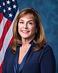
The district is currently represented by Lisa McClain.
# | County | Seat | Population |
---|---|---|---|
63 | Huron | Bad Axe | 30,927 |
87 | Lapeer | Lapeer | 88,977 |
99 | Macomb | Mount Clemens | 875,101 |
125 | Oakland | Pontiac | 1,270,426 |
147 | St. Clair | Port Huron | 159,874 |
151 | Sanilac | Sandusky | 40,368 |
157 | Tuscola | Caro | 52,826 |
Party | Candidate | Votes | % | |
---|---|---|---|---|
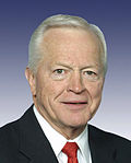
Republican | Joe Knollenberg (incumbent) | 142,279 | 51.6 | |
Democratic | Nancy Skinner | 127,651 | 46.2 | |
Libertarian | Adam Goodman | 3,698 | 1.3 | |
Green | Matthew Abel | 2,466 | 0.9 | |
Total votes | 276,094 | 100.0 | ||
Republican hold |
Party | Candidate | Votes | % | |
---|---|---|---|---|
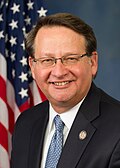
Democratic | Gary Peters | 184,098 | 52.1 | |
Republican | Joe Knollenberg (incumbent) | 150,574 | 42.6 | |
Independent | Jack Kevorkian | 9,047 | 2.6 | |
Libertarian | Adam Goodman | 4,937 | 1.4 | |
Green | Douglas Campbell | 4,800 | 1.4 | |
Total votes | 353,456 | 100.0 | ||
Democratic gain from Republican |
Party | Candidate | Votes | % | |
---|---|---|---|---|
Democratic | Gary Peters (incumbent) | 125,730 | 49.8 | |
Republican | Rocky Raczkowski | 119,325 | 47.2 | |
Libertarian | Adam Goodman | 2,601 | 1.0 | |
Green | Douglas Campbell | 2,484 | 1.0 | |
Independent | Bob Gray | 1,866 | 0.7 | |
Independent | Matthew Kuofie | 644 | 0.3 | |
Total votes | 252,650 | 100.0 | ||
Democratic hold |
Party | Candidate | Votes | % | |
---|---|---|---|---|
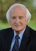
Democratic | Sander Levin (incumbent) | 208,846 | 61.9 | |
Republican | Don Volaric | 114,760 | 34.0 | |
Libertarian | Jim Fulner | 6,100 | 1.8 | |
Green | Julia Williams | 4,708 | 1.4 | |
Constitution | Les Townsend | 2,902 | 0.9 | |
Total votes | 337,316 | 100.0 | ||
Democratic hold |
Party | Candidate | Votes | % | |
---|---|---|---|---|
Democratic | Sander Levin (incumbent) | 136,342 | 60.4 | |
Republican | George Brikho | 81,470 | 36.1 | |
Libertarian | Gregory Creswell | 4,792 | 2.1 | |
Green | John V. McDermott | 3,153 | 1.4 | |
Total votes | 225,757 | 100.0 | ||
Democratic hold |
Party | Candidate | Votes | % | |
---|---|---|---|---|
Democratic | Sander Levin (incumbent) | 199,661 | 57.9 | |
Republican | Christopher Morse | 128,937 | 37.4 | |
Libertarian | Matthew Orlando | 9,563 | 2.8 | |
Green | John V. McDermott | 6,614 | 1.9 | |
Total votes | 344,775 | 100.0 | ||
Democratic hold |
Party | Candidate | Votes | % | |
---|---|---|---|---|
Democratic | Andy Levin | 181,734 | 59.7 | |
Republican | Candius Stearns | 112,123 | 36.8 | |
Working Class | Andrea Kirby | 6,797 | 2.2 | |
Green | John V. McDermott | 3,909 | 1.3 | |
Total votes | 304,563 | 100.0 | ||
Democratic hold |
Party | Candidate | Votes | % | |
---|---|---|---|---|
Democratic | Andy Levin (incumbent) | 230,318 | 57.7 | |
Republican | Charles Langworthy | 153,296 | 38.4 | |
Working Class | Andrea Kirby | 8,970 | 2.3 | |
Libertarian | Mike Saliba | 6,532 | 1.6 | |
Independent | Douglas Troszak (write-in) | 1 | 0.0 | |
Total votes | 399,117 | 100.0 | ||
Democratic hold |
Party | Candidate | Votes | % | |
---|---|---|---|---|
Republican | Lisa McClain (incumbent) | 238,300 | 63.9 | |
Democratic | Brian Jaye | 123,702 | 33.1 | |
Working Class | Jim Walkowicz | 6,571 | 1.7 | |
Libertarian | Jacob Kelts | 4,349 | 1.1 | |
Total votes | 372,922 | 100.0 | ||
Republican hold |
District boundaries were redrawn in 1993, and 2003 due to reapportionment following the censuses of 1990 and 2000.
Sanilac County is a county located in the Thumb region of the U.S. state of Michigan. As of the 2020 Census, the population was 40,611. The county seat is Sandusky. The county was created on September 10, 1822, and was fully organized on December 31, 1849. Sanilac County is considered to be part of the Thumb of Michigan, a subregion of the Flint/Tri-Cities. Sanilac County enjoys seasonal tourism in towns such as Lexington, Port Sanilac, and Carsonville. Sanilac County is economically attached to St. Clair County and Huron County and is largely composed of nearly flat areas of rich soil.
Oakland County is a county in the U.S. state of Michigan. It is a principal county of the Detroit metropolitan area, containing the bulk of Detroit's northern suburbs. Its seat of government is Pontiac, and its largest city is Troy. As of the 2020 Census, its population was 1,274,395, making it the second-most populous county in Michigan, and the most populous county in the United States without a city of 100,000 residents.
Macomb County is a county on the eastern shore of the U.S. state of Michigan. It is part of the Detroit metropolitan area, bordering Detroit to the north and containing many of its northern suburbs. Its seat of government is Mt. Clemens, and its largest community is Warren. As of the 2020 census, the county had a population of 881,217, making it the third-most populous county in the state, behind neighboring Wayne and Oakland.
Lapeer County is a county located in the U.S. state of Michigan. As of the 2020 Census, the population was 88,619. The county seat is Lapeer. The county was created on September 18, 1822, and was fully organized on February 2, 1835. The name is a corruption of the French la pierre, which means "the stone". Lapeer County is located north of Detroit and east of Flint.
Springfield Charter Township is a charter township of Oakland County in the U.S. state of Michigan. As of the 2020 census, the township population was 14,703. The township was named for the numerous springs in the area.
The Thumb is a region and a peninsula of the U.S. state of Michigan, so named because the Lower Peninsula is shaped like a mitten. The Thumb area is generally considered to be in the Central Michigan region, east of the Flint area and the Tri-Cities and north of Metro Detroit. The region is also branded as the Blue Water Area.
The Clinton River is a river in southeastern Michigan in the United States. It is named in honor of DeWitt Clinton, who was governor of New York from 1817 to 1823.
Michigan's 10th congressional district is a United States congressional district in the Lower Peninsula of Michigan. It consists of southern Macomb County, Rochester and Rochester Hills in Oakland County.
Area code 810 is a telephone area code in the North American Numbering Plan for the east-central part in the U.S. state of Michigan. The numbering plan area (NPA) comprises the cities of Flint, Lapeer, Port Huron, and the southern portion of the Thumb.
Michigan's 11th congressional district is a United States congressional district north of Detroit, comprising most of urbanized central Oakland County. Until 1993, the district covered the state's Upper Peninsula and the northernmost portion of the Lower Peninsula. In redistricting that year, it was shifted to the outer Detroit area. Its former geographical area is now the state's first district. Its current configuration dates from 2023.
Michigan's 12th congressional district is a U.S. congressional district in Michigan.
Michigan's 14th congressional district was a congressional district that stretched from eastern Detroit westward to Farmington Hills, then north to the suburb of Pontiac. From 1993 to 2013, it was based entirely in Wayne County.
Michigan's 4th congressional district is a United States congressional district located in the state of Michigan. The current 4th district contains much of Michigan's old 2nd district, and includes all of Allegan and Van Buren counties, as well as portions of Ottawa, Kalamazoo, Calhoun, and Berrien counties. In 2022, the district was redrawn to start in St. Joseph Township and extend north to Port Sheldon Township. The 4th is currently represented by Republican Bill Huizenga, who previously represented the old 2nd district.
Michigan's 7th congressional district is a United States congressional district in Southern Michigan and portions of Central Michigan. The current district, drawn in 2022, centers around Lansing, Michigan's state capital, and includes all of Clinton, Shiawassee, Ingham, and Livingston counties, as well as portions of Eaton, Gennessee, and Oakland counties.
Michigan's 2nd congressional district is a United States congressional district in Western Michigan. The current 2nd district contains much of Michigan's old 4th congressional district, and includes all of Barry, Clare, Gladwin, Gratiot, Ionia, Isabella, Lake, Manistee, Mason, Mecosta, Montcalm, Newaygo, Oceana, and Osceola counties, as well as portions of Eaton, Kent, Midland, Muskegon, Ottawa and Wexford counties. Republican John Moolenaar, who had previously represented the old 4th district, was re-elected to represent the new 2nd in 2022.
Michigan's 8th congressional district is a United States congressional district in Central Michigan. The district was first created in 1873, after redistricting following the 1870 census. From 2003 to 2013, it consisted of all of Clinton, Ingham, and Livingston counties, and included the southern portion of Shiawassee and the northern portion of Oakland counties. From 2013 to 2023, the district no longer covered Clinton or Shiawassee counties and instead covered more of Oakland County, including Rochester. In 2023, the district was redrawn to be centered on the city of Flint and the "Tri-Cities" metropolitan area around Saginaw, Midland, Bay City. The district includes all of Saginaw and Bay counties, almost all of Genesee County, and portions of Midland and Tuscola counties.
Michigan's 6th congressional district is a United States congressional district in southeast Michigan. In 2022, the district was redrawn to be centered around Ann Arbor and Washtenaw County, as well as western and southern Wayne County, a small part of southwestern Oakland County, and the city of Milan in Monroe County. In previous redistrictings, the 6th district consisted of all of Berrien, Cass, Kalamazoo, St. Joseph, and Van Buren, counties, and includes most of Allegan county.
The Detroit metropolitan area in southeast Michigan is served by a comprehensive network of roads and highways. Three primary Interstate Highways pass through the region, along with three auxiliary Interstates, and multiple state and U.S. Highways. These are supplemented by the Mile Road System, a series of local roads spaced one mile apart on a perpendicular grid.
The West Saint Clair Street Historic District is a residential historic district located along 124–328 West Saint Clair Street in the village of Almont in Almont Township in southeast Lapeer County, Michigan. It was designated as a Michigan State Historic Site and also added to the National Register of Historic Places on May 8, 1986.
The 1996 United States presidential election in Michigan took place on November 5, 1996. All 50 states and the District of Columbia participated in the 1996 United States presidential election. Voters chose 18 electors to the Electoral College, which selected the president and vice president.