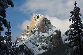
Mount Louis is a 2,682-metre (8,799-foot) mountain summit located in southeast Banff National Park in Alberta, Canada. It is part of the Sawback Range which is a subset of the Canadian Rockies.

Mount Hector is a 3,394-metre (11,135-foot) mountain summit located in the Bow River valley of Banff National Park, in the Canadian Rockies of Alberta, Canada. The mountain was named in 1884 by George M. Dawson after James Hector, a geologist on the Palliser expedition. The mountain is located beside the Icefields Parkway, 17 km (11 mi) north of Lake Louise.

Saint Nicholas Peak is a 2,938-metre (9,639-foot) mountain summit in the Rocky Mountains of Canada. It is located on the Continental Divide, on the Alberta-British Columbia border, in both Banff National Park and Yoho National Park. It lies at the eastern edge of the Wapta Icefield, and is part of the Waputik Mountains which are a sub-range of the Canadian Rockies.

Observation Peak is a 3,174-metre (10,413-foot) mountain summit located in Banff National Park, Alberta, Canada. The mountain can be seen from the Icefields Parkway near the Bow Summit.
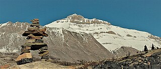
Nigel Peak is a 3,211-metre (10,535-foot) mountain summit located on the shared border of Banff National Park and Jasper National Park, in the Canadian Rockies of Alberta, Canada. Nigel has two peaks, the north summit is the highest point. The nearest higher peak is Mount Athabasca, 6.4 km (4.0 mi) to the south-southwest. Nigel Peak is situated immediately north of Sunwapta Pass and can be seen from the Icefields Parkway and from Athabasca Glacier. Topographic relief is significant as the summit rises 1,100 metres (3,609 ft) above the parkway in two kilometres (1.2 mile).

Mount Thompson is a 3,089-metre (10,135-foot) mountain summit located four kilometres west of Bow Lake in Banff National Park, in the Canadian Rockies of Alberta, Canada. Its nearest higher peak is Mount Baker, 5.0 km (3.1 mi) to the west. Mount Thompson is situated east of the Wapta Icefield, and is a member of the Waputik Mountains. Mount Thompson can be seen from the Icefields Parkway at Bow Lake.
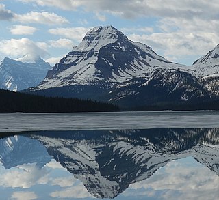
Bow Peak is a 2,840-metre (9,320-foot) mountain summit located in the Bow River valley of Banff National Park, in the Canadian Rockies of Alberta, Canada. Its nearest higher peak is Crowfoot Mountain, 2.11 km (1.31 mi) to the east. Bow Peak is situated north of Hector Lake, southeast of Bow Lake, and can be seen from the Icefields Parkway. Although not of remarkable elevation, the mountain is a conspicuous landmark and visible from as far away as the Lake Louise area. Its position in the Waputik Mountains provides magnificent views from the summit.

Tonsa, or Tonsa Peak, is a 3,053-metre (10,016 ft) mountain summit located on the border of Alberta and British Columbia on the Continental Divide in the Canadian Rockies. The mountain forms part of the backdrop to Moraine Lake in the Valley of the Ten Peaks of Banff National Park. It was named in 1894 by Samuel E.S. Allen for the Stoney Indian word for the number four.

Marvel Peak is a 2,708-metre (8,885-foot) mountain summit located in the southern tip of Banff National Park, in the Canadian Rockies of Alberta, Canada. Marvel Peak is situated in the Blue Range, three kilometers from the Continental Divide, and not visible from any road. Marvel Peak's nearest higher peak is Wonder Peak, 3.29 km (2.04 mi) to the north-northwest.

Mount Andromache is a 3,033-metre (9,951-foot) mountain summit located in the Bow River valley of Banff National Park, in the Canadian Rockies of Alberta, Canada. The nearest higher neighbor is Mount Hector, 4.00 km (2.49 mi) to the south. Mount Andromache can be seen from the Icefields Parkway as the road traverses the western base of the peak. Topographic relief is significant as the summit rises 1,180 m (3,870 ft) above the parkway in 1.5 km (0.93 mi). The Molar Glacier is situated on the northeast aspect of the mountain. Precipitation runoff from Mount Andromache drains into tributaries of the Bow River.

Portal Peak is a 2,926-metre (9,600-foot) mountain summit located four kilometers west of Bow Lake in Banff National Park, in the Canadian Rockies of Alberta, Canada. Its nearest higher peak is Mount Thompson, 1.0 km (0.62 mi) to the northwest. Portal Peak is situated east of the Wapta Icefield, and is a member of the Waputik Mountains. Portal Peak can be seen from the Icefields Parkway at Bow Lake.
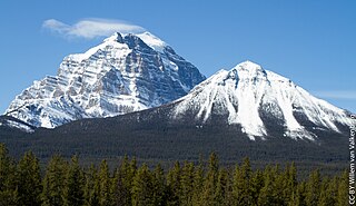
Little Temple is a 2,653-metre (8,704-foot) mountain summit located in Banff National Park of the Canadian Rockies of Alberta, Canada. Little Temple is situated in the Bow River Valley between Paradise Creek and Moraine Creek, 6.0 km (3.7 mi) south of Lake Louise, Alberta. The mountain can be seen from the Icefields Parkway along with its nearest higher peak, Mount Temple, 1.07 km (0.66 mi) to the southwest.
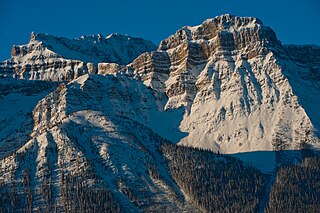
Pulpit Peak is a 2,720-metre (8,920-foot) mountain summit located one km south of Hector Lake in Banff National Park, in the Canadian Rockies of Alberta, Canada. Its nearest higher peak is Lilliput Mountain, 3.6 km (2.2 mi) to the southwest. Pulpit Peak is situated east of the Waputik Icefield, and is a member of the Waputik Mountains. Pulpit Peak can be seen from the Icefields Parkway towering 900 metres (2,950 ft) above Hector Lake.
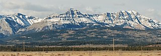
Association Peak is a 2,362-metre (7,749 ft) mountain summit located in Alberta, Canada.

Mount Mercer is a 2,970-metre (9,744-foot) mountain summit located in Alberta, Canada.

Barbette Mountain is 3,072-metre (10,079-foot) summit located on the shared border of Alberta and British Columbia, Canada.

Mount Bell is a 2,910-metre (9,550 ft) summit in Alberta, Canada.
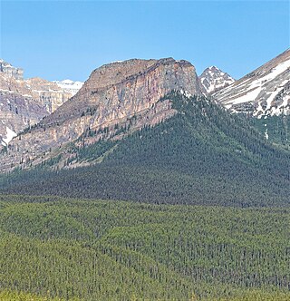
Saddle Mountain is a 2,433-metre (7,982 ft) summit in Alberta, Canada.

Protection Mountain is a mountain in the Canadian Rockies of Alberta, Canada.


