Pinjarra Hills, Queensland

Last updated

Pinjarra Hills
Brisbane,  Queensland
Pinjarra Hills, Queensland.JPG
University of Queensland paddocks
Australia Queensland location map.svg
Red pog.svg
Pinjarra Hills
Coordinates 27°32′17″S152°54′22″E / 27.5381°S 152.9060°E / -27.5381; 152.9060 (Pinjarra Hills (centre of suburb))
Population771 (2021 census) [1]
 • Density113.4/km2 (293.7/sq mi)
Postcode(s) 4069
Area6.8 km2 (2.6 sq mi)
Time zone AEST (UTC+10:00)
Location16.8 km (10 mi) SW of Brisbane CBD
LGA(s) City of Brisbane
(Pullenvale Ward) [2]
State electorate(s) Moggill
Federal division(s) Ryan
Suburbs around Pinjarra Hills:
Pullenvale Brookfield Kenmore
Anstead Pinjarra Hills Jindalee
Bellbowrie Westlake Mount Ommaney

Pinjarra Hills is a suburb in the City of Brisbane, Queensland, Australia. [3] In the 2021 census, Pinjarra Hills had a population of 771 people. [1]

Contents

Geography

Pinjarra Hills is 16.8 kilometres (10.4 mi) by road south-west of the Brisbane central business district on the northern bank of the Brisbane River. [4]

Most of the land between Pullenvale Road and the river ( 27°32′13″S152°55′13″E / 27.5369°S 152.9202°E / -27.5369; 152.9202 (University of Queensland Pinjarra Hills campus) ) is the University of Queensland's Pinjarra Hills campus. [4] The campus is a 282-hectare (700-acre) research facility. [5]

Apart from the university camps, the suburb is rural residential. [4]

Moggill Road is the main road route through the suburb. [4] Mount Crosby Road enters from the southwest. [6]

History

The suburb was named after Pinjarra Road which travels through the suburb. However, the origin of the road name is unknown. [3]

In the 1860s Patrick Mayne purchased the land now owned by the University of Queensland. Following the death of Patrick Mayne, it was inherited by his son William. In 1922 William's death resulted in his siblings Dr James O'Neil Mayne and his sister Miss Mary Emelia Mayne inheriting the land. In 1923 the Mayne siblings gave the land to the University of Queensland to enhance the teaching of agriculture. [7] It was known as the Moggill Farm. However, circa 2000 when the university began to plan the relocation of its agriculture and veterinary disciplines to its new Gatton campus which had its own farm, the role of the Moggill Road became unclear. Rumours circulated that the university tended to sell the land for housing which attracted considerable protest. In 2008 the university denied having such plans, suggesting that the rumours arose from the idea being used as a student exercise in a master class, but did not disclose its plans for the site. [8] [9]

Demographics

In the 2011 census, the population of Pinjarra Hills was 664, 54.5% female and 45.5% male. The median age of the Pinjarra Hills population was 55 years, 18 years above the Australian median. 68.1% of people living in Pinjarra Hills were born in Australia, compared to the national average of 69.8%; the next most common countries of birth were England 9%, South Africa 2.7%, New Zealand 2.1%, Malaysia 0.9%, Papua New Guinea 0.8%. 88.5% of people spoke only English at home; the next most common languages were 1.2% Cantonese, 0.9% Dutch, 0.5% German, 0.5% Swedish, 0.5% Danish. [10]

In the 2016 census, Pinjarra Hills had a population of 606 people. [11]

In the 2021 census, Pinjarra Hills had a population of 771 people. [1]

Education

There are no schools in Pinjarra Hills. The nearest primary school is Pullenvale State School in neighbouring Pullenvale. The nearest secondary school is Kenmore State High School in Kenmore. [4]

Related Research Articles

<span class="mw-page-title-main">St Lucia, Queensland</span> Suburb of Brisbane, Queensland, Australia

St Lucia is a riverside suburb in the City of Brisbane, Queensland, Australia. The University of Queensland is the main attraction of St Lucia, with the university, and residential colleges covering a large proportion of the suburb. In the 2021 census, St Lucia had a population of 12,220 people.

<span class="mw-page-title-main">Chapel Hill, Queensland</span> Suburb of Brisbane, Queensland, Australia

Chapel Hill is a western suburb in the City of Brisbane, Queensland, Australia. In the 2021 census, Chapel Hill had a population of 10,511 people.

The Division of Ryan is an Australian Electoral Division in Queensland.

<span class="mw-page-title-main">Taringa, Queensland</span> Suburb of Brisbane, Queensland, Australia

Taringa is a suburb in the City of Brisbane, Queensland, Australia. In the 2021 census, Taringa had a population of 8,732 people.

<span class="mw-page-title-main">Bellbowrie, Queensland</span> Suburb of Brisbane, Queensland, Australia

Bellbowrie is a suburb in the City of Brisbane, Queensland, Australia. In the 2021 census, Bellbowrie had a population of 5,495 people.

<span class="mw-page-title-main">Brookfield, Queensland</span> Suburb of Brisbane, Queensland, Australia

Brookfield is a rural residential suburb in the City of Brisbane, Queensland, Australia. In the 2021 census, Brookfield had a population of 3,640 people.
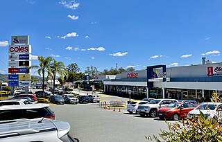
<span class="mw-page-title-main">Kenmore, Queensland</span> Suburb of Brisbane, Queensland, Australia

Kenmore is a riverside suburb in the City of Brisbane, Queensland, Australia. In the 2021 census, Kenmore had a population of 9,675 people.
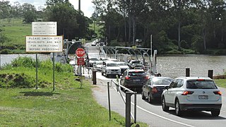
<span class="mw-page-title-main">Moggill, Queensland</span> Suburb of Brisbane, Queensland, Australia

Moggill is a suburb in the City of Brisbane, Queensland, Australia. In the 2021 census, Moggill had a population of 5,029 people.

<span class="mw-page-title-main">Kenmore Hills, Queensland</span> Suburb of Brisbane, Queensland, Australia

Kenmore Hills is a suburb in the City of Brisbane, Queensland, Australia. In the 2021 census, Kenmore Hills had a population of 2,448 people.

<span class="mw-page-title-main">Mount Ommaney, Queensland</span> Suburb of Brisbane, Queensland, Australia

Mount Ommaney is a south-western riverside suburb in the City of Brisbane, Queensland, Australia. The mountain of the same name is located within the locality. In the 2021 census, Mount Ommaney had a population of 2,503 people.

<span class="mw-page-title-main">Jamboree Heights, Queensland</span> Suburb of Brisbane, Queensland, Australia

Jamboree Heights is a south-western suburb in the City of Brisbane, Queensland, Australia. In the 2021 census, Jamboree Heights had a population of 3,141 people.

<span class="mw-page-title-main">Anstead, Queensland</span> Suburb of Brisbane, Queensland, Australia

Anstead is an outer western suburb in the City of Brisbane, Queensland, Australia. In the 2021 census, Anstead had a population of 1,522 people.

<span class="mw-page-title-main">Upper Brookfield, Queensland</span> Suburb of Brisbane, Queensland, Australia

Upper Brookfield is an outer western suburb in the City of Brisbane, Queensland, Australia. In the 2021 census, Upper Brookfield had a population of 857 people.

<span class="mw-page-title-main">Chuwar, Queensland</span> Town in Queensland, Australia

Chuwar is a town and suburb of Ipswich in the City of Ipswich and a locality of the City of Brisbane in South East Queensland, Australia. In the 2021 census, Chuwar had a population of 2,178 people.

<span class="mw-page-title-main">Seventeen Mile Rocks, Queensland</span> Suburb of Brisbane, Queensland, Australia

Seventeen Mile Rocks is a suburb in the City of Brisbane, Queensland, Australia. In the 2021 census, Seventeen Mile Rocks had a population of 2,699 people.

<span class="mw-page-title-main">Pullenvale, Queensland</span> Suburb of Brisbane, Queensland, Australia

Pullenvale is a western suburb in the City of Brisbane, Queensland, Australia. In the 2021 census, Pullenvale had a population of 3,276 people.
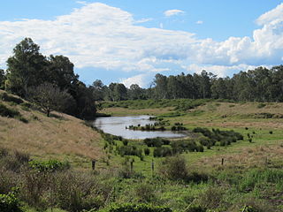
<span class="mw-page-title-main">Riverview, Queensland</span> Suburb of Ipswich, Queensland, Australia

Riverview is a suburb of Ipswich in the City of Ipswich, Queensland, Australia. In the 2016 census, Riverview had a population of 3,073 people and an unemployment rate of 15.7%, compared to the Australian unemployment rate of 6.9%.

<span class="mw-page-title-main">Moggill Creek</span> River in Queensland, Australia

Moggill Creek is a creek in Brisbane, the largest city in Queensland, Australia. The creek rises on the Taylor Range and runs in a south-easterly direction from the southern edge of Brisbane Forest Park in Kholo and Pullenvale, flowing through Upper Brookfield, Brookfield and joining the Brisbane River at Kenmore. Before entering the Brisbane River the creek is crossed by Moggill Road and winds through Rafting Ground Reserve.

<span class="mw-page-title-main">Moggill Road</span> Road in Brisbane, Australia

Moggill Road is a major road in Brisbane, Queensland, Australia. It commences at High Street at Toowong and terminates at the Moggill Ferry in Moggill. It is part of State Route 33. The road carried an average of 39,305 vehicles per day between July and December 2014.

<span class="mw-page-title-main">Pullenvale Ward</span> Subdivision in Brisbane, Queensland, Australia

The Pullenvale Ward is a Brisbane City Council ward covering Pullenvale, Anstead, Bellbowrie, Brookfield, Karana Downs, Kenmore, Kenmore Hills, Kholo, Lake Manchester, Moggill, Mt Crosby, Pinjarra Hills, Upper Brookfield and parts of Chapel Hill and Chuwar.

References

  1. 1 2 3 Australian Bureau of Statistics (28 June 2022). "Pinjarra Hills (SAL)". 2021 Census QuickStats. Retrieved 28 February 2023. OOjs UI icon edit-ltr-progressive.svg
  2. "Pullenvale Ward". Brisbane City Council. Archived from the original on 12 March 2017. Retrieved 12 March 2017.
  3. 1 2 "Pinjarra Hills – suburb in City of Brisbane (entry 41508)". Queensland Place Names. Queensland Government . Retrieved 26 January 2020.
  4. 1 2 3 4 5 "Queensland Globe". State of Queensland . Retrieved 20 April 2020.
  5. "Pinjarra Hills Research Facility". University of Queensland . 1 September 2017. Archived from the original on 20 April 2020. Retrieved 20 April 2020.
  6. Google (7 January 2024). "Pinjarra Hills, Queensland" (Map). Google Maps . Google. Retrieved 7 January 2024.
  7. "UQ plans to continue Pinjarra Hills facility". UQ News. University of Queensland. 20 April 2001. Archived from the original on 20 April 2020. Retrieved 20 April 2020.
  8. "Pinjarra Hills "plans" are hypothetical". UQ News. University of Queensland. 28 October 2008. Archived from the original on 20 April 2020. Retrieved 20 April 2020.
  9. Moore, Tony (28 October 2008). "'Brain city' a student assignment". Brisbane Times. Archived from the original on 22 May 2022. Retrieved 20 April 2020.
  10. Australian Bureau of Statistics (31 October 2012). "Pinjarra Hills (SSC)". 2011 Census QuickStats. Retrieved 4 June 2024. OOjs UI icon edit-ltr-progressive.svg
  11. Australian Bureau of Statistics (27 June 2017). "Pinjarra Hills (SSC)". 2016 Census QuickStats. Retrieved 20 October 2018. OOjs UI icon edit-ltr-progressive.svg