Likir is a village and headquarter of eponymous Subdivision in the Leh district of Ladakh, India. It is located in the Likir tehsil, in the Ladakh region. Khalatse is a nearby trekking place.

Alchi is a village in the Leh district of Ladakh, India. It is located in the Likir tehsil, on the banks of the Indus River 70 km downstream from the capital Leh. Unlike the other gompas in Ladakh, Alchi is situated on lowland, not on a hilltop.

Hemis, also spelled Hamis, is a village in the Leh district of Ladakh, India. It is located in the Kharu tehsil, 40 km southeast of Leh town on the Leh-Manali Highway and under-construction Bhanupli–Leh line.

Stok is a village in the Leh district of Ladakh, India. It is located in the Leh tehsil, in the Indus Valley 17 km southeast of the Leh town.

Chemrey is a village in the Leh district of Ladakh, India. It is located in the Kharu tehsil. The Chemrey Monastery is located in this village.

Nimo or Nyemo is a village and the headquarters of an eponymous community development block in the Leh district of Ladakh, India. It is located in the Leh tehsil, 35 km from Leh.

Thiksey is a village and the headquarters of its eponymous block in the Leh district of Ladakh, India. It is located in the Leh tehsil. The Thikse Monastery is located here.

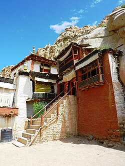
Diskit is a village and headquarter of the Nubra tehsil and the Nubra subdivision in the Leh district of Ladakh, India. The Diskit Monastery is located in this village.

Stakna is a village in the Leh district of Ladakh, India. It is located in the Leh tehsil, on the banks of the Indus River. The Stakna Monastery is located here.

Giramangu, also known as Gaira Mangue or Mangyu, is a village in the Leh district of Ladakh, India. It is located in the Likir tehsil. The Mangyu temple complex is located near this village.

Lingshet is the headquarter of Singelalok block in the Leh district of Ladakh, India. It is located in the Khalsi tehsil, about a day's trek from the nearest road. The village can be accessed via a road through Singela from Lamayuru.

Lamayouro is a village in the Leh district of Ladakh, India. The Lamayuru Monastery is located nearby. It is located in the Khalsi tehsil. The region is also referred to as ‘Moon Land’, due to its terrain's resemblance to the surface of the Moon.
Fotoksar or Photoksar is a village in the Leh district of Ladakh, India. It is located in the Khalsi tehsil.

Temisgam is a village in the Leh district of Ladakh, India. It is located in the Khalsi tehsil. The Tingmosgang castle and monastery are located here.

Wanla is a village in the Leh district of Ladakh, India. It is located in the Khalsi tehsil, on the banks of the Yapola River. The Wanla Monastery is located in this village.

Hundar is a village in the Leh district of Ladakh, India, famous for sand dunes and Bactrian camels. It is located in the Nubra tehsil, on the banks of the Shyok River. The Hunder Monastery is located here.
Teri is a village in the Leh district of Ladakh, India. It is located in the Nyoma tehsil.
Miru or Meroo is a village in the Leh district of Ladakh, India. It is located in the Kharu tehsil. The Leh–Manali Highway passes through Miru.
Sumoor is a village and tehsil in the Leh district of Ladakh, India.
Skitmang is a village in the Leh district of the Indian union territory of Ladakh. It is located in the Leh tehsil.