
Scafell Pike is a mountain in the Lake District region of Cumbria, England. It has an elevation of 978 metres (3,209 ft) above sea level, making it the highest and the most prominent mountain in England. The mountain is part of the Scafell massif, an inactive volcano, and is one of the Southern Fells.

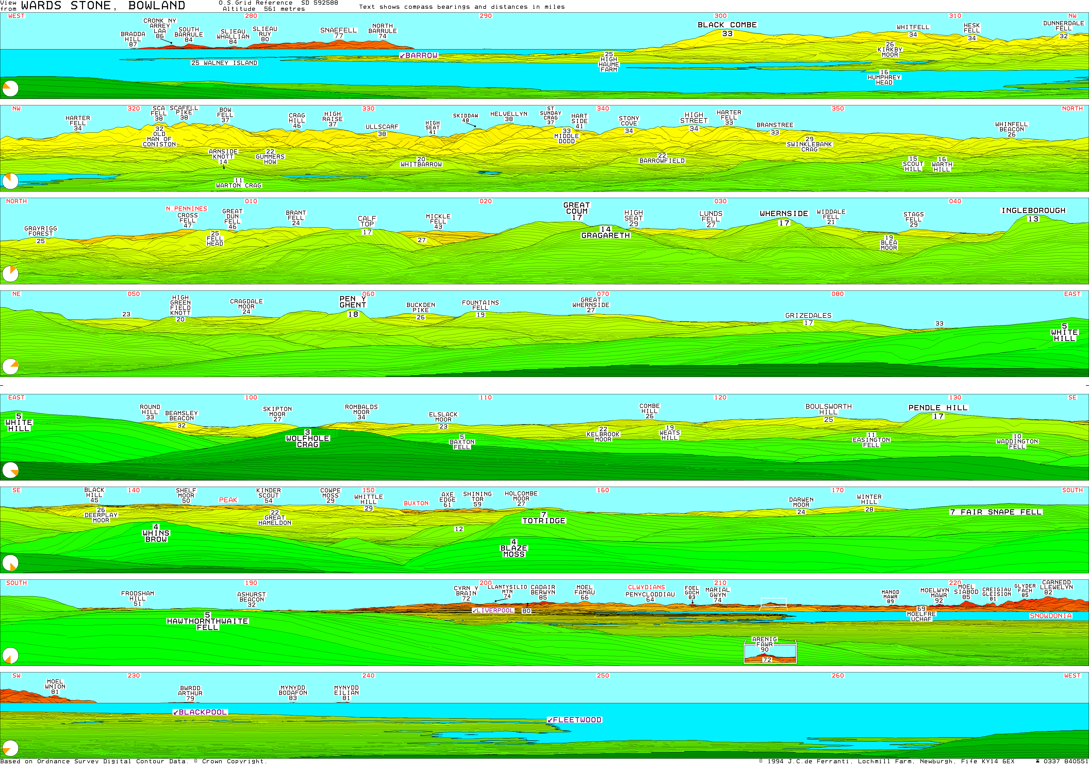
The Forest of Bowland, also known as the Bowland Fells and formerly the Chase of Bowland, is an area of gritstone fells, deep valleys and peat moorland, mostly in north-east Lancashire, England, with a small part in North Yorkshire. It is a western outlier of the Pennines.
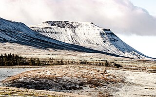
Ingleborough is the second-highest mountain in the Yorkshire Dales, England. It is one of the Yorkshire Three Peaks, and is frequently climbed as part of the Three Peaks walk. A large part of Ingleborough is designated as a Site of Special Scientific Interest and National Nature Reserve and is the home of a joint project, Wild Ingleborough, with aims to improve the landscape for wildlife and people.

Pillar is a mountain in the western part of the English Lake District. Situated between the valleys of Ennerdale to the north and Wasdale to the south, it is the highest point of the Pillar group. At 892 metres (2,927 ft) it is the eighth-highest mountain in the Lake District. The fell takes its name from Pillar Rock, a prominent feature on the Ennerdale side, regarded as the birthplace of rock climbing in the district.

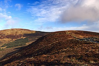
Clougha Pike is a hill in the Forest of Bowland in Lancashire, England. From the west it looms over the Conder Valley, the city of Lancaster and Lancaster University. It is visible from as far away as Barrow-in-Furness, South Lakeland mountains such as the Old Man of Coniston, and Blackpool Tower. From the west, it appears to be a large dome shape, with a cliff-like section at the very top. From the south-west, a series of notches or cloughs are visible in its flanks, giving the hill its distinctive name. The notches vary in size and run across the side of the hillside, but not down it. The largest notch has had part of its floor filled in by a small lake and swamp and is a dramatic gritstone boulder-strewn feature. These notches are thought to have been cut by meltwater flowing south-west from the area of Littledale, along the side of a glacier which occupied the Quernmore valley. They are known as marginal notch channels and are among the best examples of these features in Britain.

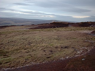
Grit Fell is a lonely hill between Clougha Pike and Ward's Stone in the Forest of Bowland in Lancashire, England. Covered by heather and large bogs, it is difficult walking country. The path from Jubilee Tower car park in the south is difficult and treacherous, with sheer-sided bogs 6 feet (1.83 m) deep. The path from Clougha Pike in the west is better, but still contains bogs crossed by the odd plank of wood. The path from Ward's Stone is the most treacherous of all. Crossing Cabin Flat, it weaves its way across hidden pools of stagnant water, the presence of which is betrayed by a form of red grass.

Wolfhole Crag is an isolated and seldom-visited hill in the Forest of Bowland in Lancashire, England. It has an elevation of 527 m (1,729 ft) and a prominence of 38 m (125 ft). Its seclusion is due in part to its low profile and long approach walks. The East crag has a 'Wolf hole' at the base of the south-facing side, presumably how it originally gained the name. Wolfhole Crag marks the northwesternmost boundary of the civil parish of Bowland Forest High, the historic Forest of Bowland, and the Lordship of Bowland.

Fair Snape Fell is one of the larger hills in the Forest of Bowland in Lancashire, England. It reaches 521.9 m (1,712 ft) with a prominence of 226.2 m (742 ft) and is classed as a Marilyn. It occupies a position in the very south of the main range of fells, alongside and just to the north of Parlick, to which it is joined by a ridge. The main paths approach the summit from Parlick in the south, Saddle Fell in the east and Bleasdale in the valley to the west. The Saddle Fell approach is as boggy as the hills to the north. The summit is covered in grass and peat groughs. A trig point and large cairn occupy the top of the western escarpment, with the highest point being about 700 metres (770 yd) to the north-east.

Bowfell is a pyramid-shaped mountain lying at the heart of the English Lake District, in the Southern Fells area. It is the sixth-highest mountain in the Lake District and one of the most popular of the Lake District fells for walkers. It is listed in Alfred Wainwright's 'best half dozen' Lake District fells.

White Hill is a hill in the Forest of Bowland, north-western England. It lies between Slaidburn and High Bentham, on the boundary between the City of Lancaster and Ribble Valley districts. The summit houses a tower and a trig point. In medieval times, the hill marked one of the northernmost limits of the Lordship of Bowland.
Hawthornthwaite Fell is one of the larger hills in the Forest of Bowland in the north west of England. Hawthornthwaite Fell marks the extreme western limit of the West Riding of the historic county of York. Since 1974 it has fallen within the boundaries of the administrative county of Lancashire. However, most of the hill is on the Duke of Westminster's land. It occupies a north-facing position on the south-western range, close to Bleasdale and Fair Snape Fell. The only path to the summit comes over the hills from the south. The summit is boggy and flanked to the north by steep heather slopes. Grouse are farmed in the area and hen harriers can be seen frequently. The trig point and the remains of its foundations are no longer upright, lying horizontally pointing westward.

A triangulation station, also known as a trigonometrical point, and sometimes informally as a trig, is a fixed surveying station, used in geodetic surveying and other surveying projects in its vicinity. The nomenclature varies regionally: they are generally known as trigonometrical stations or triangulation stations in North America, trig points in the United Kingdom, trig pillars in Ireland, trig stations or trig points in Australia and New Zealand, and trig beacons in South Africa.

Loughrigg Fell is a hill in the central part of the English Lake District. It stands on the end of the long ridge coming down from High Raise over Silver How towards Ambleside, and is separated from its neighbours by the depression of Red Bank.

Cleeve Hill is the highest point both of the Cotswolds hill range and of the county of Gloucestershire, at 330 m (1,080 ft). It is located on Cleeve Common, which is a Site of Special Scientific Interest (SSSI) looked after by a small charity called Cleeve Common Trust. It commands a clear view to the west, over Cheltenham and the racecourse, over the River Severn and into Wales; and to the north over Winchcombe. It is a conspicuous outcrop on the edge of the limestone escarpment,. It is crossed by the Cotswold Way footpath.

Grey Knotts is a fell in the English Lake District. It is situated one kilometre south of the B5289 road as it crosses the Honister Pass. It is well seen from mid-Borrowdale as it rises above Seatoller. Grey Knotts reaches a height of 697 metres and is part of a ridge which ascends from the woodland behind Seatoller and continues south-west and then south for four kilometres to Great Gable. The fell's name really only applies to the summit rocks, but has been adopted for the entire fell with the high ground in this area, locally known as Seatoller Fell on Ordnance Survey maps.
Djouce at 725 metres (2,379 ft), is the 74th–highest peak in Ireland on the Arderin scale, and the 91st–highest peak on the Vandeleur-Lynam scale. Djouce is situated in the northeastern section of the Wicklow Mountains, and dominates the views of the Wicklow Mountains from Roundwood to Newtownmountkennedy. Djouce is one of a few Irish mountains for which the Irish Office of Public Works (OPW) maintain a boarded mountain trail, using railway sleepers, from its base to a point close to its summit; making the mountain even more accessible to the public, but while also protecting the underlying bog and soil from human erosion. Djouce is popular with hill walkers, and it lies along the 131-kilometre Wicklow Way; on its southern slopes at a scenic viewpoint is the J.B. Malone memorial stone, dedicated to the creator of the Wicklow Way.
Longridge Fell is the most southerly fell in England, near the town of Longridge, Lancashire. It lies at the southern end of the Forest of Bowland Area of Outstanding Natural Beauty. As its name suggests, it takes the form of a long ridge which rises in a north-easterly direction from within the town of Longridge to its summit 4.5 miles distant. As the ridge curves towards the east, it comes to a sudden end and drops into the Hodder Valley. The fell is an example of a cuesta; the ridge has a sharp drop or escarpment on its northern side, and a gentler, more varying slope on its southern side. These features make it a popular takeoff for hang-gliders and paragliders on the relatively infrequent occurrences of a northerly wind.

Gragareth is a mountain straddling the border between Lancashire and North Yorkshire in England. At 627 metres (2,057 ft), its summit is the second highest point in the post-1974 county of Lancashire. The highest point in modern Lancashire is Green Hill, approximately 3.2 km (2.0 mi) to the north and the Old Man of Coniston in the Furness Fells of the Lake District at 803 metres (2,635 ft) is the county top of the traditional county of Lancashire. The summit of Gragareth lies about 200 m west of the county boundary, but inside the 2016 border of Yorkshire Dales National Park. The western slopes are known as Leck Fell and the southern slopes form Ireby Fell.

Beinn a' Chuallaich is a Scottish hill, four kilometres northeast of the village of Kinloch Rannoch in the Perth and Kinross council area. It is part of the high ground between Strath Tummel and Glen Errochty.
High Crag is a minor fell on the Helvellyn Range in the eastern region of the English Lake District. It sits on the ridge to the south of Helvellyn and Nethermost Pike. It rises sharply above the head of Ruthwaite Cove, and has attracted the attention of rock climbers. Its rock type is a lapilli-tuff of the Helvellyn Tuff Formation.


