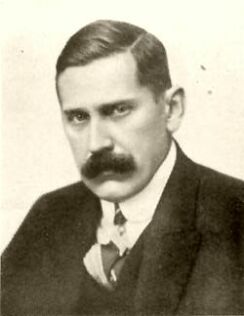
Karl Blodig was an Austrian mountaineer, optician, and writer. Blodig was the first to successfully climb all Alpine peaks of over 4000 meters, completing his final summit around 1911. He wrote about these climbs in his book Die Viertausender der Alpen, first published in 1923.
Othenio Lothar Franz Anton Louis Abel was an Austrian paleontologist and evolutionary biologist. Together with Louis Dollo, he was the founder of "paleobiology" and studied the life and environment of fossilized organisms.

The Tre Cime di Lavaredo, also called the Drei Zinnen ; pronounced[ˌdʁaɪˈtsɪnən] ), are three distinctive battlement-like peaks, in the Sexten Dolomites of northeastern Italy. They are one of the best-known mountain groups in the Alps. The three peaks, from east to west, are:
Salzofen cave is an archaeological site in Styria, Austria. It is located in the municipality of Grundlsee at an altitude of approximately 2,000 m (6,600 ft), about sixty meters below the summit. It is known for its Neolithic and Middle Paleolithic finds of fireplaces, stone tools, and bone tools, the latter dating from 65000 to 31000 BCE.
The Pizol is a mountain in the Glarus Alps of northeastern Switzerland, overlooking Wangs in the canton of St. Gallen. At 2,844 metres above sea level, it is the highest summit of the chain separating the valleys of the Seez and the Tamina rivers, and the highest mountain lying entirely within the canton of St. Gallen.

Fürschießer is a mountain of Bavaria, Germany.

The Höfats is a 2,259 m high mountain in the Allgäu Alps. Located near Oberstdorf, it separates the Oy and the Dietersbach valleys, along with the Rauheck and other lower summits. With its very steep faces it is the most striking of the Allgau "grass mountains" (Grasberge) and is unique in the Eastern Alps. It may be compared to the mountains of the Lofoten.

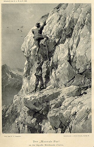
Angelo Dibona was an Austro-Hungarian and Italian mountaineer. He is remembered as one of the great pioneers of climbing in the Dolomites and is responsible for many first ascents throughout the Alps. The Aiguille Dibona in France, the Campanile Dibona and the Dibona-Kante on the Cima Grande di Lavaredo are named after him.
The Roßkopf is a mountain in the Austrian state of Tyrol in the Kitzbühel Alps. It is 1,731 metres (5,679 ft) high and lies about 7 kilometres due south of Wörgl. To the northeast an arête descends to the Marchbachjoch or Markbachjoch ; another ridge runs northeast to the Kirchköpfl and a third to the Turmkogel to the south. The summit of the Roßkopf is the highest in the local area. It is marked by a large summit cross.

The Hadži-Prodan's Cave is an archaeological site of the Paleolithic period and a national natural monument, located in the village Raščići around 7 km (4.3 mi) from Ivanjica in western central Serbia. The rather narrow and high entrance with at an altitude of 630 m (2,070 ft) above sea level sits about 40 m (130 ft) above the Rašćanska river valley bed and is oriented towards the south. The 345 m (1,132 ft) long cave was formed during the Late Cretaceous in "thick-bedded to massive" Senonian limestone. Prehistoric pottery shards and Pleistocene faunal fossils had already been collected by Zoran Vučićević from Ivanjica. Animal fossils especially Cave bear and Iron Age artifact discoveries during an unrelated areal survey were reportedly made at the cave entrance and in the main cavern. The site is named in honor of Hadži-Prodan, a 19th century Serbian revolutionary.

The Hagen Mountains are a subrange of the Berchtesgaden Alps. They lie mainly in the Austrian state of Salzburg, the western quarter is in the Bavarian county of Berchtesgadener Land. The steep western flanks of the Hagen lie in Bavaria and drop 1,700 metres (5,580 ft) in height to the basin of the Berchtesgadener Königssee.

The Großer Widderstein is a mountain, 2,533 m (AA), in the west Austrian state of Vorarlberg. Topographically it belongs to the Allgäu Alps. It is the highest peak in the subgroup of the Southeastern Walsertal Mountains.

The Schafalpenköpfe are a small mountain formation, consisting of three peaks, the First (2,272 m), Second (2,302 m) and Third Schafalpenkopf (2,320 m). A 2.4-kilometre-long klettersteig of medium difficulty, the Mindelheimer Klettersteig, runs over them.

The Gimpel is a peak in the Tannheim Mountains, a sub-range of the Allgäu Alps. It is 2,173 m high. The name is derived from the Gimpelalpe alp in der "hollow" (Mulde). The Gimpel is made of Wetterstein limestone.

At 2,163 metres, the Gehrenspitze is the third highest mountain in the Tannheim Group and is situated in the Austrian state of Tyrol. It should not be confused with the Gehrenspitze in the Wetterstein Mountains.

The small Sirgenstein Cave, German: Sirgensteinhöhle is situated 565 m (1,854 ft) above sea level inside the 20 m (66 ft) high Sirgenstein, a limestone rock. The cave sits 35 m (115 ft) above the Ach River valley bottom in the central Swabian Jura, southern Germany. Archaeologist R. R. Schmidt excavated the site in 1906 during which he identified indices of prehistoric human presence. He recorded the complete stratigraphic sequence of Palaeolithic and Neolithic origin. In his 1910 analysis Schmidt inspired future archaeologists with his pioneering concept of including the excavation site within its geographic region, contextualizing it within a wide scientific spectrum and demonstrated valuable results as he correlated the Sirgenstein layer structure to those of prehistoric sites in France. Mammoth ivory beads dating from 39,000 to 35,000 years ago have been uncovered at the cave. Because of its historical and cultural significance and its testimony to the development of Paleolithic art, the cave was inscribed on the UNESCO World Heritage List as part of the Caves and Ice Age Art in the Swabian Jura site in 2017.
Ursus ingressus is an extinct species of the family Ursidae that lived in Central Europe during the Late Pleistocene. It is named after the Gamssulzen Cave in Austria, where the holotype of this species was found.

The Bärenschützklamm is a narrow valley in the Graz Highlands in the Austrian Central Alps. It was carved out of limestone by the Mixnitzbach and is a popular tourist destination.

