Sunol is an unincorporated area and census-designated place in Alameda County, California. Located in the Sunol Valley of the East Bay, the population was 913 at the 2010 census. It is best known as the location of the Sunol Water Temple and for its historic, tourist railroad system Niles Canyon Railway.

Niles Canyon is a canyon in the San Francisco Bay Area formed by Alameda Creek, known for its heritage railroad and silent movie history. The canyon is largely in an unincorporated area of Alameda County, while the western portion of the canyon lies within the city limits of Fremont and Union City. The stretch of State Route 84 known as Niles Canyon Road traverses the length of the canyon from the Niles district of Fremont to the unincorporated town of Sunol. Two railroads also follow the same route down the canyon from Sunol to Niles: the old Southern Pacific track along the north side, now the Niles Canyon Railway, and the newer Union Pacific track a little to the south. At the west end of the canyon are the ruins of the Vallejo Flour Mill, which dates to 1853.

The Niles Canyon Railway (NCRy) is a heritage railway running through Niles Canyon, between Sunol and the Niles district of Fremont in the East Bay of the San Francisco Bay Area, in California, United States. The railway is listed on the National Register of Historic Places as the Niles Canyon Transcontinental Railroad Historic District. The railroad is operated and maintained by the Pacific Locomotive Association which preserves, restores and operates historic railroad equipment. The NCRy features public excursions with both steam and diesel locomotives along a well-preserved portion of the First Transcontinental Railroad.

The Pacific Locomotive Association, Inc. (PLA) is a non-profit organization dedicated to the preservation of the physical aspects and atmosphere of Pacific Coast railroading during the period from 1910 to 1960.

The Whitewater River is a small permanent stream in western Riverside County, California, with some upstream tributaries in southwestern San Bernardino County. The river's headwaters are in the San Bernardino Mountains and it terminates at the Salton Sea in the Colorado Desert. The area drained by the Whitewater River is part of the larger endorheic Salton Sea drainage basin.

The San Jacinto River is a 42-mile-long (68 km) river in Riverside County, California. The river's headwaters are in Santa Rosa and San Jacinto Mountains National Monument. The lower portion of the 765-square-mile (1,980 km2) watershed is urban and agricultural land. As a partially endorheic watershed that is contiguous with other Great Basin watersheds, the western side of the San Jacinto Basin is a portion of the Great Basin Divide.

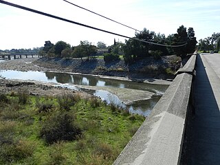
Alameda Creek is a large perennial stream in the San Francisco Bay Area. The creek runs for 45 miles (72 km) from a lake northeast of Packard Ridge to the eastern shore of San Francisco Bay by way of Niles Canyon and a flood control channel.

Laws is an unincorporated community in Inyo County, California. Laws is located 4 miles (6.4 km) northeast of Bishop on U.S. Route 6, towards the Nevada state line.

Pulga is an unincorporated community in Butte County, California. It is located along the west slope of the Feather River canyon, at an elevation of 1,398 feet (426 m). A variant name for the community is Big Bar. Other nearby communities include Mayaro, Poe and Parkhill. The town hosts a Caltrans highway maintenance station along State Route 70 (SR70). The place is at the mouth of the Flea Valley Creek, which gives rise to the toponym.

Eldorado Mountain is a mountain summit on the eastern flank of the Front Range of the Rocky Mountains of North America. The 8,344-foot (2,543 m) peak is located 8.1 miles (13.1 km) south by west of downtown Boulder, Colorado, United States. The mountain is largely in Boulder County but it straddles the border and its southern flanks are located in Jefferson County. Its name was probably borrowed from the nearby community of Eldorado Springs.

Kilkare Woods, also known as Kilcare Woods, is a small rural unincorporated community of about 773 people in southern Alameda County, California, near Pleasanton.

Brightside is an unincorporated community in Alameda County, California. It is located 2.25 miles (3.6 km) west of Sunol.

Verona is an unincorporated community in Alameda County, California. It is located on the Western Pacific and the Southern Pacific Railroads 2.25 miles (3.6 km) north of Sunol, at an elevation of 315 feet.

Brown is an unincorporated community in Kern County, California. It is located on the Southern Pacific Railroad 9 miles (14 km) north-northwest of Inyokern, at an elevation of 2392 feet.

Collins was an unincorporated community in Napa County, California. It lies at an elevation of 49 feet. Collins is located on the Southern Pacific Railroad, 1.5 miles (2.4 km) south of Napa Junction. In 1992, the community was annexed and incorporated into American Canyon.

Lowell was an unincorporated community in Napa County, California. It lies at an elevation of 66 feet. Lowell is located on the Southern Pacific Railroad, 1 mile (1.6 km) south of Napa Junction. In 1992, Lowell was annexed and incorporated into American Canyon.

Alberhill is an unincorporated community in Riverside County, California. Alberhill is located 5.5 miles (8.9 km) northwest of Lake Elsinore. It lies at an elevation of 1234 feet. Alberhill was named after C.H. Albers and James and George Hill.

Corral Hollow, formed by Corral Hollow Creek, is a canyon with part in Alameda County and parts in San Joaquin County, 6.5 miles (10.5 km) southwest of Tracy, California. Corral Hollow Creek, formerly El Arroyo de los Buenos Ayres, from its source 1.9 miles (3.1 km) north of Mount Boardman, flows north 1.89 miles where it turns to flow west-northwest 8.5 miles (13.7 km) then turns abruptly east in the vicinity of Tesla to flow 5 miles (8.0 km) east where it turns again in a northeasterly direction for 6 miles (9.7 km) to the Delta-Mendota Canal in the San Joaquin Valley.

Outlet Creek is an Eel River tributary draining the Little Lake Valley northerly through a canyon of the California Coast Ranges. The Northwestern Pacific Railroad bridges the creek twelve times, following it through the canyon. California State Route 162 bridges the creek once, following the canyon closely downstream of Longvale, California, and U.S. Route 101 bridges the creek twice, paralleling it less closely upstream of Longvale. After leaving Quaternary alluvium of the Little Lake Valley, the canyon exposes undivided Cretaceous marine sedimentary and metasedimentary rocks upstream of Longvale and Franciscan Assemblage downstream of Longvale. Outlet Creek provides groundwater recharge, recreation, and agricultural and industrial water supply plus wildlife habitat including cold freshwater habitat for fish migration and spawning.

Temescal Mountains, formerly the Sierra Temescal, are one of the northernmost mountain ranges of the Peninsular Ranges in western Riverside County, in Southern California in the United States. They extend for approximately 25 mi (40 km) southeast of the Santa Ana River east of the Elsinore Fault Zone to the Temecula Basin and form the western edge of the Perris Block.


