Grant County, Nebraska

Last updated

Grant County
Grant County, Nebraska courthouse from NE 2.JPG
Grant County Courthouse in Hyannis
Map of Nebraska highlighting Grant County.svg
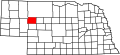
Location within the U.S. state of Nebraska
Nebraska in United States.svg
Nebraska's location within the U.S.
Coordinates: 41°55′N101°44′W / 41.92°N 101.74°W / 41.92; -101.74
CountryFlag of the United States.svg United States
StateFlag of Nebraska.svg Nebraska
FoundedMarch 31, 1887
Named after Ulysses S. Grant
Seat Hyannis
Largest villageHyannis
Area
  Total
783 sq mi (2,030 km2)
  Land776 sq mi (2,010 km2)
  Water7.0 sq mi (18 km2)  0.9%
Population
 (2020)
  Total
611
  Density0.78/sq mi (0.30/km2)
Time zone UTC−7 (Mountain)
  Summer (DST) UTC−6 (MDT)
Congressional district 3rd
Website https://grantcountyne.gov/

Grant County is a county in the U.S. state of Nebraska. As of the 2020 United States census, the population was 611, [1] making it the fourth-least populous county in Nebraska and the ninth-least populous county in the United States. Its county seat is Hyannis. [2] The county was founded in 1887 and named for Ulysses S. Grant, 18th President of the United States. [3]

Contents

In the Nebraska license plate system, Grant County is represented by the prefix 92 (it had the ninety-second-largest number of vehicles registered in the state when the license plate system was established in 1922).

Geography

Grant County terrain is characterized by continuous waves of east–west oriented rolling hillocks on otherwise flat areas. As a result, the county is dotted with small lakes and reservoirs. [4]

According to the US Census Bureau, the county has a total area of 783 square miles (2,030 km2), of which 776 square miles (2,010 km2) is land and 7.0 square miles (18 km2) (0.9%) is water. [5]

Major highways

Adjacent counties

Demographics

Historical population
CensusPop.Note
1890 458
1900 76366.6%
1910 1,09743.8%
1920 1,48635.5%
1930 1,427−4.0%
1940 1,327−7.0%
1950 1,057−20.3%
1960 1,009−4.5%
1970 1,0191.0%
1980 877−13.9%
1990 769−12.3%
2000 747−2.9%
2010 614−17.8%
2020 611−0.5%
US Decennial Census [6]
1790-1960 [7] 1900-1990 [8]
1990-2000 [9] 2010 [10]

As of the 2000 United States Census, [11] there were 747 people, 292 households, and 226 families residing in the county. The population density was 0.95 people per square mile (0.37 people/km2). There were 449 housing units at an average density of 0.57 units per square mile (0.22/km2). The racial makeup of the county was 98.80% White, 0.13% Native American, 0.27% Asian, 0.80% from other races. 1.34% of the population were Hispanic or Latino of any race.

There were 292 households, out of which 37.00% had children under the age of 18 living with them, 67.50% were married couples living together, 6.50% had a female householder with no husband present, and 22.60% were non-families. 22.30% of all households were made up of individuals, and 8.90% had someone living alone who was 65 years of age or older. The average household size was 2.56 and the average family size was 2.98.

The county population contained 29.20% under the age of 18, 5.20% from 18 to 24, 24.40% from 25 to 44, 27.60% from 45 to 64, and 13.70% who were 65 years of age or older. The median age was 40 years. For every 100 females there were 114.00 males. For every 100 females age 18 and over, there were 105.80 males.

The median income for a household in the county was $34,821, and the median income for a family was $37,011. Males had a median income of $26,319 versus $14,417 for females. The per capita income for the county was $14,815. About 8.20% of families and 9.70% of the population were below the poverty line, including 16.70% of those under age 18 and 0.00% of those age 65 or over.

Communities

Village

Unincorporated communities

Ghost town

Politics

Grant County is strongly Republican, having been Donald Trump's strongest county in 2024. The last time Grant County supported a Democrat was in 1936, when Franklin Delano Roosevelt won in a 46-state landslide over Alf Landon. Barack Obama, in 2008, was the last candidate from the Democratic Party to even get 10 percent of the vote.

United States presidential election results for Grant County, Nebraska [12]
Year Republican Democratic Third party(ies)
No.%No.%No.%
1900 14859.20%9738.80%52.00%
1904 11366.86%4928.99%74.14%
1908 9347.69%10151.79%10.51%
1912 8234.75%9339.41%6125.85%
1916 15738.57%24159.21%92.21%
1920 25664.16%14135.34%20.50%
1924 26048.69%19135.77%8315.54%
1928 39870.94%16028.52%30.53%
1932 25137.41%39558.87%253.73%
1936 26745.25%32154.41%20.34%
1940 42363.51%24336.49%00.00%
1944 32765.53%17234.47%00.00%
1948 27366.26%13933.74%00.00%
1952 45281.15%10518.85%00.00%
1956 43383.27%8716.73%00.00%
1960 41076.35%12723.65%00.00%
1964 30460.44%19939.56%00.00%
1968 31174.94%8420.24%204.82%
1972 37684.49%6915.51%00.00%
1976 31470.40%11626.01%163.59%
1980 37380.22%7616.34%163.44%
1984 40688.45%5111.11%20.44%
1988 30176.79%8922.70%20.51%
1992 24755.01%7516.70%12728.29%
1996 25864.82%8421.11%5614.07%
2000 32484.16%4912.73%123.12%
2004 35288.89%4110.35%30.76%
2008 31886.65%4111.17%82.18%
2012 32288.71%308.26%113.03%
2016 36790.62%204.94%184.44%
2020 37593.28%204.98%71.74%
2024 35195.90%154.10%00.00%

See also

References

  1. "Grant County, Nebraska". United States Census Bureau . Retrieved June 17, 2023.
  2. "Find a County". National Association of Counties. Archived from the original on May 31, 2011. Retrieved June 7, 2011.
  3. Gannett, Henry (1905). The Origin of Certain Place Names in the United States. Govt. Print. Off. p.  141.
  4. Grant County Google Maps (accessed 21 January 2019)
  5. "2010 Census Gazetteer Files". US Census Bureau. August 22, 2012. Archived from the original on November 13, 2013. Retrieved December 7, 2014.
  6. "US Decennial Census". US Census Bureau. Retrieved December 7, 2014.
  7. "Historical Census Browser". University of Virginia Library. Retrieved December 7, 2014.
  8. "Population of Counties by Decennial Census: 1900 to 1990". US Census Bureau. Retrieved December 7, 2014.
  9. "Census 2000 PHC-T-4. Ranking Tables for Counties: 1990 and 2000" (PDF). US Census Bureau. Archived (PDF) from the original on March 27, 2010. Retrieved December 7, 2014.
  10. "State & County QuickFacts". US Census Bureau. Archived from the original on June 7, 2011. Retrieved September 20, 2013.
  11. "U.S. Census website". US Census Bureau. Retrieved January 31, 2008.
  12. Election Results

41°55′N101°44′W / 41.92°N 101.74°W / 41.92; -101.74