
Kaipara District is a territorial authority district in the Northland Region of New Zealand.

The South Wairarapa District is a district at the south-east tip of the North Island of New Zealand, governed by the South Wairarapa District Council. The district comprises the southernmost part of the Wairarapa, and is part of the Wellington Region.

Tasman District is a local government district in the northwest of the South Island of New Zealand. It borders the Canterbury Region, West Coast Region, Marlborough Region and Nelson City. It is administered by the Tasman District Council, a unitary authority, which sits at Richmond, with community boards serving outlying communities in Motueka and Golden Bay / Mohua. The city of Nelson has its own unitary authority separate from Tasman District, and together they comprise a single region in some contexts, but not for local government functions or resource management (planning) functions.

South Waikato District is a local government district in the Waikato Region of the North Island of New Zealand. It is located between the cities of Hamilton to the north, Rotorua to the east, Taupō to the south and Ruapehu District to the west.

The Far North District is the northernmost territorial authority district of New Zealand, consisting of the northern part of the Northland Peninsula in the North Island. It stretches from North Cape / Otou and Cape Reinga / Te Rerenga Wairua in the north, down to the Bay of Islands, the Hokianga and the town of Kaikohe.

Taipa-Mangonui or Taipa Bay-Mangonui is a string of small resort settlements – Taipa, Cable Bay, Coopers Beach, and Mangōnui – that lie along the coast of Doubtless Bay and are so close together that they have run together to form one larger settlement.

Matauri Bay is a bay in New Zealand, situated 30 km north of Kerikeri, in Whangaroa county, just north of the Bay of Islands. It has over a kilometre of white sand and crystal clear water, making it a popular summer destinations for surfers, divers, fishers and holidaymakers.
Kaeo is a township in the Far North District of New Zealand, located some 22 km (14 mi) northwest of Kerikeri. The town's name comes from the Māori-language name of the New Zealand freshwater mussel, which is found in nearby rivers.

Ahipara is a town and locality in Northland, New Zealand at the southern end of Ninety Mile Beach, with the Tauroa Peninsula to the west and Herekino Forest to the east. Ahipara Bay is to the north west. Kaitaia is 14 km to the north east, and Pukepoto is between the two.

Herekino is a locality in Northland, New Zealand. It lies 26 km south west of Kaitaia. The Herekino Harbour, also called the Herekino River, is an estuary and inlet from the Tasman Sea to the west. The Herekino Forest, which contains a stand of large kauri, is to the north, and the Tauroa Peninsula lies to the north west.
Oruaiti is a locality in Northland, New Zealand. It lies on state highway 10. Mangonui lies to the west, and Whangaroa Harbour to the east.

Peria is a locality in Northland, New Zealand. It lies south of Taipa and east of Kaitaia. The area was once known as Oruru Valley.
Pukepoto is a town in Northland, New Zealand. It lies south west of Kaitaia and north east of Ahipara. The Herekino Forest lies to the south east.

The Karikari Peninsula on the east coast of the far north of Northland, New Zealand, is between Rangaunu Harbour to the west, and Doubtless Bay to the southeast. It is a right-angled land mass of two relatively distinct parts. The rocky northern part, which has an east–west orientation and is approximately 17 km long, was originally an island but is now connected to the mainland by a low sandy tombolo approximately 11 km long, which has a north–south orientation. The spiritually significant Puwheke sits high above the north-facing beaches.

Whangape Harbour is a harbour on the west coast of Northland, New Zealand. There is a settlement called Whangape on the northern side of the harbour. Another, called Pawarenga, is located on the southern side. Kaitaia is 42 km north east.
Panguru is a community in the northern Hokianga harbour, in Northland, New Zealand. The Whakarapa Stream flows from the Panguru Range in the Warawara Forest to the west, through Panguru and into the Hokianga.

Wairoa District is a territorial authority district within the Hawke's Bay Region in the North Island of New Zealand. The Wairoa District Council is headquartered in the largest town, Wairoa. The district covers the northern half of the Hawke's Bay coast, extending from Māhia Peninsula to Lake Waikaremoana, and south to the mouth of the Waikare River.
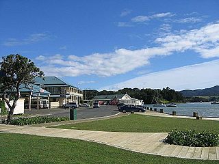
Mangōnui is a settlement on the west side of Mangōnui Harbour in Northland, New Zealand. State Highway 10 runs through it. It is the easternmost of the Taipa-Mangonui string of settlements, separated from Coopers Beach to the northwest by Mill Bay Road.

Taupō Bay is a bay, village and rural community in the Far North District and Northland Region of New Zealand's North Island. There are about 40 permanent residents, and 180 properties. The white sand beach is 1.5 km wide.

Takahue is a rural community in the Far North District and Northland Region of New Zealand's North Island, south of Kaitaia.
