
The Red Line is a rapid transit line of the Washington Metro system, consisting of 27 stations in Montgomery County, Maryland, and Washington, D.C., in the United States. It is a primary line through downtown Washington and the oldest and busiest line in the system. It forms a long, narrow "U," capped by its terminal stations at Shady Grove and Glenmont.

Rhode Island Avenue station is a Washington Metro station in Washington, D.C., on the Red Line. The station is located in the Brentwood neighborhood of Northeast, on an elevated platform crossing Rhode Island Avenue NE

Northeast is the northeastern quadrant of Washington, D.C., the capital of the United States. It encompasses the area located north of East Capitol Street and east of North Capitol Street.

Brookland, also known as Little Rome or Little Vatican, is a neighborhood located in the Northeast (NE) quadrant of Washington, D.C. It is best known for its numerous Catholic institutions, including schools, religious communities, shrines, institutes, and other organizations built and based around the Catholic University of America.
Trinidad is a neighborhood located in Ward 5, in the northeast quadrant of Washington, D.C., and is a largely residential area.

Neighborhoods in Washington, D.C., the capital of the United States, are distinguished by their history, culture, architecture, demographics, and geography. The names of 131 neighborhoods are unofficially defined by the D.C. Office of Planning. Neighborhoods can be defined by the boundaries of wards, historic districts, Advisory Neighborhood Commissions, civic associations, and business improvement districts (BIDs); these boundaries will overlap. The eight wards each elect a member to the Council of the District of Columbia and are redistricted every ten years.

Woodridge is a residential neighborhood located in Ward 5 of Northeast Washington, D.C. Woodridge is contained between Eastern Avenue N.E. to the east, Taylor Street N.E. to the north, South Dakota Avenue N.E. to the west, and Bladensburg Road N.E. to the south. Its central commercial strips are Rhode Island Avenue NE and Bladensburg Road N.E. Woodridge borders the adjacent neighborhoods of Brookland, Langdon, North Michigan Park, and Fort Lincoln in Northeast Washington D.C. In addition to these neighborhoods in the District of Columbia, Woodridge borders the city of Mount Rainier and town of Cottage City in Maryland. In terms of public transportation, residents of Woodridge have access to the Brookland-CUA and Rhode Island Avenue Metro stations.

Rhode Island Avenue is a diagonal avenue in the Northwest and Northeast quadrants of Washington, D.C., and the capital's inner suburbs in Prince George's County, Maryland. Paralleling New York Avenue, Rhode Island Avenue was one of the original streets in Pierre L'Enfant's plan for the capital. It became a major commuter route, carrying U.S. Route 1 traffic into the city from Prince George's County.

Queens Chapel is a mostly residential neighborhood with commercial elements located in Ward 5 of Northeast Washington, D.C.

Edgewood is a neighborhood located in Ward 5 of Northeast Washington, D.C. Edgewood is bounded by Michigan Avenue NE to the north, Rhode Island Avenue NE to the south, North Capitol Street to the west, and the Washington Metro's Red Line to the east. The eastern boundary originates with the establishment of the former Metropolitan Branch of the Baltimore and Ohio Railroad in 1873, creating the physical barrier which today separates Edgewood from Brookland to the east.
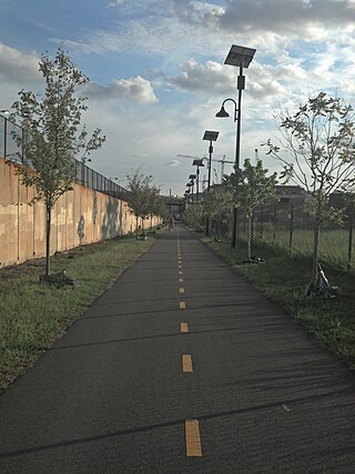
The Metropolitan Branch Trail is an American rail trail between the transit center in Silver Spring, Maryland, and Union Station in the District of Columbia. It runs for 8 miles (13 km): one in Maryland and seven within Washington, D.C. The trail parallels Metrorail and CSX tracks along a right-of-way opened in 1873 as the Baltimore and Ohio Railroad (B&O)'s Metropolitan Branch.
Washington, D.C., is administratively divided into four geographical quadrants of unequal size, each delineated by their ordinal directions from the medallion located in the Crypt under the Rotunda of the Capitol. Street and number addressing, centered on the Capitol, radiates out into each of the quadrants, producing a number of intersections of identically named cross-streets in each quadrant. Originally, the District of Columbia was a near-perfect square but contained more than one settlement; the Capitol was to be the center of the City of Washington. Thus, the Capitol was never located at the geographic center of the whole territory, which was eventually north of the Potomac River, consolidated into one city. As a result, the quadrants are of greatly varying size. Northwest is quite large, encompassing over a third of the city's geographical area, while Southwest is little more than a few neighborhoods, large parks, and a military base.

Old Engine Company No. 26, also known as the Langdon Firehouse and Chemical Company No. 3, located at 2715 22nd Street, NE, Washington, D.C. is a historic firehouse built in 1908 and listed on the National Register of Historic Places in 2007.

Engine Company 26 in the Northeast quadrant of Washington, D.C., USA, is a historic firehouse located at 1340 Rhode Island Avenue on the border between Brentwood and Brookland. The building was listed by the National Register of Historic Places in May, 2011. The same Engine Company was located at 2715 22nd St. until 1940, and that building is also listed by the NRHP, as Old Engine Company 26. Both buildings were listed as part of the "Firehouses in Washington DC" Multiple Property Submission.

The Rhode Island Avenue–New Carrollton Line, designated Route T14, is a daily bus route operated by the Washington Metropolitan Area Transit Authority between the New Carrollton station of the Orange Line of the Washington Metro and Rhode Island Avenue–Brentwood station of the Red Line of the Washington Metro. The line operates every 20–25 during the peak periods and 60 minutes during the weekday middays and on the weekends. Route T14 trips roughly take 50 minutes.

The Queens Chapel Road Line, designated Route R4, is a daily bus route operated by the Washington Metropolitan Area Transit Authority between the Highview Apartment Complex in Hyattsville, Maryland and Brookland–CUA station of the Red Line of the Washington Metro. The line operates every 20–35 minutes during peak hours, 70 minutes during midday service and 65–70 minutes on the weekends. R4 trips are roughly 30 minutes.

The Woodridge Neighborhood Library is a branch of the District of Columbia Public Library in the Woodridge neighborhood of Washington, D.C. It is located at 1801 Hamlin Street NE. A small sub-branch library at 2206 Rhode Island Ave NE served the neighborhood starting in 1929, and a full-fledged library branch opened at the current site in 1958. It was replaced in 2016 by a new, 20,000-square-foot library built at a cost of $16.5 million, after nearly three years of construction. The new building was designed by Wiencek & Associates and Bing Thom Architects.

The Annapolis Road Line, designated Route T18, is a daily bus route operated by the Washington Metropolitan Area Transit Authority between the New Carrollton station of the Orange Line of the Washington Metro and the Rhode Island Avenue–Brentwood station of the Red Line of the Washington Metro. The line operates every 12 minutes during the weekdays between 7AM and 9PM and 45-60 minutes after 9PM. T18 trips roughly take 50 minutes.

The Rhode Island Avenue Limited Line, designated Route G9 is a limited stop peak hour-only MetroExtra bus route operated by the Washington Metropolitan Area Transit Authority between Mount Rainier Terminal and Franklin Square. The line operates every 15 minutes during rush hours and trips are roughly 45 minutes. This route provides a one seat ride between Mount Rainier and Downtown DC during the weekday peak-hours so passengers won’t have to board the train.

The Crosstown Line, designated Routes H2 and H4, is a daily bus route operated by the Washington Metropolitan Area Transit Authority between Brookland–CUA station and Tenleytown–AU station of the Red Line of the Washington Metro. The line operates every 24 minutes between 7AM and 9PM, and 20 - 40 minutes after 9PM at a combined frequency of 12 minutes during the day and, 20 minutes during the late nights. Trips roughly take 48 minutes to complete.

