List of orogenies

Last updated
Geologic provinces of the world (USGS)
.mw-parser-output .col-begin{border-collapse:collapse;padding:0;color:inherit;width:100%;border:0;margin:0}.mw-parser-output .col-begin-small{font-size:90%}.mw-parser-output .col-break{vertical-align:top;text-align:left}.mw-parser-output .col-break-2{width:50%}.mw-parser-output .col-break-3{width:33.3%}.mw-parser-output .col-break-4{width:25%}.mw-parser-output .col-break-5{width:20%}@media(max-width:720px){.mw-parser-output .col-begin,.mw-parser-output .col-begin>tbody,.mw-parser-output .col-begin>tbody>tr,.mw-parser-output .col-begin>tbody>tr>td{display:block!important;width:100%!important}.mw-parser-output .col-break{padding-left:0!important}}
.mw-parser-output .legend{page-break-inside:avoid;break-inside:avoid-column}.mw-parser-output .legend-color{display:inline-block;min-width:1.25em;height:1.25em;line-height:1.25;margin:1px 0;text-align:center;border:1px solid black;background-color:transparent;color:black}.mw-parser-output .legend-text{}
Shield
Platform
Orogen
Basin
Large igneous province
Extended crust
Oceanic crust:
0-20 Ma
20-65 Ma
>65 Ma World geologic provinces.jpg
Geologic provinces of the world (USGS)

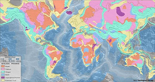
The following is a list of known orogenies organised by continent, starting with the oldest in each. The headings are present-day continents, which may differ from the geography contemporary to the orogenies. Some orogenies encompass more than one continent and may have different names in each, and some very large orogenies include sub-orogenies. As with other geological phenomena, orogenies are often subject to revised interpretations of their age, type and associated paleogeography.

Contents

In some (especially older) literature, the term orogeny refers to a long episode of basin formation and deposition of sediments over hundreds of millions of years, ending with deformation (sometimes including metamorphism) of these deposits. However, some workers use the term only for the final mountain-building deformation event over tens of millions of years or shorter. [1] [2]

African orogenies

Antarctic orogenies

Orogenies affecting Antarctica include: [3]

Asian orogenies

Persia-Tibet-Burma orogeny in Eurasian Plate EurasianPlate.png
Persia–Tibet–Burma orogeny in Eurasian Plate

European orogenies

North American orogenies

Taconic orogeny Taconic orogeny.gif
Taconic orogeny

Oceania orogenies

Australian orogenies

New Zealand orogenies

South American orogenies

Table

OrogenyEstimated start time(Ga)Estimated end time(Ga)Continent
Pan-African orogeny .55.55Africa
Damara orogeny .53.5Africa
Kibaran orogeny 1.41Africa
Eburnean orogeny 2.22Africa
East African Orogeny .75.55Africa
Mauritanide Orogeny .32.27Africa
Mozambique Orogeny 2.652.97Africa
Zambezi Orogeny .89.53Africa
Napier orogeny 4Antarctica
Rayner orogeny 3.5Antarctica
Humboldt orogeny 3Antarctica
Insel orogeny 2.65Antarctica
Early Ruker orogeny 21.7Antarctica
Late Ruker orogeny 1Antarctica
Beardmore orogeny .62Antarctica
Ross orogeny .55.48Antarctica
Borchgrevink orogeny .42.35Antarctica
Aravalli-Delhi Orogen 2.3Asia
Altaid Orogeny .54Asia
Uralian orogeny .3.25Asia
Cimmerian orogeny .22Asia
Dabie-Sulu orogeny .24Asia
Persia–Tibet–Burma orogeny.55Asia
Himalayan orogeny .29.16Asia
Saamian orogeny 3.12.9Europe
Lopian orogeny 2.92.6Europe
Svecofennian orogeny 2.01.75Europe
Gothian orogeny 1.751.5Europe
Sveconorwegian orogeny 1.14.96Europe
Timanide orogeny .62.55Europe
Cadomian orogeny .66.54Europe
Caledonian orogeny .49.39Europe
Variscan orogeny .44.35Europe
Uralian orogeny .32.25Europe
Alpine orogeny .15.25Europe
Mediterranean Ridge .15Europe
Algoman orogeny 2.72.5North America
Wopmay orogeny 2.11.9North America
Trans-Hudson orogeny 11.8North America
Nagssugtoqidian orogeny 1.91.8North America
Ketilidian orogeny 1.851.72North America
Penokean orogeny 1.851.84North America
Great Falls orogeny 1.77North America
Ivanpah orogeny 1.711.70North America
Yavapai orogeny 1.711.70North America
Mazatzal orogeny 1.671.65North America
Picuris orogeny 1.431.30North America
Grenville orogeny 1.25.98North America
Caledonian orogeny East Greenland Orogen .72.42North America
Caledonian orogeny Taconic orogeny .44North America
Caledonian orogeny Acadian orogeny .37North America
Appalachian orogeny .48North America
Taconic orogeny .44North America
Acadian orogeny .37North America
Alleghanian orogeny .35North America
Ouachita orogeny .29North America
Antler orogeny .35.32North America
Innuitian orogeny .45North America
Sonoma orogeny .27.24North America
Nevadan orogeny .2North America
Sevier orogeny .14.05North America
Laramide orogeny .07.04North America
Pasadena orogeny .03North America
Sleaford orogeny 2.442.42Oceania
Glenburgh orogeny 21.92Oceania
Barramundi orogeny 1.891.85Oceania
Kimban orogeny 1.841.70Oceania
Cornian orogeny 21.86Oceania
Miltalie orogeny 1.95Oceania
Yapungku orogeny 1.76Oceania
Albany-Fraser orogeny 1.711.02Oceania
Mangaroon orogeny 1.681.62Oceania
Isan orogeny 1.60Oceania
Kararan orogeny 1.571.55Oceania
Olarian orogeny 1.45Oceania
Capricorn orogeny 1.3Oceania
Musgrave orogeny 1.221.12Oceania
Edmundian orogeny 1.681.46Oceania
Petermann orogeny .55.53Oceania
Delamerian Orogeny .51Oceania
Lachlan Orogeny .54.44Oceania
Thomson Orogeny .51.49Oceania
Alice Springs Orogeny .45.30Oceania
Kanimblan Orogeny .32Oceania
Hunter-Bowen orogeny .26.22Oceania
Tuhua Orogeny .37.33Oceania
Rangitata Orogeny .14.09Oceania
Kaikoura Orogeny .03Oceania
Transamazonian orogeny 2.141.94South America
Guriense orogeny 2.82.7South America
Sunsás orogeny 1.41.1South America
Cariri Velhos orogeny .54South America
Brasiliano-Pan African orogeny .54South America
Pampean orogeny .53.48South America
Chonide orogeny .25.20South America
Terra Australis Orogen .54.23South America
Famatinian orogeny .49.46South America
San Rafael orogeny .29.25South America
Toco orogeny .33.30South America
Andean orogeny .200South America

Related Research Articles

<span class="mw-page-title-main">Proterozoic</span> Geologic eon, 2500–539 million years ago

The Proterozoic is the third of the four geologic eons of Earth's history, spanning the time interval from 2500 to 538.8 Mya, the longest eon of the Earth's geologic time scale. It is preceded by the Archean and followed by the Phanerozoic, and is the most recent part of the Precambrian "supereon".

<span class="mw-page-title-main">Geology of the Appalachians</span> Geologic description of the Appalachian Mountains

The geology of the Appalachians dates back more than 1.2 billion years to the Mesoproterozoic era when two continental cratons collided to form the supercontinent Rodinia, 500 million years prior to the development of the range during the formation of Pangea. The rocks exposed in today's Appalachian Mountains reveal elongate belts of folded and thrust faulted marine sedimentary rocks, volcanic rocks, and slivers of ancient ocean floor—strong evidences that these rocks were deformed during plate collision. The birth of the Appalachian ranges marks the first of several mountain building plate collisions that culminated in the construction of Pangea with the Appalachians and neighboring Anti-Atlas mountains near the center. These mountain ranges likely once reached elevations similar to those of the Alps and the Rocky Mountains before they were eroded.

<span class="mw-page-title-main">Pannotia</span> Hypothesized Neoproterozoic supercontinent

Pannotia, also known as the Vendian supercontinent, Greater Gondwana, and the Pan-African supercontinent, was a relatively short-lived Neoproterozoic supercontinent that formed at the end of the Precambrian during the Pan-African orogeny, during the Cryogenian period and broke apart 560 Ma with the opening of the Iapetus Ocean, in the late Ediacaran and early Cambrian. Pannotia formed when Laurentia was located adjacent to the two major South American cratons, Amazonia and Río de la Plata. The opening of the Iapetus Ocean separated Laurentia from Baltica, Amazonia, and Río de la Plata. A 2022 paper argues that Pannotia never fully existed, reinterpreting the geochronological evidence: "the supposed landmass had begun to break up well before it was fully assembled". However, the assembly of the next supercontinent Pangaea is well established.

<span class="mw-page-title-main">Baltica</span> Late-Proterozoic to early-Palaeozoic continent

Baltica is a paleocontinent that formed in the Paleoproterozoic and now constitutes northwestern Eurasia, or Europe north of the Trans-European Suture Zone and west of the Ural Mountains. The thick core of Baltica, the East European Craton, is more than three billion years old and formed part of the Rodinia supercontinent at c.Ga.

<span class="mw-page-title-main">Acadian orogeny</span> North American orogeny

The Acadian orogeny is a long-lasting mountain building event which began in the Middle Devonian, reaching a climax in the Late Devonian. It was active for approximately 50 million years, beginning roughly around 375 million years ago (Ma), with deformational, plutonic, and metamorphic events extending into the early Mississippian. The Acadian orogeny is the third of the four orogenies that formed the Appalachian Mountains and subsequent basin. The preceding orogenies consisted of the Grenville and Taconic orogenies, which followed a rift/drift stage in the Neoproterozoic. The Acadian orogeny involved the collision of a series of Avalonian continental fragments with the Laurasian continent. Geographically, the Acadian orogeny extended from the Canadian Maritime provinces migrating in a southwesterly direction toward Alabama. However, the northern Appalachian region, from New England northeastward into Gaspé region of Canada, was the most greatly affected region by the collision.

<span class="mw-page-title-main">Caledonian orogeny</span> Mountain building event caused by the collision of Laurentia, Baltica and Avalonia

The Caledonian orogeny was a mountain-building cycle recorded in the northern parts of the British Isles, the Scandinavian Caledonides, Svalbard, eastern Greenland and parts of north-central Europe. The Caledonian orogeny encompasses events that occurred from the Ordovician to Early Devonian, roughly 490–390 million years ago (Ma). It was caused by the closure of the Iapetus Ocean when the Laurentia and Baltica continents and the Avalonia microcontinent collided.

<span class="mw-page-title-main">Geology of Australia</span> Overview of the geology of Australia

The geology of Australia includes virtually all known rock types, spanning a geological time period of over 3.8 billion years, including some of the oldest rocks on earth. Australia is a continent situated on the Indo-Australian Plate.

The Pan-African orogeny was a series of major Neoproterozoic orogenic events which related to the formation of the supercontinents Gondwana and Pannotia about 600 million years ago. This orogeny is also known as the Pan-Gondwanan or Saldanian Orogeny. The Pan-African orogeny and the Grenville orogeny are the largest known systems of orogenies on Earth. The sum of the continental crust formed in the Pan-African orogeny and the Grenville orogeny makes the Neoproterozoic the period of Earth's history that has produced most continental crust.

<span class="mw-page-title-main">Geology of the Rocky Mountains</span> Discontinuous series of North American mountain ranges with distinct geological origin

The geology of the Rocky Mountains is that of a discontinuous series of mountain ranges with distinct geological origins. Collectively these make up the Rocky Mountains, a mountain system that stretches from Northern British Columbia through central New Mexico and which is part of the great mountain system known as the North American Cordillera.

<span class="mw-page-title-main">Trans-Hudson orogeny</span> Mountain-building event in North America

The Trans-Hudson orogeny or Trans-Hudsonian orogeny was the major mountain building event (orogeny) that formed the Precambrian Canadian Shield and the North American Craton, forging the initial North American continent. It gave rise to the Trans-Hudson orogen (THO), or Trans-Hudson Orogen Transect (THOT), which is the largest Paleoproterozoic orogenic belt in the world. It consists of a network of belts that were formed by Proterozoic crustal accretion and the collision of pre-existing Archean continents. The event occurred 2.0–1.8 billion years ago.

<span class="mw-page-title-main">Laurentia</span> Craton forming the geological core of North America

Laurentia or the North American Craton is a large continental craton that forms the ancient geological core of North America. Many times in its past, Laurentia has been a separate continent, as it is now in the form of North America, although originally it also included the cratonic areas of Greenland and also the northwestern part of Scotland, known as the Hebridean Terrane. During other times in its past, Laurentia has been part of larger continents and supercontinents and consists of many smaller terranes assembled on a network of early Proterozoic orogenic belts. Small microcontinents and oceanic islands collided with and sutured onto the ever-growing Laurentia, and together formed the stable Precambrian craton seen today.

The West African Craton (WAC) is one of the five cratons of the Precambrian basement rock of Africa that make up the African Plate, the others being the Kalahari craton, Congo craton, Saharan Metacraton and Tanzania Craton. Cratons themselves are tectonically inactive, but can occur near active margins, with the WAC extending across 14 countries in Western Africa, coming together in the late Precambrian and early Palaeozoic eras to form the African continent. It consists of two Archean centers juxtaposed against multiple Paleoproterozoic domains made of greenstone belts, sedimentary basins, regional granitoid-tonalite-trondhjemite-granodiorite (TTG) plutons, and large shear zones. The craton is overlain by Neoproterozoic and younger sedimentary basins. The boundaries of the WAC are predominantly defined by a combination of geophysics and surface geology, with additional constraints by the geochemistry of the region. At one time, volcanic action around the rim of the craton may have contributed to a major global warming event.

<span class="mw-page-title-main">Geology of Russia</span> Overview of the geology of Russia

The geology of Russia, the world's largest country, which extends over much of northern Eurasia, consists of several stable cratons and sedimentary platforms bounded by orogenic (mountain) belts.

<span class="mw-page-title-main">Tuareg Shield</span> Geological formation between the West African craton and the Saharan Metacraton in West Africa

The Tuareg Shield is a geological formation lying between the West African craton and the Saharan Metacraton in West Africa. Named after the Tuareg people, it has complex a geology, reflecting the collision between these cratons and later events. The landmass covers parts of Algeria, Niger and Mali.

<span class="mw-page-title-main">East Antarctic Shield</span> Cratonic rock body which makes up most of the continent Antarctica

The East Antarctic Shield or Craton is a cratonic rock body that covers 10.2 million square kilometers or roughly 73% of the continent of Antarctica. The shield is almost entirely buried by the East Antarctic Ice Sheet that has an average thickness of 2200 meters but reaches up to 4700 meters in some locations. East Antarctica is separated from West Antarctica by the 100–300 kilometer wide Transantarctic Mountains, which span nearly 3,500 kilometers from the Weddell Sea to the Ross Sea. The East Antarctic Shield is then divided into an extensive central craton that occupies most of the continental interior and various other marginal cratons that are exposed along the coast.

<span class="mw-page-title-main">Tectonic evolution of the Aravalli Mountains</span> Overview article

The Aravalli Mountain Range is a northeast-southwest trending orogenic belt in the northwest part of India and is part of the Indian Shield that was formed from a series of cratonic collisions. The Aravalli Mountains consist of the Aravalli and Delhi fold belts, and are collectively known as the Aravalli-Delhi orogenic belt. The whole mountain range is about 700 km long. Unlike the much younger Himalayan section nearby, the Aravalli Mountains are believed much older and can be traced back to the Proterozoic Eon. They are arguably the oldest geological feature on Earth. The collision between the Bundelkhand craton and the Marwar craton is believed to be the primary mechanism for the development of the mountain range.

<span class="mw-page-title-main">Huangling Anticline</span>

The Huangling Anticline or Complex represents a group of rock units that appear in the middle of the Yangtze Block in South China, distributed across Yixingshan, Zigui, Huangling, and Yichang counties. The group of rock involves nonconformity that sedimentary rocks overlie the metamorphic basement. It is a 73-km long, asymmetrical dome-shaped anticline with axial plane orientating in the north-south direction. It has a steeper west flank and a gentler east flank. Basically, there are three tectonic units from the anticline core to the rim, including Archean to Paleoproterozoic metamorphic basement, Neoproterozoic to Jurassic sedimentary rocks, and Cretaceous fluvial deposit sedimentary cover. The northern part of the core is mainly tonalite-trondhjemite-gneiss (TTG) and Cretaceous sedimentary rock called the Archean Kongling Complex. The middle of the core is mainly the Neoproterozoic granitoid. The southern part of the core is the Neoproterozoic potassium granite. Two basins are situated on the western and eastern flanks of the core, respectively, including the Zigui basin and Dangyang basin. Both basins are synforms while Zigui basin has a larger extent of folding. Yuanan Graben and Jingmen Graben are found within the Dangyang Basin area. The Huangling Anticline is an important area that helps unravel the tectonic history of the South China Craton because it has well-exposed layers of rock units from Archean basement rock to Cretaceous sedimentary rock cover due to the erosion of the anticline.

<span class="mw-page-title-main">Tectonic evolution of Patagonia</span>

Patagonia comprises the southernmost region of South America, portions of which lie on either side of the Argentina-Chile border. It has traditionally been described as the region south of the Rio, Colorado, although the physiographic border has more recently been moved southward to the Huincul fault. The region's geologic border to the north is composed of the Rio de la Plata craton and several accreted terranes comprising the La Pampa province. The underlying basement rocks of the Patagonian region can be subdivided into two large massifs: the North Patagonian Massif and the Deseado Massif. These massifs are surrounded by sedimentary basins formed in the Mesozoic that underwent subsequent deformation during the Andean orogeny. Patagonia is known for its vast earthquakes and the damage they cause.

<span class="mw-page-title-main">Mazatzal orogeny</span> Mountain-building event in North America

The Mazatzal orogeny was an orogenic event in what is now the Southwestern United States from 1650 to 1600 Mya in the Statherian Period of the Paleoproterozoic. Preserved in the rocks of New Mexico and Arizona, it is interpreted as the collision of the 1700-1600 Mya age Mazatzal island arc terrane with the proto-North American continent. This was the second in a series of orogenies within a long-lived convergent boundary along southern Laurentia that ended with the ca. 1200–1000 Mya Grenville orogeny during the final assembly of the supercontinent Rodinia, which ended an 800-million-year episode of convergent boundary tectonism.

<span class="mw-page-title-main">Geology of the Kimberley (Western Australia)</span> Overview of geology of the Kimberley

The geology of the Kimberley, a region of Western Australia, is a rock record of the early Proterozoic eon that includes tectonic plate collision, mountain-building (orogeny) and the joining (suturing) of the Kimberley and Northern Australia cratons, followed by sedimentary basin formation.

References

  1. Sengör, A.M.C. (1990); Plate tectonics and orogenic research after 25 years: A Tethyan perspective. Earth Sci. Reviews, 277, 1-201.
  2. van Dijk, J.P. (1992); Late Neogene fore-arc basin evolution in the Calabrian Arc (Central Mediterranean). Tectonic sequence stratigraphy and dynamic geohistory. With special reference to the geology of Central Calabria. Geologica Ultrajectina, 92, 288 pp. ISBN 90-71577-46-5; pp. 251-264
  3. "Geochronology". Archived from the original on 2008-10-19. Retrieved 2010-11-26. Tectonics of the Transantarctic Mountains: Geochronology
  4. Strachan, R.A.; Smith, M.; Harris, A.L.; Fettes, D.J. (2002). "4: The Northern Highland and Grampian terranes". In Trewin N.H. (ed.). The Geology of Scotland. Geological Society, London. ISBN   978-1-86239-126-0.
  5. Alkmima, Fernando F. and Stephen Marshak; Transamazonian Orogeny in the Southern São Francisco Craton Region, Minas Gerais, Brazil: evidence for Paleoproterozoic collision and collapse in the Quadrilátero Ferrífero, Precambrian Research, Volume 90, Issues 1–2, 30 June 1998, Pages 29–58
  6. The Geology of Chile Teresa Moreno, Wes Gibbons, Geological Society of London