List of peaks named Baldy

Last updated

There are a number of peaks named Baldy, primarily in the English-speaking countries of Canada and the United States. The popularity of the name Baldy, at least for higher peaks, may be related to the tree line, an elevation beyond which trees cannot tolerate the environmental conditions. The absence of trees past the tree line may give a mountain a bald or baren appearance, hence the name Baldy.

Contents

Canada

United States

Peaks named "Baldy"

NameUSGS linkStateCountyUSGS mapCoordinatesElevation
Baldy California Siskiyou Sheep Mountain 41°49′27″N121°53′31″W / 41.82417°N 121.89194°W / 41.82417; -121.89194 5,564 ft1,696 m
Baldy Colorado Gunnison Alpine Plateau 38°14′52″N107°20′54″W / 38.24778°N 107.34833°W / 38.24778; -107.34833 11,112 ft3,387 m
Baldy Colorado Las Animas Fishers Peak 37°02′35″N104°28′58″W / 37.04306°N 104.48278°W / 37.04306; -104.48278 8,025 ft2,446 m
Baldy California Ventura Piru 34°27′13″N118°47′59″W / 34.45361°N 118.79972°W / 34.45361; -118.79972 3,376 ft1,029 m
Baldy Idaho Lemhi Leesburg 45°08′40″N114°00′31″W / 45.14444°N 114.00861°W / 45.14444; -114.00861 9,121 ft2,780 m
Baldy Maine Aroostook Saint Croix Lake 46°17′09″N068°09′54″W / 46.28583°N 68.16500°W / 46.28583; -68.16500 994 ft303 m
Baldy Michigan Allegan Saugatuck 42°44′37″N086°12′12″W / 42.74361°N 86.20333°W / 42.74361; -86.20333 764 ft233 m
Baldy Michigan Missaukee Stittsville 44°29′45″N085°02′02″W / 44.49583°N 85.03389°W / 44.49583; -85.03389 1,401 ft427 m
Baldy Montana Missoula Bata Mountain 46°57′24″N113°20′09″W / 46.95667°N 113.33583°W / 46.95667; -113.33583 5,085 ft1,550 m
Baldy Montana Cascade The Sawteeth 47°01′13″N111°47′03″W / 47.02028°N 111.78417°W / 47.02028; -111.78417 5,617 ft1,712 m
Baldy Montana Powell Mount Powell 46°19′06″N112°59′25″W / 46.31833°N 112.99028°W / 46.31833; -112.99028 8,937 ft2,724 m
Baldy New Mexico Torrance Chilili 34°58′04″N106°09′11″W / 34.96778°N 106.15306°W / 34.96778; -106.15306 6,716 ft2,047 m
Baldy New York Sullivan Jeffersonville 41°45′57″N074°57′45″W / 41.76583°N 74.96250°W / 41.76583; -74.96250 1,522 ft464 m
Baldy Oregon Jackson Siskiyou Pass 42°05′47″N122°30′08″W / 42.09639°N 122.50222°W / 42.09639; -122.50222 4,852 ft1,479 m
Baldy Oregon Jackson Rio Canyon 42°17′54″N122°45′04″W / 42.29833°N 122.75111°W / 42.29833; -122.75111 3,779 ft1,152 m
Baldy Oregon Wheeler Richmond 44°39′25″N119°58′17″W / 44.65694°N 119.97139°W / 44.65694; -119.97139 5,882 ft1,793 m
Baldy Oregon Lincoln Harlan 44°33′52″N123°42′13″W / 44.56444°N 123.70361°W / 44.56444; -123.70361 1,197 ft365 m
Baldy Oregon Union Glass Hill 45°09′48″N118°00′54″W / 45.16333°N 118.01500°W / 45.16333; -118.01500 4,911 ft1,497 m
Baldy Utah Millard Notch Peak 39°11′32″N113°24′34″W / 39.19222°N 113.40944°W / 39.19222; -113.40944 8,389 ft2,557 m
Baldy Washington Kittitas Wymer 46°47′56″N120°25′38″W / 46.79889°N 120.42722°W / 46.79889; -120.42722 3,212 ft979 m
Baldy Washington Stevens Gillette Mountain 48°42′46″N117°51′38″W / 48.71278°N 117.86056°W / 48.71278; -117.86056 4,452 ft1,357 m
Baldy Washington Clallam Tyler Peak 47°53′42″N123°11′21″W / 47.89500°N 123.18917°W / 47.89500; -123.18917 6,808 ft2,075 m
Baldy Wyoming Platte Cassa 42°28′10″N104°52′35″W / 42.46944°N 104.87639°W / 42.46944; -104.87639 5,259 ft1,603 m

Peaks named "Baldy Mountain"

NameUSGS linkStateCountyUSGS mapCoordinatesElevation
Baldy Mountain Alaska Nome (CA)Bendeleben C-6 65°33′05″N164°33′44″W / 65.55139°N 164.56222°W / 65.55139; -164.56222 1,604 ft489 m
Baldy Mountain Arizona Maricopa Baldy Mountain 33°52′21″N112°20′29″W / 33.87250°N 112.34139°W / 33.87250; -112.34139 2,759 ft841 m
Baldy Mountain Arizona Greenlee Harden Cienega 33°09′34″N109°04′36″W / 33.15944°N 109.07667°W / 33.15944; -109.07667 6,404 ft1,952 m
Baldy Mountain Colorado Rio Blanco Sleepy Cat Peak 40°10′03″N107°32′07″W / 40.16750°N 107.53528°W / 40.16750; -107.53528 9,737 ft2,968 m
Baldy Mountain Colorado Rio Blanco Devils Causeway 40°07′25″N107°12′24″W / 40.12361°N 107.20667°W / 40.12361; -107.20667 9,564 ft2,915 m
Baldy Mountain Colorado Pitkin Highland Peak 39°08′53″N106°57′59″W / 39.14806°N 106.96639°W / 39.14806; -106.96639 13,113 ft3,997 m
Baldy Mountain Colorado La Plata Durango East 37°21′49″N107°46′59″W / 37.36361°N 107.78306°W / 37.36361; -107.78306 9,859 ft3,005 m
Baldy Mountain Colorado Archuleta Baldy Mountain 37°20′58″N107°25′12″W / 37.34944°N 107.42000°W / 37.34944; -107.42000 10,131 ft3,088 m
Baldy Mountain Colorado Mineral Workman Creek 37°41′19″N107°06′42″W / 37.68861°N 107.11167°W / 37.68861; -107.11167 12,490 ft3,810 m
Baldy Mountain Colorado Gunnison Matchless Mountain 38°47′28″N106°39′21″W / 38.79111°N 106.65583°W / 38.79111; -106.65583 11,630 ft3,540 m
Baldy Mountain Colorado Park Thirtyone Mile Mountain 38°43′01″N105°35′37″W / 38.71694°N 105.59361°W / 38.71694; -105.59361 9,711 ft2,960 m
Baldy Mountain Colorado Fremont Royal Gorge 38°26′43″N105°18′42″W / 38.44528°N 105.31167°W / 38.44528; -105.31167 6,818 ft2,078 m
Baldy Mountain Colorado Mesa Quaker Mesa 39°18′30″N107°29′59″W / 39.30833°N 107.49972°W / 39.30833; -107.49972 10,216 ft3,114 m
Baldy Mountain California Napa Chiles Valley 38°33′06″N122°19′34″W / 38.55167°N 122.32611°W / 38.55167; -122.32611 2,054 ft626 m
Baldy Mountain California Lake Wilson Valley 38°55′45″N122°24′04″W / 38.92917°N 122.40111°W / 38.92917; -122.40111 2,201 ft671 m
Baldy Mountain California Lake Leesville 39°08′32″N122°29′57″W / 39.14222°N 122.49917°W / 39.14222; -122.49917 3,363 ft1,025 m
Baldy Mountain California Siskiyou Happy Camp 41°48′00″N123°29′38″W / 41.80000°N 123.49389°W / 41.80000; -123.49389 5,590 ft1,700 m
Baldy Mountain Idaho Bannock Sedgwick Peak 42°32′45″N111°56′45″W / 42.54583°N 111.94583°W / 42.54583; -111.94583 8,333 ft2,540 m
Baldy Mountain Idaho Bonneville Thompson Peak 43°26′02″N111°12′46″W / 43.43389°N 111.21278°W / 43.43389; -111.21278 8,966 ft2,733 m
Baldy Mountain Idaho Clark Slide Mountain 44°34′05″N111°52′15″W / 44.56806°N 111.87083°W / 44.56806; -111.87083 9,869 ft3,008 m
Baldy Mountain Idaho Idaho Pilot Knob 45°57′20″N115°43′57″W / 45.95556°N 115.73250°W / 45.95556; -115.73250 6,611 ft2,015 m
Baldy Mountain Idaho Lemhi Morrison Lake 44°35′59″N113°05′18″W / 44.59972°N 113.08833°W / 44.59972; -113.08833 10,761 ft3,280 m
Baldy Mountain Massachusetts Berkshire East Lee 42°15′05″N073°10′48″W / 42.25139°N 73.18000°W / 42.25139; -73.18000 1,873 ft571 m
Baldy Mountain Montana Beaverhead Polaris 45°21′21″N113°01′34″W / 45.35583°N 113.02611°W / 45.35583; -113.02611 10,535 ft3,211 m
Baldy Mountain Montana Gallatin Saddle Peak 45°46′03″N110°56′38″W / 45.76750°N 110.94389°W / 45.76750; -110.94389 8,829 ft2,691 m
Baldy Mountain Montana Missoula Davis Point 46°42′27″N113°58′53″W / 46.70750°N 113.98139°W / 46.70750; -113.98139 5,978 ft1,822 m
Baldy Mountain Montana Sanders Baldy Lake 47°37′18″N114°49′29″W / 47.62167°N 114.82472°W / 47.62167; -114.82472 7,461 ft2,274 m
Baldy Mountain Montana Flathead Lion Mountain 48°01′30″N114°17′18″W / 48.02500°N 114.28833°W / 48.02500; -114.28833 4,954 ft1,510 m
Baldy Mountain Montana Hill Bowery Peak 48°08′55″N109°39′03″W / 48.14861°N 109.65083°W / 48.14861; -109.65083 6,900 ft2,100 m
Baldy Mountain Montana Lewis and Clark Lincoln 46°54′16″N112°37′58″W / 46.90444°N 112.63278°W / 46.90444; -112.63278 6,371 ft1,942 m
Baldy Mountain Montana Lewis and Clark Silver City 46°49′51″N112°07′39″W / 46.83083°N 112.12750°W / 46.83083; -112.12750 6,129 ft1,868 m
Baldy Mountain Montana Madison Cirque Lake 45°11′23″N111°57′42″W / 45.18972°N 111.96167°W / 45.18972; -111.96167 9,616 ft2,931 m
Baldy Mountain Nevada Lincoln Caliente 37°30′54″N114°35′50″W / 37.51500°N 114.59722°W / 37.51500; -114.59722 5,620 ft1,710 m
Baldy Mountain New Mexico Mora Maxson Crater 35°54′19″N104°53′35″W / 35.90528°N 104.89306°W / 35.90528; -104.89306 7,408 ft2,258 m
Baldy Mountain New Mexico De Baca Conejo Creek East 34°09′42″N104°16′06″W / 34.16167°N 104.26833°W / 34.16167; -104.26833 4,075 ft1,242 m
Baldy Mountain New Mexico Colfax Baldy Mountain 36°37′45″N105°12′50″W / 36.62917°N 105.21389°W / 36.62917; -105.21389 12,441 ft3,792 m
Baldy Mountain New Mexico Taos Latir Peak 36°47′08″N105°26′24″W / 36.78556°N 105.44000°W / 36.78556; -105.44000 12,047 ft3,672 m
Baldy Mountain New York Franklin Brainardsville 44°47′19″N074°04′58″W / 44.78861°N 74.08278°W / 44.78861; -74.08278 2,136 ft651 m
Baldy Mountain Oregon Malheur Wendt Butte 44°26′33″N117°51′01″W / 44.44250°N 117.85028°W / 44.44250; -117.85028 5,410 ft1,650 m
Baldy Mountain Oregon Jackson Mount Isabelle 42°18′48″N123°04′04″W / 42.31333°N 123.06778°W / 42.31333; -123.06778 3,976 ft1,212 m
Baldy Mountain Oregon Baker Durkee 44°30′40″N117°28′58″W / 44.51111°N 117.48278°W / 44.51111; -117.48278 5,463 ft1,665 m
Baldy Mountain Oregon Douglas Baldy Mountain 43°54′50″N123°48′21″W / 43.91389°N 123.80583°W / 43.91389; -123.80583 2,513 ft766 m
Baldy Mountain Oregon Grant Pine Creek Mountain 44°20′28″N118°47′54″W / 44.34111°N 118.79833°W / 44.34111; -118.79833 7,352 ft2,241 m
Baldy Mountain Oregon Grant Deardorff Mountain 44°23′36″N118°26′47″W / 44.39333°N 118.44639°W / 44.39333; -118.44639 7,579 ft2,310 m
Baldy Mountain Texas Jeff Davis El Muerto Peak 30°41′33″N104°21′20″W / 30.69250°N 104.35556°W / 30.69250; -104.35556 5,768 ft1,758 m
Baldy Mountain Texas Comal Devils Backbone 29°53′28″N098°11′59″W / 29.89111°N 98.19972°W / 29.89111; -98.19972 1,132 ft345 m
Baldy Mountain Utah Wasatch Strawberry Reservoir SW 40°03′04″N111°12′14″W / 40.05111°N 111.20389°W / 40.05111; -111.20389 9,429 ft2,874 m
Baldy Mountain Washington Cowlitz Woolford Creek 46°05′32″N122°41′53″W / 46.09222°N 122.69806°W / 46.09222; -122.69806 2,480 ft760 m
Baldy Mountain Washington Pend Oreille Deep Lake 48°49′23″N117°30′41″W / 48.82306°N 117.51139°W / 48.82306; -117.51139 5,889 ft1,795 m
Baldy Mountain Washington Chelan Baldy Mountain 47°51′50″N120°19′41″W / 47.86389°N 120.32806°W / 47.86389; -120.32806 6,279 ft1,914 m
Baldy Mountain Washington Chelan Prince Creek 48°14′20″N120°27′24″W / 48.23889°N 120.45667°W / 48.23889; -120.45667 7,733 ft2,357 m
Baldy Mountain Wisconsin Chippewa Bob Lake 45°12′18″N091°16′24″W / 45.20500°N 91.27333°W / 45.20500; -91.27333 1,384 ft422 m
Baldy Mountain Wyoming Albany Baldy Mountain 41°32′43″N105°29′28″W / 41.54528°N 105.49111°W / 41.54528; -105.49111 8,589 ft2,618 m
Baldy Mountain Wyoming Platte Cassa 42°24′55″N104°54′05″W / 42.41528°N 104.90139°W / 42.41528; -104.90139 5,210 ft1,590 m
Baldy Mountain Wyoming Teton Rosies Ridge 43°47′17″N110°19′17″W / 43.78806°N 110.32139°W / 43.78806; -110.32139 8,524 ft2,598 m
Baldy Mountain California Riverside Idyllwild 33°41′09″N116°42′57″W / 33.68583°N 116.71583°W / 33.68583; -116.71583 5,568 ft1,697 m

Peaks named "Baldy Peak"

NameUSGS linkStateCountyUSGS mapCoordinatesElevation
Baldy Peak Arizona Pima Penitas Hills 31°50′46″N111°20′06″W / 31.84611°N 111.33500°W / 31.84611; -111.33500 4,052 ft1,235 m
Baldy Peak Arizona Apache Mount Baldy 33°54′22″N109°33′46″W / 33.90611°N 109.56278°W / 33.90611; -109.56278 11,391 ft3,472 m
Baldy Peak Colorado Routt Quaker Mountain 40°44′15″N107°14′47″W / 40.73750°N 107.24639°W / 40.73750; -107.24639 8,999 ft2,743 m
Baldy Peak Colorado La Plata Hesperus 37°20′58″N108°02′14″W / 37.34944°N 108.03722°W / 37.34944; -108.03722 10,850 ft3,310 m
Baldy Peak Colorado Ouray Ouray 38°06′37″N107°40′52″W / 38.11028°N 107.68111°W / 38.11028; -107.68111 10,574 ft3,223 m
Baldy Peak Colorado Jefferson Green Mountain 39°22′28″N105°18′31″W / 39.37444°N 105.30861°W / 39.37444; -105.30861 7,835 ft2,388 m
Baldy Peak Colorado Custer Electric Peak 38°14′59″N105°44′19″W / 38.24972°N 105.73861°W / 38.24972; -105.73861 12,795 ft3,900 m
Baldy Peak California Del Norte Prescott Mountain 41°40′24″N123°43′11″W / 41.67333°N 123.71972°W / 41.67333; -123.71972 5,732 ft1,747 m
Baldy Peak Montana Powder River Baldy Peak 45°12′36″N105°31′33″W / 45.21000°N 105.52583°W / 45.21000; -105.52583 4,242 ft1,293 m
Baldy Peak Montana Custer Buck Mountain 46°26′06″N105°25′52″W / 46.43500°N 105.43111°W / 46.43500; -105.43111 3,222 ft982 m
Baldy Peak Nevada White Pine Baldy Peak 39°57′51″N114°23′48″W / 39.96417°N 114.39667°W / 39.96417; -114.39667 9,370 ft2,860 m
Baldy Peak New Mexico Doña Ana Organ Peak 32°19′18″N106°33′37″W / 32.32167°N 106.56028°W / 32.32167; -106.56028 8,412 ft2,564 m
Baldy Peak New Mexico Luna Gym Peak 32°05′20″N107°37′26″W / 32.08889°N 107.62389°W / 32.08889; -107.62389 6,959 ft2,121 m
Baldy Peak Oregon Jackson Squaw Lakes 42°05′36″N123°02′32″W / 42.09333°N 123.04222°W / 42.09333; -123.04222 4,623 ft1,409 m
Baldy Peak South Dakota Lawrence Saint Onge 44°33′26″N103°39′03″W / 44.55722°N 103.65083°W / 44.55722; -103.65083 3,612 ft1,101 m
Baldy Peak Texas Jeff Davis Mount Livermore 30°38′08″N104°10′24″W / 30.63556°N 104.17333°W / 30.63556; -104.17333 8,323 ft2,537 m
Baldy Peak Utah Rich Dairy Ridge 41°24′20″N111°27′07″W / 41.40556°N 111.45194°W / 41.40556; -111.45194 8,651 ft2,637 m
Baldy Peak Washington Klickitat Northwestern Lake 45°49′50″N121°31′54″W / 45.83056°N 121.53167°W / 45.83056; -121.53167 2,539 ft774 m
Baldy Peak Wyoming Converse Saddleback Mountain 42°26′33″N105°31′47″W / 42.44250°N 105.52972°W / 42.44250; -105.52972 7,405 ft2,257 m

Peaks named "Big Baldy" or "Little Baldy"

NameUSGS linkStateCountyUSGS mapCoordinatesElevation
Big Baldy Colorado Fremont High Park 38°39′00″N105°19′30″W / 38.65000°N 105.32500°W / 38.65000; -105.32500 8,904 ft2,714 m
Big Baldy Colorado San Miguel Beaver Park 37°59′52″N108°13′20″W / 37.99778°N 108.22222°W / 37.99778; -108.22222 9,190 ft2,800 m
Big Baldy California San Luis Obispo Tar Spring Ridge 35°13′43″N120°23′54″W / 35.22861°N 120.39833°W / 35.22861; -120.39833 2,664 ft812 m
Big Baldy Idaho Valley Big Baldy 44°46′58″N115°13′08″W / 44.78278°N 115.21889°W / 44.78278; -115.21889 9,682 ft2,951 m
Big Baldy Oregon Lake Big Baldy 42°22′00″N120°27′37″W / 42.36667°N 120.46028°W / 42.36667; -120.46028 6,978 ft2,127 m
Big Baldy Oregon Douglas Winston 43°00′10″N123°26′13″W / 43.00278°N 123.43694°W / 43.00278; -123.43694 3,127 ft953 m
Big Baldy Oregon Lane Harness Mountain 43°33′13″N123°05′26″W / 43.55361°N 123.09056°W / 43.55361; -123.09056 1,562 ft476 m
Big Baldy Oregon Grant Graylock Butte 44°09′59″N119°28′52″W / 44.16639°N 119.48111°W / 44.16639; -119.48111 5,574 ft1,699 m
Big Baldy Utah Juab Chriss Canyon 39°23′28″N111°45′06″W / 39.39111°N 111.75167°W / 39.39111; -111.75167 8,770 ft2,670 m
Big Baldy Utah Utah Orem 40°21′59″N111°39′55″W / 40.36639°N 111.66528°W / 40.36639; -111.66528 8,750 ft2,670 m
Big Baldy Utah Cache Logan 41°40′28″N111°45′09″W / 41.67444°N 111.75250°W / 41.67444; -111.75250 8,858 ft2,700 m
Big Baldy California Tulare General Grant Grove 36°40′19″N118°52′53″W / 36.67194°N 118.88139°W / 36.67194; -118.88139 8,035 ft2,449 m
Big Baldy Mountain Colorado Fremont Salida East 38°33′31″N105°54′37″W / 38.55861°N 105.91028°W / 38.55861; -105.91028 9,472 ft2,887 m
Big Baldy Mountain Montana Judith Basin Yogo Peak 46°58′07″N110°36′23″W / 46.96861°N 110.60639°W / 46.96861; -110.60639 9,183 ft2,799 m
Big Baldy Peak Texas Pecos Skyscraper Peak 30°49′31″N102°27′20″W / 30.82528°N 102.45556°W / 30.82528; -102.45556 2,881 ft878 m
Little Baldy Colorado Mesa Durango East 37°19′16″N107°46′06″W / 37.32111°N 107.76833°W / 37.32111; -107.76833 7,277 ft2,218 m
Little Baldy Colorado San Miguel Gurley Canyon 38°01′34″N108°14′15″W / 38.02611°N 108.23750°W / 38.02611; -108.23750 8,494 ft2,589 m
Little Baldy Colorado Gunnison Whitepine 38°34′53″N106°28′51″W / 38.58139°N 106.48083°W / 38.58139; -106.48083 11,345 ft3,458 m
Little Baldy California Mendocino Mina 39°54′52″N123°20′42″W / 39.91444°N 123.34500°W / 39.91444; -123.34500 2,992 ft912 m
Little Baldy California Tulare Giant Forest 36°36′52″N118°48′16″W / 36.61444°N 118.80444°W / 36.61444; -118.80444 8,048 ft2,453 m
Little Baldy California Mendocino Plaskett Ridge 39°37′54″N122°57′37″W / 39.63167°N 122.96028°W / 39.63167; -122.96028 6,211 ft1,893 m
Little Baldy California Mendocino Mendocino Pass 39°50′59″N122°59′21″W / 39.84972°N 122.98917°W / 39.84972; -122.98917 5,938 ft1,810 m
Little Baldy California Mendocino Bluenose Ridge 39°55′35″N123°12′22″W / 39.92639°N 123.20611°W / 39.92639; -123.20611 3,645 ft1,111 m
Little Baldy California Modoc Davis Creek 41°38′30″N120°16′05″W / 41.64167°N 120.26806°W / 41.64167; -120.26806 7,392 ft2,253 m
Little Baldy California Siskiyou Horse Creek 41°47′05″N122°58′21″W / 41.78472°N 122.97250°W / 41.78472; -122.97250 4,833 ft1,473 m
Little Baldy Idaho Shoshone Murray 47°41′36″N115°50′27″W / 47.69333°N 115.84083°W / 47.69333; -115.84083 5,548 ft1,691 m
Little Baldy Idaho Valley Pistol Lake 44°41′22″N115°25′57″W / 44.68944°N 115.43250°W / 44.68944; -115.43250 8,583 ft2,616 m
Little Baldy Idaho Idaho Pilot Knob 45°56′12″N115°41′00″W / 45.93667°N 115.68333°W / 45.93667; -115.68333 5,371 ft1,637 m
Little Baldy Montana Powell Bailey Mountain 46°42′11″N112°53′00″W / 46.70306°N 112.88333°W / 46.70306; -112.88333 7,008 ft2,136 m
Little Baldy Oklahoma Comanche Quanah Mountain 34°42′43″N098°38′49″W / 34.71194°N 98.64694°W / 34.71194; -98.64694 1,634 ft498 m
Little Baldy Oregon Lake Big Baldy 42°20′39″N120°26′33″W / 42.34417°N 120.44250°W / 42.34417; -120.44250 6,480 ft1,980 m
Little Baldy Oregon Lane Harness Mountain 43°33′30″N123°04′46″W / 43.55833°N 123.07944°W / 43.55833; -123.07944 2,028 ft618 m
Little Baldy Oregon Jackson Lakecreek 42°27′43″N122°36′09″W / 42.46194°N 122.60250°W / 42.46194; -122.60250 2,310 ft700 m
Little Baldy Oregon Grant Suplee Butte 44°09′13″N119°31′51″W / 44.15361°N 119.53083°W / 44.15361; -119.53083 5,079 ft1,548 m
Little Baldy Tennessee Polk Isabella 35°01′47″N084°19′40″W / 35.02972°N 84.32778°W / 35.02972; -84.32778 2,162 ft659 m
Little Baldy Utah Utah Orem 40°21′28″N111°39′04″W / 40.35778°N 111.65111°W / 40.35778; -111.65111 7,671 ft2,338 m
Little Baldy Utah Cache Logan 41°42′32″N111°45′02″W / 41.70889°N 111.75056°W / 41.70889; -111.75056 8,763 ft2,671 m
Little Baldy Washington Spokane Spokane NE 47°42′27″N117°19′50″W / 47.70750°N 117.33056°W / 47.70750; -117.33056 2,661 ft811 m
Little Baldy Washington Clark Lacamas Creek 45°40′46″N122°24′01″W / 45.67944°N 122.40028°W / 45.67944; -122.40028 1,434 ft437 m
Little Baldy Washington Skamania Bobs Mountain 45°44′47″N122°12′15″W / 45.74639°N 122.20417°W / 45.74639; -122.20417 3,819 ft1,164 m
Little Baldy Mountain Colorado Garfield Center Mountain 39°25′03″N107°27′44″W / 39.41750°N 107.46222°W / 39.41750; -107.46222 9,619 ft2,932 m
Little Baldy Mountain Colorado Park Como 39°19′43″N105°56′53″W / 39.32861°N 105.94806°W / 39.32861; -105.94806 12,149 ft3,703 m
Little Baldy Mountain Colorado Fremont Jack Hall Mountain 38°35′32″N105°51′32″W / 38.59222°N 105.85889°W / 38.59222; -105.85889 9,383 ft2,860 m
Little Baldy Mountain Colorado Custer Horn Peak 38°00′12″N105°35′07″W / 38.00333°N 105.58528°W / 38.00333; -105.58528 12,943 ft3,945 m
Little Baldy Mountain California Lassen Day 41°09′22″N121°18′54″W / 41.15611°N 121.31500°W / 41.15611; -121.31500 5,794 ft1,766 m
Little Baldy Mountain Idaho Bonneville Thompson Peak 43°25′26″N111°13′04″W / 43.42389°N 111.21778°W / 43.42389; -111.21778 8,113 ft2,473 m
Little Baldy Mountain Oregon Baker Little Baldy Mountain 44°20′05″N118°28′08″W / 44.33472°N 118.46889°W / 44.33472; -118.46889 7,680 ft2,340 m
Little Baldy Mountain Utah Wasatch Strawberry Reservoir SW 40°02′31″N111°11′54″W / 40.04194°N 111.19833°W / 40.04194; -111.19833 9,209 ft2,807 m
Little Baldy Peak Washington Skamania Northwestern Lake 45°48′09″N121°37′21″W / 45.80250°N 121.62250°W / 45.80250; -121.62250 2,805 ft855 m

Peaks named "Mount Baldy"

NameUSGS linkStateCountyUSGS mapCoordinatesElevation
Mount Baldy Arizona Apache Mount Baldy 33°54′22″N109°33′46″W / 33.90611°N 109.56278°W / 33.90611; -109.56278 11,391 ft3,472 m
Mount Baldy California Humboldt Bridgeville 40°22′55″N123°52′16″W / 40.38194°N 123.87111°W / 40.38194; -123.87111 3,012 ft918 m
Mount Baldy California Los Angeles Mount San Antonio 34°17′20″N117°38′48″W / 34.28889°N 117.64667°W / 34.28889; -117.64667 10,066 ft3,068 m
Mount Baldy Colorado Gunnison Oh-be-joyful 38°59′37″N107°02′46″W / 38.99361°N 107.04611°W / 38.99361; -107.04611 12,789 ft3,898 m
Mount Baldy Indiana LaPorte Michigan City West 41°42′40″N086°55′30″W / 41.71111°N 86.92500°W / 41.71111; -86.92500 607 ft185 m
Mount Baldy Idaho Bonneville Point Lookout 43°26′21″N111°34′28″W / 43.43917°N 111.57444°W / 43.43917; -111.57444 7,362 ft2,244 m
Mount Baldy Montana Broadwater Mount Edith 46°26′25″N111°14′51″W / 46.44028°N 111.24750°W / 46.44028; -111.24750 9,442 ft2,878 m
Mount Baldy Montana Granite Medicine Tree Hill 46°44′17″N113°25′13″W / 46.73806°N 113.42028°W / 46.73806; -113.42028 6,926 ft2,111 m
Mount Baldy Montana Mineral Wilson Gulch 47°10′01″N115°02′04″W / 47.16694°N 115.03444°W / 47.16694; -115.03444 6,903 ft2,104 m
Mount Baldy Montana Glacier Hyde Creek 48°19′07″N113°09′14″W / 48.31861°N 113.15389°W / 48.31861; -113.15389 7,690 ft2,340 m
Mount Baldy Montana Lincoln Mount Baldy 48°50′04″N115°55′32″W / 48.83444°N 115.92556°W / 48.83444; -115.92556 6,509 ft1,984 m
Mount Baldy Montana Gallatin Kelly Creek 45°44′00″N110°57′33″W / 45.73333°N 110.95917°W / 45.73333; -110.95917 7,106 ft2,166 m
Mount Baldy Nevada Humboldt Howard Hot Spring 41°39′24″N118°36′59″W / 41.65667°N 118.61639°W / 41.65667; -118.61639 6,378 ft1,944 m
Mount Baldy Nevada Washoe Mount Rose 39°16′43″N120°00′01″W / 39.27861°N 120.00028°W / 39.27861; -120.00028 9,272 ft2,826 m
Mount Baldy New Mexico Hidalgo Mount Baldy 31°41′13″N108°55′45″W / 31.68694°N 108.92917°W / 31.68694; -108.92917 6,555 ft1,998 m
Mount Baldy New Mexico Sierra Tip Top Canyon 33°14′54″N106°36′35″W / 33.24833°N 106.60972°W / 33.24833; -106.60972 7,372 ft2,247 m
Mount Baldy New York Chautauqua Westfield 42°17′02″N079°33′54″W / 42.28389°N 79.56500°W / 42.28389; -79.56500 1,355 ft413 m
Mount Baldy Oregon Jackson Ruch 42°11′39″N123°06′46″W / 42.19417°N 123.11278°W / 42.19417; -123.11278 4,629 ft1,411 m
Mount Baldy Oregon Polk Dallas 44°57′47″N123°15′42″W / 44.96306°N 123.26167°W / 44.96306; -123.26167 410 ft120 m
Mount Baldy Utah Utah Dromedary Peak 40°34′04″N111°38′17″W / 40.56778°N 111.63806°W / 40.56778; -111.63806 11,056 ft3,370 m
Mount Baldy Utah Washington New Harmony 37°25′53″N113°20′11″W / 37.43139°N 113.33639°W / 37.43139; -113.33639 8,891 ft2,710 m
Mount Baldy Utah Beaver Mount Belknap 38°24′07″N112°26′11″W / 38.40194°N 112.43639°W / 38.40194; -112.43639 12,090 ft3,690 m
Mount Baldy Utah Sanpete Spencer Canyon 39°45′37″N111°34′40″W / 39.76028°N 111.57778°W / 39.76028; -111.57778 9,048 ft2,758 m
Mount Baldy Utah Sanpete Black Mountain 39°07′32″N111°30′37″W / 39.12556°N 111.51028°W / 39.12556; -111.51028 10,919 ft3,328 m
Mount Baldy Washington Kittitas Kachess Lake 47°16′13″N121°08′06″W / 47.27028°N 121.13500°W / 47.27028; -121.13500 5,007 ft1,526 m
Mount Baldy Washington Clallam Lake Sutherland 48°02′55″N123°38′37″W / 48.04861°N 123.64361°W / 48.04861; -123.64361 4,642 ft1,415 m
Mount Baldy Wyoming Fremont Washakie Park 42°55′50″N109°13′56″W / 42.93056°N 109.23222°W / 42.93056; -109.23222 12,077 ft3,681 m
Mount Baldy Wyoming Sublette Horseshoe Lake 42°59′58″N109°35′23″W / 42.99944°N 109.58972°W / 42.99944; -109.58972 11,739 ft3,578 m

Peaks named "Old Baldy"

NameUSGS linkStateCountyUSGS mapCoordinatesElevation
Old Baldy Arizona Gila El Capitan Mountain 33°13′37″N110°47′56″W / 33.22694°N 110.79889°W / 33.22694; -110.79889 5,495 ft1,675 m
Old Baldy Arizona Santa Cruz Mount Wrightson 31°42′00″N110°51′02″W / 31.70000°N 110.85056°W / 31.70000; -110.85056 8,087 ft2,465 m
Old Baldy California Napa Calistoga 38°36′47″N122°30′16″W / 38.61306°N 122.50444°W / 38.61306; -122.50444 2,743 ft836 m
Old Baldy Colorado Rio Blanco Devils Hole Gulch 40°11′16″N107°58′12″W / 40.18778°N 107.97000°W / 40.18778; -107.97000 8,051 ft2,454 m
Old Baldy Colorado Rio Blanco Fawn Creek 40°01′14″N107°31′49″W / 40.02056°N 107.53028°W / 40.02056; -107.53028 8,510 ft2,590 m
Old Baldy Colorado Grand Ute Peak 39°45′32″N106°01′09″W / 39.75889°N 106.01917°W / 39.75889; -106.01917 11,840 ft3,610 m
Old Baldy Colorado Yuma Old Baldy 40°20′26″N102°27′38″W / 40.34056°N 102.46056°W / 40.34056; -102.46056 4,078 ft1,243 m
Old Baldy Michigan Antrim Central Lake 45°00′18″N085°19′38″W / 45.00500°N 85.32722°W / 45.00500; -85.32722 728 ft222 m
Old Baldy Montana Fergus Half Moon Canyon 46°45′08″N109°18′50″W / 46.75222°N 109.31389°W / 46.75222; -109.31389 8,684 ft2,647 m
Old Baldy Montana Meagher Bald Hills 46°59′55″N111°12′39″W / 46.99861°N 111.21083°W / 46.99861; -111.21083 6,798 ft2,072 m
Old Baldy Montana Teton Our Lake 47°51′13″N112°49′22″W / 47.85361°N 112.82278°W / 47.85361; -112.82278 9,085 ft2,769 m
Old Baldy Nebraska Dundy Champion SW 40°20′46″N101°44′40″W / 40.34611°N 101.74444°W / 40.34611; -101.74444 3,366 ft1,026 m
Old Baldy Nebraska Garden Old Baldy 41°28′14″N102°01′14″W / 41.47056°N 102.02056°W / 41.47056; -102.02056 3,871 ft1,180 m
Old Baldy Nebraska Boyd Marty 42°56′13″N098°28′40″W / 42.93694°N 98.47778°W / 42.93694; -98.47778 1,585 ft483 m
Old Baldy New Mexico Luna Hat Top Mountain 31°57′25″N108°08′25″W / 31.95694°N 108.14028°W / 31.95694; -108.14028 5,469 ft1,667 m
Old Baldy New Mexico Lea Custer Mountain 32°08′51″N103°17′28″W / 32.14750°N 103.29111°W / 32.14750; -103.29111 3,241 ft988 m
Old Baldy New York Cattaraugus Olean 42°03′25″N078°24′57″W / 42.05694°N 78.41583°W / 42.05694; -78.41583 2,018 ft615 m
Old Baldy North Dakota Cavalier Vang 48°55′34″N098°04′02″W / 48.92611°N 98.06722°W / 48.92611; -98.06722 1,171 ft357 m
Old Baldy Oregon Jackson Rogue River 42°29′26″N123°13′51″W / 42.49056°N 123.23083°W / 42.49056; -123.23083 3,947 ft1,203 m
Old Baldy Oregon Jackson Little Chinquapin Mountain 42°14′51″N122°17′18″W / 42.24750°N 122.28833°W / 42.24750; -122.28833 6,332 ft1,930 m
Old Baldy Oregon Clackamas Wildcat Mountain 45°16′22″N122°04′57″W / 45.27278°N 122.08250°W / 45.27278; -122.08250 4,180 ft1,270 m
Old Baldy Texas Hays Driftwood 30°00′35″N098°06′58″W / 30.00972°N 98.11611°W / 30.00972; -98.11611 1,178 ft359 m
Old Baldy Texas Culberson Seven Heart Gap 31°15′22″N104°33′23″W / 31.25611°N 104.55639°W / 31.25611; -104.55639 4,993 ft1,522 m
Old Baldy Utah Utah Tintic Junction 39°59′20″N112°07′42″W / 39.98889°N 112.12833°W / 39.98889; -112.12833 7,306 ft2,227 m
Old Baldy Washington Stevens Old Baldy Mountain 45°33′52″N112°08′56″W / 45.56444°N 112.14889°W / 45.56444; -112.14889 9,875 ft3,010 m
Old Baldy Mountain Montana Lewis and Clark Three Brothers 46°24′55″N112°16′11″W / 46.41528°N 112.26972°W / 46.41528; -112.26972 8,195 ft2,498 m
Old Baldy Mountain Montana Powell Windy Rock 46°42′37″N112°52′21″W / 46.71028°N 112.87250°W / 46.71028; -112.87250 7,438 ft2,267 m
Old Baldy Mountain South Dakota Pennington Mount Rushmore 43°53′27″N103°27′30″W / 43.89083°N 103.45833°W / 43.89083; -103.45833 5,587 ft1,703 m
Old Baldy Mountain South Dakota Lawrence Old Baldy Mountain 44°21′43″N104°00′50″W / 44.36194°N 104.01389°W / 44.36194; -104.01389 6,073 ft1,851 m
Old Baldy Mountain Vermont Windsor Woodstock South 43°34′01″N072°36′03″W / 43.56694°N 72.60083°W / 43.56694; -72.60083 2,405 ft733 m
Old Baldy Mountain Washington Pierce Old Baldy Mountain 47°01′02″N121°53′23″W / 47.01722°N 121.88972°W / 47.01722; -121.88972 5,777 ft1,761 m
Old Baldy Mountain Washington Okanogan Old Baldy, WA 48°35′23″N119°57′22″W / 48.58972°N 119.95611°W / 48.58972; -119.95611 7,854 ft2,394 m
Old Baldy Peak Idaho Franklin Clifton 42°08′57″N112°04′36″W / 42.14917°N 112.07667°W / 42.14917; -112.07667 8,363 ft2,549 m
Old Baldy Peak Idaho Bonneville Tincup Mountain 43°07′10″N111°13′01″W / 43.11944°N 111.21694°W / 43.11944; -111.21694 8,323 ft2,537 m

Peaks with other variants of "Baldy"

NameUSGS linkStateCountyUSGS mapCoordinatesElevation
Colony Baldy Colorado Custer Crestone Peak 37°59′44″N105°33′37″W / 37.99556°N 105.56028°W / 37.99556; -105.56028 13,705 ft4,177 m
Lone Baldy Alaska Valdez-Cordova (CA)Cordova A-2 60°13′05″N144°34′49″W / 60.21806°N 144.58028°W / 60.21806; -144.58028 866 ft264 m
Middle Baldy Colorado Gunnison West Elk Peak 38°41′18″N107°11′42″W / 38.68833°N 107.19500°W / 38.68833; -107.19500 12,703 ft3,872 m
Middle Baldy Colorado Saguache West Baldy 38°18′53″N106°30′19″W / 38.31472°N 106.50528°W / 38.31472; -106.50528 11,689 ft3,563 m
Middle Baldy Mountain Colorado Gunnison West Elk Peak 38°40′42″N107°11′31″W / 38.67833°N 107.19194°W / 38.67833; -107.19194 12,592 ft3,838 m
North Baldy Washington Pend Oreille North Baldy 48°32′45″N117°09′19″W / 48.54583°N 117.15528°W / 48.54583; -117.15528 6,135 ft1,870 m
North Baldy Mountain Colorado Gunnison West Elk Peak 38°42′01″N107°11′15″W / 38.70028°N 107.18750°W / 38.70028; -107.18750 12,851 ft3,917 m
South Baldy Colorado Ouray Mount Sneffels 38°04′44″N107°49′59″W / 38.07889°N 107.83306°W / 38.07889; -107.83306 9,819 ft2,993 m
South Baldy New Mexico Socorro South Baldy 33°59′27″N107°11′15″W / 33.99083°N 107.18750°W / 33.99083; -107.18750 10,758 ft3,279 m
South Baldy Oregon Union Little Catherine Creek 45°11′48″N117°38′09″W / 45.19667°N 117.63583°W / 45.19667; -117.63583 6,840 ft2,080 m
South Baldy Washington Pend Oreille Browns Lake 48°25′35″N117°08′17″W / 48.42639°N 117.13806°W / 48.42639; -117.13806 5,974 ft1,821 m
South Baldy Mountain Colorado Gunnison West Elk Peak 38°39′56″N107°11′50″W / 38.66556°N 107.19722°W / 38.66556; -107.19722 12,385 ft3,775 m
South Baldy Mountain Montana Madison Ramshorn Mountain 45°28′16″N111°54′56″W / 45.47111°N 111.91556°W / 45.47111; -111.91556 10,095 ft3,077 m
West Baldy Colorado San Miguel Sams 38°07′04″N107°54′01″W / 38.11778°N 107.90028°W / 38.11778; -107.90028 9,780 ft2,980 m
West Baldy Colorado Saguache West Baldy 38°17′55″N106°33′03″W / 38.29861°N 106.55083°W / 38.29861; -106.55083 11,450 ft3,490 m
West Baldy New Mexico Catron Grouse Mountain 33°15′31″N108°42′42″W / 33.25861°N 108.71167°W / 33.25861; -108.71167 9,774 ft2,979 m
Baldy Alto Colorado Saguache Stewart Peak 38°00′19″N106°55′18″W / 38.00528°N 106.92167°W / 38.00528; -106.92167 13,704 ft4,177 m
Baldy Butte Montana Custer Miller Creek SW 46°04′56″N106°09′54″W / 46.08222°N 106.16500°W / 46.08222; -106.16500 3,232 ft985 m
Baldy Butte Montana Custer Pennock Creek 46°14′31″N105°09′55″W / 46.24194°N 105.16528°W / 46.24194; -105.16528 3,205 ft977 m
Baldy Butte Montana Garfield Hell Hollow 47°33′38″N107°07′47″W / 47.56056°N 107.12972°W / 47.56056; -107.12972 2,910 ft890 m
Baldy Butte North Dakota Slope East Rainy Butte 46°29′04″N102°59′27″W / 46.48444°N 102.99083°W / 46.48444; -102.99083 3,156 ft962 m
Baldy Butte Oregon Coos Allegany 43°28′41″N124°06′30″W / 43.47806°N 124.10833°W / 43.47806; -124.10833 1,345 ft410 m
Baldy Butte Wyoming Carbon Doty Mountain 41°27′35″N107°43′14″W / 41.45972°N 107.72056°W / 41.45972; -107.72056 6,880 ft2,100 m
Baldy Chato Colorado Saguache Stewart Peak 38°02′20″N106°56′32″W / 38.03889°N 106.94222°W / 38.03889; -106.94222 13,396 ft4,083 m
Baldy Cinco Colorado Hinsdale Baldy Cinco 37°57′20″N107°06′11″W / 37.95556°N 107.10306°W / 37.95556; -107.10306 13,373 ft4,076 m
Baldy Mesa California San Bernardino Cajon 34°21′36″N117°28′38″W / 34.36000°N 117.47722°W / 34.36000; -117.47722 4,567 ft1,392 m

Related Research Articles

<span class="mw-page-title-main">Bridger Range</span> Mountain range in the U.S. state of Montana

The Bridger Range, also known as the Bridger Mountains, is a subrange of the Rocky Mountains in southwestern Montana in the United States. The range runs mostly in a north–south direction between Bozeman and Maudlow. It is separated from the Gallatin Range to the south by Bozeman Pass; from the Horseshoe Hills to the west by Dry Creek; from the Crazy Mountains to the east by the Shields River valley; and from the Big Belt Mountains to the north by Sixteen Mile Creek. The highest point in the Bridger Range is Sacagawea Peak, which is visible to the northeast from Bozeman.

<span class="mw-page-title-main">Wenatchee Mountains</span> Mountain range in Washington, United States

The Wenatchee Mountains are a range of mountains in central Washington State, United States of America. A major subrange of the Cascade Range, extending east 50 miles (80 km) from the Cascade crest, the Wenatchee Mountains separate the drainage basins of the Yakima River from the Wenatchee River. The crest of the range forms part of the boundary between Chelan and Kittitas Counties.

<span class="mw-page-title-main">Mount San Antonio</span> Highest peak of the San Gabriel Mountains in California, United States

Mount San Antonio, commonly referred to as Mount Baldy or Old Baldy, is a 10,064 ft (3,068 m) summit in the San Gabriel Mountains on the border of Los Angeles and San Bernardino counties of California. Lying within the San Gabriel Mountains National Monument and Angeles National Forest, it is the high point of the range, the County of Los Angeles, and the Los Angeles metropolitan area.

<span class="mw-page-title-main">Santa Fe Baldy</span>

Santa Fe Baldy is a prominent summit in the Sangre de Cristo Mountains of New Mexico, United States, located 15 mi (24 km) northeast of Santa Fe. There are no higher mountains in New Mexico south of Santa Fe Baldy. It is prominent as seen from Los Alamos and communities along the Rio Grande in northern New Mexico, but is relatively inconspicuous from Santa Fe, as its north-south trending main ridge line is seen nearly end-on, disguising the size of the mountain. Tree line in the Sangre de Cristos is unusually high and only the top 600 to 800 feet of the mountain is perpetually free of trees, but several severe forest fires have created bare spots extending to lower elevations. An extensive region of aspen trees on its flanks produces spectacular orange-yellow coloration during the fall that is the subject of many photographic studies.

<span class="mw-page-title-main">Parkland Region</span> Region of Manitoba in Canada

Parkland is an informal geographic region of the Canadian province of Manitoba, located between Lakes Manitoba and Winnipegosis on the east and the Manitoba–Saskatchewan border on the west.

<span class="mw-page-title-main">Baldy Mountain (Colfax County, New Mexico)</span> Mountain peak in New Mexico, US

Baldy Mountain, Baldy Peak, Mount Baldy, or Old Baldy is the highest peak in the Cimarron Range, a subrange of the Sangre de Cristo Mountains of New Mexico. It is located in Colfax County, about 6 miles (10 km) northeast of Eagle Nest. It rises abruptly, with 3,640 feet (1,110 m) of vertical relief, from the Moreno Valley to the west and has a total elevation of 12,441 feet (3,792 m).
<span class="mw-page-title-main">Venado Peak</span>

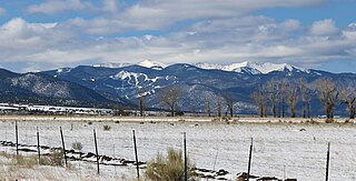
Venado Peak is one of the major peaks of the Taos Mountains group of the Sangre de Cristo Mountains, a subrange of the Rocky Mountains. It is located in Taos County, New Mexico, about 8 miles (13 km) northeast of the town of Questa. Its summit is the highest point in the Latir Peak Wilderness, part of Carson National Forest. The peak's name means "deer" in Spanish.

<span class="mw-page-title-main">Mount Baldy (Arizona)</span> Mountain in Apache County, Arizona, United States

Mount Baldy is an extinct stratovolcano in eastern Arizona in the United States. With a summit elevation of 11,409 feet (3,477 m), the peak of Mount Baldy rises above the tree line and is left largely bare of vegetation, lending the mountain its current name. The Mount Baldy Wilderness occupies the eastern slope of the mountain and is managed by the Apache-Sitgreaves National Forest.

Mount Ireland is a mountain in Grant County of the U.S. state of Oregon. It is about 5 miles (8 km) east-northeast of Granite, Oregon. It is the shortest and westernmost 8000'+ peak in the Elkhorn Range of the Blue Mountains at 8,321 feet (2,536 m), and Oregon's 71st highest peak with at least a 500' clean prominence. For a period of several years, this mountain peak was referred to as Bald Mountain, but in 1917 it was changed to Ireland Mountain—in commemoration of the late Henry Ireland, who for 10 years was supervisor of the Whitman National Forest in which the mountain is located—before formally becoming known as Mount Ireland. The name change was brought about by a cooperative effort of local citizens and the US Forest Service to honor Henry Ireland, who had died in 1916.

The Cedar Mountain Range is a short 20 mi (32 km) long, mountain range in southwest Luna County, New Mexico, USA, just north of the Mexico–United States border with Chihuahua.

Philmont Scout Ranch is located in the Sangre de Cristo Mountains of the Rocky Mountains of New Mexico. Philmont is about 12 miles (19 km) across at its widest point, and about 30 miles (48 km) long. The southern part of the ranch is mostly grasslands/prairie, while the north is rocky and rugged, but a small part of the eastern area is prairie.