Monmouth Junction, New Jersey

Last updated

Monmouth Junction, New Jersey
Monmouth Junction, NJ.jpg
Center of Monmouth Junction
Middlesex County New Jersey Incorporated and Unincorporated areas Monmouth Junction Highlighted.svg
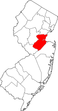
Map of Monmouth Junction CDP in Middlesex County. Inset: Location of Middlesex County in New Jersey.
Location map of Middlesex County, New Jersey.svg
Red pog.svg
Monmouth Junction
Location in Middlesex County
USA New Jersey relief location map.svg
Red pog.svg
Monmouth Junction
Location in New Jersey
Usa edcp relief location map.png
Red pog.svg
Monmouth Junction
Location in the United States
Coordinates: 40°22′49″N74°32′36″W / 40.380345°N 74.543237°W / 40.380345; -74.543237
Country Flag of the United States.svg  United States
State Flag of New Jersey.svg  New Jersey
County Middlesex
Township South Brunswick
Area
[1]
  Total4.41 sq mi (11.41 km2)
  Land4.38 sq mi (11.35 km2)
  Water0.03 sq mi (0.07 km2)  1.03%
Elevation
[2]
79 ft (24 m)
Population
 (2020) [3]
  Total8,895
  Density2,030.4/sq mi (783.9/km2)
Time zone UTC−05:00 (Eastern (EST))
  Summer (DST) UTC−04:00 (Eastern (EDT))
ZIP Code
08852 [4]
Area code(s) 732/848
FIPS code 34-47190 [5] [6] [7]
GNIS feature ID2389493 [8]

Monmouth Junction is an unincorporated community and census designated place (CDP) [9] in South Brunswick Township, Middlesex County, New Jersey, United States. [10] [11] [12] As of the 2020 census, the CDP's population was 8,895, [3] up 208% from its population of 2,887 in 2010. [13]

Contents

Geography

Monmouth Junction is in southwestern Middlesex County, in the western part of South Brunswick Township. It is bordered to the northwest by Heathcote, to the northeast by Deans, and to the east by Dayton, all within South Brunswick as well. It is bordered to the southwest by Plainsboro Township. U.S. Route 1 forms a small part of the community's western border. New Brunswick, the Middlesex county seat, is 10 miles (16 km) to the northeast, and Trenton, the state capital, is 17 miles (27 km) to the southwest.

According to the U.S. Census Bureau, the Monmouth Junction CDP has an area of 4.41 square miles (11.42 km2), nearly triple its area in 2010. Within the CDP, 4.38 square miles (11.34 km2) are land and 0.025 square miles (0.065 km2), or 0.57%, are water. [1] [5] [14] Land in the community drains southwest toward Heathcote Brook and Devils Brook, tributaries of the Millstone River and part of the Raritan River watershed.

Demographics

Historical population
CensusPop.Note
1980 2,579
1990 1,570−39.1%
2000 2,72173.3%
2010 2,8876.1%
2020 8,895208.1%
Population sources: 1980 [15]
1990-2010 [10] 2000 [16]
2010 [13] 2020 [3]

2010 census

The 2010 United States census counted 2,887 people, 903 households, and 801 families in the CDP. The population density was 1,966.3 people per square mile (759.2 people/km2). There were 919 housing units at an average density of 625.9 units per square mile (241.7 units/km2). The racial makeup was 57.40% (1,657) White, 6.03% (174) Black or African American, 0.24% (7) Native American, 32.91% (950) Asian, 0.00% (0) Pacific Islander, 0.97% (28) from other races, and 2.46% (71) from two or more races. Hispanic or Latino of any race were 4.95% (143) of the population. [13]

Of the 903 households, 50.8% had children under the age of 18; 77.6% were married couples living together; 8.4% had a female householder with no husband present and 11.3% were non-families. Of all households, 9.9% were made up of individuals and 2.8% had someone living alone who was 65 years of age or older. The average household size was 3.20 and the average family size was 3.43. [13]

29.1% of the population were under the age of 18, 7.1% from 18 to 24, 24.2% from 25 to 44, 32.0% from 45 to 64, and 7.6% who were 65 years of age or older. The median age was 38.8 years. For every 100 females, the population had 95.7 males. For every 100 females ages 18 and older there were 91.8 males. [13]

2000 census

As of the 2000 United States Census [6] there were 2,721 people, 870 households, and 736 families living in the CDP. The population density was 700.4 people/km2 (1,814 people/sq mi). There were 881 housing units at an average density of 226.8 units/km2 (587 units/sq mi). The racial makeup of the CDP was 74.97% White, 7.09% African American, 0.37% Native American, 14.48% Asian, 1.18% from other races, 1.91% from two or more races. Hispanic or Latino of any race were 4.15% of the population. [16]

There were 870 households, out of which 53.4% had children under the age of 18 living with them, 73.4% were married couples living together, 9.1% had a female householder with no husband present, and 15.3% were non-families. 11.8% of all households were made up of individuals, and 1.8% had someone living alone who was 65 years of age or older. The average household size was 3.12 and the average family size was 3.42. [16]

In the CDP the population was spread out, with 31.5% under the age of 18, 5.7% from 18 to 24, 34.8% from 25 to 44, 23.8% from 45 to 64, and 4.2% who were 65 years of age or older. The median age was 35 years. For every 100 females, there were 97.5 males. For every 100 females age 18 and over, there were 96.7 males. [16]

The median income for a household in the CDP was $89,598, and the median income for a family was $94,247. Males had a median income of $64,688 versus $39,464 for females. The per capita income for the CDP was $35,134. About 4.2% of families and 5.1% of the population were below the poverty line, including 11.2% of those under age 18 and none of those age 65 or over. [16]

Education

South Brunswick Public Schools is the local school district.

Religion

The Princeton Japanese Church (プリンストン日本語教会, Purinsuton Nihongo Kyōkai), serves the local Japanese community in Monmouth Junction. It was established in October 1991, and in 1993 had 20-25 attendees per Sunday church worship. [17]

Notable people

People who were born in, residents of, or otherwise closely associated with Monmouth Junction include:

See also

Related Research Articles

<span class="mw-page-title-main">Brownville, New Jersey</span> Populated place in Middlesex County, New Jersey, US

Brownville is an unincorporated community and census-designated place (CDP) in Old Bridge Township, Middlesex County, New Jersey, United States. As of the 2020 census, the population was 2,746, up from 2,383 in 2010.

<span class="mw-page-title-main">Concordia, New Jersey</span> Populated place in Middlesex County, New Jersey, US

Concordia is an unincorporated community and census-designated place (CDP) in Monroe Township, Middlesex County, New Jersey, United States. The CDP is oriented around the age restricted gated community of Concordia. As of the 2020 United States census, the CDP's population was 2,455, down from 3,092 in 2010. Prior to 2020, the corner of Concordia known as The Ponds was split off into its own CDP.

<span class="mw-page-title-main">Cranbury (CDP), New Jersey</span> Populated place in Middlesex County, New Jersey, US

Cranbury is an unincorporated community and census-designated place (CDP) in Cranbury Township, Middlesex County, New Jersey, in the United States. As of the 2020 United States census, the CDP's population was 2,200. Unlike in some other New Jersey townships, the Cranbury CDP is only part of Cranbury Township.

<span class="mw-page-title-main">Dayton, New Jersey</span> Populated place in Middlesex County, New Jersey, US

Dayton is an unincorporated community and census-designated place (CDP) in South Brunswick Township, Middlesex County, New Jersey, in the United States. At the 2020 United States census, the CDP's population was 8,138, up from 7,063 in 2010.

<span class="mw-page-title-main">Heathcote, New Jersey</span> Populated place in Middlesex County, New Jersey, US

Heathcote is an unincorporated community and census-designated place (CDP) in South Brunswick Township, Middlesex County, New Jersey, United States. As of the 2020 census, the population of the CDP was 7,154, up from 5,821 in 2010.

<span class="mw-page-title-main">Kendall Park, New Jersey</span> Populated place in Middlesex County, New Jersey, US

Kendall Park is an unincorporated community and census-designated place (CDP) in South Brunswick Township, Middlesex County, New Jersey, United States. As of the 2020 census, the CDP's population was 9,989, up from 9,339 in 2010. Kendall Park has a post office with its own ZIP Code (08824) that encompasses the majority of the CDP, as well as some surrounding areas.

<span class="mw-page-title-main">Kingston, New Jersey</span> Populated place in Middlesex and Somerset counties, New Jersey, US

Kingston is an unincorporated community and census designated place (CDP) along the border of South Brunswick Township in Middlesex County and Franklin Township in Somerset County, and also located relatively near Princeton in Mercer County in the U.S. state of New Jersey. The historic settlement is in the Raritan Valley region, located along the course of the Millstone River. As of the 2020 census, the CDP's population was 1,581, of which 1,272 were in South Brunswick Township and 309 in Franklin Township.

<span class="mw-page-title-main">Old Bridge (CDP), New Jersey</span> Populated place in Middlesex County, New Jersey, US

Old Bridge is a census-designated place (CDP) in Old Bridge Township, Middlesex County, New Jersey, United States. As of the 2020 census, the CDP's population was 27,210, up from 23,753 in 2010. The Old Bridge CDP occupies only a portion of Old Bridge Township.

<span class="mw-page-title-main">Plainsboro Center, New Jersey</span> Populated place in Middlesex County, New Jersey, US

Plainsboro Center is an unincorporated community and census-designated place (CDP) in Plainsboro Township, Middlesex County, New Jersey, United States. As of the 2020 census, the CDP's population was 2,760, its highest decennial count ever and an increase of 48 (+1.8%) from the 2,712 recorded at the 2010 census.

<span class="mw-page-title-main">Port Reading, New Jersey</span> Populated place in Middlesex County, New Jersey, US

Port Reading is an unincorporated community and census-designated place (CDP) in Woodbridge Township, Middlesex County, New Jersey, United States. As of the 2020 census, the population was 3,921.

<span class="mw-page-title-main">Princeton Meadows, New Jersey</span> Populated place in Middlesex County, New Jersey, US

Princeton Meadows is an unincorporated community and census-designated place (CDP) in Plainsboro Township, Middlesex County, New Jersey, United States. As of the 2020 census, the population was 14,776.

<span class="mw-page-title-main">East Freehold, New Jersey</span> Populated place in Monmouth County, New Jersey, US

East Freehold is an unincorporated community and census-designated place (CDP) in Freehold Township, Monmouth County, New Jersey, United States. As of the 2020 census, the CDP population was 4,987.

<span class="mw-page-title-main">Fairview, Monmouth County, New Jersey</span> Populated place in Monmouth County, New Jersey, US

Fairview is an unincorporated community and census-designated place (CDP) in Middletown Township, Monmouth County, New Jersey, United States. As of the 2020 United States census, the CDP's population was 3,731.

<span class="mw-page-title-main">North Middletown, New Jersey</span> Populated place in Monmouth County, New Jersey, US

North Middletown is an unincorporated community and census-designated place (CDP) within Middletown Township, in Monmouth County, in the U.S. state of New Jersey. As of the 2020 census, the CDP population was 3,146, down from 3,295 in 2010.

<span class="mw-page-title-main">Wanamassa, New Jersey</span> Populated place in Monmouth County, New Jersey, US

Wanamassa is an unincorporated community and census-designated place (CDP) within Ocean Township, in Monmouth County, New Jersey, United States. As of the 2020 census, the CDP's population was 4,344. The community was named for Wanamassa, a Native American leader of the 17th century.

<span class="mw-page-title-main">Allenwood, New Jersey</span> Populated place in Monmouth County, New Jersey, US

Allenwood is an unincorporated community and census-designated place (CDP) in Wall Township, Monmouth County, New Jersey, United States. As of the 2020 United States census, the CDP's population was 954.

<span class="mw-page-title-main">Strathmore, New Jersey</span> Populated place in Monmouth County, New Jersey, US

Strathmore is an unincorporated community and census-designated place (CDP) within Aberdeen Township, in Monmouth County, New Jersey, United States. At the 2020 census, the CDP's population was 7,225.

<span class="mw-page-title-main">Yorketown, New Jersey</span> Populated place in Monmouth County, New Jersey, US

Yorketown is an unincorporated community and census-designated place (CDP) within Manalapan Township, in Monmouth County, in the U.S. state of New Jersey. As of the 2020 census, the CDP's population was 6,617.

<span class="mw-page-title-main">Ramtown, New Jersey</span> Populated place in Monmouth County, New Jersey, US

Ramtown is a census-designated place and unincorporated community in Howell Township, in Monmouth County, New Jersey, United States. As of the 2020 United States census, the CDP population was 6,329.

<span class="mw-page-title-main">Robertsville, New Jersey</span> Populated place in Monmouth County, New Jersey, US

Robertsville is a census-designated place and unincorporated community in Marlboro Township, Monmouth County, in the U.S. state of New Jersey. As of the 2020 census, the CDP's population was 11,399.

References

  1. 1 2 "2023 U.S. Gazetteer Files: New Jersey". United States Census Bureau. Retrieved August 5, 2024.
  2. U.S. Geological Survey Geographic Names Information System: Monmouth Junction Census Designated Place, Geographic Names Information System. Accessed June 21, 2012.
  3. 1 2 3 QuickFacts Monmouth Junction CDP, New Jersey, United States Census Bureau. Accessed June 24, 2023.
  4. Look Up a ZIP Code for Monmouth Junction, NJ, United States Postal Service. Accessed June 20, 2012.
  5. 1 2 Gazetteer of New Jersey Places Archived 2015-02-01 at the Wayback Machine , United States Census Bureau. Accessed June 13, 2013.
  6. 1 2 U.S. Census website, United States Census Bureau. Accessed September 4, 2014.
  7. Geographic codes for New Jersey, Missouri Census Data Center. Accessed June 9, 2023.
  8. US Board on Geographic Names, United States Geological Survey. Accessed September 4, 2014.
  9. State of New Jersey Census Designated Places - BVP20 - Data as of January 1, 2020, United States Census Bureau. Accessed December 1, 2022.
  10. 1 2 New Jersey: 2010 - Population and Housing Unit Counts - 2010 Census of Population and Housing (CPH-2-32), United States Census Bureau, August 2012. Accessed November 29, 2012.
  11. GCT-PH1 - Population, Housing Units, Area, and Density: 2010 - County County Subdivision and Place from the 2010 Census Summary File 1 for Middlesex County, New Jersey Archived 2020-02-12 at archive.today , United States Census Bureau. Accessed November 29, 2012.
  12. Locality Search, State of New Jersey. Accessed April 19, 2015.
  13. 1 2 3 4 5 DP-1 - Profile of General Population and Housing Characteristics: 2010 Demographic Profile Data for Monmouth Junction CDP, Middlesex County, New Jersey, United States Census Bureau. Accessed June 21, 2012
  14. US Gazetteer files: 2010, 2000, and 1990, United States Census Bureau. Accessed September 4, 2014.
  15. Staff. 1980 Census of Population: Number of Inhabitants United States Summary, p. 1-141. United States Census Bureau, June 1983. Accessed January 12, 2012.
  16. 1 2 3 4 5 DP-1 - Profile of General Demographic Characteristics: 2000 from the Census 2000 Summary File 1 (SF 1) 100-Percent Data for Monmouth Junction CDP, New Jersey, United States Census Bureau. Accessed November 29, 2012.
  17. Schlegel, Jeff (July 4, 1993). "Unique church offers Japanese Christian haven". The Central Jersey Home News . New Brunswick, New Jersey. p. B6. - Clipping from Newspapers.com.
  18. Walter Perez, WPVI-TV. Accessed October 20, 2019. "A political science graduate from Duke University, Walter, and his wife, reside in Monmouth Junction, New Jersey with their two sons."
  19. Snyder, Audrey. "The work ethic behind Justin Shorter’s five-star potential at Penn State", The Athletic , May 24, 2019. Accessed April 19, 2023. "If Shorter, then a four-star prospect in Monmouth Junction, N.J., wanted to become the best receiver in the 2018 recruiting class, if he wanted to one day become the college and NFL talent he hoped, he’d have to first hop out of bed at 5 a.m. to put in extra work while his competitors were sleeping."
  20. The Senior Pastor Archived 2007-08-30 at the Wayback Machine , First Baptist Church of Lincoln Gardens. Accessed June 10, 2007. "Born in New York and raised in New Jersey, Dr. Soaries resides in Monmouth Junction, New Jersey with his wife, Donna and twin sons, Malcolm and Martin."