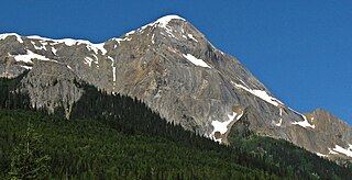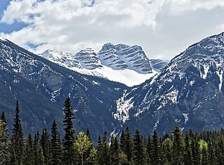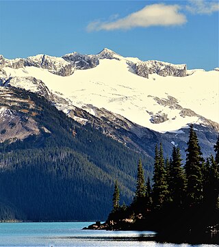
Mount Columbia is a mountain located in the Winston Churchill Range of the Rocky Mountains. It is the highest point in Alberta, Canada, and is second only to Mount Robson for height and topographical prominence in the Canadian Rockies. It is located on the border between Alberta and British Columbia on the northern edge of the Columbia Icefield. Its highest point, however, lies within Jasper National Park in Alberta.

Mount Lyell is a mountain on the Alberta–British Columbia border in western Canada. Comprising five distinct summits, Mount Lyell reaches a height of 3,498 m (11,476 ft). The mountain was named by James Hector in 1858 in recognition of Scottish geologist Sir Charles Lyell.

Mount Byng is a 2,965-metre (9,728-foot) mountain summit located in the upper Spray River Valley of southern Banff National Park, in the Canadian Rockies of Alberta, Canada. It is the second-highest point in the Blue Range. Mount Byng's nearest higher peak is Mount Alcantara, 6.5 km (4.0 mi) to the west-southwest. The mighty Mount Assiniboine is situated 10.0 km (6.2 mi) to the northwest of Byng.

Wedgwood Peak is a 3,024-metre (9,921-foot) mountain summit located in Mount Assiniboine Provincial Park, in the Canadian Rockies of British Columbia, Canada. Its nearest higher peak is Mount Assiniboine, 2.0 km (1.2 mi) to the south. The mountain is situated northwest of Lake Magog and 1.0 km (0.62 mi) south of Sunburst Peaks.

Foster Peak is a 3,204-metre (10,512-foot) mountain summit located on the western border of Kootenay National Park. It is the highest point in the Vermilion Range, a sub-range of the Canadian Rockies of British Columbia, Canada. Its nearest higher peak is Mount Ball, 14.96 km (9.30 mi) to the northeast. The mountain is part of what is known as The Rockwall. Floe Lake, southeast of the peak, is one of the beauty spots of Kootenay National Park. The area is accessible via the Floe Lake Trail and Rockwall Trail. The Rockwall Trail is a scenic 55 kilometre traverse of alpine passes, subalpine meadows, hanging glaciers, and limestone cliffs, in some places in excess of 900 metres above the trail.

Mount Niles is a 2,967-metre (9,734-foot) summit located in the Waputik Range of Yoho National Park, in the Canadian Rockies of British Columbia, Canada. The nearest higher peak is Mount Daly, 1.63 km (1.01 mi) to the immediate northeast. Takakkaw Falls is situated four km to the west, the Waputik Icefield lies to the north, and Sherbrooke Lake lies to the south. Precipitation runoff from Mount Niles drains into the Yoho River and Niles Creek, both tributaries of the Kicking Horse River. Topographic relief is significant as the summit rises approximately 1,500 meters (4,920 feet) above Yoho Valley in four kilometers (2.5 mile).

Mount Mummery is a 3,328-metre (10,919 ft) glaciated double summit mountain located in the Canadian Rockies of British Columbia, Canada. It is the highest point in the Mummery Group, and fourth-highest in the Freshfield Icefield Ranges. The mountain is situated 42 km (26 mi) north of Golden on the southern edge of the Freshfield Icefield, in the Blaeberry Valley, less than 4 km (2.5 mi) from the Continental Divide. The mountain was named in 1898 by J. Norman Collie after Albert F. Mummery (1855-1895), a famous British mountaineer who perished attempting to climb Nanga Parbat in the Himalayas. Collie named many peaks in the Canadian Rockies, and was a climbing companion who accompanied Mummery on the Nanga Parbat expedition. Around the same time, nearby Nanga Parbat Mountain was also named by Collie. Mount Mummery's name was officially adopted March 31, 1924, when approved by the Geographical Names Board of Canada. The first ascent of the mountain was made in 1906 by I. Tucker Burr Jr, Samuel Cabot Jr, W. Rodman Peabody, Robert Walcott, with guides Gottfried Feuz and Christian Kaufmann.

Mount Poland is a 2,853-metre (9,360 ft) mountain summit located in the Canadian Rockies of British Columbia, Canada. The mountain is situated 40 km (25 mi) north of Golden in the Blaeberry Valley, 4 km (2.5 mi) southeast of Mount Mummery. The mountain was named after Canadian Army Private Herbert J. Poland of Golden, BC, who was killed in 1944 World War II action. The mountain's name was officially adopted July 5, 1961, when approved by the Geographical Names Board of Canada. The first ascent of the mountain was made in 1958 by J. Owen, E. Pigou, and guide A. Bitterlich.

St. Julien Mountain is a 3,090-metre (10,138 ft) mountain summit located in the Canadian Rockies of British Columbia, Canada. It is situated on the British Columbia-Alberta border, as well as the Continental Divide, and the west boundary of Banff National Park. Neighbors include Mount Forbes 6.4 km (4.0 mi) to the east-northeast, Valenciennes Mountain 2.8 km (1.7 mi) to the south, and Icefall Peak is 12 km (7.5 mi) to the west.

Barbette Mountain is 3,072-metre (10,079-foot) summit located on the shared border of Alberta and British Columbia, Canada.

Mount Ogden is a mountain in the Canadian Rockies of British Columbia, Canada.

Overlander Mountain is a summit in British Columbia, Canada.

Mount McKirdy is a mountain summit in British Columbia, Canada.

Mount Anne-Alice is a mountain summit in the Canadian Rockies of British Columbia, Canada.

Mount Carr is a 2,590-metre (8,497-foot) mountain summit located in British Columbia, Canada.

Nestor Peak is a 2,972-metre (9,751-foot) mountain summit located in Mount Assiniboine Provincial Park of British Columbia, Canada.

Indian Peak is a 2,992-metre (9,816-foot) mountain summit located in Mount Assiniboine Provincial Park of British Columbia, Canada.

Octopus Mountain is a 2,932-metre (9,619-foot) mountain summit located in Mount Assiniboine Provincial Park of British Columbia, Canada.

Mount Sam is a 2,871-metre (9,419-foot) mountain summit located in Mount Assiniboine Provincial Park of British Columbia, Canada.

Mount Swiderski is a 3,133-metre (10,279-foot) mountain summit in British Columbia, Canada.


