National Register of Historic Places listings in Polk County, Wisconsin

Last updated
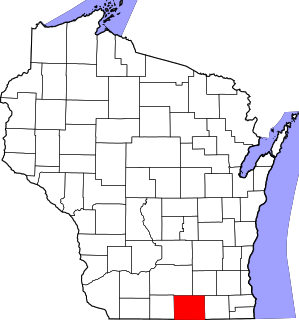
Location of Polk County in Wisconsin Map of Wisconsin highlighting Polk County.svg
Location of Polk County in Wisconsin

This is a list of the National Register of Historic Places listings in Polk County, Wisconsin. It is intended to provide a comprehensive listing of entries in the National Register of Historic Places that are located in Polk County, Wisconsin. The locations of National Register properties for which the latitude and longitude coordinates are included below may be seen in a map. [1]

Contents

There are 14 properties and districts listed on the National Register in the county.

This National Park Service list is complete through NPS recent listings posted December 13, 2019. [2]
Map all coordinates using: OpenStreetMap  
Download coordinates as: KML  ·  GPX

Current listings

[3] Name on the Register [4] ImageDate listed [5] Location City or townDescription
1 Cushing Land Agency Building
Cushing Land Agency Building Cushing Land Agency Building.jpg
Cushing Land Agency Building
September 1, 2005
(#05000955)
106 S. Washington St.
45°24′36″N92°38′41″W / 45.410026°N 92.64468°W / 45.410026; -92.64468 (Cushing Land Agency Building)
St. Croix Falls In 1854 Caleb Cushing, a Massachusetts lawyer, politician, and land speculator established the company which handled many real estate transactions in Polk, Burnett, Washburn, and Barron counties. The surviving agency building was built in 1882, designed in Queen Anne/Eastlake style by Abraham Radcliffe of St. Paul. [6]
2 Dalles Bluff Site
Dalles Bluff Site Address restricted.PNG
Dalles Bluff Site
September 5, 1981
(#81000054)
Address Restricted
St. Croix Falls
3 First Baptist Church
First Baptist Church 1stBaptistOsceola.JPG
First Baptist Church
March 12, 2008
(#08000201)
201 3rd Ave.
45°19′19″N92°42′21″W / 45.321944°N 92.705833°W / 45.321944; -92.705833 (First Baptist Church)
Osceola Neo-Gothic church building with Akron floorplan and Craftsman details, built 1908-1919 and possibly designed by Harry Wild Jones. [7]
4 Frederic Depot
Frederic Depot Frederic Depot.jpg
Frederic Depot
March 21, 2003
(#03000133)
210 Oak St. W
45°39′36″N92°28′06″W / 45.66°N 92.468333°W / 45.66; -92.468333 (Frederic Depot)
Frederic Depot building, sawed out in the Soo Line's shop in Minneapolis, hauled by rail to Frederic, and assembled in 1901, when rail was the main mode of transport. [8]
5 Geiger Building-Old Polk County Courthouse
Geiger Building-Old Polk County Courthouse Geiger Building.JPG
Geiger Building-Old Polk County Courthouse
December 2, 1985
(#85003030)
201 Cascade St.
45°19′15″N92°42′21″W / 45.320833°N 92.705833°W / 45.320833; -92.705833 (Geiger Building-Old Polk County Courthouse)
Osceola Saloon built by Veit Geiger in 1875. From 1882 to 1898 it was used as Polk County Courthouse and sheriff's and judge's quarters, with the beer storage area in the basement converted to county jail. [9] [10]
6 Alvah A. Heald House
Alvah A. Heald House Heald House.JPG
Alvah A. Heald House
December 2, 1985
(#85003097)
202 Sixth Ave.
45°19′25″N92°42′11″W / 45.323611°N 92.703056°W / 45.323611; -92.703056 (Alvah A. Heald House)
Osceola Italianate-styled home built in 1879. [11]
7 Lamar Community Center
Lamar Community Center Lamar Community Center.jpg
Lamar Community Center
March 1, 1982
(#82001860)
NE of St. Croix Falls
45°25′26″N92°34′09″W / 45.423889°N 92.569167°W / 45.423889; -92.569167 (Lamar Community Center)
St. Croix Falls Craftsman-style one-room school built in 1905, with a second room added in 1910. Then and now a unifying center of the community. [12]
8 John Lindstrom Round Barn
John Lindstrom Round Barn John Lindstrom Round Barn.jpg
John Lindstrom Round Barn
October 24, 2016
(#16000741)
1311 120th Ave.
45°22′53″N92°25′52″W / 45.381464°N 92.431066°W / 45.381464; -92.431066 (John Lindstrom Round Barn)
Balsam Lake Round barn built in 1913, with the first story walls built of fieldstone and the upper parts of wood, with a silo in the center. [13]
9 Minneapolis, St. Paul and Sault Saint Marie Railway Depot
Minneapolis, St. Paul and Sault Saint Marie Railway Depot Minneapolis, St. Paul and Sault Saint Marie Railway Depot.JPG
Minneapolis, St. Paul and Sault Saint Marie Railway Depot
December 13, 2000
(#00001535)
114 Depot Rd.
45°19′03″N92°42′30″W / 45.3175°N 92.708333°W / 45.3175; -92.708333 (Minneapolis, St. Paul and Sault Saint Marie Railway Depot)
Osceola built 1916 to replace a wooden structure. The brick structure was fancier than other Soo Line stations in towns of similar size. The Osceola Historical Society has restored it and uses it for interpretive historical education.
10 Osceola Commercial Historic District
Osceola Commercial Historic District Osceola1.JPG
Osceola Commercial Historic District
December 13, 2000
(#00001533)
Roughly along Cascade St., from First Ave. to Third Ave.
45°19′15″N92°42′21″W / 45.320833°N 92.705833°W / 45.320833; -92.705833 (Osceola Commercial Historic District)
Osceola 17 contributing commercial buildings, [14] ranging from the 1875 Geiger Saloon described above to the 1879 Bank of Osceola [15] to the 1947 Art Moderne Mobil Gas Station. [16]
11 Polk County Courthouse
Polk County Courthouse Polk County Courthouse.JPG
Polk County Courthouse
March 9, 1982
(#82000697)
Main St.
45°27′07″N92°27′08″W / 45.451944°N 92.452222°W / 45.451944; -92.452222 (Polk County Courthouse)
Balsam Lake courthouse built in 1899 was converted into three floors of museum galleries featuring a general store, blacksmith shop, barbershop, kitchen, hardware store, bedroom, parlor, ethnic exhibits, military room, and the Native American room with wigwam
12 Seven Pines Lodge
Seven Pines Lodge Seven Pines close email.tif
Seven Pines Lodge
December 8, 1978
(#78000125)
SE of Lewis of WI 35
45°41′46″N92°22′57″W / 45.696111°N 92.3825°W / 45.696111; -92.3825 (Seven Pines Lodge)
Lewis Rustic resort complex built 1903-1910 for Minnesota wheat broker Charles E. Lewis by Norwegian carpenter John "Ole" Mangseth. Later visited by Calvin Coolidge. [17]
13 St. Croix Falls Auditorium
St. Croix Falls Auditorium St. Croix Falls Auditorium SW.jpg
St. Croix Falls Auditorium
July 20, 2007
(#07000711)
201 N Washington St
45°24′45″N92°38′40″W / 45.412549°N 92.644572°W / 45.412549; -92.644572 (St. Croix Falls Auditorium)
St. Croix Falls Built by the city in 1917, the Spanish Colonial-styled 400-seat auditorium hosted silent films, talkies, dances, commencements, basketball games, the library, city offices, and now the Festival Theatre. [18] [19]
14 Thomas Henry Thompson House
Thomas Henry Thompson House Thomas Henry Thompson House.jpg
Thomas Henry Thompson House
March 8, 1984
(#84003777)
205 South Adams St.
45°24′32″N92°38′37″W / 45.408974°N 92.643729°W / 45.408974; -92.643729 (Thomas Henry Thompson House)
St. Croix Falls 1882 Italianate house of a prominent shopkeeper and civic leader in early St. Croix Falls. [20]

See also

Related Research Articles

National Register of Historic Places listings in Rock County, Wisconsin Wikimedia list article

This is a list of the National Register of Historic Places listings in Rock County, Wisconsin. It is intended to provide a comprehensive listing of entries in the National Register of Historic Places that are located in Rock County, Wisconsin. The locations of National Register properties for which the latitude and longitude coordinates are included below may be seen in a map.
National Register of Historic Places listings in Sauk County, Wisconsin Wikimedia list article

This is a list of the National Register of Historic Places listings in Sauk County, Wisconsin. It is intended to provide a comprehensive listing of entries in the National Register of Historic Places that are located in Sauk County, Wisconsin. The locations of National Register properties for which the latitude and longitude coordinates are included below may be seen in a map.

National Register of Historic Places listings in Brown County, Wisconsin Wikimedia list article

This is a list of the National Register of Historic Places listings in Brown County, Wisconsin. It is intended to provide a comprehensive listing of entries in the National Register of Historic Places that are located in Brown County, Wisconsin. The locations of National Register properties for which the latitude and longitude coordinates are included below may be seen in a map.

National Register of Historic Places listings in Iowa County, Wisconsin Wikimedia list article

This is a list of the National Register of Historic Places listings in Iowa County, Wisconsin. It is intended to provide a comprehensive listing of entries in the National Register of Historic Places that are located in Iowa County, Wisconsin. The locations of National Register properties for which the latitude and longitude coordinates are included below may be seen in a map.

National Register of Historic Places listings in St. Croix County, Wisconsin Wikimedia list article

This is a list of the National Register of Historic Places listings in St. Croix County, Wisconsin. It is intended to provide a comprehensive listing of entries in the National Register of Historic Places that are located in St. Croix County, Wisconsin. The locations of National Register properties for which the latitude and longitude coordinates are included below may be seen in a map.
National Register of Historic Places listings in Oconto County, Wisconsin Wikimedia list article

This is a list of the National Register of Historic Places listings in Oconto County, Wisconsin. It is intended to provide a comprehensive listing of entries in the National Register of Historic Places that are located in Oconto County, Wisconsin. The locations of National Register properties for which the latitude and longitude coordinates are included below may be seen in a map.

National Register of Historic Places listings in Marinette County, Wisconsin Wikimedia list article

This is a list of the National Register of Historic Places listings in Marinette County, Wisconsin. It is intended to provide a comprehensive listing of entries in the National Register of Historic Places that are located in Marinette County, Wisconsin. The locations of National Register properties for which the latitude and longitude coordinates are included below may be seen in a map.

National Register of Historic Places listings in Bayfield County, Wisconsin Wikimedia list article

This is a list of the National Register of Historic Places listings in Bayfield County, Wisconsin. It is intended to provide a comprehensive listing of entries in the National Register of Historic Places that are located in Bayfield County, Wisconsin. The locations of National Register properties for which the latitude and longitude coordinates are included below may be seen in a map.

National Register of Historic Places listings in Douglas County, Wisconsin Wikimedia list article

This is a list of the National Register of Historic Places listings in Douglas County, Wisconsin. It is intended to provide a comprehensive listing of entries in the National Register of Historic Places that are located in Douglas County, Wisconsin. The locations of National Register properties for which the latitude and longitude coordinates are included below may be seen in a map.
National Register of Historic Places listings in Portage County, Wisconsin Wikimedia list article

This is a list of the National Register of Historic Places listings in Portage County, Wisconsin. It is intended to provide a comprehensive listing of entries in the National Register of Historic Places that are located in Portage County, Wisconsin. The locations of National Register properties for which the latitude and longitude coordinates are included below may be seen in a map.

National Register of Historic Places listings in Barron County, Wisconsin Wikimedia list article

This is a list of the National Register of Historic Places listings in Barron County, Wisconsin. It is intended to provide a comprehensive listing of entries in the National Register of Historic Places that are located in Barron County, Wisconsin. The locations of National Register properties for which the latitude and longitude coordinates are included below may be seen in a map.

National Register of Historic Places listings in Chippewa County, Wisconsin Wikimedia list article

This is a list of the National Register of Historic Places listings in Chippewa County, Wisconsin. It is intended to provide a comprehensive listing of entries in the National Register of Historic Places that are located in Chippewa County, Wisconsin. The locations of National Register properties for which the latitude and longitude coordinates are included below may be seen in a map.

National Register of Historic Places listings in Buffalo County, Wisconsin Wikimedia list article

This is a list of the National Register of Historic Places listings in Buffalo County, Wisconsin. It is intended to provide a comprehensive listing of entries in the National Register of Historic Places that are located in Buffalo County, Wisconsin. The locations of National Register properties for which the latitude and longitude coordinates are included below may be seen in a map.

National Register of Historic Places listings in Richland County, Wisconsin Wikimedia list article

This is a list of the National Register of Historic Places listings in Richland County, Wisconsin. It is intended to provide a comprehensive listing of entries in the National Register of Historic Places that are located in Richland County, Wisconsin. The locations of National Register properties for which the latitude and longitude coordinates are included below may be seen in a map.
National Register of Historic Places listings in Taylor County, Wisconsin Wikimedia list article

This is a list of the National Register of Historic Places listings in Taylor County, Wisconsin. It is intended to provide a comprehensive listing of entries in the National Register of Historic Places that are located in Taylor County, Wisconsin. The locations of National Register properties for which the latitude and longitude coordinates are included below may be seen in a map.

National Register of Historic Places listings in Burnett County, Wisconsin Wikimedia list article

This is a list of the National Register of Historic Places listings in Burnett County, Wisconsin. It is intended to provide a comprehensive listing of entries in the National Register of Historic Places that are located in Burnett County, Wisconsin. The locations of National Register properties for which the latitude and longitude coordinates are included below may be seen in a map.

National Register of Historic Places listings in Florence County, Wisconsin Wikimedia list article

This is a list of the National Register of Historic Places listings in Florence County, Wisconsin. It is intended to provide a comprehensive listing of entries in the National Register of Historic Places that are located in Florence County, Wisconsin. The locations of National Register properties for which the latitude and longitude coordinates are included below may be seen in a map.
National Register of Historic Places listings in Iron County, Wisconsin Wikimedia list article

This is a list of the National Register of Historic Places listings in Iron County, Wisconsin. It is intended to provide a comprehensive listing of entries in the National Register of Historic Places that are located in Iron County, Wisconsin. The locations of National Register properties for which the latitude and longitude coordinates are included below may be seen in a map.

National Register of Historic Places listings in Juneau County, Wisconsin Wikimedia list article

This is a list of the National Register of Historic Places listings in Juneau County, Wisconsin. It is intended to provide a comprehensive listing of entries in the National Register of Historic Places that are located in Juneau County, Wisconsin. The locations of National Register properties for which the latitude and longitude coordinates are included below may be seen in a map.

National Register of Historic Places listings in Sawyer County, Wisconsin Wikimedia list article

This is a list of the National Register of Historic Places listings in Sawyer County, Wisconsin. It is intended to provide a comprehensive listing of entries in the National Register of Historic Places that are located in Sawyer County, Wisconsin. The locations of National Register properties for which the latitude and longitude coordinates are included below may be seen in a map.

References

  1. The latitude and longitude information provided is primarily from the National Register Information System, and has been found to be fairly accurate for about 99% of listings. For 1%, the location info may be way off. We seek to correct the coordinate information wherever it is found to be erroneous. Please leave a note in the Discussion page for this article if you believe any specific location is incorrect.
  2. "National Register of Historic Places: Weekly List Actions". National Park Service, United States Department of the Interior. Retrieved on December 13, 2019.
  3. Numbers represent an ordering by significant words. Various colorings, defined here, differentiate National Historic Landmarks and historic districts from other NRHP buildings, structures, sites or objects.
  4. "National Register Information System". National Register of Historic Places . National Park Service. April 24, 2008.
  5. The eight-digit number below each date is the number assigned to each location in the National Register Information System database, which can be viewed by clicking the number.
  6. "Cushing Land Agency Building". Wisconsin Historical Society. Retrieved 2013-05-09.
  7. "First Baptist Church". Wisconsin Historical Society. Retrieved 2013-05-09.
  8. "Historic Soo Line Depot/Museum". Frederic Area Historical Society. Archived from the original on 2012-07-22. Retrieved 2013-05-16.
  9. "Geiger Building - Old Polk County Courthouse". Architecture and History Inventory. Wisconsin Historical Society. Retrieved 2013-05-09.
  10. "Polk County Government History". Polk County Historical Society. Retrieved 2013-05-09.
  11. "Alvah A. Heald House". Architecture and History Inventory. Wisconsin Historic Society. Retrieved 2013-05-09.
  12. "History". Lamar Community. Archived from the original on 2013-12-09. Retrieved 2013-05-16.
  13. "John Lindstrom Round Barn". Wisconsin Historical Society. Retrieved 2016-11-07.
  14. "Osceola Commercial Historic District". National Register or State Register. Wisconsin Historical Society. Retrieved 2013-05-16.
  15. "Bank of Osceola". Architecture and History Inventory. Wisconsin Historical Society. Retrieved 2013-05-16.
  16. "Mobil Gas Station". Architecture and History Inventory. Wisconsin Historical Society. Retrieved 2013-05-16.
  17. "Seven Pines Lodge". Wisconsin Historical Society. Retrieved 2013-05-09.
  18. "History of the St. Croix Falls Civic Auditorium". St. Croix Festival Theatre. Retrieved 2013-05-28.
  19. "St. Croix Falls Auditorium". Architecture and History Inventory. Wisconsin Historical Society. Retrieved 2013-05-28.
  20. Taylor, Mary E. (December 1983). "National Register of Historic Places Inventory—Nomination Form: Thompson, Thomas Henry, House". National Park Service. Retrieved 2015-05-03.Cite journal requires |journal= (help)

See also