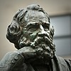
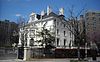
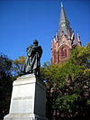
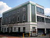
[2] Name on the Register Image Date listed [3] Location Neighborhood Description 1 Adams Memorial Adams Memorial March 16, 1972 (# 72001420 Webster St. and Rock Creek Church Rd., NW. 38°56′50″N 77°00′39″W / 38.9472°N 77.0108°W / 38.9472; -77.0108 (Adams Memorial ) Petworth 2 Administration Building, Carnegie Institute of Washington Administration Building, Carnegie Institute of Washington October 15, 1966 (# 66000959 1530 P St., NW. 38°54′34″N 77°02′10″W / 38.9094°N 77.0361°W / 38.9094; -77.0361 (Administration Building, Carnegie Institute of Washington ) Dupont Circle 3 Alden, Babcock, Calvert Apartments Alden, Babcock, Calvert Apartments May 25, 1990 (# 90000737 2620 13th St., NW. 38°55′27″N 77°01′49″W / 38.9242°N 77.0303°W / 38.9242; -77.0303 (Alden, Babcock, Calvert Apartments ) Columbia Heights 4 All Souls Church, Unitarian All Souls Church, Unitarian December 7, 2020 (# 100005905 1500 Harvard St. NW 38°55′34″N 77°02′10″W / 38.9260°N 77.0360°W / 38.9260; -77.0360 (All Souls Church, Unitarian ) 5 American Revolution Statuary American Revolution Statuary July 14, 1978 (# 78000256 Public buildings and various parks within DC 38°54′25″N 77°02′29″W / 38.9069°N 77.0414°W / 38.9069; -77.0414 (American Revolution Statuary ) Dupont Circle 14 statues including 11 in central DC, and Doctor John Witherspoon south of Dupont Circle 6 Larz Anderson House Larz Anderson House April 7, 1971 (# 71000993 2118 Massachusetts Ave., NW. 38°54′39″N 77°02′53″W / 38.9108°N 77.0481°W / 38.9108; -77.0481 (Larz Anderson House ) Dupont Circle National headquarters of the Society of the Cincinnati 7 Andrew Rankin Memorial Chapel, Frederick Douglass Memorial Hall, Founders Library Andrew Rankin Memorial Chapel, Frederick Douglass Memorial Hall, Founders Library January 3, 2001 (# 01000070 2441 and 2365 6th St. NW; and 500 Howard Place NW 38°55′21″N 77°01′13″W / 38.9225°N 77.0204°W / 38.9225; -77.0204 (Andrew Rankin Memorial Chapel, Frederick Douglass Memorial Hall, Founders Library ) Howard University 8 Apartment Building at 2225 N Street Apartment Building at 2225 N Street September 9, 1994 (# 94001043 2225 N St., NW. 38°54′27″N 77°03′00″W / 38.9075°N 77.05°W / 38.9075; -77.05 (Apartment Building at 2225 N Street ) West End (Washington, D.C.) 9 Apartments at 5922 13th Street, NW. Apartments at 5922 13th Street, NW. January 17, 2017 (# 100000471 5922 13th St., NW. 38°57′45″N 77°01′47″W / 38.9624°N 77.0298°W / 38.9624; -77.0298 (Apartments at 5922 13th Street, NW. ) Brightwood 10 Armed Forces Retirement Home-Washington Armed Forces Retirement Home-Washington December 5, 2007 (# 07001237 3700 N Capitol St NW 38°56′11″N 77°00′33″W / 38.9363°N 77.0091°W / 38.9363; -77.0091 (Armed Forces Retirement Home-Washington ) Park View , Petworth 11 Armstrong Manual Training School Armstrong Manual Training School August 16, 1996 (# 96000893 Junction of 1st and P Sts., NW 38°54′32″N 77°00′49″W / 38.9089°N 77.0136°W / 38.9089; -77.0136 (Armstrong Manual Training School ) Truxton Circle 12 Army Medical Museum Army Medical Museum October 15, 1966 (# 66000854 Armed Forces Institute of Pathology Building, Walter Reed Army Medical Center , 13th St. and Fern Pl. 38°58′41″N 77°01′47″W / 38.9780°N 77.0297°W / 38.9780; -77.0297 (Army Medical Museum ) Walter Reed Army Medical Center Original listed building has been demolished; collection is now in Maryland. 13 Francis Asbury Memorial Francis Asbury Memorial October 11, 2007 (# 07001052 Reservation 309-B, 16th & Mt. Pleasant Sts. NW 38°55′47″N 77°02′13″W / 38.9297°N 77.0369°W / 38.9297; -77.0369 (Francis Asbury Memorial ) Mount Pleasant 14 Banneker Recreation Center Banneker Recreation Center April 28, 1986 (# 86000876 2500 Georgia Ave. NW 38°55′20″N 77°01′25″W / 38.9222°N 77.0236°W / 38.9222; -77.0236 (Banneker Recreation Center ) Columbia Heights 15 George M. Barker Company Warehouse George M. Barker Company Warehouse August 27, 2008 (# 08000820 1525 7th St., NW. 38°54′36″N 77°01′17″W / 38.9100°N 77.0214°W / 38.9100; -77.0214 (George M. Barker Company Warehouse ) Logan Circle 16 Battleground National Cemetery Battleground National Cemetery October 15, 1966 (# 66000032 6625 Georgia Ave., NW. 38°58′14″N 77°01′37″W / 38.9706°N 77.0269°W / 38.9706; -77.0269 (Battleground National Cemetery ) Brightwood 17 Joseph Beale House Joseph Beale House May 8, 1973 (# 73002073 2301 Massachusetts Ave., NW. 38°54′46″N 77°03′05″W / 38.9128°N 77.0514°W / 38.9128; -77.0514 (Joseph Beale House ) Sheridan-Kalorama 18 Perry Belmont House Perry Belmont House May 8, 1973 (# 73002074 1618 New Hampshire Ave., NW. 38°54′44″N 77°02′30″W / 38.9122°N 77.0417°W / 38.9122; -77.0417 (Perry Belmont House ) Dupont Circle 19 Blagden Alley-Naylor Court Historic District Blagden Alley-Naylor Court Historic District November 16, 1990 (# 90001734 Bounded by O, 9th, M, & 10th Sts. NW. 38°54′44″N 77°01′33″W / 38.9122°N 77.0258°W / 38.9122; -77.0258 (Blagden Alley-Naylor Court Historic District ) Logan Circle 20 Bloomingdale Historic District Bloomingdale Historic District November 26, 2018 (# 100003129 Bounded by Florida Ave., Channing, Bryant, North Capital & 2nd Sts. NW 38°54′59″N 77°00′41″W / 38.9164°N 77.0114°W / 38.9164; -77.0114 (Bloomingdale Historic District ) Bloomingdale 21 Boulder Bridge and Ross Drive Bridge Boulder Bridge and Ross Drive Bridge March 20, 1980 (# 80000348 Rock Creek Park 38°56′53″N 77°02′42″W / 38.9481°N 77.045°W / 38.9481; -77.045 (Boulder Bridge and Ross Drive Bridge ) Rock Creek Park Extends to both sides of Rock Creek 22 Anthony Bowen YMCA Anthony Bowen YMCA October 3, 1983 (# 83003523 1816 12th St. NW 38°54′53″N 77°02′25″W / 38.914722°N 77.040278°W / 38.914722; -77.040278 (Anthony Bowen YMCA ) U Street Corridor (Cardozo/Shaw) 23 Brodhead-Bell-Morton Mansion Brodhead-Bell-Morton Mansion October 14, 1987 (# 87001769 1500 Rhode Island Ave., NW 38°54′27″N 77°02′06″W / 38.907469°N 77.034992°W / 38.907469; -77.034992 (Brodhead-Bell-Morton Mansion ) Logan Circle 24 Blanche Kelso Bruce Elementary School Blanche Kelso Bruce Elementary School March 31, 2015 (# 15000114 770 Kenyon St., NW. 38°55′47″N 77°01′32″W / 38.9296°N 77.0256°W / 38.9296; -77.0256 (Blanche Kelso Bruce Elementary School ) Park View 25 Blanche K. Bruce House Blanche K. Bruce House May 15, 1975 (# 75002046 909 M St., NW 38°54′21″N 77°01′29″W / 38.905833°N 77.024722°W / 38.905833; -77.024722 (Blanche K. Bruce House ) Shaw 26 Buildings at 1644–1666 Park Road NW Buildings at 1644–1666 Park Road NW November 6, 1986 (# 86003019 1644–1666 Park Rd. NW 38°55′54″N 77°02′17″W / 38.931667°N 77.038056°W / 38.931667; -77.038056 (Buildings at 1644–1666 Park Road NW ) Mount Pleasant 27 Buildings at 5000–5040 New Hampshire Avenue, NW Buildings at 5000–5040 New Hampshire Avenue, NW February 4, 2022 (# 100007399 5000–5040 New Hampshire Ave., NW 38°57′06″N 77°00′46″W / 38.9518°N 77.0129°W / 38.9518; -77.0129 (Buildings at 5000–5040 New Hampshire Avenue, NW ) Brightwood Park 28 Lucinda Cady House Lucinda Cady House May 28, 1975 (# 75002047 7064 Eastern Ave., NW. 38°58′40″N 77°01′07″W / 38.977778°N 77.018611°W / 38.977778; -77.018611 (Lucinda Cady House ) Takoma 29 Cairo Apartment Building Cairo Apartment Building September 9, 1994 (# 94001033 1615 Q St., NW. 38°54′41″N 77°02′16″W / 38.911389°N 77.037778°W / 38.911389; -77.037778 (Cairo Apartment Building ) Dupont Circle 30 Capital Traction Company Car Barn Capital Traction Company Car Barn May 22, 2013 (# 13000290 4615 14th St., N.W. 38°56′50″N 77°01′56″W / 38.947332°N 77.032303°W / 38.947332; -77.032303 (Capital Traction Company Car Barn ) Sixteenth Street Heights 31 Canadian Embassy Canadian Embassy April 3, 1973 (# 73002076 1746 Massachusetts Ave., NW. 38°54′29″N 77°02′26″W / 38.908169°N 77.040633°W / 38.908169; -77.040633 (Canadian Embassy ) Dupont Circle Now the Embassy of Uzbekistan; also known as the Clarence Moore House 32 Francis L. Cardozo Senior High School Francis L. Cardozo Senior High School September 30, 1993 (# 93001015 Junction of 13th and Clifton Sts., NW. 38°55′14″N 77°01′48″W / 38.920556°N 77.03°W / 38.920556; -77.03 (Francis L. Cardozo Senior High School ) Columbia Heights 33 Mary Ann Shadd Cary House Mary Ann Shadd Cary House December 8, 1976 (# 76002128 1421 W. St., NW 38°55′10″N 77°02′08″W / 38.919444°N 77.035556°W / 38.919444; -77.035556 (Mary Ann Shadd Cary House ) U Street Corridor (Cardozo/Shaw) 34 Chapman Coal Company Garage and Stable Chapman Coal Company Garage and Stable October 23, 2013 (# 13000845 57 N St., NW. 38°54′27″N 77°00′40″W / 38.907498°N 77.011113°W / 38.907498; -77.011113 (Chapman Coal Company Garage and Stable ) Downtown 35 Chilchester Arms Apartments Chilchester Arms Apartments January 24, 2017 (# 100000559 1388 Tuckerman St., NW 38°58′02″N 77°01′59″W / 38.967351°N 77.033025°W / 38.967351; -77.033025 (Chilchester Arms Apartments ) Brightwood 36 Civil War Fort Sites Civil War Fort Sites July 15, 1974 (# 74000274 Arc of sites surrounding central Washington in Maryland, Virginia, and D.C. 38°57′50″N 77°01′46″W / 38.963944°N 77.029444°W / 38.963944; -77.029444 (Civil War Fort Sites ) All quadrants At the outset of the Civil War in 1861, Washington became a critical target for rebel attacks but was virtually without protection. The Union Army hastily began construction of a fortified defense line around the city, the physical remnants of which encompass these 19 earthwork forts, including Fort Stevens and Fort Slocum . [4] See also National Register listings in central D.C. , western NW D.C. , NE D.C. , SE D.C. , Prince George's County, Maryland , and Fairfax County, Virginia . 37 Civil War Monuments in Washington, DC Civil War Monuments in Washington, DC September 20, 1978 (# 78000257 Various parks within the original boundaries of city 38°54′26″N 77°02′12″W / 38.907222°N 77.036667°W / 38.907222; -77.036667 (Civil War Monuments in Washington, DC ) Various 18 statues about people and topics related to the Civil War, including 11 in central Washington, 6 in the NW quadrant, and 1 in Lincoln Park (NE & SE quadrants). 38 Clifton Terrace Clifton Terrace December 26, 2001 (# 01001366 1308,1312,1350 Clifton St. 38°55′19″N 77°01′52″W / 38.921944°N 77.031111°W / 38.921944; -77.031111 (Clifton Terrace ) Columbia Heights 39 Codman-Davis House Codman-Davis House October 11, 1979 (# 79003100 2145 Decatur Pl., NW 38°54′49″N 77°02′54″W / 38.913572°N 77.048353°W / 38.913572; -77.048353 (Codman-Davis House ) Sheridan-Kalorama 40 Congressional Club Congressional Club October 6, 2011 (# 11000717 2001 New Hampshire Ave., NW 38°55′02″N 77°02′09″W / 38.917222°N 77.035833°W / 38.917222; -77.035833 (Congressional Club ) U Street 41 Connecticut Avenue Bridge Connecticut Avenue Bridge July 3, 2003 (# 03000584 Connecticut Ave., northwest of Rock Creek 38°55′16″N 77°03′02″W / 38.921111°N 77.050556°W / 38.921111; -77.050556 (Connecticut Avenue Bridge ) Sheridan-Kalorama and Woodley Park Extends to both sides of Rock Creek 42 Calvin Coolidge Senior High School Calvin Coolidge Senior High School April 12, 2022 (# 100007616 6315 5th St. NW 38°58′02″N 77°01′09″W / 38.9672°N 77.0192°W / 38.9672; -77.0192 (Calvin Coolidge Senior High School ) 43 Cosmos Club Cosmos Club April 3, 1973 (# 73002079 2121 Massachusetts Ave., NW. 38°54′41″N 77°02′54″W / 38.911389°N 77.048333°W / 38.911389; -77.048333 (Cosmos Club ) Dupont Circle Also known as the Richard H. Townsend House 44 Elliott Coues House Elliott Coues House May 15, 1975 (# 75002049 1726 N St., NW 38°54′25″N 77°02′24″W / 38.906944°N 77.04°W / 38.906944; -77.04 (Elliott Coues House ) Dupont Circle 45 Charles Dickson Site Upload image May 29, 2024 (# 100010450 Rock Creek Park Coordinates missing Documentation does not show on which side of Rock Creek this site is located. 46 Jane Dickson Site Upload image May 29, 2024 (# 100010451 Rock Creek Park Coordinates missing Documentation does not show on which side of Rock Creek this site is located. 47 Dorsch's White Cross Bakery Dorsch's White Cross Bakery February 3, 2012 (# 11001076 641 S St., NW 38°54′52″N 77°01′16″W / 38.91455°N 77.021097°W / 38.91455; -77.021097 (Dorsch's White Cross Bakery ) U Street Corridor (Cardozo/Shaw) 48 Dumbarton Bridge Dumbarton Bridge July 16, 1973 (# 73002080 Q St. over Rock Creek 38°54′39″N 77°03′04″W / 38.910833°N 77.051111°W / 38.910833; -77.051111 (Dumbarton Bridge ) Dupont Circle 49 Dupont Circle Historic District Dupont Circle Historic District July 21, 1978 (# 78003056 Roughly bounded by Florida and Rhode Island Aves., T, 17th, 21st, and 22nd Sts. 38°54′38″N 77°02′38″W / 38.910556°N 77.043889°W / 38.910556; -77.043889 (Dupont Circle Historic District ) Dupont Circle 50 Eighteen Hundred Block Park Road, NW Eighteen Hundred Block Park Road, NW November 15, 1978 (# 78003057 1801–1869 Park Rd., NW. 38°55′57″N 77°02′35″W / 38.9325°N 77.043056°W / 38.9325; -77.043056 (Eighteen Hundred Block Park Road, NW ) Mount Pleasant 51 Embassy Building No. 10 Embassy Building No. 10 November 6, 1986 (# 86003023 3149 Sixteenth St. NW 38°55′52″N 77°02′11″W / 38.931111°N 77.036389°W / 38.931111; -77.036389 (Embassy Building No. 10 ) Columbia Heights 52 Embassy Gulf Service Station Embassy Gulf Service Station September 30, 1993 (# 93001014 2200 P St., NW. 38°54′33″N 77°02′59″W / 38.909167°N 77.049722°W / 38.909167; -77.049722 (Embassy Gulf Service Station ) Dupont Circle 53 Embassy of Mexico-MacVeagh House Embassy of Mexico-MacVeagh House February 13, 2013 (# 13000001 2829 16th St., NW 38°55′32″N 77°02′09″W / 38.92553°N 77.035815°W / 38.92553; -77.035815 (Embassy of Mexico-MacVeagh House ) Meridian Hill /Columbia Heights now the Mexican Cultural Institute 54 Emory United Methodist Church Emory United Methodist Church October 13, 2015 (# 15000717 6100 Georgia Ave., NW. 38°57′51″N 77°01′41″W / 38.9641°N 77.0281°W / 38.9641; -77.0281 (Emory United Methodist Church ) Brightwood 55 Engine Company 12 Engine Company 12 June 6, 2007 (# 07000537 1626 N. Capitol St., NW 38°54′43″N 77°00′35″W / 38.911944°N 77.009722°W / 38.911944; -77.009722 (Engine Company 12 ) Bloomingdale 56 Engine Company No 21 Engine Company No 21 June 27, 2007 (# 07000594 1763 Lanier Place NW 38°55′34″N 77°02′31″W / 38.926111°N 77.041944°W / 38.926111; -77.041944 (Engine Company No 21 ) Lanier Heights 57 Engine Company 22 Engine Company 22 May 18, 2011 (# 11000282 5760 Georgia Ave., NW 38°57′36″N 77°01′42″W / 38.96°N 77.028333°W / 38.96; -77.028333 (Engine Company 22 ) Brightwood Park 58 Euclid Apartments Euclid Apartments April 29, 2010 (# 10000239 1740 Euclid St, NW 38°55′22″N 77°02′26″W / 38.922883°N 77.040433°W / 38.922883; -77.040433 (Euclid Apartments ) Adams Morgan 59 Evans-Tibbs House Evans-Tibbs House September 8, 1987 (# 86003025 1910 Vermont Ave. NW 38°54′58″N 77°01′35″W / 38.916028°N 77.026250°W / 38.916028; -77.026250 (Evans-Tibbs House ) U Street Corridor (Cardozo/Shaw) 60 Fire Department Headquarters-Fire Alarm Headquarters Fire Department Headquarters-Fire Alarm Headquarters May 18, 2011 (# 11000286 300 McMillan Dr., NW. 38°55′24″N 77°00′47″W / 38.923333°N 77.013056°W / 38.923333; -77.013056 (Fire Department Headquarters-Fire Alarm Headquarters ) Bloomingdale 61 First African New Church First African New Church January 29, 2009 (# 08001375 2105-07 10th St., NW. 38°55′06″N 77°01′33″W / 38.918333°N 77.025833°W / 38.918333; -77.025833 (First African New Church ) U Street Corridor (Cardozo/Shaw) 62 First Church of Christ, Scientist First Church of Christ, Scientist January 27, 2015 (# 14001206 1770 Euclid St., NW. 38°55′23″N 77°02′31″W / 38.9230°N 77.0420°W / 38.9230; -77.0420 (First Church of Christ, Scientist ) Adams Morgan 63 Fort View Apartments Fort View Apartments January 21, 2010 (# 09001264 6000–6020 and 6030–6050 13th Place, N.W. 38°57′49″N 77°01′52″W / 38.963572°N 77.030975°W / 38.963572; -77.030975 (Fort View Apartments ) Brightwood 64 L. Ron Hubbard House L. Ron Hubbard House September 6, 2022 (# 100008142 1812 19th St. NW 38°54′53″N 77°02′37″W / 38.9146°N 77.0435°W / 38.9146; -77.0435 (L. Ron Hubbard House ) Dupont Circle 65 Fourteenth Street Historic District Fourteenth Street Historic District November 9, 1994 (# 94000992 Roughly bounded by S, 12th, N and 15th Sts., NW. 38°54′30″N 77°01′47″W / 38.908333°N 77.029722°W / 38.908333; -77.029722 (Fourteenth Street Historic District ) Logan Circle 66 Fraser Mansion Fraser Mansion August 19, 1975 (# 75002054 1701 20th St., NW. 38°54′46″N 77°02′42″W / 38.912778°N 77.045°W / 38.912778; -77.045 (Fraser Mansion ) Dupont Circle 67 Frelinghuysen University, Former Classroom Building Frelinghuysen University, Former Classroom Building November 6, 1995 (# 95001228 1800 Vermont Ave., NW. 38°54′54″N 77°01′37″W / 38.915°N 77.026944°W / 38.915; -77.026944 (Frelinghuysen University, Former Classroom Building ) U Street Corridor (Cardozo/Shaw) 68 The Fulford The Fulford March 6, 2018 (# 100002179 2518 17th St. NW 38°55′26″N 77°02′21″W / 38.923772°N 77.039029°W / 38.923772; -77.039029 (The Fulford ) Adams Morgan 69 Fuller House Fuller House February 21, 1985 (# 85000302 2317 Ashmead Pl., NW 38°55′08″N 77°02′53″W / 38.918889°N 77.048056°W / 38.918889; -77.048056 (Fuller House ) Adams Morgan 70 Nathaniel Parker Gage School Nathaniel Parker Gage School November 19, 2008 (# 08001064 2035 2nd St., NW. 38°55′04″N 77°00′52″W / 38.917772°N 77.014561°W / 38.917772; -77.014561 (Nathaniel Parker Gage School ) Bloomingdale 71 Garden Club of America Entrance Marker at Georgia Avenue Garden Club of America Entrance Marker at Georgia Avenue April 29, 2008 (# 08000347 Georgia Ave. at Kalmia Rd. & Alaska Ave. 38°59′02″N 77°01′36″W / 38.983808°N 77.026578°W / 38.983808; -77.026578 (Garden Club of America Entrance Marker at Georgia Avenue ) Shepherd Park 72 General Baking Company Bakery General Baking Company Bakery December 24, 2013 (# 13000961 2146 Georgia Ave., NW. 38°55′06″N 77°01′19″W / 38.918318°N 77.021906°W / 38.918318; -77.021906 (General Baking Company Bakery ) Pleasant Plains 73 General Federation of Women's Clubs Headquarters General Federation of Women's Clubs Headquarters December 4, 1991 (# 91002057 1734 N St., NW. 38°54′25″N 77°02′25″W / 38.906944°N 77.040278°W / 38.906944; -77.040278 (General Federation of Women's Clubs Headquarters ) Dupont Circle 74 James Cardinal Gibbons Memorial James Cardinal Gibbons Memorial October 11, 2007 (# 07001051 Reservation 309-G, 16th St. & Park Rd. NW. 38°55′59″N 77°02′11″W / 38.933056°N 77.036389°W / 38.933056; -77.036389 (James Cardinal Gibbons Memorial ) Mount Pleasant 75 Glade Apartments Glade Apartments January 31, 2017 (# 100000595 1370–1372 Ft. Stevens Dr., NW. 38°57′50″N 77°02′00″W / 38.964008°N 77.033283°W / 38.964008; -77.033283 (Glade Apartments ) Brightwood 76 Gladstone and Hawarden Apartment Buildings Gladstone and Hawarden Apartment Buildings September 7, 1994 (# 94001034 1419 and 1423 R St., NW. 38°54′46″N 77°01′59″W / 38.912778°N 77.033056°W / 38.912778; -77.033056 (Gladstone and Hawarden Apartment Buildings ) Logan Circle 77 The Glenn Arms The Glenn Arms March 6, 2018 (# 100002180 2524 17th St. NW 38°55′26″N 77°02′21″W / 38.924000°N 77.039036°W / 38.924000; -77.039036 (The Glenn Arms ) Adams Morgan 78 Samuel Gompers House Samuel Gompers House September 23, 1974 (# 74002161 2122 1st St., NW 38°55′02″N 77°00′46″W / 38.917222°N 77.012778°W / 38.917222; -77.012778 (Samuel Gompers House ) Bloomingdale 79 Grace Evangelical Lutheran Church Grace Evangelical Lutheran Church September 18, 2013 (# 13000712 4300 16th St., NW. 38°56′36″N 77°02′13″W / 38.943316°N 77.036919°W / 38.943316; -77.036919 (Grace Evangelical Lutheran Church ) Crestwood 80 Grace Reformed Church, Sunday School and Parish House Grace Reformed Church, Sunday School and Parish House April 18, 1991 (# 91000396 1405 15th St., NW. 38°54′32″N 77°02′03″W / 38.908889°N 77.034167°W / 38.908889; -77.034167 (Grace Reformed Church, Sunday School and Parish House ) Logan Circle 81 Grant Circle Historic District Grant Circle Historic District October 13, 2015 (# 15000718 4–33 Grant Cir., NW. 38°56′35″N 77°01′09″W / 38.9430°N 77.0193°W / 38.9430; -77.0193 (Grant Circle Historic District ) Petworth 82 Greater U Street Historic District Greater U Street Historic District December 31, 1998 (# 98001557 Roughly bounded by New Hampshire Ave., Florida Ave, 6th St., R St., and 16th St. 38°54′59″N 77°01′45″W / 38.916389°N 77.029167°W / 38.916389; -77.029167 (Greater U Street Historic District ) U Street 83 Charlotte Forten Grimke House Charlotte Forten Grimke House May 11, 1976 (# 76002129 1608 R St., NW. 38°54′45″N 77°02′13″W / 38.9125°N 77.036944°W / 38.9125; -77.036944 (Charlotte Forten Grimke House ) Dupont Circle 84 Samuel Hahnemann Monument Samuel Hahnemann Monument October 11, 2007 (# 07001055 Reservation 64, Massachusetts & Rhode Island Aves. at Scott Cir. NW 38°54′26″N 77°02′08″W / 38.907222°N 77.035694°W / 38.907222; -77.035694 (Samuel Hahnemann Monument ) Golden Triangle 85 Hampshire Garden Apartment Buildings Hampshire Garden Apartment Buildings September 9, 1994 (# 94001031 4912 New Hampshire Ave., 208, 222, 236 and 250 Farragut St., 4915 3rd St. and 215, 225 and 235 Emerson St., NW. 38°57′02″N 77°00′53″W / 38.950556°N 77.014722°W / 38.950556; -77.014722 (Hampshire Garden Apartment Buildings ) Brightwood Park 86 Hebrew Home for the Aged and Jewish Social Service Agency Hebrew Home for the Aged and Jewish Social Service Agency July 25, 2014 (# 14000436 1125–1131 Spring Rd., NW. 38°56′10″N 77°01′43″W / 38.9361°N 77.0285°W / 38.9361; -77.0285 (Hebrew Home for the Aged and Jewish Social Service Agency ) Petworth 87 Christian Heurich Mansion Christian Heurich Mansion June 23, 1969 (# 69000296 1307 New Hampshire Ave., NW. 38°54′29″N 77°02′40″W / 38.908056°N 77.044444°W / 38.908056; -77.044444 (Christian Heurich Mansion ) Golden Triangle 88 Hilltop Manor Hilltop Manor July 26, 2007 (# 07000810 3500 14th St., NW 38°56′05″N 77°02′00″W / 38.934606°N 77.033217°W / 38.934606; -77.033217 (Hilltop Manor ) Columbia Heights 89 Anthony Holmead Archeological Site Anthony Holmead Archeological Site April 27, 1995 (# 95000527 1801 23rd St., NW 38°54′52″N 77°03′01″W / 38.914492°N 77.050242°W / 38.914492; -77.050242 (Anthony Holmead Archeological Site ) Kalorama Triangle 90 Holt House Holt House April 24, 1973 (# 73002090 Adams Mill Rd. in the National Zoological Park 38°55′31″N 77°02′50″W / 38.925278°N 77.047222°W / 38.925278; -77.047222 (Holt House ) Rock Creek Park 91 Holzbeierlein Bakery Holzbeierlein Bakery April 10, 2017 (# 100000845 1815–1827 Wiltberger St., NW 38°54′53″N 77°01′15″W / 38.914803°N 77.020860°W / 38.914803; -77.020860 (Holzbeierlein Bakery ) U Street Corridor (Cardozo/Shaw) 92 The Homestead Apartments The Homestead Apartments February 14, 2018 (# 100002111 812 Jefferson St. NW 38°57′18″N 77°01′29″W / 38.954889°N 77.024758°W / 38.954889; -77.024758 (The Homestead Apartments ) Petworth 93 House at 2437 Fifteenth Street, NW House at 2437 Fifteenth Street, NW March 16, 1988 (# 88000171 2437 Fifteenth St., NW 38°55′20″N 77°02′11″W / 38.922222°N 77.036389°W / 38.922222; -77.036389 (House at 2437 Fifteenth Street, NW ) Meridian Hill /Columbia Heights Also known as the Old Hungarian Embassy 94 Howard Theatre Howard Theatre February 15, 1974 (# 74002162 620 T St., NW. 38°54′55″N 77°01′17″W / 38.915278°N 77.021389°W / 38.915278; -77.021389 (Howard Theatre ) U Street Corridor (Cardozo/Shaw) 95 Charles Evans Hughes House Charles Evans Hughes House November 28, 1972 (# 72001424 2223 R St., NW 38°54′45″N 77°02′58″W / 38.9125°N 77.049444°W / 38.9125; -77.049444 (Charles Evans Hughes House ) Sheridan-Kalorama 96 Immaculate Conception Church Immaculate Conception Church September 17, 2003 (# 03000946 1315 8th St., NW 38°54′26″N 77°01′22″W / 38.907222°N 77.022778°W / 38.907222; -77.022778 (Immaculate Conception Church ) Logan Circle 97 Indonesian Embassy Indonesian Embassy January 18, 1973 (# 73002091 2020 Massachusetts Ave., NW. 38°54′36″N 77°02′47″W / 38.91°N 77.046389°W / 38.91; -77.046389 (Indonesian Embassy ) Dupont Circle Also known as the Walsh-McLean House 98 Ingleside Ingleside January 8, 1987 (# 86002936 1818 Newton St. NW 38°56′01″N 77°02′35″W / 38.933611°N 77.043056°W / 38.933611; -77.043056 (Ingleside ) Mount Pleasant 99 Japanese Embassy Japanese Embassy February 20, 1973 (# 73002092 2520 Massachusetts Ave., NW. 38°54′54″N 77°03′23″W / 38.915°N 77.056389°W / 38.915; -77.056389 (Japanese Embassy ) Sheridan-Kalorama 100 Jost-Kuhn House Jost-Kuhn House April 5, 2016 (# 16000127 1354 Madison St. NW 38°57′30″N 77°01′58″W / 38.958358°N 77.032773°W / 38.958358; -77.032773 (Jost-Kuhn House ) Sixteenth Street Heights 101 Kalorama Park and Archeological District Kalorama Park and Archeological District April 21, 2016 (# 16000193 1875 Columbia Rd., NW 38°55′13″N 77°02′41″W / 38.920148°N 77.044793°W / 38.920148; -77.044793 (Kalorama Park and Archeological District ) Kalorama Triangle House destroyed in 1937 subject of archeological investigation. Also part of Kalorama Triangle Historic District. 102 Kalorama Triangle Historic District Kalorama Triangle Historic District May 4, 1987 (# 87000627 Roughly bounded by Connecticut Ave., Columbia Rd., and Calvert St. 38°55′14″N 77°02′47″W / 38.920556°N 77.046389°W / 38.920556; -77.046389 (Kalorama Triangle Historic District ) Kalorama Triangle 103 Kelsey Temple Church of God in Christ Kelsey Temple Church of God in Christ September 18, 2017 (# 16000684 1435–1437 Park Rd., NW. 38°55′51″N 77°02′02″W / 38.930747°N 77.033937°W / 38.930747; -77.033937 (Kelsey Temple Church of God in Christ ) Columbia Heights 104 Lafayette Apartment Building Lafayette Apartment Building September 7, 1994 (# 94001044 1605–1607 7th St., NW. 38°54′42″N 77°01′18″W / 38.911667°N 77.021667°W / 38.911667; -77.021667 (Lafayette Apartment Building ) Logan Circle 105 John Mercer Langston School John Mercer Langston School April 9, 2013 (# 13000143 43 P St., NW. 38°54′35″N 77°00′38″W / 38.909651°N 77.010556°W / 38.909651; -77.010556 (John Mercer Langston School ) Truxton Circle 106 LeDroit Park Historic District LeDroit Park Historic District February 25, 1974 (# 74002165 Bounded roughly by Florida and Rhode Island Aves., 2nd and Elm Sts., Howard University 38°54′57″N 77°01′03″W / 38.915833°N 77.0175°W / 38.915833; -77.0175 (LeDroit Park Historic District ) LeDroit Park 107 George M. Lightfoot House George M. Lightfoot House January 15, 2014 (# 13001070 1329 Missouri Ave., NW 38°57′43″N 77°01′51″W / 38.961927°N 77.030772°W / 38.961927; -77.030772 (George M. Lightfoot House ) Brightwood 108 Lincoln Industrial Mission-Lincoln Memorial Congregational Church Lincoln Industrial Mission-Lincoln Memorial Congregational Church February 24, 1995 (# 95000163 1701 11th St., NW. 38°54′47″N 77°01′36″W / 38.913056°N 77.026667°W / 38.913056; -77.026667 (Lincoln Industrial Mission-Lincoln Memorial Congregational Church ) Logan Circle 109 Lincoln Theatre Lincoln Theatre October 27, 1993 (# 93001129 1215 U St. NW 38°55′01″N 77°01′46″W / 38.916944°N 77.029444°W / 38.916944; -77.029444 (Lincoln Theatre ) U Street Corridor (Cardozo/Shaw) 110 The Lindens The Lindens June 4, 1969 (# 69000297 2401 Kalorama Rd., NW. 38°55′06″N 77°03′13″W / 38.918333°N 77.053611°W / 38.918333; -77.053611 (The Lindens ) Sheridan-Kalorama 111 Logan Circle Historic District Logan Circle Historic District June 30, 1972 (# 72001426 Junction of Rhode Island and Vermont Aves. 38°54′35″N 77°01′49″W / 38.909722°N 77.030278°W / 38.909722; -77.030278 (Logan Circle Historic District ) Logan Circle 112 Henry Wadsworth Longfellow Memorial Henry Wadsworth Longfellow Memorial October 11, 2007 (# 07001056 Reservation 150, Connecticut Ave., M & 18th Sts. NW. 38°54′28″N 77°02′30″W / 38.907778°N 77.041667°W / 38.907778; -77.041667 (Henry Wadsworth Longfellow Memorial ) Golden Triangle 113 Lothrop Mansion Lothrop Mansion December 20, 1988 (# 88001346 2001 Connecticut Ave. 38°55′01″N 77°02′48″W / 38.916944°N 77.046667°W / 38.916944; -77.046667 (Lothrop Mansion ) Adams Morgan 114 Luther Place Memorial Church Luther Place Memorial Church July 16, 1973 (# 73002096 1226 Vermont Ave., NW. (Thomas Circle) 38°54′25″N 77°01′56″W / 38.906944°N 77.032222°W / 38.906944; -77.032222 (Luther Place Memorial Church ) Logan Circle 115 MacFarland Junior High School MacFarland Junior High School December 3, 2018 (# 100003212 4400 Iowa Ave. NW 38°56′38″N 77°01′39″W / 38.9440°N 77.0274°W / 38.9440; -77.0274 (MacFarland Junior High School ) Petworth 116 Manhattan Laundry Manhattan Laundry November 21, 1994 (# 94001327 1326–1346 Florida Ave., NW. 38°55′12″N 77°01′51″W / 38.920000°N 77.030833°W / 38.920000; -77.030833 (Manhattan Laundry ) U Street Corridor (Cardozo/Shaw) 117 Mansion at 2401 15th St., NW Mansion at 2401 15th St., NW January 28, 1991 (# 90002147 2401 15th St., NW. 38°55′18″N 77°02′06″W / 38.921667°N 77.035°W / 38.921667; -77.035 (Mansion at 2401 15th St., NW ) Meridian Hill /Columbia Heights Also known as Meridian Hall 118 Guglielmo Marconi Memorial Guglielmo Marconi Memorial October 12, 2007 (# 07001057 Reservation 309A, 16th & Lamont Sts. NW 38°55′56″N 77°02′13″W / 38.932222°N 77.036944°W / 38.932222; -77.036944 (Guglielmo Marconi Memorial ) Mount Pleasant 119 Mary McLeod Bethune Council House National Historic Site Mary McLeod Bethune Council House National Historic Site October 15, 1982 (# 82005389 1318 Vermont Ave., NW 38°54′27″N 77°01′52″W / 38.9075°N 77.031111°W / 38.9075; -77.031111 (Mary McLeod Bethune Council House National Historic Site ) Logan Circle 120 Massachusetts Avenue Historic District Massachusetts Avenue Historic District October 22, 1974 (# 74002166 Both sides of Massachusetts Ave. between 17th St. and Observatory Circle, NW 38°54′50″N 77°03′06″W / 38.913889°N 77.051667°W / 38.913889; -77.051667 (Massachusetts Avenue Historic District ) Dupont Circle , Sheridan-Kalorama , and Woodland-Normanstone Terrace 121 The Maycroft The Maycroft October 17, 2012 (# 12000864 1474 Columbia Rd., NW. 38°55′37″N 77°02′07″W / 38.926999°N 77.035146°W / 38.926999; -77.035146 (The Maycroft ) Columbia Heights 122 McMillan Park Reservoir Historic District McMillan Park Reservoir Historic District February 20, 2013 (# 13000022 Roughly bounded by Hobart Pl., NW, Michigan Ave., NW, 1st, 4th, Bryant & North Capitol Sts., NW 38°55′28″N 77°00′53″W / 38.924578°N 77.01485°W / 38.924578; -77.01485 (McMillan Park Reservoir Historic District ) Bloomingdale 123 McCormick Apartments McCormick Apartments April 3, 1973 (# 73002100 1785 Massachusetts Ave., NW 38°54′33″N 77°02′30″W / 38.909167°N 77.041667°W / 38.909167; -77.041667 (McCormick Apartments ) Dupont Circle Also known as the Andrew Mellon Building 124 Meeting House of the Friends Meeting of Washington Meeting House of the Friends Meeting of Washington September 6, 1990 (# 90001294 2111 Florida Ave., NW. 38°54′46″N 77°02′52″W / 38.912778°N 77.047778°W / 38.912778; -77.047778 (Meeting House of the Friends Meeting of Washington ) Sheridan-Kalorama 125 Meridian Hill Historic District Meridian Hill Historic District May 21, 2014 (# 14000211 2201–2319 15th, 2400–2600 blocks 15th & 16th, 2600–3000 blocks 16th Sts., NW., 1600 blk. of Crescent Pl., NW. 38°55′16″N 77°02′10″W / 38.9211°N 77.0361°W / 38.9211; -77.0361 (Meridian Hill Historic District ) Meridian Hill /Adams Morgan -Columbia Heights 126 Meridian Hill Park Meridian Hill Park October 25, 1974 (# 74000273 Bounded by 16th, Euclid, 15th, and W Sts., NW. 38°55′16″N 77°02′10″W / 38.921111°N 77.036111°W / 38.921111; -77.036111 (Meridian Hill Park ) Meridian Hill /Columbia Heights 127 Meridian House Meridian House May 8, 1973 (# 73002101 1630 Crescent Pl., NW. 38°55′13″N 77°02′18″W / 38.920278°N 77.038333°W / 38.920278; -77.038333 (Meridian House ) Meridian Hill /Adams Morgan 128 Meridian Manor Meridian Manor March 29, 2001 (# 01000324 1424 Chapin St., NW 38°55′17″N 77°01′59″W / 38.921389°N 77.033056°W / 38.921389; -77.033056 (Meridian Manor ) Meridian Hill /Columbia Heights 129 Meridian Mansions Meridian Mansions July 28, 1983 (# 83001417 2400 16th St. NW 38°55′17″N 77°02′13″W / 38.921389°N 77.036944°W / 38.921389; -77.036944 (Meridian Mansions ) Meridian Hill /Adams Morgan 130 Military Road School Military Road School July 25, 2003 (# 03000674 1375 Missouri Ave., NW 38°57′43″N 77°01′58″W / 38.961944°N 77.032778°W / 38.961944; -77.032778 (Military Road School ) Brightwood 131 Miner Normal School Miner Normal School October 11, 1991 (# 91001490 2565 Georgia Ave., NW. 38°55′24″N 77°01′21″W / 38.923333°N 77.0225°W / 38.923333; -77.0225 (Miner Normal School ) Howard University 132 Mount Pleasant Historic District Mount Pleasant Historic District October 5, 1987 (# 87001726 Roughly bounded by Sixteenth & Harvard Sts., Rock Creek Church Rd., & Adams Mill Rd. 38°55′53″N 77°02′22″W / 38.931389°N 77.039444°W / 38.931389; -77.039444 (Mount Pleasant Historic District ) Mount Pleasant 133 Mount Vernon Square Historic District Mount Vernon Square Historic District September 3, 1999 (# 99001070 Roughly bounded by New York Ave., 7th St., N St., and 1st St. NW 38°54′24″N 77°01′04″W / 38.906667°N 77.017778°W / 38.906667; -77.017778 (Mount Vernon Square Historic District ) Mount Vernon Square Extends to both sides of M Street 134 Mount Vernon West Historic District Mount Vernon West Historic District September 9, 1999 (# 99001071 Roughly bounded by Rhode Island Ave., 6th St., Massachusetts Ave., and Vermont Ave. 38°54′26″N 77°01′34″W / 38.907222°N 77.026111°W / 38.907222; -77.026111 (Mount Vernon West Historic District ) Mount Vernon Square Also known as Shaw Historic District. Extends to both sides of M Street. 135 National Home for Destitute Colored Women and Children National Home for Destitute Colored Women and Children October 5, 2022 (# 100008262 733 Euclid St. NW 38°55′27″N 77°01′25″W / 38.9242°N 77.0237°W / 38.9242; -77.0237 (National Home for Destitute Colored Women and Children ) Pleasant Plains 136 Northumberland Apartments Northumberland Apartments March 25, 1980 (# 80004304 2039 New Hampshire Ave., NW 38°55′04″N 77°02′09″W / 38.917778°N 77.035833°W / 38.917778; -77.035833 (Northumberland Apartments ) U Street 137 Northeast No. 2 Boundary Marker of the Original District of Columbia Northeast No. 2 Boundary Marker of the Original District of Columbia November 1, 1996 (# 96001257 6980 Maple Ave., NW 38°58′32″N 77°00′53″W / 38.975556°N 77.014722°W / 38.975556; -77.014722 (Northeast No. 2 Boundary Marker of the Original District of Columbia ) Takoma 138 O Street Market O Street Market April 28, 1995 (# 95000442 1400 7th St., NW. 38°54′31″N 77°01′11″W / 38.908611°N 77.019722°W / 38.908611; -77.019722 (O Street Market ) Logan Circle 139 Old Chinese Legation Old Chinese Legation June 17, 2024 (# 100010419 2001 19th Street NW 38°55′02″N 77°02′56″W / 38.9172°N 77.049°W / 38.9172; -77.049 (Old Chinese Legation ) 140 Old Korean Legation Old Korean Legation September 9, 2024 (# 100010773 1500 13th Street NW (15 Logan Circle NW) 38°54′37″N 77°01′47″W / 38.9103°N 77.0298°W / 38.9103; -77.0298 (Old Korean Legation ) 141 Olympia Apartments Olympia Apartments June 9, 2003 (# 03000534 1368 Euclid St. NW 38°55′25″N 77°01′54″W / 38.923536°N 77.031683°W / 38.923536; -77.031683 (Olympia Apartments ) Columbia Heights 142 General Oliver Otis Howard House General Oliver Otis Howard House February 12, 1974 (# 74002163 607 Howard Pl. 38°55′23″N 77°01′20″W / 38.923056°N 77.022222°W / 38.923056; -77.022222 (General Oliver Otis Howard House ) Howard University 143 Thomas Nelson Page House Thomas Nelson Page House September 5, 1975 (# 75002053 1759 R St., NW. 38°54′46″N 77°02′28″W / 38.912778°N 77.041111°W / 38.912778; -77.041111 (Thomas Nelson Page House ) Dupont Circle 144 Park Road Courts Park Road Courts July 3, 2012 (# 12000380 1346 Park Rd., NW 38°55′49″N 77°01′53″W / 38.930404°N 77.031376°W / 38.930404; -77.031376 (Park Road Courts ) Columbia Heights 145 Park Tower Park Tower October 30, 1989 (# 89001744 2440 Sixteenth St., NW. 38°55′19″N 77°02′14″W / 38.921944°N 77.037222°W / 38.921944; -77.037222 (Park Tower ) Adams Morgan 146 Park View Christian Church Park View Christian Church December 29, 2014 (# 14001082 625 Park Rd., NW. 38°55′59″N 77°01′22″W / 38.9331°N 77.0228°W / 38.9331; -77.0228 (Park View Christian Church ) Park View 147 Park View Playground and Field House Park View Playground and Field House February 24, 2014 (# 14000014 693 Otis Pl., NW. 38°56′06″N 77°01′17″W / 38.935042°N 77.021433°W / 38.935042; -77.021433 (Park View Playground and Field House ) Park View 148 Park View School Park View School May 1, 2013 (# 13000213 3570 Warder Street. NW,. 38°56′04″N 77°01′16″W / 38.9344300°N 77.0212100°W / 38.9344300; -77.0212100 (Park View School ) Park View 149 Park Vista and Pine Manor Apartments Park Vista and Pine Manor Apartments October 18, 2016 (# 16000725 5807–5825 14th St., NW. 38°57′40″N 77°02′00″W / 38.960998°N 77.033250°W / 38.960998; -77.033250 (Park Vista and Pine Manor Apartments ) Brightwood 150 W. H. Penland & Company W. H. Penland & Company December 29, 1994 (# 94001510 1211–1219 13th St., NW. 38°54′22″N 77°01′45″W / 38.906111°N 77.029167°W / 38.906111; -77.029167 (W. H. Penland & Company ) Logan Circle Also known as Proctor Alley Livery Stable and Mount Vernon Stables 151 Frances Perkins House Frances Perkins House July 17, 1991 (# 91002048 2326 California St., NW. 38°54′55″N 77°03′07″W / 38.915278°N 77.051944°W / 38.915278; -77.051944 (Frances Perkins House ) Sheridan-Kalorama 152 Petworth Branch Library Petworth Branch Library December 3, 2018 (# 100003149 4200 Kansas Ave. NW 38°56′32″N 77°01′34″W / 38.942186°N 77.026165°W / 38.942186; -77.026165 (Petworth Branch Library ) Petworth 153 Petworth Gardens Petworth Gardens November 10, 2008 (# 08001029 124, 126, 128, and 130 Webster St., NW. 38°56′39″N 77°00′47″W / 38.944111°N 77.013142°W / 38.944111; -77.013142 (Petworth Gardens ) Petworth 154 Duncan Phillips House Duncan Phillips House August 14, 1973 (# 73002108 1600–1614 21st St., NW. 38°54′40″N 77°02′51″W / 38.911111°N 77.0475°W / 38.911111; -77.0475 (Duncan Phillips House ) Dupont Circle 155 Pierce-Klingle Mansion Pierce-Klingle Mansion October 10, 1973 (# 73000223 3545 Williamsburg Lane, NW 38°56′18″N 77°03′00″W / 38.938333°N 77.05°W / 38.938333; -77.05 (Pierce-Klingle Mansion ) Cleveland Park 156 Pink Palace Pink Palace August 5, 1991 (# 91000916 2600 16th St., NW. 38°55′23″N 77°02′13″W / 38.923056°N 77.036944°W / 38.923056; -77.036944 (Pink Palace ) Meridian Hill /Adams Morgan 157 The Plymouth The Plymouth June 2, 1986 (# 86001242 1236 Eleventh St. NW 38°54′23″N 77°01′39″W / 38.906389°N 77.0275°W / 38.906389; -77.0275 (The Plymouth ) Logan Circle 158 Prince Hall Masonic Temple Prince Hall Masonic Temple September 15, 1983 (# 83001418 1000 U St., NW 38°55′00″N 77°01′35″W / 38.916667°N 77.026389°W / 38.916667; -77.026389 (Prince Hall Masonic Temple ) U Street Corridor (Cardozo/Shaw) 159 Potomac Electric Power Company Substation No. 13 Potomac Electric Power Company Substation No. 13 June 3, 2019 (# 100004072 1001 Harvard St. NW 38°55′36″N 77°01′35″W / 38.9268°N 77.0264°W / 38.9268; -77.0264 (Potomac Electric Power Company Substation No. 13 ) Columbia Heights 160 Potomac Electric Power Company Substation No. 25 Potomac Electric Power Company Substation No. 25 June 6, 2019 (# 100004073 2119 Champlain St. NW 38°55′08″N 77°02′25″W / 38.9188°N 77.0404°W / 38.9188; -77.0404 (Potomac Electric Power Company Substation No. 25 ) Adams Morgan 161 Walter Reed Army Medical Center (WRAMC) Historic District Walter Reed Army Medical Center (WRAMC) Historic District March 9, 2015 (# 15000061 6900 Georgia Ave., NW 38°58′30″N 77°01′48″W / 38.975°N 77.03°W / 38.975; -77.03 (Walter Reed Army Medical Center (WRAMC) Historic District ) Brightwood 162 Zalmon Richards House Zalmon Richards House October 15, 1966 (# 66000866 1301 Corcoran St., NW 38°54′42″N 77°01′49″W / 38.911667°N 77.030278°W / 38.911667; -77.030278 (Zalmon Richards House ) Logan Circle 163 Riggs-Tompkins Building Riggs-Tompkins Building January 5, 1987 (# 86002915 1403–1405 and 1413 Park Rd. NW and 3300, 3306–3316, 3328, and 3336 Fourteenth St. NW 38°55′50″N 77°01′59″W / 38.930556°N 77.033056°W / 38.930556; -77.033056 (Riggs-Tompkins Building ) Columbia Heights 164 Rock Creek and Potomac Parkway Historic District Rock Creek and Potomac Parkway Historic District May 4, 2005 (# 05000367 Rock Creek and Potomac Parkway 38°54′47″N 77°03′16″W / 38.913056°N 77.054444°W / 38.913056; -77.054444 (Rock Creek and Potomac Parkway Historic District ) NW Extends to both sides of Rock Creek 165 Rock Creek Church Yard and Cemetery Rock Creek Church Yard and Cemetery August 12, 1977 (# 77001498 Webster St. and Rock Creek Church Rd., NW. 38°56′52″N 77°00′47″W / 38.947778°N 77.013056°W / 38.947778; -77.013056 (Rock Creek Church Yard and Cemetery ) Fort Totten 166 Rock Creek Park Historic District Rock Creek Park Historic District October 23, 1991 (# 91001524 Roughly, Rock Creek Park from Klingle Rd. to Montgomery County line 38°57′27″N 77°02′42″W / 38.9575°N 77.045°W / 38.9575; -77.045 (Rock Creek Park Historic District ) NW See Rock Creek Park . Extends to both sides of Rock Creek. 167 Theodore Roosevelt Senior High School Theodore Roosevelt Senior High School December 3, 2018 (# 100003213 4301 13th St. NW 38°56′37″N 77°01′47″W / 38.9435°N 77.0297°W / 38.9435; -77.0297 (Theodore Roosevelt Senior High School ) Petworth 168 St. Luke's Episcopal Church St. Luke's Episcopal Church May 11, 1976 (# 76002131 15th and Church Sts., NW 38°54′36″N 77°02′07″W / 38.91°N 77.035278°W / 38.91; -77.035278 (St. Luke's Episcopal Church ) Dupont Circle NHL - First independent black Episcopal parish in Washington 169 St. Matthew's Cathedral and Rectory St. Matthew's Cathedral and Rectory January 24, 1974 (# 74002173 1725–1739 Rhode Island Ave., NW. 38°54′22″N 77°02′24″W / 38.906111°N 77.04°W / 38.906111; -77.04 (St. Matthew's Cathedral and Rectory ) Golden Triangle 170 St. Paul's Episcopal Church St. Paul's Episcopal Church March 16, 1972 (# 72001433 Rock Creek Church Rd. and Webster St., NW. 38°56′49″N 77°00′44″W / 38.946944°N 77.012222°W / 38.946944; -77.012222 (St. Paul's Episcopal Church ) Fort Totten 171 Brigadier General George P. Scriven House Brigadier General George P. Scriven House August 27, 2013 (# 13000620 1300 New Hampshire Ave., NW. 38°54′27″N 77°02′44″W / 38.907465°N 77.045574°W / 38.907465; -77.045574 (Brigadier General George P. Scriven House ) Dupont Circle 172 Seventh Street Savings Bank Seventh Street Savings Bank September 17, 2003 (# 03000944 1300 7th St. NW 38°54′26″N 77°01′20″W / 38.907222°N 77.022222°W / 38.907222; -77.022222 (Seventh Street Savings Bank ) Logan Circle 173 Shaw Junior High School Shaw Junior High School December 22, 2008 (# 08001206 7th St., and Rhode Island Ave., NW 38°54′44″N 77°01′19″W / 38.912253°N 77.021925°W / 38.912253; -77.021925 (Shaw Junior High School ) Logan Circle 174 Sheridan-Kalorama Historic District Sheridan-Kalorama Historic District October 30, 1989 (# 89001743 Roughly bounded by Rock Creek Park, Connecticut Ave., NW., Florida Ave., NW., 22nd St., NW., and P St., NW. 38°54′56″N 77°03′06″W / 38.915556°N 77.051667°W / 38.915556; -77.051667 (Sheridan-Kalorama Historic District ) Sheridan-Kalorama 175 Billy Simpson's House of Seafood and Steaks Billy Simpson's House of Seafood and Steaks March 17, 2009 (# 09000152 3815 Georgia Avenue, NW 38°56′17″N 77°01′27″W / 38.938181°N 77.024267°W / 38.938181; -77.024267 (Billy Simpson's House of Seafood and Steaks ) Petworth 176 Sixteenth Street Historic District Sixteenth Street Historic District August 25, 1978 (# 78003060 16th St. between Scott Cir. and Florida Ave. NW 38°54′46″N 77°02′13″W / 38.912778°N 77.036944°W / 38.912778; -77.036944 (Sixteenth Street Historic District ) Dupont Circle 177 John Fox Slater Elementary School John Fox Slater Elementary School April 9, 2013 (# 13000144 45 P St., NW. 38°54′35″N 77°00′38″W / 38.909651°N 77.010556°W / 38.909651; -77.010556 (John Fox Slater Elementary School ) Truxton Circle Documentation 178 Southern Aid Society-Dunbar Theater Building Southern Aid Society-Dunbar Theater Building November 6, 1986 (# 86003071 1901–1903 Seventh St. NW 38°54′56″N 77°01′19″W / 38.915556°N 77.021944°W / 38.915556; -77.021944 (Southern Aid Society-Dunbar Theater Building ) U Street Corridor (Cardozo/Shaw) 179 Spencer Carriage House and Stable Spencer Carriage House and Stable August 29, 1996 (# 96000894 2123 Twining Crt., NW 38°54′33″N 77°02′53″W / 38.909167°N 77.048056°W / 38.909167; -77.048056 (Spencer Carriage House and Stable ) Dupont Circle 180 Standard Material Company-Gyro Motor Company Standard Material Company-Gyro Motor Company September 30, 2014 (# 14000799 770–774 Girard St. NW 38°55′33″N 77°01′30″W / 38.9258°N 77.0251°W / 38.9258; -77.0251 (Standard Material Company-Gyro Motor Company ) Pleasant Plains 181 Strivers' Section Historic District Strivers' Section Historic District February 6, 1985 (# 85000239 Roughly bounded by New Hampshire and Florida Aves., 17th and 18th Sts. along T, U, and Willard Sts. NW 38°55′00″N 77°02′26″W / 38.916667°N 77.040556°W / 38.916667; -77.040556 (Strivers' Section Historic District ) Dupont Circle 182 Studio House Studio House April 27, 1995 (# 95000528 2306 Massachusetts Ave., NW. 38°54′43″N 77°03′05″W / 38.911944°N 77.051389°W / 38.911944; -77.051389 (Studio House ) Sheridan-Kalorama 183 Sulgrave Club Sulgrave Club December 5, 1972 (# 72001434 1801 Massachusetts Ave., NW. 38°54′34″N 77°02′32″W / 38.909444°N 77.042222°W / 38.909444; -77.042222 (Sulgrave Club ) Dupont Circle Also known as Herbert Wadsworth House 184 Charles Sumner School Charles Sumner School December 20, 1979 (# 79003150 17th and M Sts., NW 38°54′21″N 77°02′18″W / 38.905833°N 77.038333°W / 38.905833; -77.038333 (Charles Sumner School ) Golden Triangle 185 Tabard Inn Tabard Inn June 22, 2020 (# 100005295 1737–1741 N St. NW 38°54′27″N 77°02′24″W / 38.907428°N 77.039893°W / 38.907428; -77.039893 (Tabard Inn ) Dupont Circle 186 Takoma Park Historic District Takoma Park Historic District June 30, 1983 (# 83001416 Roughly bounded by DC/MD boundary, 7th, Piney Branch, Aspen, and Fern Sts. 38°58′31″N 77°01′11″W / 38.975278°N 77.019722°W / 38.975278; -77.019722 (Takoma Park Historic District ) Takoma 187 Tenth Precinct Station House Tenth Precinct Station House November 10, 1986 (# 86003063 750 Park Rd. NW 38°55′57″N 77°01′32″W / 38.932592°N 77.025618°W / 38.932592; -77.025618 (Tenth Precinct Station House ) Park View 188 Mary Church Terrell House Mary Church Terrell House May 15, 1975 (# 75002055 326 T St., NW 38°54′56″N 77°01′00″W / 38.915556°N 77.016667°W / 38.915556; -77.016667 (Mary Church Terrell House ) Le Droit Park 189 Third Baptist Church Third Baptist Church November 26, 2008 (# 08001094 1546 5th St., NW. 38°54′38″N 77°01′09″W / 38.910661°N 77.019236°W / 38.910661; -77.019236 (Third Baptist Church ) Logan Circle 190 Alma Thomas House Alma Thomas House July 28, 1987 (# 86002923 1530 Fifteenth St. NW 38°54′39″N 77°02′06″W / 38.910833°N 77.035°W / 38.910833; -77.035 (Alma Thomas House ) Dupont Circle 191 Tivoli Theatre Tivoli Theatre April 10, 1985 (# 85000716 3301–3325 14th St. NW 38°55′50″N 77°02′39″W / 38.930556°N 77.044167°W / 38.930556; -77.044167 (Tivoli Theatre ) Columbia Heights 192 Trinity Towers Trinity Towers December 26, 2001 (# 01001367 3023 14th St., NW 38°55′41″N 77°01′57″W / 38.928056°N 77.0325°W / 38.928056; -77.0325 (Trinity Towers ) Columbia Heights 193 Truck Company F Truck Company F June 6, 2007 (# 07000539 1336–1338 Park Rd. NW 38°55′49″N 77°01′54″W / 38.930278°N 77.031667°W / 38.930278; -77.031667 (Truck Company F ) Columbia Heights 194 True Reformer Building True Reformer Building January 9, 1989 (# 88003063 1200 U St., NW 38°55′00″N 77°01′43″W / 38.916667°N 77.028611°W / 38.916667; -77.028611 (True Reformer Building ) U Street Corridor (Cardozo/Shaw) 195 Tucker House and Myers House Tucker House and Myers House August 14, 1973 (# 73002119 2310–2320 S St., NW. 38°54′50″N 77°03′07″W / 38.913889°N 77.051944°W / 38.913889; -77.051944 (Tucker House and Myers House ) Sheridan-Kalorama 196 Twin Oaks Playground and Field House Twin Oaks Playground and Field House February 3, 2020 (# 100004941 4025 14th St. NW 38°56′26″N 77°01′56″W / 38.9406°N 77.0322°W / 38.9406; -77.0322 (Twin Oaks Playground and Field House ) Petworth 197 U.S. Soldiers' and Airmen's Home U.S. Soldiers' and Airmen's Home February 11, 1974 (# 74002176 Rock Creek Church Rd., NW 38°56′27″N 77°00′44″W / 38.940833°N 77.012222°W / 38.940833; -77.012222 (U.S. Soldiers' and Airmen's Home ) Park View , Petworth 198 United States Daughters of 1812, National Headquarters United States Daughters of 1812, National Headquarters December 12, 1997 (# 97001469 1461 Rhode Island Ave., NW 38°54′30″N 77°02′02″W / 38.908333°N 77.033889°W / 38.908333; -77.033889 (United States Daughters of 1812, National Headquarters ) Logan Circle 199 Van View Van View December 29, 2014 (# 14001083 7714 13th St., NW. 38°59′02″N 77°01′48″W / 38.984°N 77.03°W / 38.984; -77.03 (Van View ) Shepherd Park 200 Walsh Stable Walsh Stable November 6, 1986 (# 86002932 1511 (rear) 22nd St. NW 38°54′36″N 77°02′54″W / 38.91°N 77.048333°W / 38.91; -77.048333 (Walsh Stable ) Dupont Circle 201 Warder-Totten House Warder-Totten House April 14, 1972 (# 72001437 2633 16th St., NW. 38°55′26″N 77°02′10″W / 38.923889°N 77.036111°W / 38.923889; -77.036111 (Warder-Totten House ) Meridian Hill /Columbia Heights 202 Wardman Flats Wardman Flats October 10, 2019 (# 100004500 Square 519 bounded by 3rd, 4th& R Sts., & Florida Ave. NW 38°54′47″N 77°00′57″W / 38.9131°N 77.0157°W / 38.9131; -77.0157 (Wardman Flats ) Truxton Circle 203 Wardman Row Wardman Row July 27, 1984 (# 84000871 1416–1440 R St. NW 38°54′44″N 77°02′02″W / 38.912222°N 77.033889°W / 38.912222; -77.033889 (Wardman Row ) Logan Circle 204 Washington Animal Rescue League Animal Shelter Washington Animal Rescue League Animal Shelter June 22, 2020 (# 1000052968 71 O St. NW 38°54′31″N 77°00′41″W / 38.908730°N 77.011353°W / 38.908730; -77.011353 (Washington Animal Rescue League Animal Shelter ) Truxton Circle 205 Washington Club Washington Club December 5, 1972 (# 72001438 15 Dupont Circle, NW. 38°54′36″N 77°02′33″W / 38.91°N 77.0425°W / 38.91; -77.0425 (Washington Club ) Dupont Circle Also known as Patterson House 206 Washington Heights Historic District Washington Heights Historic District September 27, 2006 (# 06000875 Bounded by Columbia Rd., NW, 19th St. NW, 18th St. NW and Florida Ave. NW 38°55′07″N 77°02′35″W / 38.918744°N 77.043049°W / 38.918744; -77.043049 (Washington Heights Historic District ) Adams Morgan 207 Margaret Murray Washington School Margaret Murray Washington School November 22, 2011 (# 11000843 27 O St., NW 38°54′31″N 77°00′37″W / 38.908611°N 77.010278°W / 38.908611; -77.010278 (Margaret Murray Washington School ) Truxton Circle 208 Washington Railway and Electric Company Garage Washington Railway and Electric Company Garage February 5, 2014 (# 13001133 2112 Georgia Ave., NW. 38°55′06″N 77°01′20″W / 38.918212°N 77.022211°W / 38.918212; -77.022211 (Washington Railway and Electric Company Garage ) Pleasant Plains 209 Daniel Webster Memorial Daniel Webster Memorial October 12, 2007 (# 07001063 Reservation 62, Massachusetts and Rhode Island Aves. at Scott Circle, NW. 38°54′26″N 77°02′14″W / 38.907222°N 77.037222°W / 38.907222; -77.037222 (Daniel Webster Memorial ) NW 210 Marjorie Webster Junior College Historic District Marjorie Webster Junior College Historic District February 24, 2014 (# 14000015 1638 & 1640 Kalmia Rd., NW., 7753 & 7775 17th St., NW. 38°59′08″N 77°02′19″W / 38.985647°N 77.038512°W / 38.985647; -77.038512 (Marjorie Webster Junior College Historic District ) Colonial Village 211 Phyllis Wheatley YWCA Phyllis Wheatley YWCA October 6, 1983 (# 83003532 901 Rhode Island Ave. NW 38°54′42″N 77°01′28″W / 38.911667°N 77.024444°W / 38.911667; -77.024444 (Phyllis Wheatley YWCA ) Shaw 212 Sarah Whitby Site Upload image May 29, 2024 (# 100010452 Rock Creek Park Coordinates missing Documentation does not show on which side of Rock Creek this site is located. 213 David White House David White House January 7, 1976 (# 76002133 1459 Girard St., NW 38°55′32″N 77°02′04″W / 38.925556°N 77.034444°W / 38.925556; -77.034444 (David White House ) Columbia Heights 214 White-Meyer House White-Meyer House January 20, 1988 (# 87002293 1624 Crescent Pl., NW 38°55′13″N 77°02′15″W / 38.920278°N 77.0375°W / 38.920278; -77.0375 (White-Meyer House ) Adams Morgan 215 Whitelaw Hotel Whitelaw Hotel July 14, 1993 (# 93000595 1839 13th St. NW 38°54′55″N 77°01′45″W / 38.915339°N 77.029256°W / 38.915339; -77.029256 (Whitelaw Hotel ) U Street Corridor (Cardozo/Shaw) 216 Whittemore House Whittemore House July 16, 1973 (# 73002126 1526 New Hampshire Ave., NW. 38°54′39″N 77°02′35″W / 38.910833°N 77.043056°W / 38.910833; -77.043056 (Whittemore House ) Dupont Circle 217 James Ormond Wilson Normal School James Ormond Wilson Normal School March 31, 2015 (# 15000115 1100 Harvard St., NW 38°55′36″N 77°01′38″W / 38.9266°N 77.0273°W / 38.9266; -77.0273 (James Ormond Wilson Normal School ) Columbia Heights 218 Woodrow Wilson House Woodrow Wilson House October 15, 1966 (# 66000873 2340 S St., NW 38°54′49″N 77°03′08″W / 38.913611°N 77.052222°W / 38.913611; -77.052222 (Woodrow Wilson House ) Sheridan-Kalorama 219 Windsor Lodge Windsor Lodge December 8, 1976 (# 76002134 2139–2141 Wyoming Ave., NW 38°55′03″N 77°02′57″W / 38.9175°N 77.049167°W / 38.9175; -77.049167 (Windsor Lodge ) Sheridan-Kalorama 220 Carter G. Woodson House Carter G. Woodson House May 11, 1976 (# 76002135 1538 9th St., NW 38°54′36″N 77°01′27″W / 38.91°N 77.024167°W / 38.91; -77.024167 (Carter G. Woodson House ) Logan Circle 221 Robert Simpson Woodward House Robert Simpson Woodward House January 7, 1976 (# 76002136 1513 16th St., NW 38°54′32″N 77°02′11″W / 38.908889°N 77.036389°W / 38.908889; -77.036389 (Robert Simpson Woodward House ) Dupont Circle Home of geologist Robert Simpson Woodward 222 Wyoming Apartments Wyoming Apartments September 27, 1983 (# 83001414 2022 Columbia Rd., NW 38°55′02″N 77°02′45″W / 38.917222°N 77.045833°W / 38.917222; -77.045833 (Wyoming Apartments ) Adams Morgan 223 Youth Pride, Inc. (aka Pride, Inc.) Youth Pride, Inc. (aka Pride, Inc.) August 29, 2024 (# 100010724 1536 U Street NW 38°55′01″N 77°02′10″W / 38.9169°N 77.0362°W / 38.9169; -77.0362 (Youth Pride, Inc. (aka Pride, Inc.) )