Riccarton | |
---|---|
Coordinates: 43°31′48″S172°35′51″E / 43.52998°S 172.59744°E | |
Country | New Zealand |
City | Christchurch |
Electoral ward |
|
Community board |
|
Established | 1840 |
Area | |
• Land | 232 ha (573 acres) |
Population (June 2024) [2] | |
• Total | 11,650 |
Postcode(s) | 8041 |
Ilam | Fendalton | |
Upper Riccarton | Riccarton | (Hagley Park) |
Wigram | Addington |
Riccarton is a suburb of Christchurch. It is due west of the city centre, separated from it by Hagley Park. Upper Riccarton is to the west of Riccarton.
On 12 April 1840, the ship Sarah and Elizabeth landed Herriot, McGillivray, Ellis, Shaw (and wife) and McKinnon (with his wife and child) who established a farm at Riccarton. They were the first European settlers on the plains." [3] In January 1841, they abandoned their attempt to farm in the area. [4]
Riccarton House was the homestead commissioned by Jane Deans in circa 1855. The Deans brothers, who along with the Gebbies and the Mansons were the second group of Europeans to settle in Christchurch on the same site as the first group in 1843. [5] Their original cottage is on the grounds, moved twice from its original position. Riccarton House is now a restaurant and function centre, and conducts regular tours. [6] The Deans brothers, John and William, named the suburb after the parish in Ayrshire, Scotland, in which they were born. They were also responsible for naming the River Avon after the river of the same name in Lanarkshire, Scotland.
Antonio Hall is located on Riccarton Road. A large property with 279 rooms and once described as "one of the finest in Christchurch and vicinity", it has been left to decay despite a Category II listing with Heritage New Zealand. [7] [8] In July 2019, 30% of the building was lost to a fire started by a 14 year old youth. [9] [10]
The Al Noor Mosque on Deans Avenue was the site of a mass shooting during the Christchurch mosque shootings on 15 March 2019. [11]
Adjacent to Riccarton House is Riccarton Bush, a prominent feature also known as Deans Bush (Māori : Pūtaringamotu). The Māori word Pūtaringamotu means either 'the place of an echo' or 'the severed ear'. The latter is a metaphoric expression referring to 'bush isolated from the rest'. It is one of only four remnants of the original forest that covered the Canterbury plains, escaping the huge fires that swept across the province during the moa hunter period. [12] Another remnant, at Papanui, was cut down in the 1850s. The other two remnants were at Kaiapoi and Rangiora. [13] It is dominated by kahikatea trees. [14] A predator-proof perimeter fence has now been erected, with the hope of reintroducing kiwi to the reserve. In 1848, Scots brothers John and William Deans signed an agreement with the New Zealand Company to protect what was originally about 22 hectares of the kahikatea forest at Pūtaringamotu. In 1914, the 6.4 hectares that remained of Deans Bush was formally protected, with the passing of the Riccarton Bush Act 1914, spearheaded by prominent citizens of Christchurch, including Harry Ell and botanist Dr. Leonard Cockayne.
Riccarton Bush has played an important role in the history of New Zealand entomology. A number of native insects were first collected and named from Riccarton Bush. [15] One of the first collections was of a plume moth Pterophorus monospilalis in 1859 which is now in the Fereday collection held in the Canterbury Museum. Thirty nine families of Lepidoptera are found in New Zealand; 27 of these occur in Riccarton Bush. [16] The moths of Riccarton Bush represent the majority of these families. The bag moth Mallobathra metrosema is only known to occur in Riccarton Bush. [17]
The Riccarton Racecourse Hotel is considered to be one of the most haunted places in New Zealand. It is said that the ghost of former licensee Donald Fraser walks the corridors of the hotel looking for his killer. In 1933, Fraser was murdered in the dead of night in his bedroom, where his wife was sleeping, by two blasts from a double-barrelled shotgun. Despite investigations, nobody was found guilty of the crime. [18]
Until local government amalgamation in 1989, Riccarton was an independent borough. Since then, Riccarton is represented by the Halswell-Hornby-Riccarton community board. [19] In the 2019 local government elections, Catherine Chu was elected as Councillor for the Riccarton ward. [20]
Riccarton is home to Westfield Riccarton, which at approximately 54,000 square metres (580,000 sq ft) is one of New Zealand's largest shopping malls. [21] The mall was first opened as Riccarton Mall in 1965, and has since undergone multiple redevelopments and expansions. The most recent of these took place in 2009, with the addition of a second floor and new carpark building, while plans for further expansions into neighbouring property are within the design process. [22] This development underpins much of the economic activity in Riccarton, with the nearby stretch of Riccarton Road also a busy retail area with numerous motels.
Riccarton is divided into five statistical areas by Statistics New Zealand. Four of these are primarily residential, and Riccarton Central is the commercial area.
Name | Area (km2) | Population | Density (per km2) | Households | Median age | Median income |
---|---|---|---|---|---|---|
Mona Vale | 0.55 | 1,341 | 2,438 | 501 | 35.1 years | $34,700 [23] |
Riccarton West | 0.62 | 3,330 | 5,371 | 999 | 25.5 years | $18,600 [24] |
Riccarton South | 0.54 | 3,444 | 6,378 | 1,245 | 28.3 years | $26,400 [25] |
Riccarton East | 0.21 | 1,083 | 5,157 | 378 | 29.2 years | $31,800 [26] |
Riccarton Central | 0.40 | 51 | 128 | 21 | 32.2 years | $33,800 [27] |
New Zealand | 37.4 years | $31,800 |
The residential areas of Riccarton cover 1.92 km2 (0.74 sq mi). [1] It had an estimated population of 11,580 as of June 2024, with a population density of 6,031 people per km2.
Year | Pop. | ±% p.a. |
---|---|---|
2006 | 7,860 | — |
2013 | 8,319 | +0.81% |
2018 | 9,198 | +2.03% |
Source: [28] |
The residential areas, comprising the statistical areas of Mona Vale, Riccarton West, Riccarton South and Riccarton East, had a population of 9,198 at the 2018 New Zealand census, an increase of 879 people (10.6%) since the 2013 census, and an increase of 1,338 people (17.0%) since the 2006 census. There were 3,123 households, comprising 4,821 males and 4,377 females, giving a sex ratio of 1.1 males per female, with 1,095 people (11.9%) aged under 15 years, 3,969 (43.2%) aged 15 to 29, 3,429 (37.3%) aged 30 to 64, and 702 (7.6%) aged 65 or older. [28] Due to its proximity to the University of Canterbury, Riccarton is also home to many Christchurch students. The population of Riccarton is disproportionately younger as a result. [29]
Riccarton is one of the most culturally diverse suburbs of Christchurch. Ethnicities were 53.4% European/Pākehā, 7.5% Māori, 3.5% Pasifika, 39.1% Asian, and 4.5% other ethnicities. People may identify with more than one ethnicity. [28]
The proportion of people born overseas was 47.7%, compared with 27.1% nationally. [28] After English, the next most common languages spoken are Tagalog, Sinitic, Northern Chinese and te reo Māori. [30]
Although some people chose not to answer the census's question about religious affiliation, 44.9% had no religion, 35.5% were Christian, 0.2% had Māori religious beliefs, 4.9% were Hindu, 3.8% were Muslim, 1.9% were Buddhist and 4.3% had other religions. [28]
Places of worship cover a variety of faiths, including Christian churches, the Yolin Assemblies of God Korean Church, the Fo Guang Shan Buddhist temple, a Sikh temple on Kilmarnock St, [31] [32] and the Al Noor Mosque. [33] [34]
Of those at least 15 years old, 2,382 (29.4%) people had a bachelor's or higher degree, and 786 (9.7%) people had no formal qualifications. 708 people (8.7%) earned over $70,000 compared to 17.2% nationally. The employment status of those at least 15 was that 3,927 (48.5%) people were employed full-time, 1,416 (17.5%) were part-time, and 423 (5.2%) were unemployed. [28]
Riccarton Central includes Westfield Riccarton and the commercial area along Mandeville Street. It covers 0.40 km2 (0.15 sq mi) [1] and had an estimated population of 70 as of June 2024, [2] with a population density of 175 people per km2.
Year | Pop. | ±% p.a. |
---|---|---|
2006 | 30 | — |
2013 | 21 | −4.97% |
2018 | 51 | +19.42% |
Source: [35] |
Riccarton Central had a population of 51 at the 2018 New Zealand census, an increase of 30 people (142.9%) since the 2013 census, and an increase of 21 people (70.0%) since the 2006 census. There were 21 households, comprising 27 males and 21 females, giving a sex ratio of 1.29 males per female. The median age was 32.2 years (compared with 37.4 years nationally), with 3 people (5.9%) aged under 15 years, 18 (35.3%) aged 15 to 29, 24 (47.1%) aged 30 to 64, and 3 (5.9%) aged 65 or older.
Ethnicities were 70.6% European/Pākehā, 11.8% Māori, and 29.4% Asian. People may identify with more than one ethnicity.
The percentage of people born overseas was 35.3, compared with 27.1% nationally.
Although some people chose not to answer the census's question about religious affiliation, 47.1% had no religion, 29.4% were Christian, and 11.8% were Buddhist.
Of those at least 15 years old, 18 (37.5%) people had a bachelor's or higher degree, and 3 (6.2%) people had no formal qualifications. The median income was $33,800, compared with $31,800 nationally. 6 people (12.5%) earned over $70,000 compared to 17.2% nationally. The employment status of those at least 15 was that 27 (56.2%) people were employed full-time, 6 (12.5%) were part-time, and 3 (6.2%) were unemployed. [35]
Christchurch Girls' High School is a girls' secondary school for years 9 to 13, [36] with a roll of 1284 students. It opened in 1877. [37]
Wharenui School is a full primary school for students in years 1 to 8. [38] It has a roll of 458. The school opened in 1907. [39] : 215
St Teresa's School is a Catholic full primary school for years 1 to 8. [40] It has a roll of 174. It opened in 1936. [41]
Rolls are as of August 2024. [42]
Timaru is a port city in the southern Canterbury Region of New Zealand, located 157 km (98 mi) southwest of Christchurch and about 196 km (122 mi) northeast of Dunedin on the eastern Pacific coast of the South Island. The Timaru urban area is home to 29,600 people, and is the largest urban area in South Canterbury, and the third-largest in the Canterbury Region overall, after Christchurch and Rolleston. The town is the seat of the Timaru District, which includes the surrounding rural area and the towns of Geraldine, Pleasant Point and Temuka, which combined have a total population of 50,100.
Christchurch is the largest city in the South Island and the second-largest city by urban area population in New Zealand. Christchurch has an urban population of 415,100, and a metropolitan population of over half a million. It is located in the Canterbury Region, near the centre of the east coast of the South Island, east of the Canterbury Plains. It is located near the southern end of Pegasus Bay, and is bounded to the east by the Pacific Ocean and to the south by the ancient volcanic complex of the Banks Peninsula. The Avon River (Ōtākoro) winds through the centre of the city, with a large urban park along its banks. With the exception of the Port Hills, it is a relatively flat city, on an average around 20 m (66 ft) above sea level. Christchurch has a reputation for being an English city, with its architectural identity and nickname the 'Garden City' due to similarities with garden cities in England, but also has a historic Māori heritage. Christchurch has a temperate oceanic climate with regular moderate rainfall.
Waipara is a wine and tourism district in Canterbury, New Zealand, on the banks of the Waipara River. Its name translates to "Muddy Water", wai meaning water and para meaning mud.
Ilam is a suburb of Christchurch, New Zealand about five kilometres west of the city centre. It is the location of the University of Canterbury.
Fendalton is a suburb of Christchurch, in the South Island of New Zealand.
Addington is a major suburb of Christchurch, New Zealand. It is sited 2.5 kilometres (1.6 mi) south-west of the city centre.
Hornby is a major residential and retail suburb at the western edge of Christchurch, New Zealand. The suburb is directly connected to other parts of Christchurch and the South Island by a number of main arterial routes, including State Highway 1 and the Christchurch Southern Motorway.
Sydenham is an inner suburb of Christchurch, New Zealand, 2 kilometres south of the city centre, on and around the city's main street, Colombo Street. It is a residential, retail and light industrial suburb.
Rolleston is the seat and largest town in the Selwyn District, in the Canterbury region of New Zealand's South Island. It is located on the Canterbury Plains 22 kilometres (14 mi) south-west of Christchurch, and is part of the wider Christchurch metropolitan area.
Redwood is a northern suburb of Christchurch, New Zealand which includes the sub-division of Redwood Springs. It is bordered by the Styx River to the north. Before the area was settled the original forest cover was tōtara and kahikatea. Like much of Christchurch, the early settlers drained the swamps and cut the bush to create farmland.
Beckenham is an inner suburb of Christchurch, New Zealand, located three kilometres south of the city centre. The Heathcote River winds through this predominantly residential suburb, a section of which is often referred to locally as the "Beckenham Loop". Beckenham is bounded by Sydenham to the north, Somerfield to the west, Cashmere and Huntsbury to the south and St Martins to the east.
Waikuku is a small town in the Canterbury region of New Zealand, which sits 28 km north of central Christchurch. Waikuku lies 11.8 km (7.3 mi) south of Leithfield on state highway 1 and 3 km (1.9 mi) north of Woodend. In 1901 there were 86 people resident in Waikuku according to that year's census. Waikuku settlement had a population of 156 people at the time of the 2018 Census. It is popular with both those that commute into work in Christchurch each day and with owners of holiday houses. Waikuku was home to rope and twine works. This business started off using flax from local swamps. It closed in 1987. The nearby sandy beach and pine forests are popular with surfers, swimmers, campers and horse-riders, and the large estuary of the Ashley River hosts many species of birds.
Woodend is a town in the Waimakariri District, in the Canterbury Region of the South Island of New Zealand. It may have been named because it was on the edge of what was then called the Maori Bush, or after an early settler, Thomas Wooding. It is situated with both the Waimakariri and Ashley / Rakahuri Rivers running either side. Woodend is 6.6 kilometres north of Kaiapoi and 6.3 kilometres to the east of Rangiora. Woodend is within walking distance of the town of Pegasus.
Avonhead is a suburb of the New Zealand city of Christchurch. It has two primary schools, a shopping centre and several parks.
Upper Riccarton is a suburb of Christchurch. It is due west of Riccarton.
Christchurch Central City or Christchurch City Centre is the geographical centre and the heart of Christchurch, New Zealand. It is defined as the area within the Four Avenues and thus includes the densely built up central city, some less dense surrounding areas of residential, educational and industrial usage, and green space including Hagley Park, the Christchurch Botanic Gardens and the Barbadoes Street Cemetery.
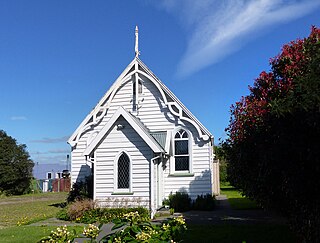
Jane Deans was a New Zealand pioneer and community leader. She came to Christchurch in 1853 onto her husband's farm that he had established ten years earlier. Her husband died in the following year, and Deans became a community leader. The Christchurch suburb of Riccarton derives its name from the farm, and the historic buildings and the adjacent forest are popular places to visit.
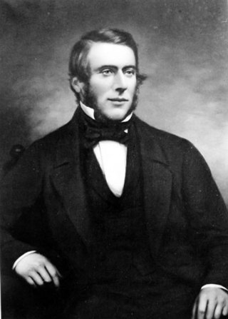
John Deans was, together with his brother William, a pioneer farmer in Canterbury, New Zealand. He was born in Kirkstyle, Riccarton, Scotland. Their Riccarton farm in New Zealand was the first permanent settlement by immigrants on the Canterbury Plains. Deans returned to Scotland in 1852 to marry Jane McIlraith. They returned to New Zealand, where he died from tuberculosis at Riccarton Farm on 23 June 1854, not before he had asked Jane to keep the adjacent Riccarton Bush in perpetuity. The Deans had one son, also called John. The Deans brothers named the Christchurch river Avon after the stream on their grandfather's farm.
Brian Peter John Molloy was a New Zealand plant ecologist, conservationist, and rugby union player.
Christchurch is a major city in the Canterbury Region, and is the largest city in the South Island of New Zealand. With a Māori history stemming back to the thirteenth century as the domain of the historic Waitaha iwi, Christchurch was constituted as a colonial outpost of the British Empire in 1850. Today Christchurch is the second largest city in New Zealand, after Auckland, with a metropolitan population of over half a million.