River aux Vases (Mississippi River tributary)

Last updated
River aux Vases Creek
River aux Vases, Missouri road sign Highway 61 bridge 1.jpg
River aux Vases Creek sign at Highway 61
USA Missouri location map.svg
Red pog.svg
River aux Vases Creek within Missouri
Usa edcp relief location map.png
Red pog.svg
River aux Vases (Mississippi River tributary) (the United States)
Etymology French: La Rivière aux Vases meaning "Muddy" or "Swampy River".
Location
Country United States
State Missouri
Physical characteristics
Source 
  location Ste. Genevieve County, MO
Mouth Mississippi River
  location
La Saline, MO
  coordinates
37°54′23″N89°58′31″W / 37.90639°N 89.97528°W / 37.90639; -89.97528 Coordinates: 37°54′23″N89°58′31″W / 37.90639°N 89.97528°W / 37.90639; -89.97528
  elevation
361 ft (110 m)
Basin size47.8 sq mi (124 km2)

River aux Vases is a creek that rises in Union Township in western Ste. Genevieve County, Missouri and flows into the Mississippi River about two miles north of St. Marys, Missouri.

Contents

Etymology

The stream's original name - La Rivière aux Vases - is French meaning The muddy or swampy River and referred to quicksand and soggy conditions around the creek, especially crossings. [1]

History

The earliest French colonial families had long-established family sugar camps (les sucreries) along the creek to process sugar. [2] In 1797 the younger son of Pierre de Lassus, Commandant of New Bourbon received a grant by the Spanish government to establish a sugar mill along the creek. [3] Over time the area around River aux Vases became known as a breeding center for mules. Mining was also prominent in the area and River aux Vases sandstone was used in the abutments of Eads Bridge in downtown St. Louis, with decorative onyx and limestone quarried nearby. [4]

Physical geography

River aux Vases rises near Jonca in Union Township in the western part of Ste. Genevieve County, and flows east through Hawn State Park and empties into the Mississippi River about two miles north of St. Mary at an elevation of 361 feet. It has a watershed of 47.8 sq. mi. [5] [6]

Cultural geography

There are a number of communities along River aux Vases Creek, most notably the community by the same name River aux Vases, as well as New Bremen (Ozora), and New Tennessee. [7]

Bridges that converse River aux Vases Creek include the River aux Vases Bridge on Old Kingshighway (Highway 61), the River aux Vases Route B Bridge, The Interstate 55 Bridge, and the River aux Vases US 61 Bridge. [8]

Related Research Articles

New Offenburg, Missouri unincorporated community

New Offenburg is an unincorporated community in Sainte Genevieve County, Missouri, Missouri, United States. It is located approximately ten miles southwest of Ste. Genevieve on Route 32.

River aux Vases, Missouri unincorporated community in Missouri

River aux Vases is an unincorporated community in Beauvais Township in Sainte Genevieve County, Missouri, United States.

Weingarten, Missouri unincorporated community

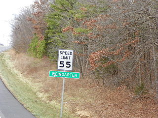
Weingarten is an unincorporated community and census-designated place in Sainte Genevieve County, Missouri, United States.

Jackson Township, Ste. Genevieve County, Missouri Civil Township in Missouri, United States

Jackson Township is a subdivision of Ste. Genevieve County, Missouri, in the United States of America, and is one of the five townships located in Ste. Genevieve County.

Cinque Hommes Township, Perry County, Missouri Civil Township in Missouri, United States

Cinque Hommes is one of the eight townships located in Perry County, Missouri, in the United States of America.

Bois Brule Township, Perry County, Missouri Civil Township in Missouri, United States

Bois Brûlé is one of the eight townships located in Perry County, Missouri, in the United States of America.

New Bourbon, Missouri Abandoned village in Missouri, United States

New Bourbon is an abandoned village located in Ste. Genevieve Township in Ste. Genevieve County, Missouri, United States. New Bourbon is located approximately two and one-half miles south of Ste. Genevieve.

Zell, Missouri unincorporated community in Missouri, United States

Zell is an unincorporated community located in Ste. Genevieve Township in Ste. Genevieve County, Missouri, United States. Zell is located approximately six miles west of Sainte Genevieve.

La Saline is an abandoned village located in Beauvais Township in Sainte Genevieve County, Missouri, United States. La Saline was located approximately six miles south of Sainte Genevieve.

Central Township, Perry County, Missouri Civil Township in Missouri, United States

Central Township is one of the eight townships located in Perry County, Missouri, United States.

Saline Township, Perry County, Missouri Civil Township in Missouri, United States

Saline Township is one of the eight townships located in Perry County, Missouri, in the United States of America.

Cinque Hommes Creek stream in Perry County, Missouri, United States of America

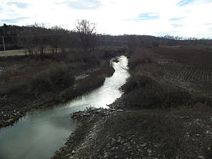
Cinque Hommes Creek is a tributary of the Mississippi River flowing through Perry County, Missouri.

Saline Creek (Mississippi River tributary) river in the United States of America

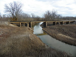
Saline Creek is a creek that rises in western Ste. Genevieve County and flows east briefly passing through a portion of northern Perry County before emptying into an offshoot of the Mississippi River north of St. Mary across from Kaskaskia Island.

Beauvais Township, Ste. Genevieve County, Missouri Civil Township in Missouri, United States

Beauvais Township is a subdivision of Ste. Genevieve County, Missouri, in the United States of America, and is one of the five townships located in Ste. Genevieve County.

Kinsey, Missouri unincorporated community

Kinsey is an unincorporated community located in the central part of Jackson Township in Sainte Genevieve County, Missouri, United States. The town was named after William Metcalfe Kinsey, a congressman of St. Louis. Kinsey was born in Ohio, and came to Missouri in 1875, where he was elected congressman for the 10th district and became a leading Republican politician in the state.

Lawrenceton, Missouri unincorporated community

Lawrenceton is an unincorporated community located in the southern part of Jackson Township in Sainte Genevieve County, Missouri, United States. The town lies 14 miles to the west of Ste. Genevieve.

Saline Township, Ste. Genevieve County, Missouri Civil Township in Missouri, United States

Saline Township is a subdivision of Ste. Genevieve County, Missouri, in the United States of America, and is one of the five townships located in Ste. Genevieve County.

Union Township, Ste. Genevieve County, Missouri Civil Township in Missouri, United States

Union Township is a subdivision of Ste. Genevieve County, Missouri, in the United States of America, and is one of the five townships located in Ste. Genevieve County.

Ste. Genevieve Township, Ste. Genevieve County, Missouri Civil Township in Missouri, United States

Ste. Genevieve Township is a subdivision of Ste. Genevieve County, Missouri, in the United States of America, and is one of the five townships located in Ste. Genevieve County.

Brickeys, Missouri unincorporated community

Brickey's or Brickeys is an unincorporated community located in Jackson Township in Sainte Genevieve County, Missouri, United States. The town lies 11 miles to the northwest of Ste. Genevieve on the Mississippi River.

References

  1. "Ste. Genevieve County, Missouri Place Names, 1928-1945 | The State Historical Society of Missouri". Shs.umsystem.edu. Retrieved 2013-10-28.
  2. Walter A. Schroeder (2002). "Opening the Ozarks: A Historical Geography of Missouri's Ste. Genevieve District, 1760-1830". ISBN   9780826263063.Cite journal requires |journal= (help)
  3. The State Historical Society of Missouri http://shs.umsystem.edu/manuscripts/ramsay/ramsay_sainte_genevieve.html
  4. Rome of the West http://www.romeofthewest.com/2009/09/photos-of-saints-philip-and-james.html
  5. Biological Criteria for Streams of Missouri http://dnr.mo.gov/env/esp/docs/BiologicalCriteriaMUFinalReport.pdf
  6. lat-long.com http://www.lat-long.com/Latitude-Longitude-751895-Missouri-River_aux_Vases.html
  7. The library.org http://thelibrary.org/lochist/moser/stegenevievepl.html
  8. "Ste. Genevieve County, Missouri". Bridgehunter.com. Retrieved 2013-10-28.