Chula Vista Isles is a neighborhood of Fort Lauderdale, Florida, United States. It was previously a census-designated place (CDP) in Broward County, Florida, United States. The population was 573 at the 2000 census.
Golden Heights was a census-designated place (CDP) in Broward County, Florida, United States. It is now a neighborhood in the City of Fort Lauderdale. The population was 501 at the 2000 census.
Green Meadow was a census-designated place (CDP) in Broward County, Florida, United States. The population was 1,875 at the 2000 census. It was incorporated into the town of Southwest Ranches, Florida in 2000.
Hillsboro Pines is a census-designated place (CDP) in Broward County, Florida, United States. The population was 496 at the 2020 census.
Hillsboro Ranches was a census-designated place (CDP) in Broward County, Florida, United States in 2000. The population was 47 at the 2000 census. Hillsboro Ranches was not designated a CDP in the 2010 census. As of 2018, Hillsboro Ranches remains an unincorporated neighborhood, part of the Broward Municipal Services District, Northern County.
Lake Forest was a census-designated place (CDP) in Broward County, Florida, United States. The population was 4,994 at the 2000 census. It is now a neighborhood of West Park, Florida.
Utopia was a census-designated place (CDP) in Broward County, Florida, in the United States. As of the 2000 census, the CDP population was 714. The area is now part of a West Park neighborhood.
Village Park was a census-designated place (CDP) in Broward County, Florida, United States. The population was 895 at the 2000 census. It is now a part of North Lauderdale, Florida.

Lake Asbury is an unincorporated community and census-designated place (CDP) in Clay County, Florida, United States. It is referred to as the Asbury Lake CDP by the U.S. Census Bureau. The population at the 2020 census was 11,036, up from 8,700 at the 2010 census. It is part of the Jacksonville, Florida Metropolitan Statistical Area.

Homestead Base is a census-designated place (CDP) in Miami-Dade County, Florida, United States. The CDP comprises the extent of Homestead Air Reserve Base plus some surrounding land. It is part of the Miami metropolitan area of South Florida. The population was 999 at the 2020 census.

Leisure City is an unincorporated community and census-designated place (CDP) in Miami-Dade County, Florida, United States, that includes the smaller, older community of Modello in its northwestern section. The CDP is most notable for the Coral Castle Museum, located in the Modello area. It is located in the Miami metropolitan area of South Florida. The population was 26,324 at the 2020 census, up from 22,655 in 2010.

The Crossings is a census-designated place (CDP) and suburb of Miami in Miami-Dade County, Florida, United States. It is part of the Miami metropolitan area of South Florida. The CDP includes the neighborhoods of The Crossings, Devon Aire, and Calusa. The population was 23,276 at the 2020 census.
North Key Largo is an unincorporated area and census-designated place (CDP) in Monroe County, Florida, United States. The population was 1,431 at the 2020 census, up from 1,244 in 2010. It includes two private clubs, the Ocean Reef Club and the Key Largo Anglers Club, and is reached from the mainland via the Card Sound Bridge.
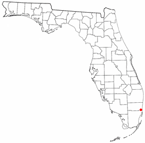
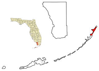
Lake Belvedere Estates is a census-designated place (CDP) in Palm Beach County, Florida, United States. It is part of the Miami metropolitan area of South Florida. The population was 2,091 at the 2020 US census.

South Miami Heights is a census-designated place (CDP), originally known as Eureka, in Miami-Dade County, Florida. It is part of the Miami metropolitan area of South Florida. The population was 36,770 as of the 2020 census.
Lake Worth Corridor was a former census-designated place (CDP) and now a current unincorporated place in Palm Beach County, Florida, United States, approximately 3 miles (4.8 km) west of the city of Lake Worth Beach. The population was 18,663 at the 2000 census. The CDP was not included in the 2010 census.

Crystal Lake is a census-designated place (CDP) in Polk County, Florida, United States. The population was 5,341 at the 2000 census, an increase from 5,300 in 1990. The 2010 Census reported a population of 5,514. It is part of the Lakeland–Winter Haven Metropolitan Statistical Area.

Coyote Acres is a census-designated place (CDP) in Jim Wells County, Texas, United States. The population was 570 at the 2020 census, up from 508 at the 2010 census.

Burbank is a census-designated place (CDP) in Walla Walla County, Washington, United States, where the Snake River meets the Columbia. The population was 3,291 at the 2010 census. Named for Luther Burbank, the city is located just east of Pasco and Kennewick, across the Snake and Columbia Rivers, respectively. Burbank is part of the Tri-Cities, WA urban area, despite being located in the Walla Walla metropolitan area.

Great Barrington is a census-designated place (CDP) located in the town of Great Barrington in Berkshire County, Massachusetts, United States. The population was 2,231 at the 2010 census, out of 7,104 in the entire town of Great Barrington.
