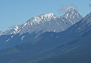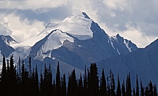
Mount Columbia is a mountain located in the Winston Churchill Range of the Rocky Mountains. It is the highest point in Alberta, Canada, and is second only to Mount Robson for height and topographical prominence in the Canadian Rockies. It is located on the border between Alberta and British Columbia on the northern edge of the Columbia Icefield. Its highest point, however, lies within Jasper National Park in Alberta.

Mount Ball is a mountain located on the Continental Divide, on the borders of Banff and Kootenay national parks in Western Canada. Mt. Ball is the highest peak of the Ball Range in the Canadian Rockies.

Mount Lyell is a mountain on the Alberta–British Columbia border in western Canada. Comprising five distinct summits, Mount Lyell reaches a height of 3,498 m (11,476 ft). The mountain was named by James Hector in 1858 in recognition of Scottish geologist Sir Charles Lyell.

Mount Robertson is a mountain in the Canadian Rockies, standing astride the British Columbia-Alberta boundary between Palliser Pass and North Kananaskis Pass. The British Columbia side of the pass is in Mount Assiniboine Provincial Park. The mountain is named for Sir William Robertson (1860–1933), 1st Baronet, Chief of the Imperial General Staff from 1916 to 1918 during the First World War.

Division Mountain is located on the Continental Divide along the Alberta - British Columbia border of Canada. It also straddles the shared boundary of Banff National Park with Kootenay National Park in the Canadian Rockies. It was named in 1919 by Charles D. Walcott since the mountain divides the Lyell Icefield from the Mons Icefield.

Aiguille Peak is a peak located on the Canadian provincial boundary of Alberta and British Columbia in Banff National Park. It was named in 1915 by Arthur O. Wheeler. "Aiguille" is French for "needle" and is also a mountaineering term for a sharp-ridged summit.

Stairway Peak is a 3,006 metres (9,862 ft) mountain summit located on the Continental Divide, on the shared border of Alberta and British Columbia in the Canadian Rockies. It is also on the shared border between Banff National Park and Yoho National Park, and can be seen from the Icefields Parkway. It was named in 1918 by Arthur O. Wheeler.

Wedgwood Peak is a 3,024-metre (9,921-foot) mountain summit located in Mount Assiniboine Provincial Park, in the Canadian Rockies of British Columbia, Canada. Its nearest higher peak is Mount Assiniboine, 2.0 km (1.2 mi) to the south. The mountain is situated northwest of Lake Magog and 1.0 km (0.62 mi) south of Sunburst Peaks.

The Marshall is a 3,180-metre (10,430-foot) mountain summit located in Mount Assiniboine Provincial Park, in the Canadian Rockies of British Columbia, Canada. Its nearest higher peak is Mount Assiniboine, 3.0 km (1.9 mi) to the east-southeast. The mountain is situated west of Wedgwood Peak.

Sunburst Peaks is a 2,849-metre (9,347-foot) mountain summit located in Mount Assiniboine Provincial Park, in the Canadian Rockies of British Columbia, Canada. Its nearest higher peak is Wedgwood Peak, 1.0 km (0.62 mi) to the south. The mountain is situated immediately southeast of Sunburst Lake, west of Lake Magog, and south of Cerulean Lake.

Floe Peak is a 3,006-metre (9,862 ft) mountain summit located on the western border of Kootenay National Park, in the Canadian Rockies of British Columbia, Canada. The name for this mountain has not been officially adopted yet. Its nearest higher peak is Foster Peak, 3.0 km (1.9 mi) to the northwest, and both are part of the Vermilion Range. The mountain is part of what is known as the Rockwall in the Vermilion Range, and is named for Floe Lake which is situated below the enormous northern cliffs of the peak. Floe Lake, one of the beauty spots of Kootenay Park, is accessible via the Floe Lake Trail.

Mount Selkirk is a 2,930-metre (9,610-foot) mountain summit located in the Vermilion River Valley along the eastern border of Kootenay National Park. Park visitors can see the peak from Highway 93, also known as the Banff–Windermere Highway. It is part of the Mitchell Range, which is a sub-range of the Canadian Rockies of British Columbia, Canada. The nearest higher neighbor is Catlin Peak, 1.6 km (0.99 mi) to the northwest.

Mount Vaux is a 3,310-metre (10,860-foot) mountain summit located in the Kicking Horse River valley of Yoho National Park, in the Ottertail Range of the Canadian Rockies in British Columbia, Canada. Its nearest higher peak is Mount Goodsir, 11.0 km (6.8 mi) to the southeast. Mount Vaux can be seen from Highway 1, the Trans-Canada Highway, which traverses the western foot of the mountain, as well as from Emerald Lake. Vaux is pronounced Vox, rhymes with box.

Emerald Peak is a 2,701-metre (8,862-foot) mountain summit located in Yoho National Park, in the Canadian Rockies of British Columbia, Canada. Its nearest higher peak is Mount Carnarvon, 1.7 km (1.1 mi) to the northwest. Both are part of the President Range which is a subset of the Waputik Mountains. Emerald Peak is visible from Emerald Lake, rising 1,256-metre (4,121-foot) above the northwest shore. The mountain's name was officially adopted in 1924 when approved by the Geographical Names Board of Canada, in association with Emerald Lake, which in turn was named in 1900 on account of its color.

Mount Carnarvon is a 3,046-metre (9,993-foot) mountain summit located in the Kiwetinok River Valley of Yoho National Park, in the Canadian Rockies of British Columbia, Canada. Its nearest higher peak is The President, 3.9 km (2.4 mi) to the north-northeast. Both are part of the President Range which is a subset of the Waputik Mountains. Mount Carnarvon is situated five kilometers northwest of Emerald Lake, but is hidden from view behind Emerald Peak. However, Carnarvon is visible from Highway 1, the Trans-Canada Highway. The months July through September offer the most favorable weather for viewing or climbing Mount Carnarvon.

Rostrum Peak is a 3,284-metre (10,774-foot) mountain summit located in the Canadian Rockies of British Columbia, Canada. Rostrum is the highest summit of the Bush Mountain massif. Its nearest higher peak is Christian Peak, 13.5 km (8.4 mi) to the north-northeast. Icefall Peak lies 2 km (1.2 mi) to the north-northwest. The peak was named in 1918 for its resemblance to a rostrum, and was officially adopted in 1924 when approved by the Geographical Names Board of Canada. The first ascent of the mountain was made in 1936 by W.N.M. Hogg with guide Christian Hasler Jr.

Arras Mountain is a 3,090-metre (10,138 ft) mountain summit located in the Canadian Rockies of British Columbia, Canada. Arras Mountain is situated immediately northeast of the confluence of Icefall Brook with Valenciennes River, 7.2 km (4.5 mi) east-southeast of Rostrum Peak, and 6 km (3.7 mi) west of Valenciennes Mountain, and all are in the Kootenay Land District. The peak was named in 1921 to commemorate the World War I battlefield at Arras, France, where Canadian troops fought in the first battle April 1917, and in the second battle August 1918. The name was officially adopted in 1924 when approved by the Geographical Names Board of Canada.

St. Julien Mountain is a 3,090-metre (10,138 ft) mountain summit located in the Canadian Rockies of British Columbia, Canada. It is situated on the British Columbia-Alberta border, as well as the Continental Divide, and the west boundary of Banff National Park. Neighbors include Mount Forbes 6.4 km (4.0 mi) to the east-northeast, Valenciennes Mountain 2.8 km (1.7 mi) to the south, and Icefall Peak is 12 km (7.5 mi) to the west.

Whaleback Mountain is a 2,627-metre (8,619-foot) summit in British Columbia, Canada.

Mount Sam is a 2,871-metre (9,419-foot) mountain summit located in Mount Assiniboine Provincial Park of British Columbia, Canada.


