Henry County, Indiana

Last updated

Henry County, Indiana
Henry County Courthouse - New Castle, IN.jpg
Henry County Courthouse
Map of Indiana highlighting Henry County.svg
Location within the U.S. state of Indiana
Coordinates: 39°56′N85°24′W / 39.93°N 85.4°W / 39.93; -85.4
CountryFlag of the United States.svg United States
StateFlag of Indiana.svg Indiana
Founded1822
Named after Patrick Henry
Seat New Castle
Largest cityNew Castle
Area
  Total
394.83 sq mi (1,022.6 km2)
  Land391.88 sq mi (1,015.0 km2)
  Water2.96 sq mi (7.7 km2)  0.75%
Population
 (2020)
  Total
48,914
  Estimate 
(2025 [1] )
49,158 Increase2.svg
  Density124.82/sq mi (48.193/km2)
Time zone UTC−5 (Eastern)
  Summer (DST) UTC−4 (EDT)
Congressional district 6th
Website www.henryco.net
Indiana county number 33

Henry County is a county located in east central Indiana, United States. As of 2020, the population was 48,914. [2] The county seat and largest and only city is New Castle. [3] Henry County is the main setting of the novel Raintree County by Ross Lockridge Jr.

Contents

History

Henry County was formed in 1822 from the Delaware New Purchase resulting from the Treaty of St. Mary's in 1818. It was named for Patriot Patrick Henry, governor of Virginia. [4]

Geography

According to the 2010 census, the county has a total area of 394.83 square miles (1,022.6 km2), of which 391.88 square miles (1,015.0 km2) (or 99.25%) is land and 2.96 square miles (7.7 km2) (or 0.75%) is water. [5]

New Castle from the air, looking east. New-castle-indiana-from-above.jpg
New Castle from the air, looking east.

Cities

Towns

Unincorporated areas

Townships

Reservoirs

Adjacent counties

Major highways

Sources: National Atlas, [6] U.S. Census Bureau [7]

Climate and weather

New Castle, Indiana
Climate chart (explanation)
J
F
M
A
M
J
J
A
S
O
N
D
 
 
2.2
 
 
33
16
 
 
2.3
 
 
38
19
 
 
3
 
 
49
28
 
 
3.9
 
 
60
37
 
 
4.7
 
 
71
48
 
 
4.6
 
 
80
57
 
 
4.7
 
 
84
61
 
 
3.6
 
 
82
59
 
 
2.9
 
 
76
52
 
 
2.9
 
 
64
41
 
 
3.7
 
 
50
32
 
 
2.8
 
 
38
22
Average max. and min. temperatures in °F
Precipitation totals in inches
Source: The Weather Channel [8]
Metric conversion
J
F
M
A
M
J
J
A
S
O
N
D
 
 
57
 
 
1
−9
 
 
57
 
 
3
−7
 
 
75
 
 
9
−2
 
 
100
 
 
16
3
 
 
119
 
 
22
9
 
 
117
 
 
27
14
 
 
119
 
 
29
16
 
 
91
 
 
28
15
 
 
73
 
 
24
11
 
 
75
 
 
18
5
 
 
93
 
 
10
0
 
 
71
 
 
3
−6
Average max. and min. temperatures in °C
Precipitation totals in mm

In recent years, average temperatures in New Castle have ranged from a low of 16 °F (−9 °C) in January to a high of 84 °F (29 °C) in July, although a record low of −26 °F (−32 °C) was recorded in January 1994 and a record high of 103 °F (39 °C) was recorded in June 1988. Average monthly precipitation ranged from 2.24 inches (57 mm) in January to 4.70 inches (119 mm) in May. [8]

Government

The county government is a constitutional body, and is granted specific powers by the Constitution of Indiana, and by the Indiana Code.

County Council: The county council is the legislative branch of the county government and controls all the spending and revenue collection in the county. Representatives are elected from county districts. The council members serve four-year terms. They are responsible for setting salaries, the annual budget, and special spending. The council also has limited authority to impose local taxes, in the form of an income and property tax that is subject to state level approval, excise taxes, and service taxes. [9] [10]

County Commissioners: The executive body of the county is made of a board of commissioners. The commissioners are elected county-wide, in staggered terms, and each serves a four-year term. One of the commissioners, typically the most senior, serves as president. The commissioners are charged with executing the acts legislated by the council, collecting revenue, and managing the day-to-day functions of the county government. [9] [10]

County Courts: The county maintains three courts. Circuit Court I, Circuit Court II and Circuit Court III. The judge on the court is elected to a term of four years and must be a member of the Indiana Bar Association. In some cases, court decisions can be appealed to the state level circuit court. [10]

County Officials: The county has several other elected offices, including sheriff, coroner, auditor, treasurer, recorder, surveyor, and circuit court clerk Each of these elected officers serves a term of four years and oversees a different part of county government. Members elected to county government positions are required to declare party affiliations and to be residents of the county. [10]

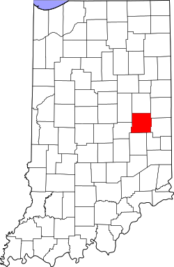
Henry County is part of Indiana's 6th congressional district; Indiana Senate district 28; [11] and Indiana House of Representatives districts 54 and 56. [12]

United States presidential election results for Henry County, Indiana [13]
Year Republican Democratic Third party(ies)
No.%No.%No.%
1888 3,84960.07%2,27735.54%2814.39%
1892 3,33655.04%1,87130.87%85414.09%
1896 4,00156.43%2,98042.03%1091.54%
1900 4,04756.72%2,75438.60%3344.68%
1904 4,39159.99%2,48233.91%4466.09%
1908 4,35854.63%3,19740.07%4235.30%
1912 2,47932.12%2,68734.82%2,55133.06%
1916 4,38650.01%3,56040.59%8259.41%
1920 8,74257.03%5,82438.00%7624.97%
1924 8,80060.85%5,37637.18%2851.97%
1928 10,50268.53%4,55429.72%2681.75%
1932 8,43048.67%8,25547.66%6343.66%
1936 9,09946.85%10,17252.38%1490.77%
1940 11,05152.98%9,62346.14%1840.88%
1944 10,58354.85%8,29743.00%4162.16%
1948 10,48754.00%8,52343.89%4112.12%
1952 14,18461.99%8,37836.61%3201.40%
1956 13,75061.33%8,50237.92%1660.74%
1960 13,75258.44%9,62940.92%1490.63%
1964 10,18444.87%12,37454.52%1390.61%
1968 11,62652.61%8,04536.41%2,42610.98%
1972 14,53871.94%5,61027.76%600.30%
1976 11,62053.19%10,13746.40%910.42%
1980 12,72460.03%7,62635.98%8463.99%
1984 11,92662.56%7,06437.06%720.38%
1988 11,28059.01%7,77940.69%570.30%
1992 8,72043.62%6,79433.99%4,47522.39%
1996 8,53745.68%7,66741.03%2,48413.29%
2000 10,32156.35%7,64741.75%3471.89%
2004 13,13764.07%7,17635.00%1910.93%
2008 10,89651.11%10,05947.18%3641.71%
2012 10,83857.02%7,61340.05%5562.93%
2016 13,89568.48%5,12425.25%1,2716.26%
2020 15,04371.43%5,54426.32%4742.25%
2024 15,03372.76%5,20825.21%4192.03%

Demographics

Historical population
CensusPop.Note
1830 6,497
1840 15,128132.8%
1850 17,60516.4%
1860 20,11914.3%
1870 22,98614.3%
1880 24,0164.5%
1890 23,879−0.6%
1900 25,0885.1%
1910 29,75818.6%
1920 34,68216.5%
1930 35,2381.6%
1940 40,20814.1%
1950 45,50513.2%
1960 48,8997.5%
1970 52,6037.6%
1980 53,3361.4%
1990 48,139−9.7%
2000 48,5080.8%
2010 49,4622.0%
2020 48,914−1.1%
2025 (est.)49,158 [1] 0.5%
U.S. Decennial Census [14]
1790-1960 [15] 1900-1990 [16]
1990-2000 [17] 2010-2013 [2]

2020 census

As of the 2020 census, the county had a population of 48,914. The median age was 43.4 years. 20.2% of residents were under the age of 18 and 20.0% of residents were 65 years of age or older. For every 100 females there were 109.3 males, and for every 100 females age 18 and over there were 109.3 males age 18 and over. [18] [19]

The racial makeup of the county was 92.8% White, 2.2% Black or African American, 0.2% American Indian and Alaska Native, 0.4% Asian, <0.1% Native Hawaiian and Pacific Islander, 1.1% from some other race, and 3.3% from two or more races. Hispanic or Latino residents of any race comprised 2.0% of the population. [19]

37.9% of residents lived in urban areas, while 62.1% lived in rural areas. [20]

There were 18,954 households in the county, of which 27.9% had children under the age of 18 living in them. Of all households, 47.7% were married-couple households, 18.1% were households with a male householder and no spouse or partner present, and 26.2% were households with a female householder and no spouse or partner present. About 28.7% of all households were made up of individuals and 13.5% had someone living alone who was 65 years of age or older. [18]

There were 20,952 housing units, of which 9.5% were vacant. Among occupied housing units, 73.1% were owner-occupied and 26.9% were renter-occupied. The homeowner vacancy rate was 1.9% and the rental vacancy rate was 9.9%. [18]

2010 Census

As of the 2010 United States census, there were 49,462 people, 19,077 households, and 13,020 families residing in the county. [21] The population density was 126.2 inhabitants per square mile (48.7/km2). There were 21,288 housing units at an average density of 54.3 per square mile (21.0/km2). [5] The racial makeup of the county was 95.7% white, 2.2% black or African American, 0.3% Asian, 0.1% American Indian, 0.4% from other races, and 1.2% from two or more races. Those of Hispanic or Latino origin made up 1.4% of the population. [21] In terms of ancestry, 19.9% were German, 13.3% were American, 11.8% were Irish, and 9.1% were English. [22]

Of the 19,077 households, 31.2% had children under the age of 18 living with them, 52.1% were married couples living together, 11.6% had a female householder with no husband present, 31.8% were non-families, and 27.3% of all households were made up of individuals. The average household size was 2.43 and the average family size was 2.94. The median age was 41.4 years. [21]

The median income for a household in the county was $47,697 and the median income for a family was $52,701. Males had a median income of $42,628 versus $30,226 for females. The per capita income for the county was $19,879. About 10.2% of families and 13.7% of the population were below the poverty line, including 20.0% of those under age 18 and 8.8% of those age 65 or over. [23]

Education

School districts include: [24]

Recreation

Notable people

See also

References

  1. 1 2 "Henry County Demographic Statistics". Indiana Demographics by Cubit. Retrieved January 29, 2025.
  2. 1 2 "Henry County QuickFacts". United States Census Bureau . Retrieved June 11, 2022.
  3. "Find a County". National Association of Counties. Archived from the original on May 31, 2011. Retrieved June 7, 2011.
  4. Gannett, Henry (1905). The Origin of Certain Place Names in the United States. Govt. Print. Off. pp.  155.
  5. 1 2 "Population, Housing Units, Area, and Density: 2010 - County". United States Census Bureau. Archived from the original on February 12, 2020. Retrieved July 10, 2015.
  6. National Atlas Archived December 5, 2008, at the Wayback Machine
  7. GEO. "Directory Browsing is Not Allowed". www.census.gov. Retrieved April 8, 2018.
  8. 1 2 "Monthly Averages for New Castle, Indiana". The Weather Channel. Retrieved January 27, 2011.
  9. 1 2 Indiana Code. "Title 36, Article 2, Section 3". IN.gov. Retrieved September 16, 2008.
  10. 1 2 3 4 Indiana Code. "Title 2, Article 10, Section 2" (PDF). IN.gov. Retrieved September 16, 2008.
  11. "Indiana Senate Districts". State of Indiana. Retrieved July 14, 2011.
  12. "Indiana House Districts". State of Indiana. Retrieved July 14, 2011.
  13. Leip, David. "Dave Leip's Atlas of U.S. Presidential Elections". uselectionatlas.org. Retrieved April 8, 2018.
  14. "U.S. Decennial Census". United States Census Bureau. Retrieved July 10, 2014.
  15. "Historical Census Browser". University of Virginia Library. Retrieved July 10, 2014.
  16. "Population of Counties by Decennial Census: 1900 to 1990". United States Census Bureau. Retrieved July 10, 2014.
  17. "Census 2000 PHC-T-4. Ranking Tables for Counties: 1990 and 2000" (PDF). United States Census Bureau. Retrieved July 10, 2014.
  18. 1 2 3 "2020 Decennial Census Demographic Profile (DP1)". United States Census Bureau. 2021. Retrieved December 30, 2025.
  19. 1 2 "2020 Decennial Census Redistricting Data (Public Law 94-171)". United States Census Bureau. 2021. Retrieved December 30, 2025.
  20. "2020 Decennial Census Demographic and Housing Characteristics (DHC)". United States Census Bureau. 2023. Retrieved December 30, 2025.
  21. 1 2 3 "DP-1 Profile of General Population and Housing Characteristics: 2010 Demographic Profile Data". United States Census Bureau. Archived from the original on February 13, 2020. Retrieved July 10, 2015.
  22. "DP02 SELECTED SOCIAL CHARACTERISTICS IN THE UNITED STATES – 2006-2010 American Community Survey 5-Year Estimates". United States Census Bureau. Archived from the original on February 14, 2020. Retrieved July 10, 2015.
  23. "DP03 SELECTED ECONOMIC CHARACTERISTICS – 2006-2010 American Community Survey 5-Year Estimates". United States Census Bureau. Archived from the original on February 14, 2020. Retrieved July 10, 2015.
  24. Geography Division (December 18, 2020). 2020 CENSUS - SCHOOL DISTRICT REFERENCE MAP: Henry County, IN (PDF) (Map). U.S. Census Bureau . Retrieved May 3, 2025. - Text list
  25. Alford, Steve (1990). Playing for Knight: My Six Seasons with Coach Knight. Simon Schuster. ISBN   067172441X.
  26. "Document Center / Remembering General Omar Bundy - by Ben Badgley / City of New Castle, IN". www.cityofnewcastle.net. Retrieved November 9, 2022.
  27. "Ira Hough | U.S. Civil War | U.S. Army | Medal of Honor Recipient". Congressional Medal of Honor Society. Retrieved November 9, 2022.
  28. "Arthur Calvin Mellette". National Governors Association. Retrieved November 9, 2022.
  29. Lauck, Jon (2008). ""The Organic Law of a Great Commonwealth": The Framing of the South Dakota Constitution". South Dakota Law Review. 53 (2): 203–259.
  30. "National Inventors Hall of Fame Inductee Wilbur Wright and the Airplane". www.invent.org. Retrieved October 22, 2020.

Further reading

39°56′N85°24′W / 39.93°N 85.40°W / 39.93; -85.40